Auchencloigh Castle: A Medieval Fortification near Cumnock
Site at a Glance
- Rating
- 5
- Popularity
- Very Low
- Country
- United Kingdom
- Primary era
- Medieval
- Eras represented
- Medieval
- Civilizations
- Kingdom of Scotland
- Site type
- Military
- Remains
- Castle
On this page9 sections
History
Auchencloigh Castle is the ruined remains of a medieval lowland fortification near Cumnock in the United Kingdom. Built during the medieval period, it is generally assigned to the fifteenth century, although that date remains tentative. The castle stood within the feudal lands of Clan Craufurd, also known as Clan Crawford, a kin-based social and political grouping, and may have formed part of a defensive chain of small fortified residences that included Drongan Castle and Martnaham Castle.
Medieval Origins and Local Lordship
The castle’s unusually thick walls have encouraged the proposed fifteenth-century dating, but its construction has not been fixed by direct evidence. Its position near Burnton Burn and within the Craufurd lands reflects the network of local fortified residences that shaped the medieval landscape of the parish of Ochiltree.
The surrounding lands appear in sixteenth-century legal transactions. In 1578, William and James Cuninghame of Polquharne granted the lands of Burntoun, within their lands of Easter Polquharne, to John Cuninghame, James’s son. These lands were contiguous with, or included, Auchencloigh. In 1579, William Wallace of Auchencloigh witnessed a precept, a formal legal writ or order, issued by James, Lord Torphichen, in favour of John Chalmer of Inchgotrick.
Later Use and Ruin
Auchencloigh remained in use until the early eighteenth century. Maps then trace the site’s gradual change in status. Robert Gordon’s map, prepared about 1635 to 1652, marks a castle called “E. Achincloigh” east of Belston Loch. Blaeu’s map of about 1654, based on Timothy Pont’s work of about 1600, shows East Auchincloigh Castle as intact. Maps from 1745 and 1747 depict a dwelling or settlement rather than a castle, while those of 1775, 1821, and 1828 label the castle as a ruin.
A large opencast mine later occupied the area around the castle and the old farm. The land has since been restored to agricultural use. The castle is protected as a scheduled monument under the Ancient Monuments and Archaeological Areas Act 1979, with the designation recorded as SM5393 from 1992 onward.
Remains
Castle Mound and Building
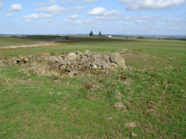
The castle stood on a mound approximately 100 metres east of Auchencloigh Farm, close to woodland and Burnton Burn. Its surviving remains belong to a rectangular building whose interior appears to have been divided into several small rooms. The medieval tower was constructed from dark whinstone blocks, a hard local stone, bonded with lime mortar.
Wall Remains
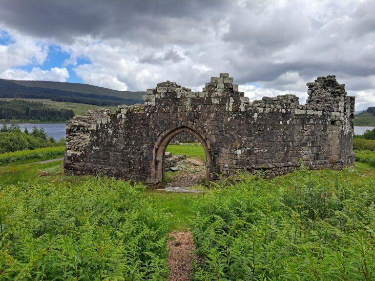
In 1978, fragments of the walls survived in places to heights of about 0.6 to 1.6 metres. Some sections were several feet thick, a feature that has contributed to the proposed early date of the building. The castle is now represented by ruinous remains rather than an intact structure.
Mapped Grounds and Approach
East Auchincloigh Castle
Blaeu’s map presents East Auchincloigh Castle as smaller than nearby Kerse Castle. It shows wooded grounds, a southern pale, meaning a fence or boundary often formed from stakes or posts, and watercourses along the northern, eastern, and western sides. The loch shown to the west as Drumsmodda Loch is now known as Belston Loch. The same map also records a separate West Achincloigh dwelling.
Holloway and Roman Road
A clearly defined holloway, a sunken road formed by prolonged use and erosion, runs toward Auchencloigh near Old Polquharne. It follows the line of a Roman road and probably corresponds to the route shown on Armstrong’s map of 1775 between Bank, now Bankglen on the New Cumnock to Dalmellington road, and present-day Littlemill. The route has a heavily cobbled base covered with clay.