Asthall Barrow: A Seventh-Century Anglo-Saxon Cremation Burial Mound
Site at a Glance
- Popularity
- Medium
- Country
- United Kingdom
- Primary era
- Medieval
- Eras represented
- Medieval
- Civilizations
- Anglo-Saxon
- Site type
- Burial
- Remains
- Burial Mound
On this page9 sections
History
Asthall Barrow is a seventh-century Anglo-Saxon cremation burial mound near Asthall in the United Kingdom. Anglo-Saxon is a broad term for early medieval peoples and communities in England, not a single unified group. The grave goods indicate that the person buried here was of high rank, but they do not identify the deceased with a particular Anglo-Saxon people.
Burial and archaeological investigation
An attempt to obtain permission for an excavation on George Rolleston’s behalf failed in 1872. In August 1923, amateur archaeologist George S. Bowles led an excavation with Tom Arnold and five helpers. Edward Thurlow Leeds, an assistant keeper at Oxford’s Ashmolean Museum, advised Bowles and visited the mound. Leeds published the main discoveries in 1924 and later briefly described the 1924 work in a 1939 history of Oxfordshire.
Bowles regarded the mound as undisturbed before his excavations, though the scattered grave goods may indicate earlier disturbance. Cremated human bone, charcoal and ash showed that a funeral pyre had been built at the burial site. A blue-linen plan at the Ashmolean plots both excavations and was probably made by Leeds.
Protection and conservation
Asthall Barrow became a scheduled monument on 16 May 1934, gaining statutory protection for its archaeological and historical importance. Historic England later described it as one of the best-preserved examples of its type among about ten burial mounds in West Oxfordshire.
The mound was on Historic England’s Heritage at Risk Register from 2009 to 2017. Its condition was rated as declining from 2009 to 2014; collapse was noted in 2015, and its condition was judged to be improving in 2016. Extensive rabbit burrowing was identified in 2017. Vegetation was cleared and measures were taken to exclude rabbits, with help from the landowners and volunteer wardens from the Cotswolds Area of Outstanding Natural Beauty, a protected landscape. The site was classed as saved and removed from the register in 2018.
Remains
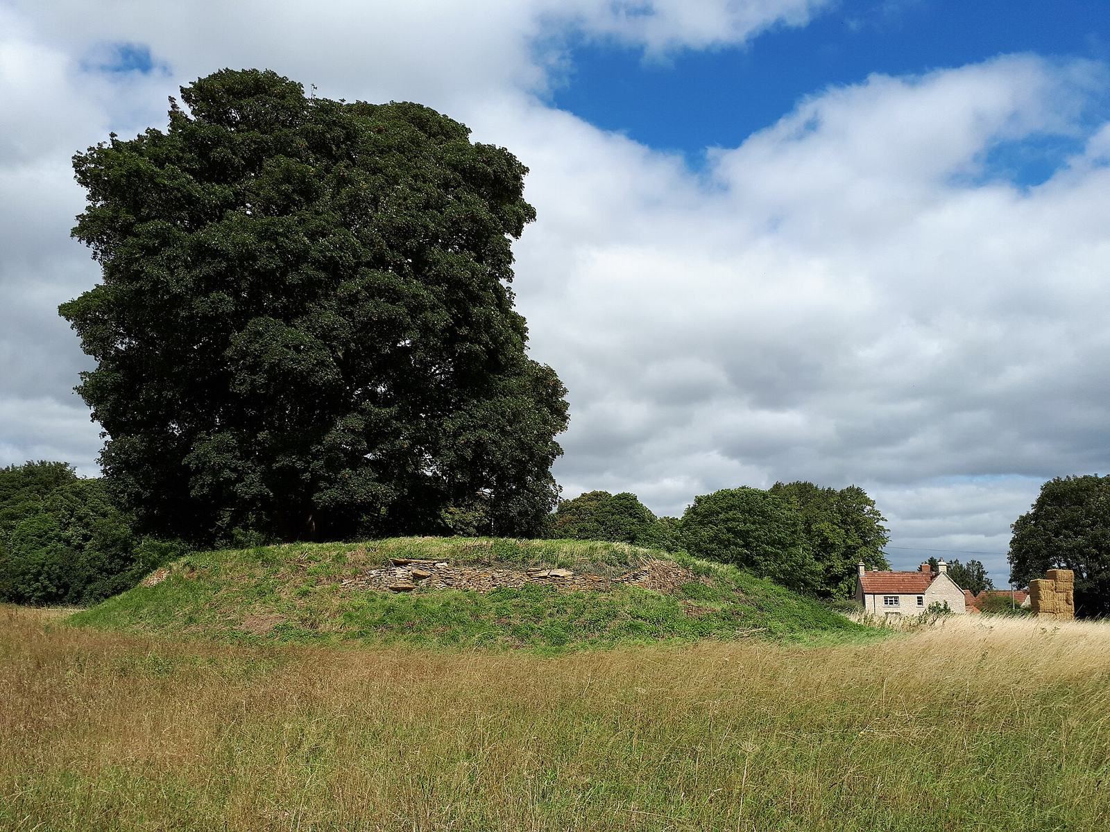
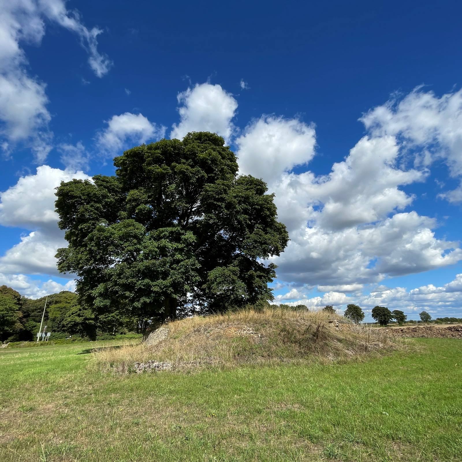
The site is centred on a circular mound of earth and stone, about 17 m across and 2.4 m high today. A dry-stone retaining wall encircles it, with about 1.37 m of the wall’s height surviving.
Mound and retaining wall
The mound’s height was recorded as about 2.6 m around 1907 and 3.7 m in 1923. Soil slippage may partly account for its lower present height. The mound may originally have extended beyond its current outline, with the circular wall serving as a reinforcing structure or internal division rather than a wholly external boundary. In 1923, a raised, elliptical area along the southwestern edge stood about 10 cm above the surrounding field. The grave goods’ position away from the centre of the mound as it stands today also suggests that its original extent may have been different.
Construction layers and burial deposits
The mound’s earth contains stones and occasional Romano-British pottery, material associated with Britain during and after Roman rule. The pottery and the slope of the surrounding ground suggest that builders may have gathered topsoil from nearby. A layer of yellowish clay covered the excavated surface and may have come from the nearby River Windrush. Its thickness varied, with more clay toward the southern part of the excavation. Charcoal and ash lay above it, reaching about 15 cm deep in places. Excavators also found a large charred timber south of the burial area.
Excavation area and record
In 1923, excavation began with a central shaft about 12 ft square and 12 ft deep. Several extensions took the work to field level or below, forming an irregular seven-sided area that was enlarged twice. Bowles labelled its corners A to H, omitting F. In 1924, the excavators added a rectangular extension on the west and dug four small trenches in the raised ground south of the mound. Each trench measured 18 inches square.
Grave goods
The highly fragmented finds include at least seven vessels: three pottery vessels, two handmade jars, a bottle associated with Merovingian culture, the Frankish world of early medieval western Europe, and a small silver bowl or cup. A bowl fragment is identified as Byzantine, referring to the culture of the eastern Roman Empire. Foil fragments, including five stamped with interwoven animal designs, point to a decorated drinking horn. Other objects include a patterned, gilded pear-shaped mount; clothing fittings with copper- and silver-alloy buckles and mounts; a copper-alloy strap and mount; an antler die; and bone gaming pieces. The finds are held by the Ashmolean Museum in Oxford.
Landscape and vegetation
The mound stands about 1.5 km south of Asthall village and immediately north of the A40. It is near the point where Akeman Street, a Roman road in Britain, crossed the River Windrush beside a former Roman settlement. Its elevated position provides views across the Thames Valley between Lechlade and Wytham Hill. Leafield Barrow lies to the north; Faringdon Hill and the Berkshire Downs, including White Horse Hill, are to the south; and Sinodun Hill lies southeast, with the Chilterns farther away. Beech and fir trees, probably planted in the nineteenth century, once covered the mound. A sycamore remains at its summit, while cultivated land reaches the mound’s edges; barley was growing in the surrounding field in 1992.