Alcazaba of Málaga: An Islamic Palatial Fortress in Spain
Site at a Glance
- Rating
- 4.6
- Popularity
- Very High
- Country
- Spain
- Primary era
- Medieval
- External website
- Open
- Eras represented
- Classical, Medieval, Early Modern
- Civilizations
- Almohad, Nasrid, Roman, Spanish, Taifa Kingdoms, Taifa of Málaga
- Site type
- Military
- Remains
- Citadel
On this page23 sections
History
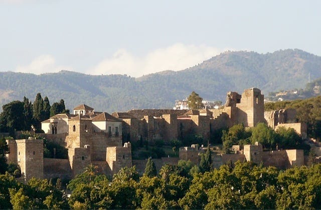
The Alcazaba of Málaga is an Islamic palatial fortress in Spain, built and adapted by Muslim rulers on elevated ground beside Málaga’s historic center. Its present complex developed mainly from the early eleventh century through the Nasrid period, combining military architecture with palatial construction. It became both an urban fortress and the political-administrative seat of Málaga, housing rulers, governors, and officials at the eastern end of the city’s former walled enclosure.
Phoenician-Punic and early Islamic foundations
The fortress occupies a site with earlier defensive and urban activity. An older Phoenician-Punic walled enclosure formed the basis for later construction, while Roman occupation left industrial remains and building materials that were subsequently incorporated into the Alcazaba. A fortress also existed during the early Islamic period. The present complex was probably begun in the early eleventh century, possibly during the reign of Yahya I, and some of its preserved palace elements may belong to that phase.
After the political fragmentation of the Córdoba Caliphate, the Hammudid dynasty, which claimed the caliphal title and ruled Málaga as one of the independent taifa kingdoms, transferred its court to the city. The Hammudids used the enclosure and its rooms as a palace residence. Historical tradition attributes the major fortification of the Alcazaba to the Taifa ruler Badis ben Habús between approximately 1057 and 1063. Another interpretation regards his work chiefly as the restoration and enlargement of the earlier Phoenician-Punic enclosure rather than the creation of an entirely new fortress.
Almoravid, Almohad, and Nasrid rule
The Alcazaba changed political hands as successive North African dynasties extended their authority across Al-Andalus, the name for Muslim-ruled territories of the Iberian Peninsula. The Almoravids entered the fortress in 1092, followed by the Almohads in 1146. In 1279 it was surrendered to Muhammad II Ben al-Ahmar and incorporated into the Nasrid Kingdom of Granada, the last major Muslim state in Iberia before the Christian conquest of Granada.
Under the Nasrids, the fortifications and palaces were enlarged or substantially rebuilt, particularly in the early fourteenth century. The Alcazaba formed the eastern end of Málaga’s former walled city, or madina. Its southern, western, and northern sides were integrated into the city defenses, while a protected walled passage called La Coracha connected it with the higher Castle of Gibralfaro. Together, the castle, passage, and Alcazaba formed a closely integrated defensive complex.
The Christian conquest of Málaga
The Alcazaba played a major role during the Reconquista, the centuries-long Christian expansion into Muslim-ruled Iberia. Ferdinand the Catholic began the siege of Málaga in early May 1487. After prolonged resistance, the Alcazaba was surrendered on 18 August, when Alí Dordux negotiated a Mudéjar status for Muslims who remained under Christian rule after the conquest.
Hamet el Zegrí and his gómers had continued the resistance, while Gibralfaro held out for two further days under El Zegrí and Alí Derbal. The castle eventually surrendered because of hunger and thirst. Ferdinand and Isabella entered Málaga on 19 August 1487. Ferdinand raised the Cross and the Castilian standard on the Torre del Homenaje and presented the city with an image of the Virgin of Victory, a German sculpture given to him by Emperor Maximilian I. The image subsequently became Málaga’s patron.
Christian military use and decline
The Alcazaba continued to serve military purposes after the conquest, although its role changed under Christian rule. During the eighteenth century, the military function ended. Houses progressively occupied the outer walls and parts of the inner enclosure, turning the site into a marginal residential district. The decline was worsened by the earthquake of 1680 and by the bombardment of Málaga from the bay in 1693 by nine French ships during the Nine Years’ War, a European conflict fought from 1688 to 1697.
Between 1733 and 1735, Governor Francisco Antonio de Unzaga Amézaga y Aperribay permitted poorer residents to attend Mass in the chapel-oratory of San Gabriel. He also sought royal authorization to restore the chapel after earthquake damage. Its Andalusi arches remained until the bombardment of 1937 during the Spanish Civil War.
Between 1787 and 1792, Luis de Unzaga y Amézaga ordered improvements to the Alcazaba and Gibralfaro so their military garrisons could receive potable water. During the War of the Roussillon in 1794, the Alcazaba held 479 French prisoners. By order of Manuel Godoy, the Hospital Real de San Luis was also established there.
Archaeological recovery and conservation
Military abandonment and residential reuse caused prolonged deterioration from the nineteenth century into the early twentieth century. Rehabilitation and archaeological work began during the first decades of the twentieth century and intensified from the 1930s, when residents were evacuated and the monument began to be systematically recovered.
The recovery involved the art critic Ricardo de Orueta; the architects José Joaquín González Edo, Leopoldo Torres Balbás, Fernando Guerrero-Strachan Rosado, and Francisco Prieto Moreno; and the researcher Juan Temboury, working under the auspices of civil governor Emilio Lamo de Espinosa. Successive reconstructions continued during the twentieth century, while further conservation work was established in 2009. The Alcazaba was declared a historic-artistic monument in 1931 and is protected as a Spanish Cultural-Interest Property in the monument category.
Leopoldo Torres Balbás described the Alcazaba as a prototype of Taifa-period military architecture because of its double defensive walls and numerous fortifications. Its historical development is commonly divided into four broad phases: the Andalusi period from the tenth to the fifteenth century, Christian use from the late fifteenth to the eighteenth century, military abandonment and deterioration from the nineteenth century to the early twentieth century, and recovery as a historic monument from the 1930s onward. It is regarded as one of Spain’s best-preserved alcazabas, although parts of the present fabric are reconstructed.
Remains
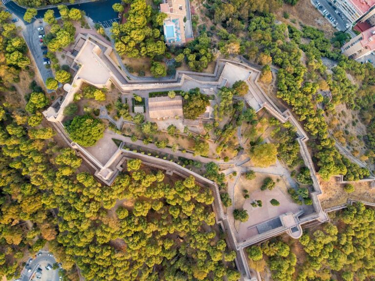
The Alcazaba stands on bedrock on the lower slopes of Mount Gibralfaro, overlooking Málaga, its port, and the bay. The surviving complex covers approximately 15,000 square metres, while historical plans show a larger earlier area. About 3,478 square metres consist of civil construction and 3,516 square metres of military construction, with the rest formed by open ground. Lower and upper walled enclosures, towers, palatial courtyards, gardens, pools, and interior rooms are arranged within successive defenses.
Walls, gates, and defensive route
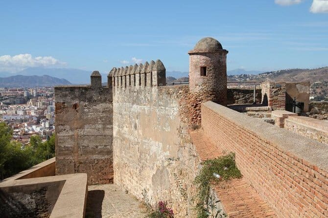
The approach from the city passed through concentric defensive lines and eight fortified gates, including two bent entrances. The former city ramparts added another defensive barrier. Battlemented walls, projecting or albarrana towers, arrow slits, machicolations, and heavily fortified gateways protected the route. An albarrana tower is a projecting or detached tower linked to a fortification by a wall or bridge, while a machicolation is a projecting structure with openings for dropping objects or missiles onto attackers.
Puerta de las Columnas
The entrance route rises through the main gate and continues through the Puerta de las Columnas before reaching a stepped ramp. The gate incorporates two Roman columns and their capitals, reused from the nearby theatre. An eighteenth-century residence for the Alcazaba’s governor or mayor was built above it. Houses later covered much of the passage, which by the nineteenth century was known as the Alcazaba Tunnel.
Arco del Cristo
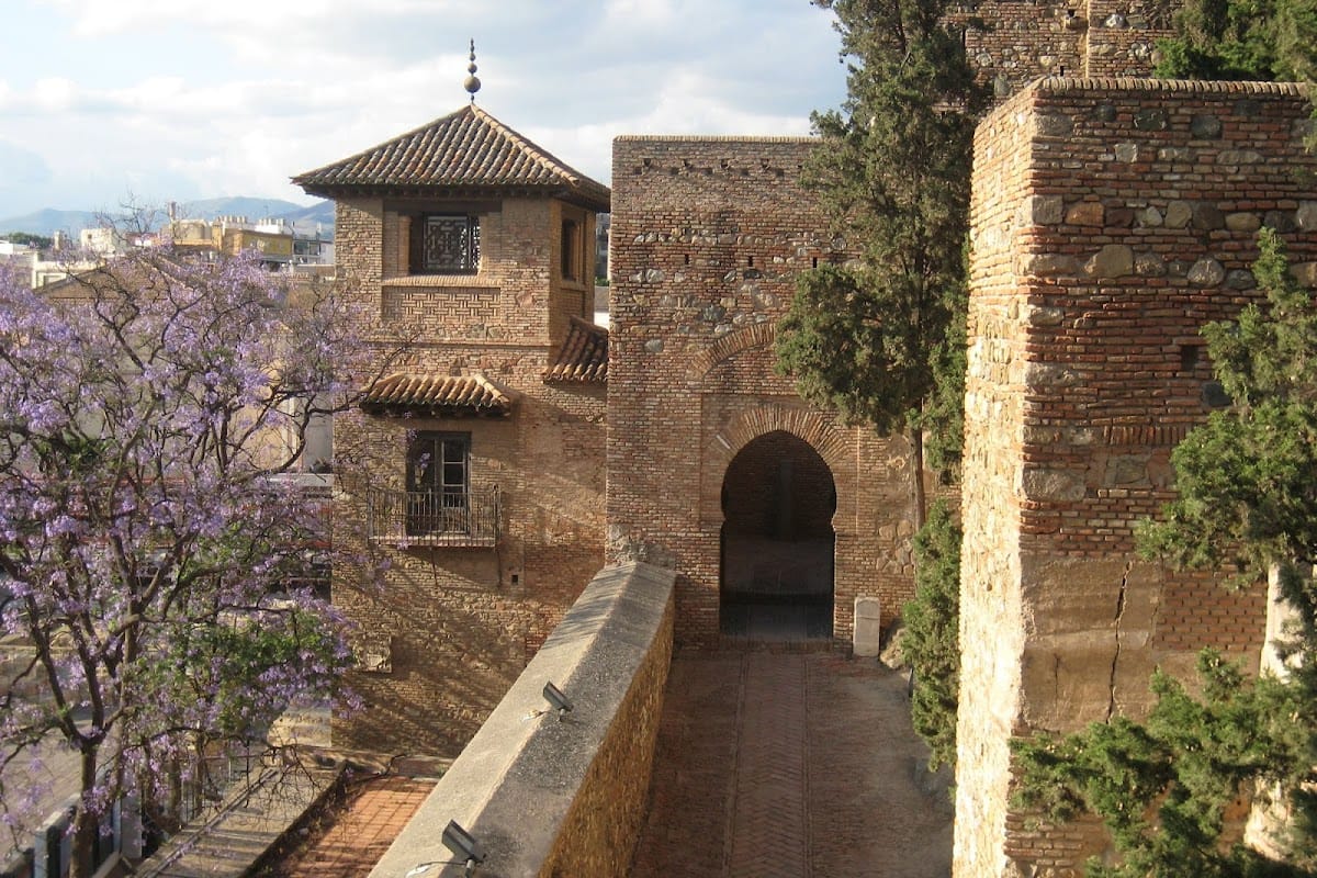
The Arco del Cristo is a bent passage within a tower. Its upper portion was reconstructed, while the inner door jambs retain eleventh-century blocks of nummulitic limestone. The entrance arch is framed by a brick alfiz, a rectangular ornamental frame around an arch, and rests on pilasters. Its stone keystone was formerly covered with gold and carved with a key. Two projecting stone corbels indicate a former machicolation. Inside, a brick cloister vault rises over the passage. The gate was reconstructed at the end of the thirteenth century.
Plaza de las Armas and La Coracha
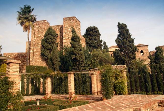
Beyond the Arco del Cristo lies the Plaza de las Armas. After the Christian conquest, this open space was used for artillery and is now laid out as gardens. The nearby Torre de la Vela received a bell after the conquest. The Puerta de La Coracha leads toward the protected passage connecting the Alcazaba with Gibralfaro.
Construction materials and archaeological evidence
Early Andalusi builders used nummulitic limestone from quarries near the sea. The blocks were laid with alternating edge-set and face-set courses. Damp conditions caused the stone to deteriorate rapidly, requiring early repairs. During the late thirteenth or early fourteenth century, external masonry walls were added to reinforce the towers and other defenses.
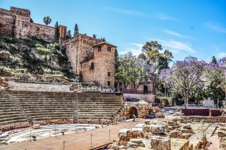
Roman material was reused throughout the fortress, including columns, capitals, marble, and statues from the adjacent theatre. Excavation also revealed Roman concrete walls faced with reddish stucco and small basins cut from slate. These basins were associated with the preparation of garum, a fermented Roman fish sauce or paste. Roman theatre remains lie beside the Alcazaba entrance, while other Roman marble pieces were incorporated into the terraced gardens.
Lower enclosure and upper approach
Archaeological work in the Plaza de las Armas identified remains of a primitive congregational mosque from the Emirate period, possibly dating to the eighth century. The area also contains evidence of Roman industrial activity and the slate basins connected with garum production.
Puerta de los Arcos and Torre del Tinel
The final approach to the upper enclosure passes through the Puerta de los Arcos and the Torre del Tinel. Excavation in this area found a silo or dungeon where captive Christian women were confined at night while working during the day. Fernando Guerrero-Strachan later created small terraced gardens there, incorporating a Roman marble bath basin, a stone-carved boar, and a large Roman marble foot.
Puerta de los Cuartos de Granada
The upper enclosure is entered through the Puerta de los Cuartos de Granada, also called the Puerta de los Arcos. Flanking towers protect the gate, whose passage contains two doorways separated by a small open space. Defenders could attack intruders from this intermediate position. The gate fell into ruin and was largely demolished in 1854 before being reconstructed during the twentieth century with the aid of historical illustrations.
Torre del Homenaje
The Torre del Homenaje stands at the eastern end of the upper enclosure. Nearly square in plan, it originated in the eleventh century and was rebuilt during the Nasrid period. Twentieth-century restoration conserved the surviving tower rather than reconstructing it. A residence with rooms and a courtyard once occupied its upper level, although its staircase does not survive.
Palatial courtyards and residences
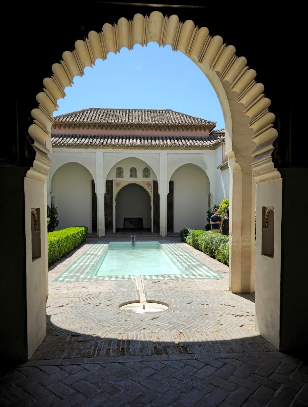
The Cuartos de Granada comprise palatial residences for kings and governors, including remains of a Taifa palace and a Nasrid palace. Their rooms and galleries were organized around rectangular courtyards. Three courtyards retain traces of porticoes with three arches, in an Andalusi Islamic arrangement in which the central arch is larger than the two side arches. Reconstructed rooms contain small wall niches displaying fragments of Muslim pottery recovered during excavation.
Taifa palace pavilion
The southern pavilion is the surviving part of the first and southernmost palace courtyard. Its portico has three horseshoe arches supported by two central columns and two engaged side columns. The arches carry carved arabesque decoration and alternating plain and decorated wedge-shaped stones, known as voussoirs. The pavilion was heavily restored by Leopoldo Torres Balbás in the early twentieth century.
A small rectangular chamber behind the pavilion is entered through another arcade. Its intersecting multifoil arches, which have lobed profiles, relate to decorative precedents in the tenth-century expansion of the Great Mosque of Córdoba and anticipate more elaborate forms at the eleventh-century Aljafería Palace in Zaragoza. Torres Balbás created the arches on the southwest side.
Torre de Maldonado and adjoining chamber
The Torre de Maldonado stands directly behind the southern pavilion as an outer fortification tower. The Almohads remodeled it during the twelfth or thirteenth century, and traces of decoration from that period remain. Across from the tower is a large sixteenth-century chamber with a wooden Mudéjar ceiling. Mudéjar architecture combines Islamic artistic and construction traditions with work produced under Christian rule. The chamber now contains a model of the Alcazaba.
Nasrid palace courtyards
The Nasrid palace occupies much of the northeastern upper enclosure. Its rooms and porticoes are arranged around rectangular courtyards, most of which were reconstructed or restored during the twentieth century on the basis of archaeological remains. The southern courtyard, the Patio de los Naranjos, retains two original pools and their paved tile decoration. The northern Patio de la Alberca contains a long central pool surrounded by original tile paving. The Patio del Aljibe may also have formed part of the Nasrid palace and now contains the restoration workshop, while a cistern of approximately 25 square metres lies beneath it.
Military District
The Barrio Castrense, or Military District, occupies the area between the Nasrid palace and the Torre del Homenaje. Probably dating from the eleventh century, it contained eight houses for officials and servants connected by narrow streets. The district is arranged in three blocks separated by paved streets. Some houses were reconstructed during the twentieth century, while others remain under a protective roof. Surviving walls reach a maximum height of approximately one metre.
Officials’ and servants’ houses
The dwellings vary in size and arrangement. The southwest block contained a small bath and two very small houses, the eastern block held two similarly small dwellings, and the southern block contained three larger houses. Each house had a compact plan centered on a nearly square patio, with paving strips and rooms around it. Wooden double-leaf doors provided entry, and some houses retain the first steps of narrow staircases leading to upper floors.
Floors were chiefly made from lime mortar colored with red almagra, an earth pigment used on floors and architectural surfaces. Some rooms retain terracotta tiles and reused marble pieces. Interior wall dadoes were painted red and decorated with Kufic inscriptions, an early angular style of Arabic script, together with geometric eight-pointed interlace designs. One of the larger houses had its own hammam, or bathhouse, and toilets.
Bath and water system
A bath stood in the northern part of the Military District. Its water was raised by a noria, or water-raising wheel, from the Pozo Airón, a deep well cut into the bedrock in the lower enclosure. The well reaches approximately 30 metres. Channels carried wastewater away from the district, and nearly every dwelling had a latrine.