Carchemish: Ancient Euphrates Capital and Neo-Hittite Kingdom


Site at a Glance
- Rating
- 4.1
- Popularity
- Low
- Country
- Syria
- Primary era
- Iron Age
- External website
- Open
- Eras represented
- Bronze Age, Iron Age, Classical, Medieval
- Civilizations
- Abbasid, Achaemenid, Assyrian, Babylonian, Byzantine, Hittite, Roman, Seleucid
- Site type
- City
On this page17 sections
History
Carchemish was an ancient city divided between Türkiye and Syria on the west bank of the Euphrates. Occupied from prehistoric times, it became a major Late Bronze Age and Iron Age center under Hittite and Neo-Hittite rule, with its power rooted in control of a strategic river crossing and regional trade routes.
Prehistoric and Bronze Age Carchemish
Settlement at Carchemish began at least in the Neolithic and Chalcolithic periods. Excavations in the Inner Town have extended the history of habitation to around 6000 BC, while pot burials and other early remains provide evidence of prehistoric communities. Cist tombs, graves lined or covered with stone slabs, date to approximately 2400 BC. The city appears in the archives of Ebla during the third millennium BC.
During the Middle Bronze Age, Carchemish was ruled successively by Aplahanda, his son Yatar-Ami, and Yahdul-Lim. Documents from Mari and Alalakh dating to approximately the 1770s and 1760s BC describe the city as an important center of timber trade. Its rulers maintained treaty or commercial connections with Ugarit and Mitanni, as well as relations with Mari. Control of a major ford across the Euphrates gave Carchemish both commercial reach and strategic importance.
Carchemish was allied with Yamhad when the Hittite king Hattusili I besieged Urshu. The alliance failed, and Carchemish fell along with other Syrian cities. Hantili I later campaigned against the city during conflict with the Hurrians. An Egyptian victory stele erected by Thutmose I near Carchemish commemorated his conquest of Syrian territories beyond the Euphrates.
Hittite rule and imperial prominence
Mitanni later held Carchemish until the Hittite king Šuppiluliuma I besieged and conquered it around 1345 BC. Šuppiluliuma, a major fourteenth-century BC ruler who expanded Hittite power into Syria, made the city the center of a Hittite-controlled kingdom and appointed his son Piyassili, also known as Šarri-Kušuḫ, as its ruler.
After Šuppiluliuma’s death, Carchemish joined a rebellion against Hittite authority. His successor, Mursili II, restored Hittite control, and the kingdom remained attached to the Hittite Empire until that empire collapsed. Piyassili was followed by Shakhurunuwa, who took part in the Battle of Kadesh in 1274 BC, and then by Ini-Teššub.
Carchemish became one of the leading centers of the Hittite Empire during the Late Bronze Age. Its position beside the Euphrates supported administration, trade, and military movement across Anatolia and northern Syria. An inscription of Ramesses III claims that the city was destroyed by the Sea Peoples, but Carchemish survived the upheavals at the end of the Bronze Age.
The Neo-Hittite kingdom
After the collapse of the Hittite Empire, Carchemish became the capital of a powerful Neo-Hittite kingdom. The Neo-Hittite states were Iron Age kingdoms in northern Syria and southeastern Anatolia that continued Hittite political and artistic traditions. Carchemish reached its height during the Late Bronze and early Iron Age, when it also developed as an important trading center.
Kuzi-Teshub, the son of Talmi-Teshub and a contemporary of the last Hittite king Šuppiluliuma II, ruled Carchemish with the title “Great King.” He and his successors controlled a territory extending from southeastern Anatolia into northern Syria and toward the western bend of the Euphrates. This wider political entity lasted approximately from 1175 to 975 BC before contracting into a city-state centered on Carchemish.
Several dynasties governed the later kingdom. Rulers associated with its succession include Tuthaliya I, Sapaziti, Ura-Tarhunza, Suhi I, Astuwalamanza, Katuwa, Yariri, Kamani, and Sastura. The House of Suhi carried out an extensive building program. Katuwa, who ruled around 880 BC, is the best-known ruler of that dynasty in the city’s Hieroglyphic Luwian inscriptions. Hieroglyphic Luwian was a monumental writing system used for inscriptions in the Luwian language. Astiruwa founded a later ruling house, the House of Astiruwa, whose last ruler was Pisiri.
Carchemish’s principal deity was the Hurrian goddess Kubaba, a figure of northern Syrian and Anatolian religious traditions. Middle Bronze Age worship also centered on Nergal and Nubandag. From approximately the mid-fourteenth century BC, the city god became Karhuha, a warrior and stag deity, probably through Mitannian influence. These traditions reflect Carchemish’s position among Anatolian, Syrian, Mesopotamian, and Hurrian cultural networks.
Assyrian domination and destruction
Assyrian campaigns progressively restricted Carchemish’s independence. Shalmaneser I visited the city after the fall of Mitanni, and Tiglath-pileser I imposed tribute on its ruler Ini-Teššub around 1100 BC. In the ninth century BC, King Sangara, who ruled approximately from 870 to 848 BC, paid tribute to Ashurnasirpal II and Shalmaneser III. Assyrian records portray Carchemish as a wealthy and powerful state involved in regional alliances and controlling subsidiary fortified settlements.
A local Hieroglyphic Luwian inscription identified Sangara’s name in 2015. Carchemish also appears in Assyrian records under King Pisiri, who paid tribute to Tiglath-pileser III in 738 BC. Sargon II conquered the city in 717 BC during Pisiri’s reign, destroyed the kingdom, deported its inhabitants, and converted Carchemish into an Assyrian provincial center.
Babylonian, Hellenistic, and Roman phases
The Battle of Carchemish took place near the city around 605 BC. The Babylonian army of Nebuchadnezzar II defeated the army of the Egyptian pharaoh Necho II and remnants of the Assyrian army. Nebuchadnezzar was the principal ruler of the Neo-Babylonian Empire, while Necho belonged to Egypt’s Twenty-sixth Dynasty. Necho’s campaign aimed to check Babylonian expansion westward and control the Euphrates corridor. The Babylonian victory expelled the Egyptians from Syria.
A brief Neo-Babylonian occupation was followed by three phases of Achaemenid occupation. The Achaemenid dynasty, founded by Cyrus the Great, ruled much of the Near East before Alexander’s conquests. Major rebuilding took place during the Hellenistic period, when Greek political and cultural institutions spread across the eastern Mediterranean and Near East. A monumental phase followed in the Late Roman period, and the city then passed through an Early Byzantine phase and three Abbasid phases. In Roman times Carchemish was known as Europus. It retained strategic value during the Hellenistic and Roman periods, then declined after Roman rule. Medieval settlement concentrated in the Inner Town, and the site was abandoned after the Middle Ages.
Rediscovery and archaeological work
The ruins were identified in 1699. George Smith confirmed their connection with the Carchemish mentioned in biblical, Egyptian, and Assyrian texts in 1876, correcting an earlier identification with Circesium at the confluence of the Khabur and Euphrates. Patrick Henderson conducted soundings for the British Museum from 1878 to 1881. Major excavations followed under D. G. Hogarth from 1911 to 1914 and under C. L. Woolley and Philip Langstaffe Ord Guy in 1920. World War I interrupted the work, which ended during the Turkish War of Independence.
The first major campaigns exposed Assyrian and Neo-Hittite defenses, temples, palaces, basalt sculpture, reliefs, and Hieroglyphic Luwian inscriptions. The Turkish Land Forces mined the site between 1956 and 1998. After mine clearance on the Turkish side was completed in February 2011, a joint Turkish-Italian expedition from the universities of Bologna, Gaziantep, and Istanbul resumed archaeological work in September of that year under Nicolò Marchetti.
From 2011 onward, excavations investigated the Inner Town and Outer Town and continued to reveal Late Bronze Age, Iron Age, Neo-Assyrian, and later remains. The Syrian Outer Town was explored through the Land of Carchemish project in cooperation with the Syrian Directorate General of Antiquities and Museums. Work on the Syrian side was later halted by the Syrian Civil War and continuing security conditions.
The Turkish portion became a military restricted zone after the establishment of the Turkish Republic and remained inaccessible to archaeological work until mine clearance. In 2016, the Turkish Army completed a prefabricated security wall along the southern side of the railway. Its design used no foundations that could damage ancient remains. Conservation and presentation work on the Turkish portion was completed by 2019, creating an archaeological park. The Syrian Outer Town was classified as an endangered cultural heritage site because of agricultural expansion and urban encroachment, while in 2019 the Jerablus City Council declared the area enclosed by the Iron Age city walls a first-degree protected site.
Remains
Setting and urban defenses
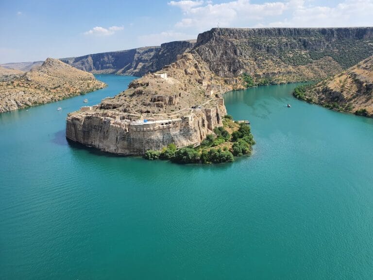
Carchemish covers approximately 90 hectares on the west bank of the Euphrates, with about 55 hectares in Türkiye and 35 hectares in Syria. The site includes an acropolis beside the river, an Inner Town enclosed by earthen ramparts, and an Outer Town extending beyond it, much of which lies in Syrian territory. The Berlin-Baghdad railway crosses the site and forms the modern border between Türkiye and Syria. The elevated acropolis and lower settlement occupied a major crossing point between Anatolia, Syria, and Mesopotamia.
Walls built on stone foundations with mud-brick superstructures enclosed the settlement. Five gates have been identified. The defensive system, largely constructed or developed during the Late Hittite period, included towers, projecting bastions, and concealed underground tunnels. The lower settlement had double walls and gates, while the Inner Town was protected by earthen ramparts. The Outer Town extended on both sides of the modern border and formed part of the wider urban area.
Residential and administrative areas
Excavated houses were rectangular and built with mud-brick walls. Their entrances opened from stone-paved forecourts. The site also preserves temples, palaces, administrative buildings, storage facilities, and other urban installations belonging to Assyrian, Neo-Hittite, Late Bronze Age, Hellenistic, Roman, Byzantine, and Abbasid phases.
Stratigraphic evidence, the layered remains showing successive periods of occupation, survives in the acropolis, the Lower Palace area, the Inner Town, and peripheral zones. These layers trace urban development from Late Bronze Age II through the Achaemenid period. Excavations near the border in 2016 produced a fuller sequence for the peripheral areas.
Palaces and monumental buildings
Katuwa’s Palace
Katuwa’s Palace, built around 900 BC, lies east of the Processional Entry. Excavations exposed carved stone slabs, known as orthostats, that were set into walls or foundations and decorated with reliefs. Some show processions of gazelle-bearers and remained beside a courtyard paved with squared stone slabs. During the Neo-Assyrian period, the courtyard received a mosaic of river pebbles arranged in alternating black and white squares.
Late Bronze Age buildings
A monumental Late Bronze Age II building occupied the eastern Lower Palace area, while a massive palace of the same period stood on the summit of the acropolis. Another Late Bronze Age II administrative building in area C East may correspond to the Hittite building designated E2.KIŠIB. An Iron Age storage facility was excavated in area S, adding evidence for the city’s administrative and economic organization.
Roman street
A Roman-style colonnaded street in the Inner Town reflects the city’s substantial development during the Roman period. Its remains form part of the later urban phases layered over the earlier Bronze Age and Iron Age settlement.
Sculpture, inscriptions, and excavated objects
Carchemish has produced basalt statues, freestanding sculptures, relief orthostats, portal lions, stelae, seals, clay tablets, inscribed clay bullae, and fragments of Hieroglyphic Luwian inscriptions. A bulla was a clay sealing or impression used to secure or authenticate a document, container, or package. A cuneiform tablet recovered from Katuwa’s Palace contains an exorcism in the name of Marduk.
Two fragments of clay prismatic cylinders inscribed with a text by Sargon II came from a well 14 metres deep. The well was sealed in 605 BC during the Late Babylonian takeover. The inscription describes Sargon’s capture and reorganization of Carchemish. A large limestone stele depicting the face of Nebuchadnezzar II also came from the excavations. Its cuneiform inscription gives his name and titles and may record his activities at the city.
Stelae of Kubaba and Thutmose I
King Kamani commissioned a basalt stele dedicated to Kubaba around 790 BC. Its six surviving fragments were formerly divided among three museums and were reunited in 2015. The inscription gives information about Carchemish and Kamani’s military and civic achievements. Two fragments removed during nineteenth-century investigations were later recognized as parts of the same monument.
A stele erected by Thutmose I stood near Carchemish to commemorate his conquest of Syrian lands beyond the Euphrates. Numerous other inscribed stelae have been recovered, and the city’s Hieroglyphic Luwian inscriptions were studied and published during the early twentieth century.
Neo-Assyrian figurines
Excavations recovered hundreds of Neo-Assyrian clay figurines known as Handmade Syrian Horses and Riders and Syrian Pillar Figurines. Dating from the mid-eighth to the seventh centuries BC, they may represent male and female figures performing distinct public roles. A stone block depicting a goat-headed deity was found in 2015, while excavations in 2017 produced a jug bearing a smiley-like design.
Sculptures and inscription fragments also came from the remains of Lawrence’s excavation house in the Inner Town. The building was fully excavated during the 2014 campaign, yielding hundreds of sculpture and inscription fragments. Other reliefs, statues, inscriptions, and architectural blocks belonged to Late Hittite monumental programs whose subjects included deities, rulers, processions, warfare, and civic or religious activities. Material from earlier excavations is held chiefly by the British Museum and the Museum of Anatolian Civilizations, with smaller groups in the Louvre and Gaziantep Archaeology Museum. Finds from the 2011 and 2012 campaigns were transferred to the Museum of Anatolian Civilizations.