Potaissa Fort: A Roman Legionary Fortress in Romania



Site at a Glance
- Rating
- 3.7
- Popularity
- Low
- Country
- Romania
- Primary era
- Classical
- External website
- Open
- Eras represented
- Classical
- Civilizations
- Roman
- Site type
- Military
- Remains
- Fort
On this page20 sections
History
Potaissa Fort was a Roman legionary fortress at Turda, Romania, established in the late second century during the Roman occupation of Dacia. It became the headquarters of Legio V Macedonica and the military centre of a substantial urban settlement whose population eventually exceeded 20,000 people.
Before the Legionary Fortress
A Dacian settlement existed in the area before the Roman conquest of AD 101 to 106. The Romans retained the name Potaissa, which appears as Patauissa on the Tabula Peutingeriana and as Patreuissa in Ptolemy’s Geography. The earliest inscriptional evidence is the Aiton milestone of AD 107/108, which records a road connecting Potaissa and Napoca.
Potaissa probably began as a Roman vicus, a civilian settlement without a formal town charter, soon after the Dacian Wars. A second community, the canabae legionis, developed west of the fortress when the legion arrived. This settlement provided services and trade for the soldiers and may eventually have joined the earlier civilian centre.
Several auxiliary units were associated with Potaissa before the legionary fortress was established. They included Cohors I Flavia Ulpia Hispanorum, Cohors I Batavorum, and Cohors I Alpinorum, although their exact bases remain uncertain. A Trajanic auxiliary fort on Dealul Zânelor has been proposed as a likely location, but its remains have not been demonstrated. Cohors I Flavia Ulpia Hispanorum helped build the road between Potaissa and Napoca around AD 107/108. Cohors I Batavorum remained associated with Potaissa into at least the 160s and is named in an inscription of AD 253, while Cohors I Alpinorum was last recorded in AD 211 to 212.
Legio V Macedonica at Potaissa
Around AD 168 to 170, during the reign of Marcus Aurelius and the Marcomannic Wars, Legio V Macedonica transferred its headquarters from Troesmis to Potaissa. The Marcomannic Wars were conflicts between Rome and several peoples north of the Danube and the empire’s central European frontier. Potaissa then became one of the two contemporary legionary headquarters in the Dacian provinces, alongside Apulum.
The legion defended northern Dacia against groups including the Iazyges, Sarmatians, Marcomanni, Quadi, Carpi, Vandals, and Goths. It is associated with Potaissa from approximately AD 170 to 270. Around AD 274, after Aurelian withdrew the Roman army from Dacia, the legion was transferred to Oescus.
The military presence reshaped the settlement. At its height, Potaissa had about 15,000 civilians and more than 5,000 legionaries, with estimates for the wider population reaching 20,000 to 25,000. The city received the status of a municipium in AD 193, early in the reign of Septimius Severus, under the name Municipium Septimium Potaissense. Under Caracalla it gained the rights of a titular colonia.
Potaissa’s prosperity rested partly on the legion’s purchasing power and partly on nearby salt deposits. Salt extraction in the Turda area had prehistoric origins and continued intermittently until 1932. After the army departed, the civilian city continued to exist. A legal text from AD 533 indicates that it retained rights acquired earlier, although coins from the fourth and fifth centuries show a sharp decline in commercial activity. Gepid cultural traces appear in the former urban territory from the second half of the fifth century.
Excavation and Protection
The site was first described archaeologically in 1851. In 1873, Theodor Mommsen identified Turda with ancient Potaissa through the evidence of the Aiton milestone, which had been found in 1758. Ion Horațiu Crișan excavated sections of the fortress walls in 1958 and published the results in 1961.
Continuous systematic research began in 1971 and continued annually through 2016. Constantin Daicoviciu initially coordinated the work, while Mihai Bărbulescu later shaped much of the investigation. Between 2014 and 2021, responsibility for the Turda research was progressively assumed by Florin Nemeti. Reconstruction and conservation followed the excavation campaigns, and part of the fortress is now presented as an archaeological park. Potaissa is protected as a Romanian historic monument under Law 422/2001, code CJ-I-s-A-07208. In 2024 it became part of the UNESCO World Heritage property Frontiers of the Roman Empire – Dacia.
Remains
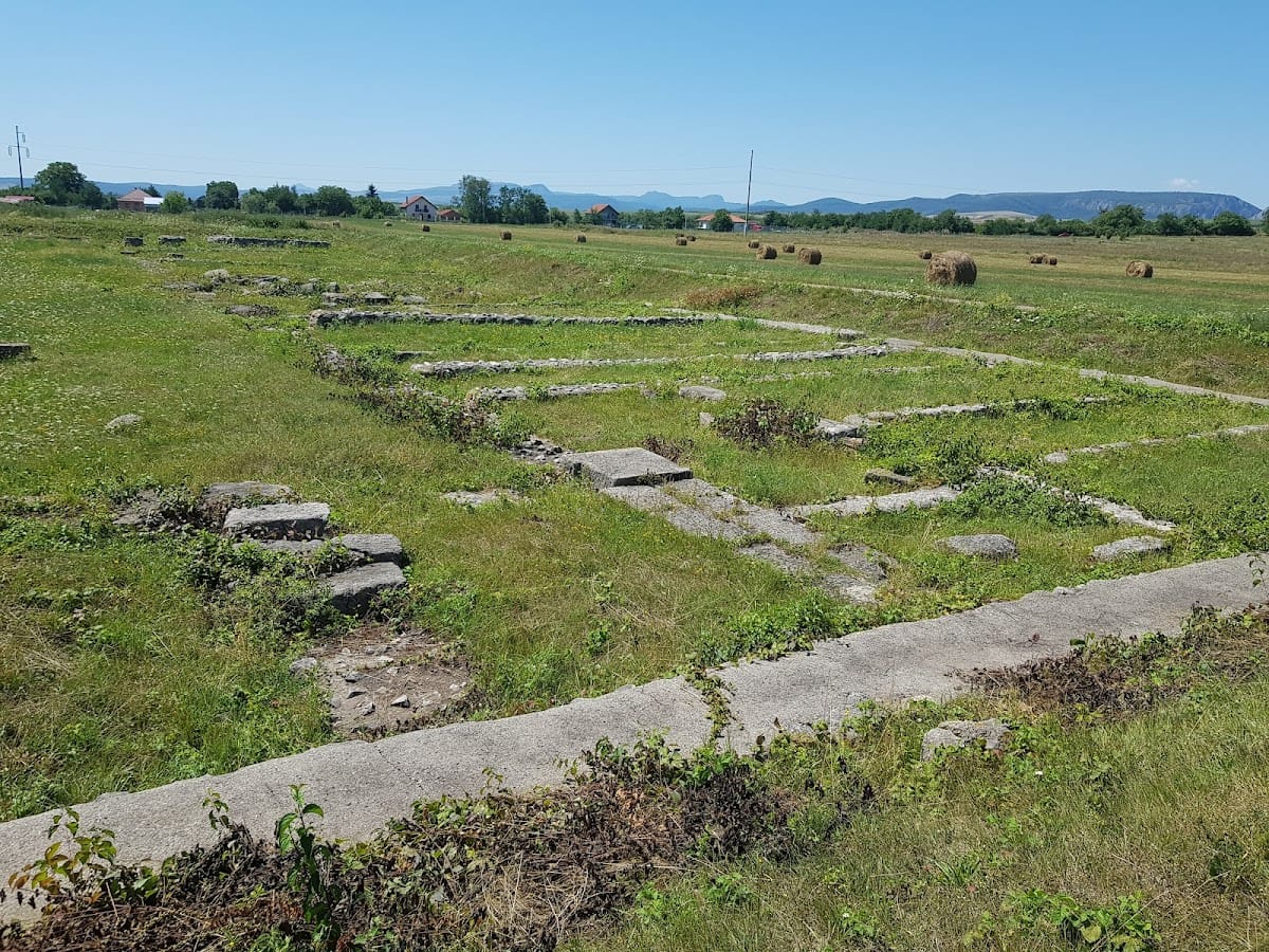
Potaissa Fort occupied Dealul Cetății, a high terrace between the Arieș River and the valleys of Valea Racilor and Valea Săndulești. The terrace stood about 30 to 40 metres above the ancient civilian settlement, while the Trascău Mountains began several kilometres to the northwest. The fortress followed a rectangular Roman plan with rounded corners. Its short sides were aligned approximately east-southeast and west-northwest, and its measured dimensions were about 408 by 573 metres, covering roughly 23.4 hectares.
Walls, Ditches, and Gates
Fortress Wall and Towers
The defensive wall had a perimeter of nearly two kilometres and may originally have reached about five metres in height. Its foundations were 1.7 to 2 metres thick and used opus incertum, a construction method employing irregular stones set in mortar. Fallen squared blocks indicate that the outer face was clad in opus quadratum, made from regularly shaped stone blocks. The upper masonry has not survived in substantial form, and the walls visible today are modern reconstructions based on archaeological measurements.
A V-shaped ditch ran outside the wall. It was approximately 12 metres wide and between 2.75 and 3 metres deep. The four corners contained inward-projecting trapezoidal towers. The northwestern tower followed the curve of the wall over a radius of 18 metres, with an inward-facing side 11.40 metres long and shorter sides 5.30 and 5.50 metres wide. The total number of intermediate towers is unknown, although one between the northwestern corner tower and the western gate had an external rectangular plan measuring about 6 to 6.25 by 6.90 metres.
Porta Decumana
Four gates opened through the fortress wall, one on each side. The porta decumana was flanked by two-storey rectangular towers. The northern tower measured about 6.25 to 6.80 by 8.95 metres, and the southern tower about 6.25 by 9.10 metres. Each projected approximately 3.25 metres beyond the wall.
The gate’s total opening was 12.50 metres wide. A central wall 2.95 metres thick and 6.50 metres long divided it into two passageways, each with an effective width of about 4.78 metres. In a later phase, one half of the gate was temporarily blocked, then demolished while the roadway was rebuilt. The gates connected the fortress with roads in the civilian settlement and with the long-distance route toward Napoca and Apulum.
Roads and Headquarters
Internal Roads and Groma
The principal roads were the via praetoria, via decumana, via principalis, and via sagularis. Smaller roads ran between the barracks and around the headquarters. Their surfaces consisted mainly of marl and river gravel laid in clay. The via praetoria measured about 5.5 to 9.30 metres wide, while the via principalis was about 7 to 10 metres wide. Excavation reports also give widths of 10.30 and 9.40 metres. Porticoes as much as four metres deep stood before some buildings along the main roads.
A 2019 geophysical survey identified a groma over the crossing of the two principal roads. Here, the term refers to an entrance-hall structure rather than the Roman surveying instrument with the same name. The rectangular building measured about 35 metres long, with 17.80 metres between its column foundations and 18.90 metres between its walls. A vestibule extended its total length to about 40 metres. It had a 7.60-metre main entrance toward the headquarters, two side entrances 3 to 3.30 metres wide, and passages 8.50 metres wide toward the via principalis.
Principia
The principia, or headquarters complex, occupied the centre of the fortress on its long axis. Including its outer portico, it measured about 124.6 to 125.6 metres from north to south and 71.8 to 72.6 metres from east to west, covering approximately 0.899 hectares. It was the largest headquarters building in Dacia and among the largest in the Roman Empire.
The front range originally contained five rooms on each side of the entrance. Four rooms in the southern wing were later equipped with hypocaust heating, an underfloor system supplied by hot air. The two rooms nearest the entrance had apses opening toward the entrance and stone platforms probably intended for statues. In a later phase, the apses were removed and two northern rooms were combined as an oil store. About 500 amphorae, mostly Dressel 24 or Similis types, were found there.
Fourteen rooms lined each long side of the headquarters. Their finds and inscriptions identify them as armamentaria, or armouries. One dedication was made by Aelius Vitalis, a custos armorum, to the protective spirit of the armoury. One of the 28 rooms was heated at a time and probably served as an office or living room for the armour guard.
The central courtyard was surrounded by porticoes. Those along the front were 5.30 to 5.40 metres deep, while those beside the armouries measured 3.60 to 4 metres. The columns, including their capitals, stood 2.60 to 2.80 metres high. The open courtyard measured about 41.5 by 73 metres, or approximately 3,030 square metres. It contained paving fragments, imperial honorific inscriptions, fragments of gilded bronze statues, and a well in its southeastern corner.
Basilica and Standards Sanctuary
A basilica occupied the western side of the headquarters and extended across its full width. Its internal dimensions were about 15.65 to 15.90 by 69.90 metres, giving an area of approximately 1,103 square metres. The hall was roofed without internal columns or piers and received light through glazed windows. Foundations of tribunals were identified at both ends.
The basilica yielded fragments of gilded bronze statues and inscriptions naming emperors and imperial relatives from the Severan dynasty through Philip the Arab. The names of 36 centurions also appear among the finds. At the western end, the aedes, or standards sanctuary, stood above the aerarium, the military treasury. The apsidal sanctuary measured approximately 11.60 by 11.80 metres, while the treasury covered about 60 square metres and lay roughly 1.45 to 1.50 metres below the headquarters floor.
The sanctuary was flanked by larger outer rooms, narrower inner rooms, and corridors. All were heated by hypocausts supplied through praefurnia, the furnaces for the heating system. Finds included a fragment of scale armour made from about 3,000 scales and a bronze statuette of Jupiter wielding a thunderbolt.
Barracks and Storage Buildings
Cohort Barracks
Barracks for the second through tenth cohortes quingenariae were excavated in the retentura, the rear sector of the fortress. Each cohort occupied a block of five barracks, one for each century, with 10 to 12 contubernia in each barrack. A contubernium was the basic barracks unit used by a small group of soldiers. Four barracks were arranged in facing pairs, forming internal courts and allowing porticoes about three metres deep.
The individual units covered approximately 33 to 48 square metres. In one excavation phase, six barracks attributed to two cohorts formed a complex measuring about 69.90 by 89.20 metres. Each barrack had eleven rooms, including ten broadly comparable rooms and one L-shaped room. The regular rooms measured about 5.30 by 5.80 to 6.80 by 7 metres, and each housed eight soldiers, giving 480 men for the six barracks. The military tribunes probably lived immediately west of the via principalis, in front of the cohort barracks.
The barracks were built from stone in opus incertum on foundations of river stone and had tiled roofs. Floors included compacted mortar mixed with sand and earth, sometimes containing small brick fragments, as well as pieces of terracotta paving. Pottery, weapons, military equipment, coins, and inscriptions were recovered from the buildings.
First Cohort and Granary
The first cohort, a cohors milliaria of 800 men, occupied about 4,600 square metres south of the headquarters. Its barracks appear to have been arranged in five pairs, each containing eight contubernia. This area was larger than the 2,100 to 2,500 square metres assigned to the smaller cohorts.
A three-part horreum, or granary, stood near the porta principalis sinistra. External buttresses and a raised floor supported by cross-walls and stone posts improved ventilation and protected stored goods from rodents and ground moisture. The building was 36 metres wide, although its full length is unknown. The two outer sections were each 13.50 metres wide and probably served as granaries, while the nine-metre central section may have been a passage or courtyard. Mud-brick facing on the outer walls probably provided insulation.
Baths and Exercise Court
Bath Complex
The baths stood in the right-hand front sector of the fortress beside the via praetoria. Their polygonal complex was oriented northeast to southwest, measured up to 73 by 37 metres, and covered approximately 1,850 square metres. At least two major building phases are represented. The remains are protected by an open roof structure.
The first phase divided the baths into a heated western sector and a cold-bathing eastern sector. Later alterations changed this arrangement. Entry from the via praetoria led through the basilica thermarum, a central assembly hall, to the bathing rooms. The long rectangular frigidarium E, a cold room, measured 9 by 23 metres. Latrine 1 lay to its left, while the 9-by-9-metre apodyterium, or changing room, lay to its right and could also be entered directly from the assembly hall.
Two statue bases in the cold room carry dedications of AD 253 by Marcus Publicianus Rhesus, prefect of Cohors I Batavorum, to Fortuna, Aesculapius, and Hygia. Behind Latrine 1 were two cold-water rooms, including a semicircular room covering about 38 square metres and a rectangular room covering about 31 square metres.
Room F, south of the cold room, was later converted first into another cold room and then into a tepidarium, or warm room. Room J to its east began with a furnace and was later converted into a cold room. Rooms G and H initially formed a cold-bathing area with an apsidal basin. They were later equipped with two furnaces and converted into a caldarium, or hot room.
South of the changing room, rooms B, C, and D provided further heated spaces. Room B was a warm room of about 80 square metres, while room C, covering about 81 square metres, probably served the same purpose. Room D was probably planned as a hot room or steam room, with a heated basin and a shallow basin in its southern apse. Its heating system was later altered. The baths originally followed a partly reverse and partly circular circulation plan, later developing more features of a ring-shaped arrangement.
Palaestra and Southern Complex
A palaestra, an exercise court associated with a bathing complex, extended at right angles to the baths and ran parallel to the via praetoria. It measured internally about 91.15 by 23.40 metres, or approximately 2,133 square metres. Columns probably lined the interior, leaving an exercise width of about 19 metres. Athletic activity took place outdoors rather than in a roofed exercise area.
A four-room complex south of the exercise court measured either 35 by 53 metres or 35 by 60 metres. It may have been heated and included a second latrine beside room K. Its date and function remain uncertain. It may have been an earlier bath building, or it may have been an unrelated structure destroyed by an unknown event. It was not a praetorium, or commander’s residence.
Water Supply and Drainage
Two water-conveyance lines supplied the fortress and civilian settlement from the Izvorul Copăcenilor spring at the foot of the Trascău Mountains, about five kilometres from the Roman settlement boundaries. Both systems used terracotta pipes and stone intermediate basins.
The southern line served the fortress. It descended about 150 metres over five kilometres and used approximately 10,000 pipe sections, each averaging half a metre in length and 12.5 centimetres in internal diameter. It could carry about 15 litres per second, or approximately 1,296 cubic metres per day, much of it used by the baths.
The northern line supplied the civilian settlement. It used about 12,800 pipe sections averaging 0.39 metres long and 25.5 centimetres in internal diameter. Its overall gradient was about 0.9 degrees, although the first 1,250 metres descended 139 metres. Numerous intermediate basins reduced the resulting water pressure. The line carried about 50 litres per second, or approximately 4,320 cubic metres per day, and pipe fragments indicate that the city possessed its own distribution network.
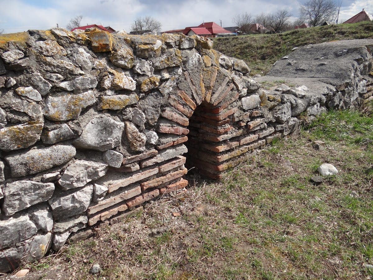
A channel near the northeastern corner carried wastewater through the defensive wall. Another excavated drain was about 0.70 metres wide, bounded by opus incertum walls, paved with square bricks over sand and fine gravel, and covered with stone slabs.
Objects, Cemeteries, and the Civilian Settlement
Construction materials came from several nearby sources. Limestone was obtained from quarries near Săndulești, while ophiolite and volcanic tuff came from the Cheile Turzii area. River stone was collected from the Arieș, and other materials included alabaster, calcareous sandstone, conglomerate, microconglomerate, and breccia. Small quantities of marble came from Runc and Poșaga.
More than 3,200 coins have been recovered from the fortress and civilian settlement. Other finds include roof tiles stamped by Legio V Macedonica, red and grey pottery, rare terra sigillata, amphora fragments, iron tools and weapons, pilum points, keys, hooks, buckles, armour fittings, fibulae, and fragments of scale armour.
The headquarters produced gilded imperial bronze statues, gilded votive statuettes, two bronze statuettes of Jupiter, a bronze acrobat, a child’s bust, the head of a stone statue of Ammon, altars, and honorific inscriptions. A fragment of terra sigillata bears the stamp of the Ianuarius workshop at Rheinzabern and dates to the second half of the second century. Other finds include a lead weight covered with bronze and decorated with silver letters, attributed to a legionary non-commissioned officer active between AD 198 and 211, and a bronze seal box with surviving wax and textile cord.
Two major burial areas belonged to Potaissa. The northern cemetery, near the fortress and civilian settlement, contains 59 recorded graves. A southern cemetery south of Turda and the Arieș contains 86 graves. Cremation burials, including urns and busta, predominate in the northern cemetery over inhumations in sarcophagi, suggesting that it was probably earlier.
The modern town overlies parts of the civilian settlement, while agriculture and later construction destroyed much of the ancient ground surface. Research in the urban area has therefore relied heavily on small rescue excavations and soundings. Finds from Potaissa are displayed chiefly at the Turda History Museum, with additional objects held in museums in Cluj-Napoca, Aiud, Budapest, and Vienna.