Porolissum Roman Fort: A Roman Frontier and Civilian Center in Romania
Site at a Glance
- Rating
- 4.7
- Popularity
- Low
- Country
- Romania
- Primary era
- Classical
- External website
- Open
- Eras represented
- Classical
- Civilizations
- Roman
- Site type
- Military
- Remains
- Fort
On this page15 sections
History
Porolissum Roman Fort is a Roman military and civilian complex in Romania, near Mirșid, established under Emperor Trajan around AD 106 during the Second Dacian War. Built to control a major passage through the Carpathians and defend northwestern Dacia, it became the center of the Porolissensis sector of the Dacian frontier. Its installations formed part of a deep defensive system of forts, watchtowers, ramparts, ditches, walls, and communication routes.
Foundation and military development
The principal position stood about 3 kilometers south of the Meseș Gate, an important route between Dacia and the territory of the Iazyges in the eastern Pannonian Plain. The first fort was a timber-and-earth enclosure occupied by detachments of Legio IIII Flavia Felix and Legio XIII Gemina, together with Cohors V Lingonum and Cohors VI Thracum. Cohors I Ulpia Brittonum and Cohors I Augusta Ituraeorum sagittariorum joined the garrison during the second decade of the second century.
Porolissum’s soldiers came from many parts of the Roman Empire. The garrison included detachments from several legions and auxiliary cohorts, including units associated with Gallic, British, Spanish, Thracian, Illyrian, Ituraean, Lingonian, and Palmyrene recruitment. Some inscriptions may refer to temporary detachments, construction parties, messengers, or travelers rather than permanent units. A building inscription shows that Cohors I Ulpia Brittonum helped construct the left principal gate in AD 128 or 129. The unit remained repeatedly connected with Porolissum during the second and third centuries and took part in the Marcomannic Wars, the conflict between Rome and Germanic and allied peoples from AD 166 to 180.
The timber fort was later replaced by a stone fort. Its construction date remains debated, although a beginning under Hadrian and completion under Antoninus Pius, within the Antonine period of AD 131 to 168, is considered more probable than a date at the beginning of the third century. A further enlargement and rebuilding phase probably took place around AD 213, with some additions perhaps continuing from the middle of the third century. The fort may have remained active until the reign of Aurelian.
Growth of the civilian settlement
A vicus, the civilian settlement beside a Roman military base, developed outside the fort’s northeastern and eastern sides. It expanded southeastward and southward, acquiring an urban character and becoming the administrative center of the province Dacia Porolissensis when that province was created under Hadrian in AD 124. Under Septimius Severus, the community became Municipium Septimum Porolissensis, a municipium being a Roman civic settlement with organized local government and a higher legal status than an ordinary settlement.
At its greatest extent in the late second or early third century, Porolissum may have accommodated about 20,000 civilians and 5,000 soldiers. It was probably the largest military vicus in the Dacian provinces and became a center for cross-border trade and local production. Pottery was produced locally, and glass may also have been manufactured there. Roads linked the settlement with the interior of Dacia and with the frontier market at Sub Ferice. The frequently repeated claim that Caracalla visited Porolissum in AD 213 is now considered unlikely.
The frontier supported sustained contact with communities beyond Roman territory. Neighboring settlements included free populations and mixed Dacian-Germanic communities, possibly including the Buri. Inscriptions bearing Romano-Dacian names indicate political cooperation, while the relationship between the Roman garrison and nearby communities appears to have been relatively peaceful. Porolissum was known as Porolisso on the Tabula Peutingeriana, a Roman road map, and was also mentioned by Claudius Ptolemy. Although the name is not Latin, no archaeological evidence confirms a Dacian settlement beneath the Roman fort. Two nearby Dacian hillforts, at Poguior and Măgura, belonged to the wider regional defensive landscape.
Withdrawal and later occupation
The Roman military and much of the civilian population withdrew under Aurelian around AD 270 to 275 in an apparently organized and largely peaceful evacuation of Dacia. Some Romanized civilians remained, and a smaller settlement continued to trade with the Roman provinces south of the Danube. Christianization appears to have begun gradually from the late fourth century and became more evident during the fifth.
The settlement survived attacks or periods of retreat associated with the Goths, Gepids, Huns, and early Bulgars. Early medieval graves were found within the complex, and occupation may have continued sporadically into the late fourth century. Porolissum was probably finally abandoned in the tenth century, possibly after Magyar incursions.
Excavation and protection
Limited investigations began in the nineteenth century, when Károly Torma worked in the region from about 1860 and published an important account in 1880. Systematic excavations followed under Constantin Daicoviciu in 1937 to 1939 and under Aladár Radnóti and László Barkóczi in 1941 to 1943. Further work took place in 1957 to 1958 and from the mid-1970s through the 1980s. Annual excavations have continued since 1999, supported by archaeological, geophysical, LiDAR, osteological, archaeometric, architectural, and conservation investigations.
Collaborative work included the Porolissum Forum Project from 2004 to 2011 and cemetery investigations at Ursoieș from 2006 to 2009. The area examined by the forum project had a public function, but its precise identification as a forum remains uncertain. A stone sarcophagus containing the remains of a young person was found during restoration in 2015 outside the known cemetery area. Its lid carried common Roman carvings and a hole suggesting that the grave had been robbed in antiquity.
The archaeological remains are protected as historical monuments under Romanian Law 422/2001 and are registered nationally under code SJ-I-s-A-04909. The Dacian Limes, Rome’s frontier system in the former province of Dacia, was inscribed as a 277-component UNESCO World Heritage property in 2024. Parts of the forts, settlement, and amphitheater have been excavated, conserved, restored, or reconstructed. Excavated material is held principally by institutions in Cluj-Napoca and Zalău.
Remains
The Pomet fort
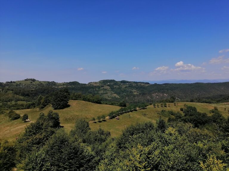
The principal fort, known as Moigrad-Pomet, occupies the summit and northwestern slope of Pomet Hill within a landscape of hills and valleys associated with several river systems. Its first enclosure was a rectangular timber-and-earth fort measuring about 225 by 295 meters, or 6.6 hectares. The corners followed the cardinal directions. An earth rampart strengthened with timber was about 8 meters wide and 1.6 meters high, while a V-shaped ditch about 15 meters wide and 3.5 meters deep protected three sides. The southwestern side had two ditches, an inner ditch about 9 meters wide and 2.5 meters deep and an outer ditch about 5.5 meters wide and 3 meters deep.
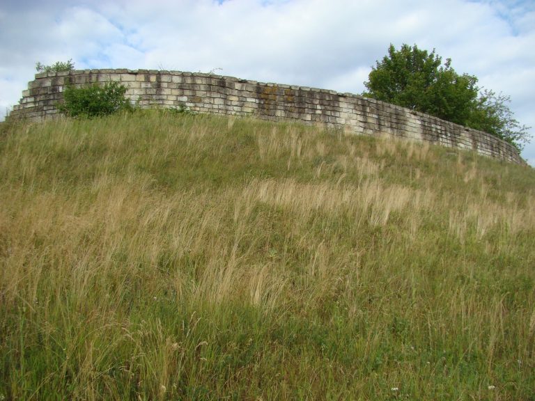
The later stone fort retained the earlier orientation and had a rectangular plan with rounded corners, often described as playing-card shaped. It measured approximately 225 to 230 by 295 to 300 meters and covered about 6.6 to 6.9 hectares. Its walls were built in opus incertum, a Roman technique using irregular stones set into concrete, and were about 1.5 to 2.5 meters thick. Landslides displaced sections of the wall, which were strengthened with buttresses. The northeast-facing front, directed toward the presumed enemy, had trapezoidal corner towers and inward-projecting intermediate towers.
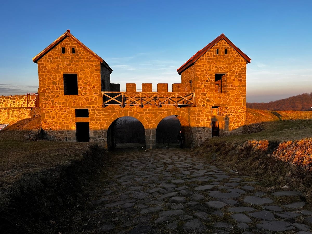
Four large gates were flanked by towers. The gate towers may first have been rectangular before being replaced by outward-projecting semicircular towers about 4.8 by 9 meters. Three gates had two passages, while the rear gate had one. The reconstructed main gate is lower than the original structure. The earlier gate stood one story higher, with wider openings between its battlements and cornices on the towers and walls.
Headquarters and internal buildings
The first headquarters building, or Principia, and the commander’s residence, or Praetorium, were constructed in clay and timber during the first fort phase. The Principia later passed through seven building, repair, and expansion phases. It initially measured about 29 by 30 meters. Its central arrangement included an atrium, a basilica for administrative and judicial activity, and a sanctuary for the unit’s standards. Six rooms at the rear surrounded the sanctuary, and their floors used opus signinum, a waterproof cement-like finish containing crushed ceramic material. Two statue bases stood beside the sanctuary entrance.
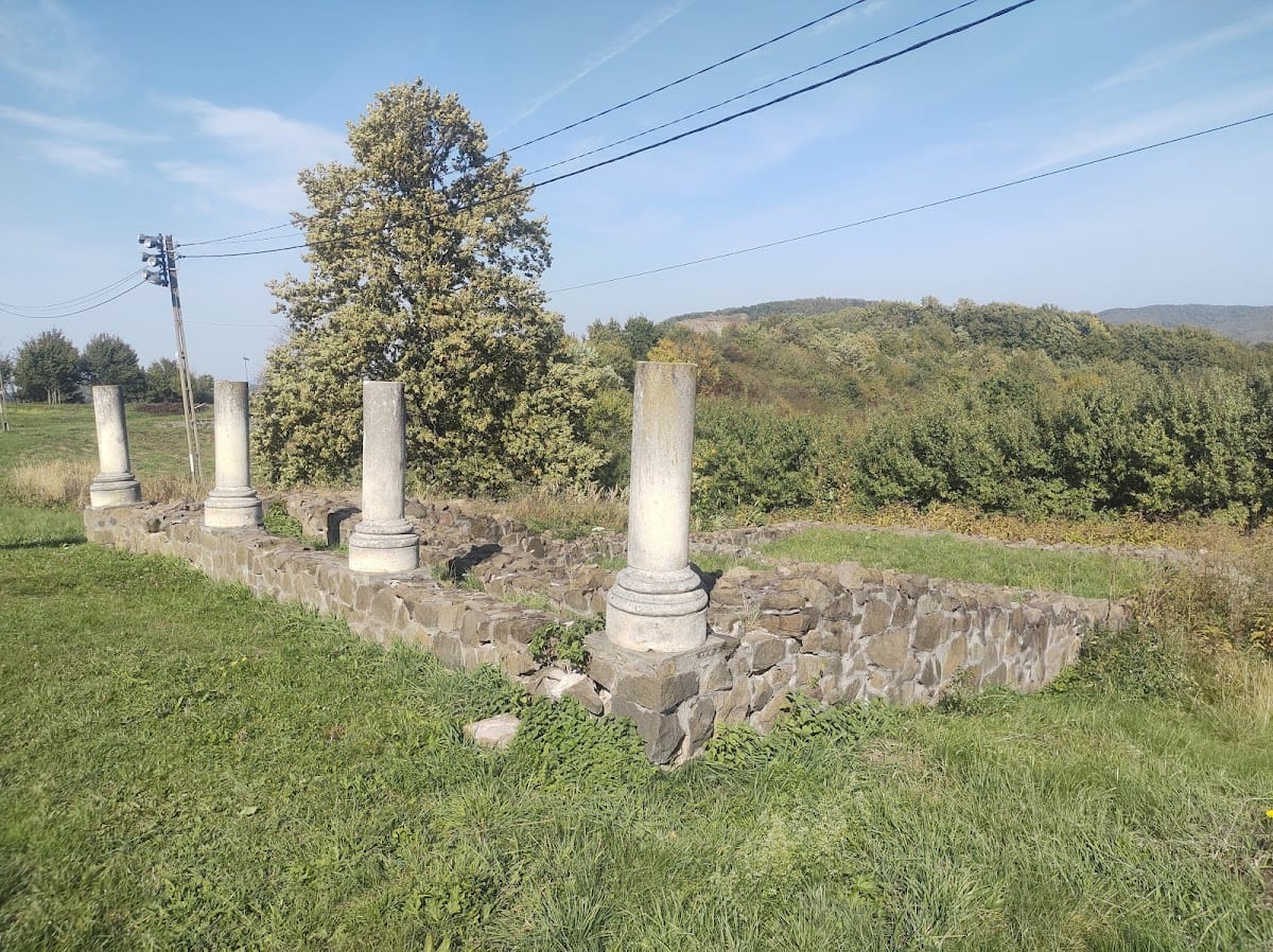
Later changes added pilasters or columns along the basilica wall facing the atrium and created further rooms inside and outside the original structure. These alterations produced an irregular polygonal plan. Rooms on the southeastern side contained traces of a hypocaust, an underfloor heating system through which hot air circulated beneath the floor.
Building C2 stood immediately south of the right principal road. It covered about 1,995 square meters and included a portico along the road, an open courtyard, rows of rooms, and a long entrance range. It is generally interpreted as a Praetorium, although limited excavation leaves that identification uncertain. Buildings C4 and C5/7 formed part of the same line of large buildings. C4 has been interpreted as a commander’s residence, hospital, workshop, or storehouse. Corridors beside possible sick rooms support the hospital interpretation, while the function of C5/7 remains unresolved.
Water supply and storage
A large cistern occupied the left front sector of the fort and was stabilized externally by buttresses. Its interior measured about 6 to 6.4 meters wide and 27 meters long, with a depth of 2 to 2.5 meters. Its estimated capacity was between 324,000 and 432,000 liters.
An underground building west of the headquarters measured about 7.5 by 25 meters. Two reliefs of Mithras initially led to its interpretation as a Mithraic shrine, but investigations in 2011 identified it as a second cistern, probably holding about 400,000 liters. Four strongly founded and buttressed storehouses supplied the fort and its outer posts. The largest measured approximately 15.4 by 50 meters and provided about 780 square meters of storage space.
Citera and Coasta Citerii
The Citera installations stood about half a kilometer east-northeast of Pomet on the summit of wooded Citera Hill, nearly 500 meters above sea level. Their position allowed visual communication with Pomet and other military posts. The first Citera fort was a rectangular timber-and-earth enclosure measuring about 60 by 95 meters. Its rampart was approximately 6 meters wide and 1.5 meters high.
The stone fort measured about 66.65 by 101.1 meters and covered approximately 0.67 hectares. It retained the earlier orientation and had rounded corners, walls about 1.2 meters thick made in opus incertum, and a ditch approximately 7.5 meters wide and 3.9 meters deep. Four corner towers and four large gates formed part of the enclosure. The northwest-facing main gate and the other gates each had two towers, with one-third of each tower projecting outward and two-thirds extending into the fort. A coin of Antoninus Pius supports a date in the middle of the second century. The fort’s abandonment is disputed, with interpretations ranging from destruction during the Marcomannic Wars to continued use far into the third century.
Moigrad-Coasta Citerii lies on the eastern slope of Citera Hill beside the Citera fort. LiDAR evidence suggests that the two areas may partly overlap. The enclosure covered no more than about 2.56 hectares, and its western side has not been identified. A clearly visible turf-sod wall surrounds it, while only a small trench has cut through the enclosure and its interior remains little explored. Interpretations include a Dacian fortification reused as a Roman marching camp, a training camp, or an annex fort. The wall did not also surround the Citera fort, making simultaneous use of both installations unlikely.
Frontier road and customs station
A paved road from Napoca approached Porolissum from the southeast, crossed the civilian settlement, passed directly in front of the northeast face of the Pomet fort, and continued about 400 meters northwest toward the frontier. It was approximately 4.5 to 5 meters wide. Worn wheel ruts preserved in excavated sections indicate intensive movement of goods.
A small fort and customs station stood at the road’s frontier end, beyond which lay the Barbaricum, the Roman term for territories and communities outside the imperial frontier. The first fort had a timber-and-earth enclosure measuring 32 by 40 meters and a single wooden gate on the south. Probably during the 140s, it was replaced by a stone enclosure measuring about 35 by 43 meters with a stone gate. A former watchtower may have been incorporated into its northern side. Two wooden barracks stood inside during both phases, separated by a gravel path, and soldiers of Cohors V Lingonum served there.
A two-room customs annex was built against the western wall beside the road. One room had an official or religious character, with bases for inscribed stones and possible portraits. The building yielded varied material linked to state-controlled economic activity and is regarded as the first excavated customs building identified within the Roman Empire.
Sub Ferice market
The temporary frontier market of Sub Ferice lay beyond the boundary near the customs station and fort. A watchtower on Dealul Ferice could oversee the market. Rescue excavations in 2013 exposed more than 120 sunken features across about 3,500 square meters, including market stalls and small ditches. The market produced large quantities of pottery, more than 750 small finds, and 129 coins.
The finds included iron and bronze brooches, many made outside the Roman world, as well as tools, shoe nails, handmade and wheel-thrown pottery, imported Terra Sigillata, glass vessels, and Baltic amber. Some imported objects were associated with the Przeworsk culture and the Vandals. A branding iron probably related to the sale or inspection of livestock. The high proportion of silver denarii points to wholesale exchange, while counterfeit coins included bronze-cored denarii and a supposed gold coin made by covering a denarius with gold.
The civilian settlement
The civilian settlement began directly outside the fort’s front and extended for several hundred meters along the frontier road before spreading southeastward and south of Pomet. Its original northeastern core covered about five hectares and included houses, shops, public buildings, and religious structures. Builders used artificial fill to create level platforms. Residences, combined houses and shops, and tabernae occupied the settlement. These commercial buildings had domestic rooms at the rear, sales areas on the ground floor, and some spaces in basements. Many houses had underfloor heating in at least part of their interiors.
A public or commercial area traditionally called a forum contained representative buildings and evidence of trade, although its exact function remains uncertain. Excavations recovered about one tonne of material, including mainly local pottery, pottery imported from elsewhere in Dacia, Italian and Germanic Terra Sigillata, window glass, glass vessels, coins ranging from Domitian to Severus Alexander, iron nails and clamps, copper-alloy brooches, and animal bones. Cattle represented about 41 percent of the animal bones, pigs 28.6 percent, and sheep and goats 20.1 percent. Some bones had butchery marks.
Public baths were identified or suspected in two locations. One possible complex lay at the southwestern edge of the settlement near the amphitheater, where a possible exercise court was also observed. Another was located south of the fort’s southern corner tower in the forum area.
Sanctuaries and amphitheater
A sanctuary terrace north of the fort contained temples dedicated to Jupiter Optimus Maximus Dolichenus, Bel, and Liber Pater. The buildings underwent their own enlargement and alteration phases. A shop associated with the Jupiter Dolichenus temple may have supported rituals or processions. The temple was probably destroyed by fire at the beginning of the second half of the third century, and its latest coins date to AD 251 to 253.
The amphitheater stood about 260 meters southeast of the rear gate of the Pomet fort. Its elliptical long axis ran from west-northwest to east-southeast. An earlier timber-and-earth building, probably erected around AD 120, had a performance area measuring about 60 by 46 meters. Timber seating rested on an artificial earth bank, whose postholes survived.
In AD 157, the timber structure was replaced with stone after the earlier building had become dilapidated. An inscription attributes the rebuilding under Antoninus Pius to his procurator, Tiberius Claudius Quintilianus. The stone amphitheater had an arena about 66.5 by 51.8 meters and could hold an estimated 4,500 to 5,500 spectators. A wall and internal drainage channel separated the arena from the seating.
Rooms for gladiators lay beneath the seating along the transverse axis and opened directly onto the arena. Small shrines to Nemesis, the Greco-Roman goddess associated with justice, fortune, and destiny, occupied the same area. The main entrances at the ends of the long axis were connected with animal cages and direct access to the arena. A temple of Nemesis stood beside the southern side of the northwestern entrance. The amphitheater has been partly reconstructed and conserved.
Cemeteries and wider defenses
Two burial grounds formed part of the wider complex. One extended southeast of the fort and settlement for perhaps 1.5 kilometers along the road toward Napoca, reaching Dealul Ursoieș west of Jac. It contained both cremations and inhumations. Another cemetery lay about 2.5 kilometers east of Pomet at Leanca. Their precise organization and relationship to the Pomet and Citera forts remain uncertain.
The wider frontier relied on mutually visible forts and watchtowers connected through local communication networks. Inner defensive lines stood immediately west and north of the main forts, while the principal frontier line lay farther outward. The southwestern inner line consisted mainly of watchtowers. One excavated tower measured approximately 9.5 by 10.5 meters, with walls 1 to 1.1 meters thick and surviving to about 1.5 meters high. Pottery, glass, weapons, and building materials were found inside, together with a hearth against the southern wall. A tile stamp identifies Cohors VI Thracum.
The northern defensive line combined watchtowers, forts, ramparts, and ditches. It curved around Porolissum in an approximate quarter circle from the latitude of Romita in the southwest toward Tihău in the northeast. Together with the main forts, roads, customs installations, market, and civilian settlement, these remains show how military defense, administration, production, and controlled exchange operated across the Porolissensis frontier.