Fortress Mont Royal: A French Stronghold on the Moselle
Site at a Glance
- Rating
- 4.3
- Popularity
- Low
- Country
- Germany
- Primary era
- Early Modern
- External website
- Open
- Eras represented
- Early Modern
- Civilizations
- French
- Site type
- Military
- Remains
- Fort
On this page12 sections
History
Fortress Mont Royal is a French fortress in Germany, located above Traben-Trarbach on a bend of the Moselle. Built between 1687 and 1698 during the reign of Louis XIV, it formed part of a northern defensive belt intended to secure France’s eastern frontier and control the Moselle Valley.
Planning and construction
The fortress emerged from Louis XIV’s policy of territorial reunions, which sought to extend and consolidate French control along defensible frontiers. In 1681, War Minister François Michel Le Tellier, commonly known as Louvois, commissioned the engineer Thomas de Choisy to locate a suitable fortress site on the route toward the Rhine. Choisy selected a hill in a bend of the Moselle near Traben-Trarbach.
On 24 March 1687, Louvois sent Choisy’s concept to Sébastien Le Prestre de Vauban, France’s commissioner-general of fortifications and the principal designer of many of Louis XIV’s defensive works. Vauban prepared the design and presented it to the king on 23 May. Louis XIV named the planned fortress Mont-Royal in June and awarded Vauban a gratuity of 12,000 silver thalers.
The hill was cleared in July 1687, and the foundation stone was laid on 25 July. Construction continued for eleven years, employing as many as 8,000 forced laborers and consuming substantial financial resources. The project was organized as one of nine new towns created and fortified according to Vauban’s plans between 1679 and 1698.
Military role and dismantling
Mont Royal was planned as an operational base, supply depot, and winter quarter for Louis XIV’s Army of the Rhine. It functioned in this capacity during the Nine Years’ War, also called the War of the League of Augsburg, a European conflict fought from 1688 to 1697 against French expansion.
In 1690, the fortress held a garrison of fourteen regiments. Its arsenal and supply depots contained weapons, ammunition, and provisions for an entire army. The facilities could accommodate 8,450 soldiers, 3,000 cavalry horses, and 1,500 civilians, while by 1692 the storage capacity could provision more than twice that number of people and animals.
The fortress supported Louis XIV’s vision of a continuous natural frontier along the Rhine. The Peace of Ryswick in 1697 ended the Nine Years’ War and required France to surrender several territorial acquisitions. After France gave up its reunified territories under the settlement, Mont Royal lost its strategic purpose. In exchange for Strasbourg, Louis XIV ordered its dismantling in spring 1698.
Demolition began before construction had been fully completed. The depots were dissolved, French troops withdrew, and the civilian inhabitants were relocated to Saarlouis. Parish registers preserved from the brief settlement show that an independent and multicultural community had developed on the mountain during the fortress’s short existence.
Rediscovery and preservation
Regional historian Dr. Ernst Willen Spies helped bring Mont Royal back into historical view. After studying original plans preserved in the military archives at Vincennes, he directed major excavations with local volunteers from 1929 to 1938. A voluntary labor service also assisted with the work from 1929 to 1937.
The early excavations were partly intended to create a distinctive attraction for the Middle Moselle region. After the war, the exposed remains were left for a long period to gradual deterioration. Later volunteer efforts, linked to renewed interest in conserving castles and fortifications, sought to preserve and interpret the ruins as evidence of European cultural heritage.
Remains
Fortress Mont Royal occupied the entire ridge of the Traben peninsula above a bend of the Moselle, between Kröv to the west and Kövenig to the east. The ridge lies north of Traben-Trarbach, at elevations described as approximately 200 metres above the Moselle and between 240 and 305 metres above sea level. The fortified complex covered about 50 hectares, with a principal fortified area approximately 1,600 metres long and up to 750 metres wide.
Fortifications and citadel
Rampart and defensive circuit
A main rampart enclosed the complex for almost 3 kilometres, with a more precise recorded length of 2,920 metres. It rose more than 20 metres in places and reached up to 30 metres at some points. The system followed the low, angular principles associated with Vauban-style fortification, arranging defensive works so that they could support one another against attack.
Citadel and external works
The citadel was protected by five projecting bastions, three bastioned towers, and numerous external defensive works. A bastion was an angular projection from which defenders could fire along the faces of the enclosing walls. Excavations have revealed wells, vaulted cellars, wall walks, and flank batteries, providing physical evidence of the fortress’s defensive and logistical organization.
Military and civil quarters
Trarbach and Grevenburg
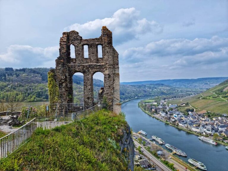
The complex incorporated Trarbach, which was protected by an enceinte, the principal enclosing wall or defensive circuit of a fortified place. On the opposite side of the river stood the older Grevenburg castle, which Vauban transformed into an advanced outwork of Mont Royal.
Grand Royal Headquarters
South of the citadel lay the Grand Royal Headquarters, a fortified camp with tents and barracks for up to 12,000 men. It also contained stables for 3,000 horses. The wider complex included a commercial quarter, premises for contractors, and a small town governed under its own jurisdiction.
Arsenal, hospital, and barracks
Mont Royal contained the largest arsenal in France at the time, together with a hospital of approximately 1,000 beds and barracks for more than 4,000 soldiers. The original plans preserved in the military archives at Vincennes guided archaeological work that recovered and documented parts of the former military and civil complex.
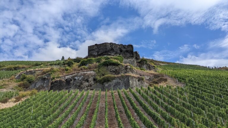
After dismantling and prolonged neglect, the fortress survives as archaeological ruins affected by vegetation and erosion. The surviving remains include elements of the enclosing defenses, underground spaces, and military structures, while interpretive signs explain the excavated features along a former fortress route on the mountain.
Nearby sites