Bibracte: Capital of the Aedui in France


Site at a Glance
- Rating
- 4.8
- Popularity
- Very Low
- Country
- France
- Primary era
- Iron Age
- External website
- Open
- Eras represented
- Iron Age, Classical
- Civilizations
- Celtic, Roman
- Site type
- City
On this page18 sections
History
Bibracte is the fortified capital of the Aedui in France, developed chiefly during the second and first centuries BC on Mont Beuvray in the Morvan. Founded near the end of the second century BC, it served for about a century as the political center of a powerful Celtic people whose territory lay in central Gaul. At its height, the settlement had an estimated population of 5,000 to 10,000 and functioned as a major center of government, trade, taxation, and craft production.
Foundation and Aeduan power
The Aedui selected Mont Beuvray for its position between the Rhône and Saône corridor, the Loire, and the Seine basin. The mountain commanded the valleys of the Loire and Saône, while its abundant water, rainfall, and relatively mild mountain climate supported a substantial population. Bibracte was an oppidum, a large fortified settlement often built on a hill, and its irregular form followed the steep terrain around the mountain’s three summits.
The Aedui had been allied with Rome since at least the middle of the second century BC. This relationship brought Roman merchants and Mediterranean goods to Bibracte before the Roman conquest of Gaul. The settlement controlled routes through the Rhône, Saône, Loire, and Allier valleys, helping distribute Roman products across Gaul. Italian wine and ceramics arrived in large quantities, while local workshops made iron and copper-alloy objects. The Aedui also taxed goods crossing their territory, including commodities transported along the Saône.
Bibracte during the Gallic War
Bibracte became involved in decisive events during the Gallic War, the Roman campaign that brought most of Gaul under Roman control. In 58 BC, Julius Caesar defeated the Helvetii near Montmort, about 25 kilometres south of the settlement. Four years later, in 52 BC, an assembly of Gallic peoples held at Bibracte entrusted Vercingetorix, a Gallic military leader, with supreme command of the Gallic armies.
Caesar treated Bibracte relatively leniently after the conflict. He spent the winter of 52 to 51 BC there and wrote part of his Commentaries on the Gallic War at the settlement. He described Bibracte as the largest and richest city of the Aedui. The geographer Strabo still identified it as an Aeduan stronghold a generation later.
Romanization and abandonment
Romanization had begun before the conquest and accelerated afterward. From the middle of the first century BC, Mediterranean construction methods appeared alongside Roman-style houses and monumental buildings. Bibracte nevertheless retained its fortified hilltop setting and irregular urban organization.
During the reign of Augustus, around 15 BC, the Romans founded Augustodunum, modern Autun, about 25 kilometres away. Bibracte then declined and was gradually abandoned over several decades. The move may have reflected economic considerations or the wish of part of the Aedui elite to adopt the Roman model of a lowland city located on major communication routes. Religious activity at temples and fountains continued, and some aristocratic residences remained in use for a time. The Temple of the Terrace was later replaced by a Christian oratory.
Medieval memory and rediscovery
Bibracte faded from historical awareness after antiquity. From the sixteenth century, scholars, aristocrats, and clergy debated whether the ancient capital had stood at Autun, Beaune, or Mont Beuvray. Evidence for Mont Beuvray included the resemblance between the names Bibracte and Beuvrect, medieval traditions, the survival of a major annual fair, and finds of pottery and coins. In 1725, the priest of Saint-Léger-sous-Beuvray also made observations that supported the identification.
A major fair continued at Mont Beuvray from at least the thirteenth century, taking place in the first days of May. A Franciscan convent was established there in the late fourteenth century and abandoned about two centuries later, while the fair continued. Autun was initially the favored location for ancient Bibracte and was temporarily renamed Bibracte after the French Revolution.
The archaeologist Jacques-Gabriel Bulliot shifted opinion toward Mont Beuvray. In 1851, he investigated the summit and recognized that what he had first interpreted as a Roman military embankment was actually a Celtic sacred enclosure, or nemeton. A nemeton was a ritual enclosure used in the religious traditions of Celtic-speaking communities. After investigations by Xavier Garenne and the landowner Viscount Auguste Ernest d’Aboville, Napoleon III assigned Bulliot to research the site in 1867 and provided funding. Bulliot excavated Bibracte until 1895, and his nephew Joseph Déchelette continued the work until 1907. Their research established Mont Beuvray as ancient Bibracte.
Modern archaeology and conservation
Excavations resumed in 1984 through an initiative of President François Mitterrand, who proclaimed Bibracte a site of national interest in 1985. French and European teams have since investigated the settlement from its foundation through its peak, early Romanization, and abandonment. Excavated materials are presented at the site museum, while earlier excavation collections are held partly at the Rolin Museum in Autun and the National Museum of Archaeology at Saint-Germain-en-Laye.
The European Archaeological Center of Mont Beuvray was established in 1989 and inaugurated in 1995 at Glux-en-Glenne. It brought the archaeological site, museum, and research facilities into a coordinated program. Research led by Vincent Guichard has focused particularly on the Rebout area, the Gallo-Roman complex at the Pasture of the Convent, and the Roman residence in the Horse Park. Since 2007, Bibracte has been managed and conserved by a public establishment for cultural cooperation involving the French state, regional and departmental authorities, the Morvan Regional Natural Park, the National Monuments Centre, and the National Centre for Scientific Research.
The summit has been protected as a historic monument since 1988, and Bibracte received the Grand Site de France designation in 2007. The wider massif was classified for its landscape and scientific interest in 1990 and is also included in ZNIEFF and Natura 2000 frameworks. Airborne lidar surveys introduced since 2007 have supplemented ground investigations and produced a fuller plan of the settlement while recording its topography.
Remains
Mountain setting and fortified enclosure
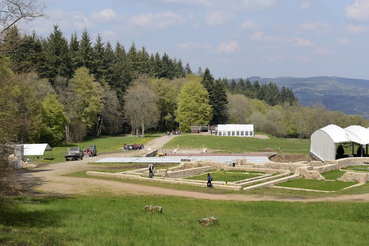
Bibracte occupies the summit and slopes of Mont Beuvray across the communes of Saint-Léger-sous-Beuvray, Glux-en-Glenne, and Larochemillay. The mountain reaches 821 metres and has three principal summits, the Theurot de la Wivre, the Theurot de la Roche, and the Porrey. The archaeological site lies within a heavily forested landscape covering roughly 1,000 hectares.
The settlement was organized around a central route running from the Rebout Gate toward the Great Gates and was divided into neighborhoods. Its uneven plan reflects the varied slopes surrounding the three summits rather than a regular grid. Two successive fortification lines enclosed the oppidum. The outer enclosure surrounded about 200 hectares and extended for approximately 7 kilometres. It was built as a murus gallicus, a Gallic rampart with an internal timber framework, earth or rubble fill, and a stone facing. The wall stood about 4 to 5 metres high and had a comparable depth. A ditch about 2 to 4 metres deep and 6 to 10 metres wide lay in front of it. The original upper structure, possibly involving palisades or towers, remains uncertain. The outer wall was later dismantled, and its stone facing was probably reused in the inner enclosure.
The later inner enclosure extended for approximately 5 kilometres and enclosed about 135 hectares. Its construction consumed more than 10,000 cubic metres of timber, between 10,000 and 20,000 cubic metres of earth, and about 30 tonnes of iron. The wall was repaired or rebuilt at least five times. Its construction reduced the enclosed area from roughly 200 to 135 hectares.
Rebout Gate
About fifteen gates punctuated the fortifications, with the Rebout Gate serving as the principal access point. It measures approximately 20 metres wide and 40 metres deep. Excavations between 1984 and 1986 revealed five successive repair levels as well as a Neolithic palisade dated by radiocarbon. A reconstruction of the palisade dates from 1996. No locking system or defensive mechanism has been identified, while the proposed double gate and wooden guard tower remain hypothetical.
Advanced defenses and postern
A separate fortification line downhill from the Rebout Gate has been investigated since 2005. Its dating places it later than the gate and indicates a role as an advanced defensive work. Aristocratic funerary enclosures lay between the two fortification lines. At Porrey, a known postern is currently the only identified secondary entrance associated at Bibracte with a murus gallicus fortification.
Artisan neighborhoods
The Côme Chaudron and Champlain neighborhoods near the Rebout Gate combined metalworking with artisan housing. Excavations have identified activity by blacksmiths, bronzeworkers, and enamellers, along with probable goldsmiths and coiners. Investigations in Champlain and the surrounding massifs have indicated the extraction of gold, iron, and tin ore. Some metal may have reached Bibracte in bars for further work inside the oppidum.
A second artisan neighborhood lay near the summit at Pierre de la Wivre. It was only lightly investigated during the nineteenth and early twentieth centuries, and its precise organization and function remain under study.
Houses and elite residences
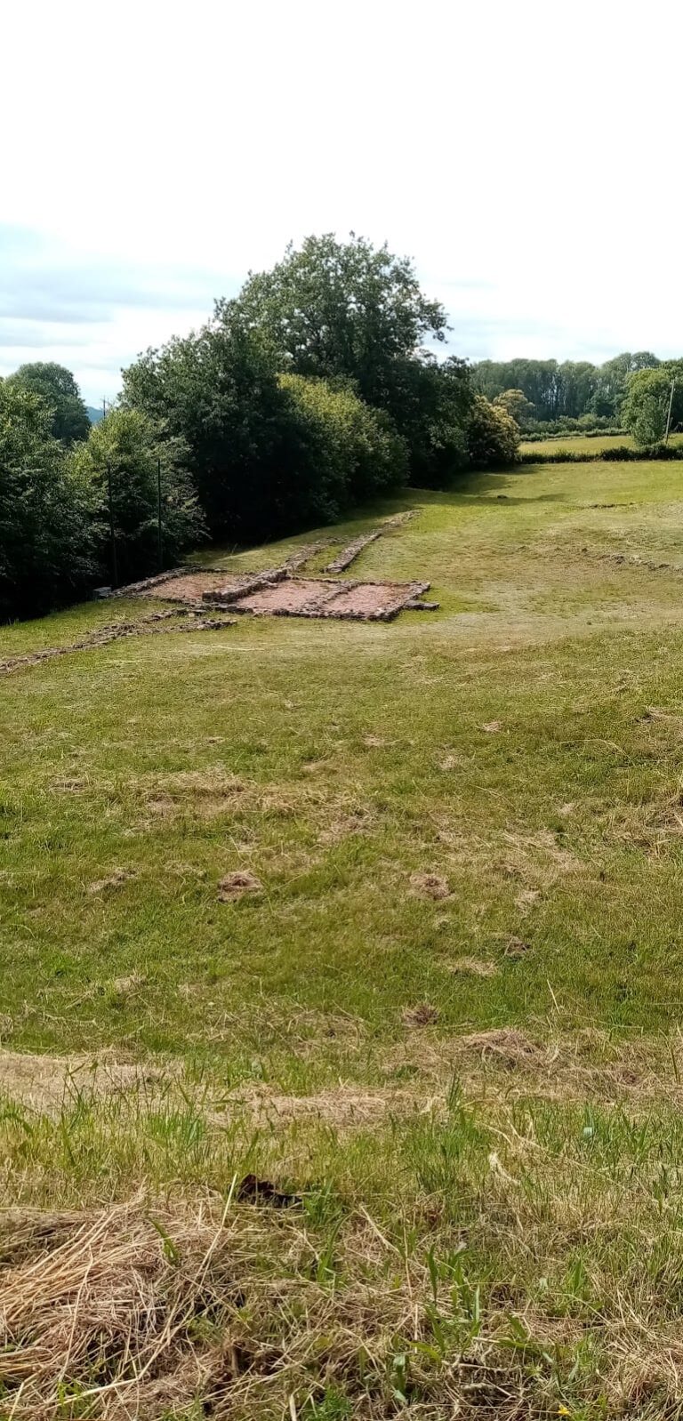
Most Gallic houses were built mainly from wood and earth, with stone used sparingly outside features such as the fortifications. Because wood survives poorly, the form of these buildings is only partly understood. Stone buildings in the Horse Park are probably aristocratic residences, while a columned building at the Pasture of the Convent was probably public. These Roman-influenced structures appeared soon after the Gallic War.
Horse Park residences
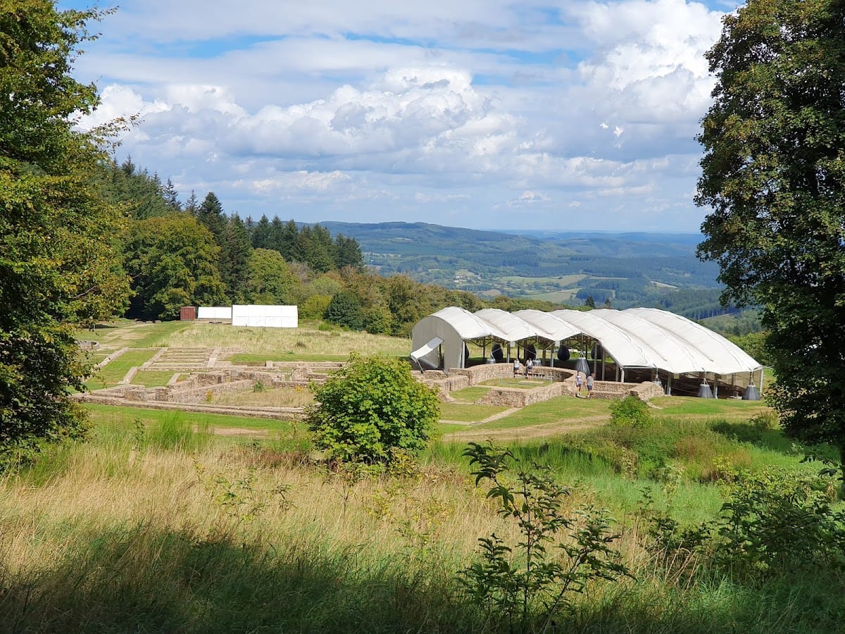
The Horse Park contains several Roman-style stone houses excavated since the nineteenth century. Residence PC1 developed from a wooden building influenced by Roman design into a large domus, or Roman-style urban house. Its later form included an atrium with an impluvium, a basin that collected rainwater, porticos, heated baths using a hypocaust, and sewers. In its final phase, the residence measured approximately 55 by 67 metres and covered about 3,500 square metres. Around fifteen domus are estimated in the area, including the smaller PC2 across the central road and villa rustica-type buildings such as PC33. Forges near the residences leave open whether the district was exclusively residential or reserved solely for the elite.
Monumental and civic complex
The Pasture of the Convent contained a monumental complex organized around a Roman basilica that may have served as a forum. The complex dates approximately from 50 to 30 BC, with construction phases placed more narrowly between 50 and 40 BC and between 35 and 25 BC. Its basilica had three naves, an internal peristyle, a colonnade surrounding a courtyard, and a peripheral ambulatory, or circulation passage. Four rows of eight columns or pilasters supported the building. On the east, it connected to a square measuring 22 metres on each side and bordered by porticos. On the west, another square measuring 17 metres on each side linked it to the main road.
Surviving architectural fragments include limestone columns, Attic bases, and Doric and Corinthian capitals. The basilica and adjacent square were carefully levelled before being replaced by a large private residence, probably during the transfer of the Aedui capital to Autun. The basilica is regarded as the earliest known example of monumental Roman stone architecture in non-Mediterranean Europe.
Granite basin
A monumental basin of pink granite stands at the center of the main road in the Pasture of the Convent. Its transverse orientation corresponds to sunrise at the winter solstice and sunset at the summer solstice. Water flowed through a northern opening and continued along a channel, although no supply system has been found. Red clay waterproofed the basin, excluding a spring as its source, and no inlet channel has been identified.
The basin was laid out through the intersection of two circles and precise proportions forming a 3:4:5 Pythagorean triangle. Its purpose remains uncertain. Interpretations include a sacred foundation point and a monument connected with water worship. Its unusual granite-working technique has Mediterranean affinities, suggesting that the Aedui may have employed foreign specialists. Some researchers have also connected the basin with druidic practice.
Storage buildings
Numerous cellars and probable public buildings near the basin stored large quantities of grain and imported wine. One wooden cellar has been reconstructed. These structures may have helped centralize Aeduan harvests and imported goods.
Water sources, sanctuaries, and burial areas
About ten springs and five fountains from the Gallic or Gallo-Roman periods are known at Bibracte. The Saint-Pierre Fountain served as a place of worship and pilgrimage, where coins and votive offerings were found.
At the summit, a Celtic nemeton covered about 1 hectare. A palisade and concentric ditches enclosed the sacred area. Excavations in 1988 beneath the present nineteenth-century chapel uncovered a Gallo-Roman temple.
The necropolis lies beneath the present museum parking area. Rescue excavations connected with construction of the museum and the diversion of a departmental road revealed about seventy east-facing cremation enclosures across 1.5 hectares, with the cremation area farther south. Additional funerary urns discovered below the Rebout Gate may belong to an aristocratic family.
Museum and research center
The modern Museum of Bibracte was designed by Pierre-Louis Faloci and opened in 1996. Its architecture combines a cut-stone base with walls of polished stone, smooth concrete, glass, and a metal roof. Large glazed facades are partly screened by a wall on the valley side, while those facing the archaeological site provide views toward it. The permanent exhibition occupies about 2,000 square metres over two floors and presents Bibracte, the Aedui, the oppida, and the process of Romanization.
The European Archaeological Center at Glux-en-Glenne stands 4 kilometres from Mont Beuvray. Its facilities include archaeological storage, laboratories, restoration spaces, administrative offices, a specialist library, a seminar room, and a regional center for conserving and studying archaeological collections. After works completed in 2011, the center provided about 4,100 square metres of usable space. Its library contained approximately 37,500 indexed titles and about one hundred journals.