Fort 49 1/2 a “Mogiła”: An Austro-Hungarian Infantry Fort in Kraków


Site at a Glance
- Rating
- 4.2
- Popularity
- Low
- Country
- Poland
- Primary era
- Modern
- External website
- Open
- Eras represented
- Modern
- Civilizations
- Austria-Hungary, Habsburg
- Site type
- Military
- Remains
- Fort
On this page16 sections
History
Fort 49 1/2 a “Mogiła” is an Austro-Hungarian infantry fort in Kraków, Poland, built by the Austro-Hungarian Army in 1895–1896 as part of the Krakow Fortress. It belonged to the system’s third defensive ring and guarded the Sandomierz route and the Vistula escarpment at Mogiła.
Construction and defensive purpose
The fort was designed as a small intermediate work for close defence. Its position allowed it to protect the forefield of Redoubt 49 1/2 “Wanda”, a detached fortification that reinforced the surrounding defensive line, while an artillery battery beside the southern flank helped control the Vistula valley. The fort therefore operated as one element in a network of forts, batteries, redoubts, roads, and field obstacles centred on Kraków.
Its arrangement was functionally and structurally almost identical to Fort 41a “Mydlniki”. The surrounding agricultural landscape influenced the defensive design. Vegetation, concealed roads, and earth-covered structures helped disguise the fort and allowed protected movement around it. A concealed road in a ravine connected the position with the Sandomierz route, and a single-storey guardhouse beside that route may have served as a military checkpoint and possibly as the easternmost post of the Krakow Fortress.
War and the end of military importance
The artillery batteries associated with Fort 49 1/2 a “Mogiła” and Redoubt 49 1/2 “Wanda” probably took part in the First Battle of Krakow, fighting around the city during World War I from 16 to 25 November 1914. Their activity formed part of the wider defensive action involving the fortifications at “Grębałów”, “Krzesławice”, and “Dłubnia”.
During the interwar period, the fort no longer had the same military value and was taken over by the Polish Army. It probably served as storage space. The barbed-wire obstacles and their steel posts in the forefield were removed shortly after Poland regained independence, changing the appearance of the approaches while leaving the principal fort structures in place.
Wartime reuse and post-war decline
Between 1939 and 1945, the fort contained barracks and storage facilities used by the German airfield-construction service. Probably toward the end of 1944, a field position for a heavy infantry weapon was inserted into the left side of the rampart. Its earth profile suggests that it may have been adapted for a grenade launcher.
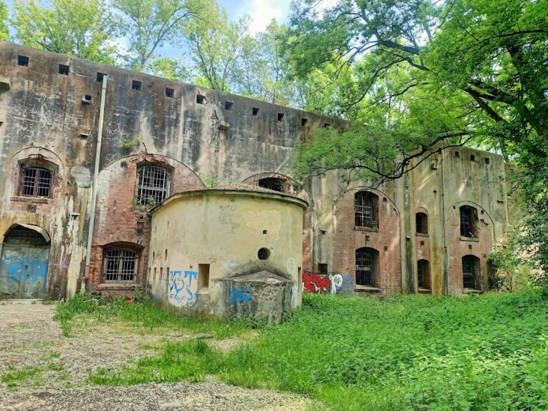
After World War II, workers involved in the construction of Nowa Huta, Kraków’s planned industrial district, were quartered in the fort. It was later abandoned and gradually deteriorated. The most severe damage affected the defensive landscape: the rear rampart was completely levelled, and the earthworks of the artillery battery on the southern flank were destroyed. Part of the rampart near the southern exit from the main shelter was also excavated for reasons that remain unexplained.
As the industrial complex expanded, a metallurgical-gas pumping station and utilitarian garages were built within the rear area. These later uses altered the setting of the fort, but much of the barracks block survived in its original form.
Protection and conservation
Fort 49 1/2 a “Mogiła” was entered in Kraków’s register of monuments as A-105/M on 6 July 2007. Between 2014 and 2018, the Municipality of Kraków carried out conservation and rehabilitation works. Archaeological investigations took place in front of the barracks and on its roof slab, alongside architectural and conservation documentation.
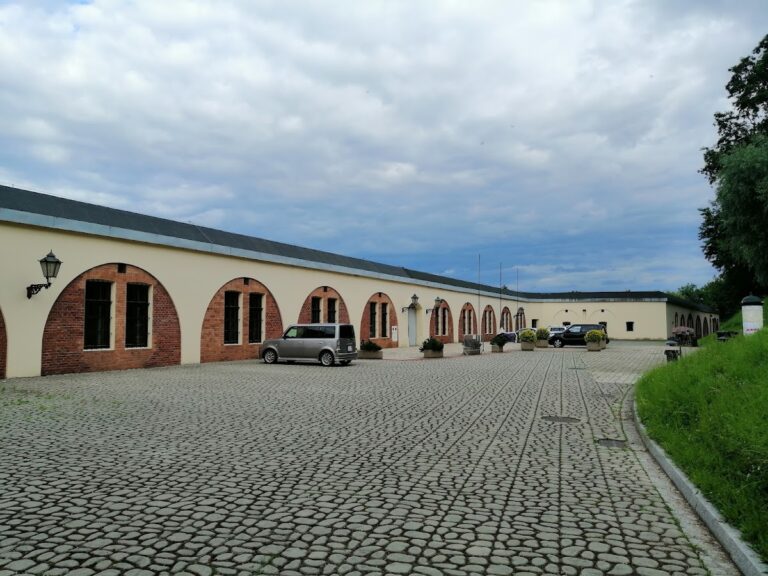
The intervention waterproofed the roof slab, reconstructed the historical earth layers above it, rebuilt chimneys in their original positions, and conserved the internal metal elements of the ceilings. The brick façades and window surrounds were restored, and part of the original parade-ground level was reinstated. In 2019, historically modelled window joinery and replica steel shutters were added. Surviving armored doors and window frames were conserved, while two firing openings in the rear caponier received replica steel shields and the remaining small shields were conserved. Roof drainage was also installed. The building is under the care of Kraków’s Municipal Buildings Authority.
Remains
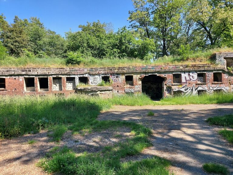
The fort stands in eastern Kraków, in District XVIII on Igołomska Street, in the area of the former village of Mogiła and about 500 metres southeast of Wanda Mound, a prehistoric earthwork and landmark. It was laid out in an open agricultural setting with a flattened rampart outline, three frontal profiles, and two flanks. A conventional open ditch surrounded the work, while planted vegetation helped conceal the outer edge, access routes, and parts of the earthworks.
Main defensive layout
Rampart and ditch
The fort’s rampart was arranged for close infantry defence, with its frontal profiles and flanks covering the approaches. A low projecting caponier, a protected structure beside a ditch used to defend it with firearms, was attached to the barracks block in the rear area. It protected the entrance to the parade ground. Direct exits from the barracks and the main shelter led to the infantry rampart, connecting the enclosed buildings with the defensive earthworks.
Entrances and protected movement
The main gate occupied the central axis of the complex, while a narrow secondary entrance was placed in the northern wing. A fortification grille, or narrow belt of obstacles, stood in front of the gate and barracks façade. Two belts of barbed wire on steel posts added protection, one outside the ditch and another at the bottom of the ditch, restricting access to the rampart.
The communication system included concealed roads running through ravines. These routes were intended to allow equipment and troops to move under protection during a siege. A further concealed road led towards the Sandomierz route. The associated artillery battery on the southern flank and its earthworks have been completely levelled, leaving the surviving fort focused on the barracks, shelter, ditch, and remaining rampart features.
Barracks and shelter structures
Barracks block
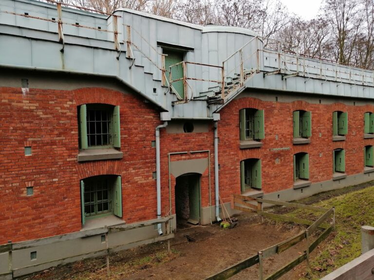
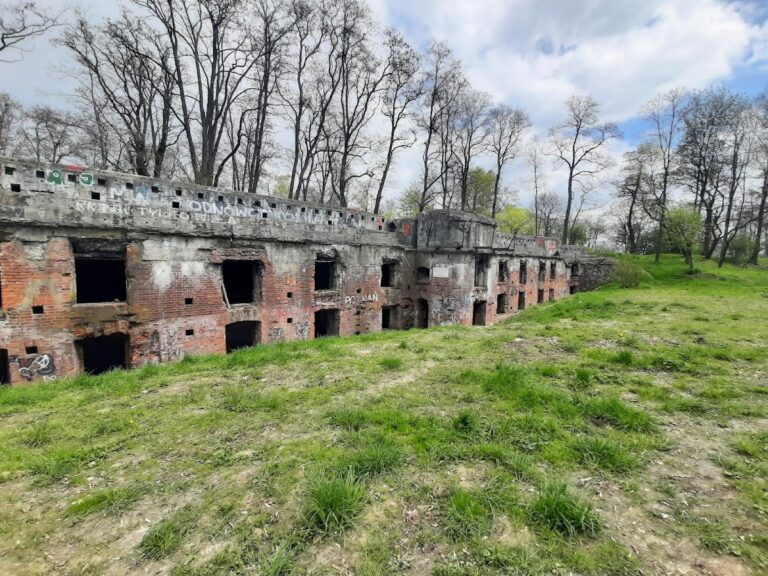
The barracks block contained two large sleeping halls, sanitary facilities in the wings, and administrative and service rooms. Its brick walls were combined with steel-and-concrete ceilings. Shaped lintels and stone facings framed the windows and gate portal. The barracks opened directly towards the infantry rampart, and its vestibules could function as small readiness shelters during a siege or bombardment.
The building retains much of its original form, although architectural details suffered damage before conservation. The restored brick façades include stone-imitating rusticated surrounds. The 2019 work installed historically modelled windows and replica steel shutters, conserved the surviving armored gate and window frames, and improved roof drainage and ventilation.
Main shelter and internal passage
A narrow passage connected the barracks with the main shelter. The shelter vestibules had direct exits to the infantry rampart, maintaining a protected link between the accommodation areas and the fighting position. A deep well stood on the right side of the passage beside the entrance-hall wall.
An armored observation tower, or possibly two towers placed on opposite sides of the main shelter, stood on the earth-covered roof. The precise arrangement is uncertain. The roof slab was waterproofed during conservation, and its historical covering of earth was reconstructed, restoring the protective relationship between the shelter and the rampart.
Armament, fittings, and lighting
Caponier and armored elements
The caponier’s firing openings were designed to cover the ditch and nearby entrance. The surviving armored fittings include the original gate and the plates in these openings. Two caponier openings were restored with replica steel shields in 2019, while the remaining small firing shields were conserved. Most of the fort’s original steel shutters and doors had been removed before the surviving elements were treated.
Heating and illumination
Several stoves heated the fort, and oil lamps provided its original lighting. Large recesses in the barracks walls may have held gas cylinders, suggesting that acetylene lighting was installed later. The recesses provide physical evidence for a change in the building’s internal services, although the precise date of that alteration is not established.
Camouflage and surviving landscape features
Vegetation was planted along the outer edge of the ditch, near the northern exit from the main shelter, and in a belt across the rear area to create a background screen. Another strip concealed the access road. Robinia acacia trees were useful because their dense crowns and thorny branches could also be cut down to form additional obstacles. Mature willows near the fort probably represent interwar camouflage planting.
Fort 49 1/2 a “Mogiła” is relatively well preserved compared with other abandoned sites of the Krakow Fortress. The surviving barracks, restored roof covering, conserved metalwork, reconstructed chimneys, remaining armored fittings, and portions of the defensive layout retain the principal physical character of the small intermediate fort. The reconstructed parade-ground level also helps clarify the relationship between the barracks and the rear defensive area.