Werk bij Maarsseveen: A Fortification of the New Dutch Waterline


Site at a Glance
- Rating
- 4.6
- Popularity
- Low
- Country
- Netherlands
- Primary era
- Modern
- External website
- Open
- Eras represented
- Modern
- Civilizations
- Dutch
- Site type
- Military
- Remains
- Fort
On this page6 sections
History
Werk bij Maarsseveen is a fortification in the Netherlands, east of Maarssen, built in 1880–1881 as part of the New Dutch Waterline, a defensive system using controlled flooding, forts, dikes, and other obstacles to protect the country. Its purpose was to defend the access corridor of the Maarsseveensevaart, a raised route beside a canal that remained usable when surrounding land was flooded, together with the dikes of the Maarsseveense and Tienhovense polders.
Construction and defence
The fort formed part of a wider chain of waterline positions around Maarssen. Its location at the junction of the Herenweg and the Maarsseveensevaart allowed it to cover an important passage through the water-managed landscape. Fort bij Tienhoven stood to the north, while Fort aan de Klop and Fort De Gagel occupied positions to the south.
Alteration and protection
A gun shelter was added to the fortification in 1886. In 1940, it was demolished during the construction of trenches, and most of the surrounding earthworks were levelled at the same time. The fort keeper’s house, built in 1880, survived and was later altered. Werk bij Maarsseveen is protected as a Dutch national monument, a legally protected heritage site recognized for its historical or cultural importance.
Remains
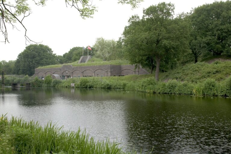
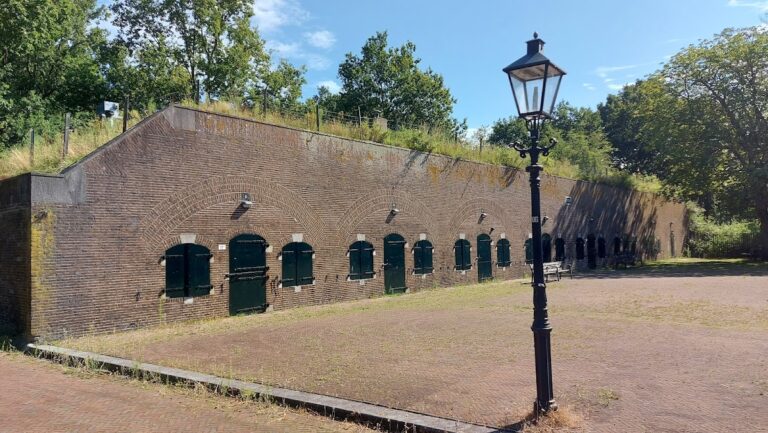
The surviving property covers approximately 1.5 hectares. Its central feature is a single casemate, a fortified enclosed structure intended to house weapons or troops, set into a hill whose summit rises more than eight metres above the surrounding ground. The fort consists of a brick barracks structure covered by earthworks and enclosed by a moat about 20 metres wide.
Fortification and water boundary
The earthen hill conceals and protects the brick structure beneath it, while the moat forms a broad surrounding boundary. The present entrance bridge is not original, so the approach to the fort has been altered from its historical form.
Fort keeper’s house
The fort keeper’s house remains on the site in modified form. Dating from 1880, it belongs to the original period of the fortification and survives alongside the earth-covered barracks and casemate.