Fort Rammekens: A Renaissance Coastal Fortress in the Netherlands


Site at a Glance
- Rating
- 4.3
- Popularity
- Low
- Country
- Netherlands
- Primary era
- Early Modern
- External website
- Open
- Eras represented
- Early Modern, Modern
- Civilizations
- French, German, Habsburg, Holy Roman Empire
- Site type
- Military
- Remains
- Fort
On this page15 sections
History
Fort Rammekens is a coastal fortress in the Netherlands, near Ritthem, built in 1547 during the Renaissance to control shipping routes toward Middelburg and Antwerp. Ordered by Mary of Hungary, the Habsburg regent of the Netherlands for her brother Charles V, it occupied a strategic position beside the mouth of the Welzinge channel. The fort controlled the beginning of the waterway to Middelburg and a channel running close to the coast toward Antwerp. At the time, Middelburg was the largest commercial city in the northern Netherlands.
The medieval castle
A medieval castle called Rammekens, or Zeeburg, stood on the site before the present fort. It appears in records from 1357, when Floris van Borsele, viscount of Zeeland, was ordered by Count Albert of Bavaria to maintain it. This suggests that the castle had originally been a comital foundation. Its position beside a navigable route probably allowed it to collect tolls or anchorage dues.
The castle was also involved in the difficult management of the surrounding water landscape. Dike failures affected parts of the area around Ritthem during the fifteenth century. Middelburg’s magistrate discussed problems at Rammekens in 1459, and an inner dike was built there in 1461. Charles the Bold, Duke of Burgundy, stayed at the castle in 1460 during an inspection tour of Zeeland. In 1472, Adriaan van de Nieuwenwerve was described as lord of Rammekens and resident of the castle.
Although storm floods caused further damage, the castle continued to stand. Ships anchoring in the roadstead still paid dues to it in the early sixteenth century. Rammekens was also identified as a bay where ships moored in 1496. Joanna of Castile, a Habsburg queen, landed there on 8 September of that year while travelling to Lier for her marriage to Philip the Handsome, Duke of Burgundy, in October. The castle’s final mention came in 1547, when its foundations had to be removed for construction of the new fort. The date and cause of its disappearance are otherwise unknown.
Fortification and the Eighty Years’ War
Fort Rammekens was established to protect a heavily used maritime approach. It was originally also known as Zeeburg and became an important military position during the Eighty Years’ War, the long revolt of the Dutch provinces against Spanish Habsburg rule. Between about 1560 and 1575, control of the fort changed repeatedly.
Jan van Marnix, a leader of the Dutch revolt, made an unsuccessful attempt to capture the fort on 1 March 1567. Sea Beggars, Dutch rebel forces that included privateers and insurgents, succeeded on 5 August 1573 under Charles de Boisot. After a brief engagement, the garrison of 70 men surrendered. The agreement for the surrender of Middelburg was signed at Fort Rammekens on 8 February 1574 by the Spanish general Cristóbal de Mondragón and William of Orange. After 1580, Philip of Egmont, a Netherlandish nobleman and military commander, was held prisoner there by the States’ army.
English possession and the maritime hospital
From 1585 to 1616, Fort Rammekens was held by England. Queen Elizabeth I received it, together with Brielle, Vlissingen, and their associated ports, in exchange for English military assistance to the Netherlands in the war against Spain. The arrangement involved several thousand troops. The fort returned to Dutch control in 1616.
The nearby roadstead, known as Vlacke, sheltered merchant ships waiting for favourable winds, including vessels of the Dutch East India Company. By 1787, the fort had become militarily obsolete. Barracks inside it were then converted by the company into a hospital for sick crew members whose ships waited offshore. The hospital had 120 beds, a kitchen, and separate sleeping quarters for doctors and assistants. The physician Paulus de Wind worked there and identified scabies and what was called “Spanish pox,” described as syphilis. Patients returned to their ships when those vessels were ready to sail.
French military works
Fort Rammekens came under French control in 1810. After the British Walcheren expedition of 1809, Napoleon Bonaparte ordered major works to strengthen the fort and defend Zeeland against British attack. Buildings that offered easy targets were demolished, bringing the hospital’s use to an end. The fort was renovated and enlarged to resist attacks from the land.
Dutch control was restored in 1814. The fortress was decommissioned in 1869, although it continued to serve as a gunpowder magazine. Its military history later gained another layer during the Second World War, when German forces incorporated the site into Landfront Vlissingen, a defensive system around Vlissingen. Two Tobruk Regelbau 201 bunkers were built on top of the fort in 1942. This standardized German bunker type provided a protected position for a weapon or observation post.
Flooding, reclamation, and preservation
On 7 October 1944, Allied bombers breached the dike east of Rammekens to flood Walcheren and force German troops to withdraw. Seawater destroyed large parts of the French crownwork, an advanced fortification with a central front and projecting horn-like bastions. The effects of the breach remain visible in Rammekens Creek. The fort itself was lightly bombarded during the Battle of the Scheldt in the autumn of 1944.
During the 1960s, the tidal marshes and mudflats around the Sloe were reclaimed for an industrial and harbour area. New harbour breakwaters removed the former tidal landscape, leaving Fort Rammekens farther from the sea. Staatsbosbeheer has managed the fort and surrounding nature area since the 1960s. The fort is operated as a museum in cooperation with the Zeeuws maritiem muZEEum and has been restored from 2012 onward. It is protected as a Dutch national monument and is regarded as one of the oldest surviving coastal fortifications in Western Europe.
Remains
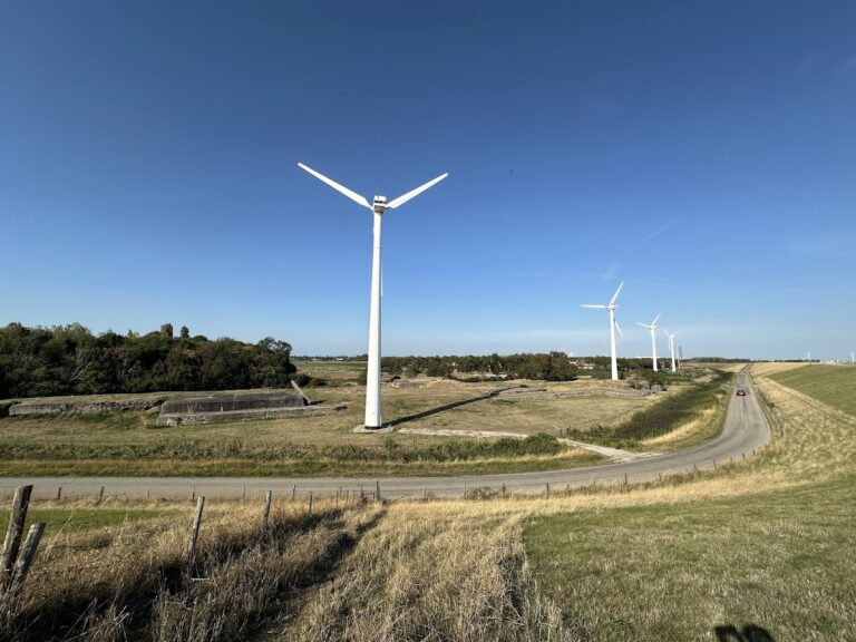
Fort Rammekens survives as a ruined coastal bastioned fort within a nature reserve on an old creek ridge and across the former sea dike. Its original position was partly in the open sea, near the mouth of the Welzinge channel. The fort has a diamond-shaped plan, with a bastion facing the Westerschelde. Its thick walls were built to carry cannon, and extensive natural stone was used because the site was exposed to salt water. A dike now separates the fort from the sea, while Rammekens Creek preserves the altered landscape created by the 1944 flood.
Entrance and landward defenses
Gateway
The landward walls are made of masonry and contain the entrance. The gateway has a bent passage, designed to prevent enemy shot from travelling far into the interior. The gateway is a distinctive example of Italian Renaissance fortification in the Netherlands. Its design follows the trace italienne, an early-modern system of low, thick walls and projecting bastions arranged to provide interlocking artillery fire.
Moat and courtyard
The original fort had a moat on the landward side, while the sea formed its seaward defense. The courtyard was built up within the walls. A ditch between the fort and the sea was filled around 1977 and excavated again in 1979, leaving the present layout shaped by both military construction and later landscape work.
Seaward bastions and artillery works
Half-bastions
Half-bastions stood at the outer ends of the two seaward walls. Their cannon positions were originally open to the sky. During the Napoleonic period, these half-bastions were vaulted and covered with earth, changing their protection and appearance as artillery defenses were adapted to new military conditions.
Later bastions and casemates
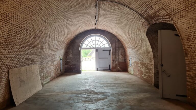
Later alterations added new bastions, further ditches on the landward side, and casemates in the outer walls. A casemate is a vaulted, protected chamber used for artillery or other military purposes. These additions strengthened the fort’s defenses against attacks from land and incorporated artillery into its masonry structures.
Twentieth-century remains
Tobruk Regelbau 201 bunkers
Two Tobruk Regelbau 201 bunkers built on the fort in 1942 remain part of the site’s twentieth-century military fabric. They were constructed as components of Landfront Vlissingen, the German defensive system around Vlissingen during the Second World War. The fort’s northeastern part is a restricted military area, while the rest lies in a ruined condition within the surrounding nature reserve.
Nearby sites