Archaeological Area of the Roman Town of Industria: A Roman River Port in Italy

Site at a Glance
- Rating
- 4.2
- Popularity
- Low
- Country
- Italy
- Primary era
- Classical
- External website
- Open
- Eras represented
- Classical, Medieval
- Civilizations
- Roman
- Site type
- City
On this page11 sections
History
The Archaeological Area of the Roman Town of Industria in Italy preserves a Roman city probably founded as a colony around 124–123 BC and reorganized during the Augustan period. It developed near Bodincomagus, an earlier Celto-Ligurian settlement whose name meant “market on the Po,” and became a river port, manufacturing centre, and place of worship near the confluence of the Dora Baltea and the Po.
Foundation and Augustan Reorganization
Industria was probably established after the campaigns of the Roman consul Marcus Fulvius Flaccus in the Monferrato. Its legal foundation may have preceded the later planned development of the urban centre. During the late first century BC and early first century AD, the city was reorganized with a regular street plan. It was enrolled in the Pollia tribe and included in Region IX of Augustan Italy, the administrative division of the peninsula created under Augustus.
The city’s position beside two rivers supported transport and trade. River routes connected Industria with the mines of the Aosta Valley, bringing copper, iron, stone, and other mineral products for local manufacture and wider commerce. Its prosperity reached a high point during the first and second centuries AD, when metalworking, trade, private construction, and religious activity expanded. Inscriptions preserve the presence of merchant and entrepreneurial families such as the Avilii and Lollii.
Religious Life and Urban Prosperity
Industria’s principal sanctuary was dedicated to Isis, an Egyptian goddess associated with protection, fertility, and salvation, and Serapis, a Greco-Egyptian deity whose worship spread across the Roman world. The complex was begun during the Augustan–Tiberian period, altered in the middle of the first century AD, and enlarged again under Emperor Hadrian, who ruled from AD 117 to 138. It continued to function until the fourth century.
The sanctuary formed part of a city where public buildings, workshops, shops, houses, and streets developed around a planned urban structure. A Christian community existed at Industria by the middle of the fourth century, while worship in the pagan sanctuary continued into the late Roman period, as shown by a fourth-century bronze plaque depicting Harpocrates, the Hellenized child-god Horus.
Decline and Medieval Continuity
Between the fourth and late fifth centuries AD, Industria contracted. The destruction of major pagan temples, the movement of inhabitants into smaller settlements, and possibly repeated Hun incursions have been associated with this decline. A change in the course of the Po also weakened the river-based commercial importance on which the city had depended.
After the pagan district was abandoned, looted, and partly destroyed, settlement continued into the early Middle Ages. Former urban spaces were sometimes used for burials, including a Lombard grave with goods dating to the beginning of the seventh century. A medieval rural church, or pieve, developed at the site and preserved the ancient name in altered forms such as Dustria and Lustria. The church of San Giovanni di Dustria appears in a charter of Emperor Otto III dated 31 December 997. During the tenth century, the pieve depended on the diocese of Vercelli. In the later Middle Ages, settlement moved to a nearby hill and developed into Monteu da Po.
Rediscovery and Archaeological Research
Investigations began in the mid-eighteenth century. A bronze inscription found near Monteu da Po named the ancient inhabitants and helped identify the site with Industria, the northern Italian town mentioned by Pliny the Elder in his Natural History. Its publication in Turin in 1745 encouraged further research.
Count Bernardino Morra di Lauriano excavated the area between 1811 and 1813, producing important finds and detailed plans. He initially, and incorrectly, interpreted a large semicircular structure as a theatre. Systematic looting during the nineteenth century damaged the site at a time when effective protective legislation was absent. Interest revived late in that century through Ariodante Fabretti, director of the Royal Egyptian and Antiquities Museum.
Excavations by the University of Turin and archaeological authorities in 1961–1963 established that the semicircular structure belonged to the sanctuary of the eastern cults. Later work enlarged the excavated area, catalogued the finds, and refined the chronology of Industria’s urban changes. Excavations in 2025 revealed an earlier arrangement of a public space that was later transformed into a more conventional forum. Non-destructive investigations near the ruins of San Giovanni di Dustria have also examined the area immediately north of the ancient city centre. Only about one tenth of the ancient city has been excavated. The archaeological area is state property within the Po Torinese protected park and the Special Nature Reserve of the Dora Baltea confluence.
Remains
Urban Layout and Residential Quarter
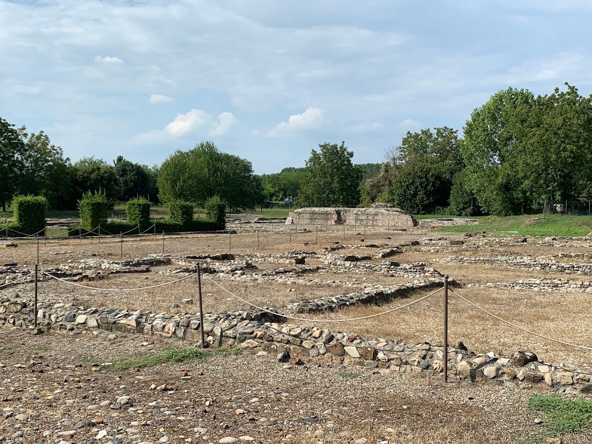
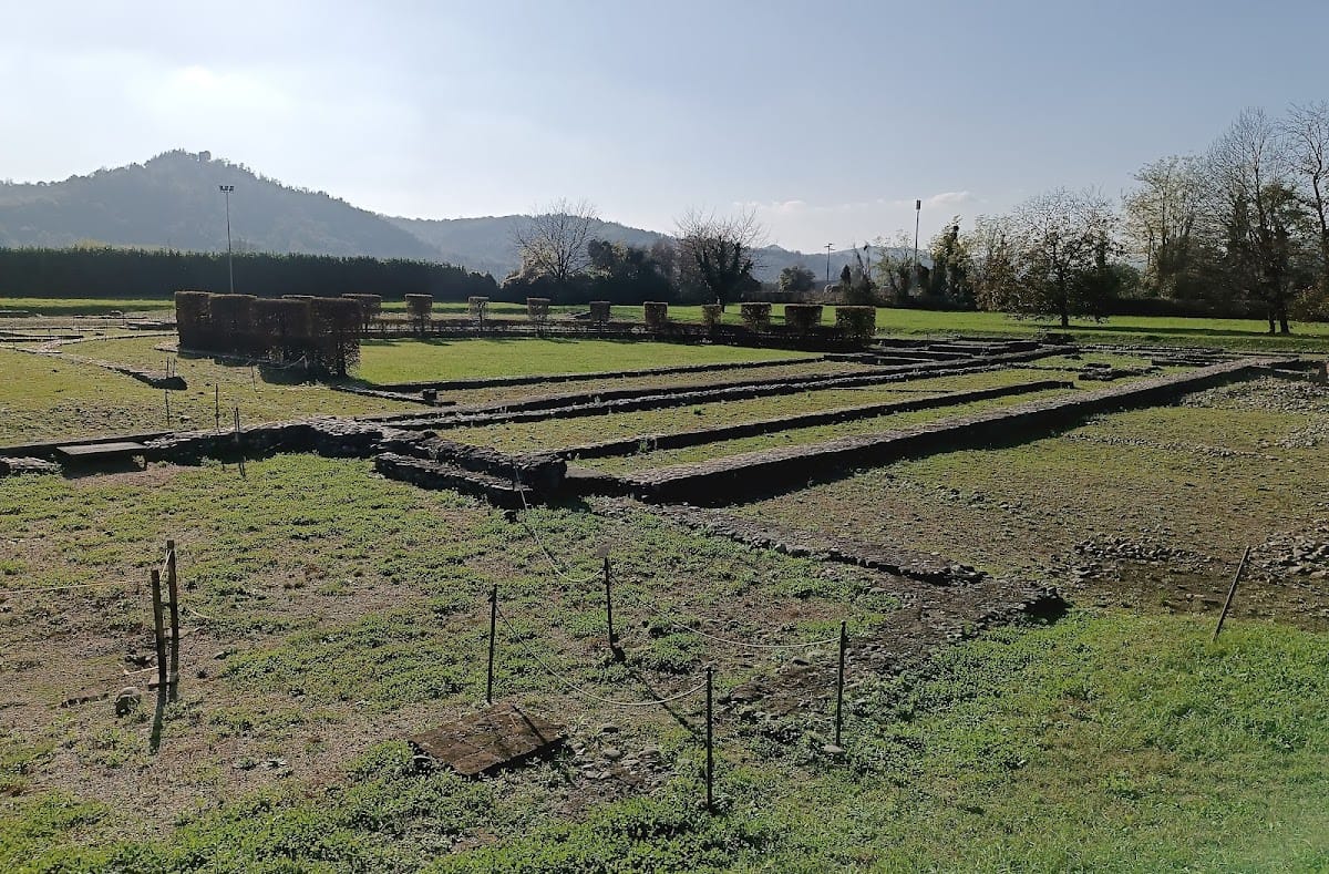
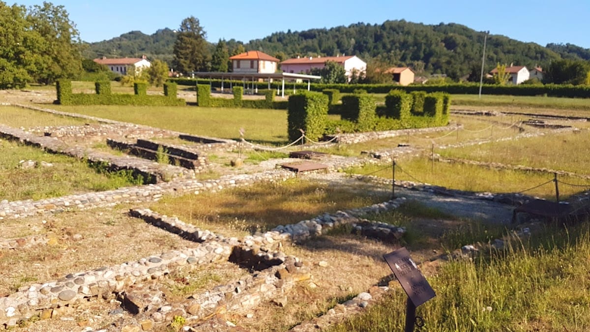
The archaeological area covers approximately 26,500 square metres between Provincial Road 590, the road to Monteu da Po, and the Rio della Valle. About 15,000 square metres are exposed, while the ancient city extended beyond the excavated ground. Industria was a small, approximately square settlement with sides about 400 metres long. Its regular plan consisted of rectangular blocks measuring about 40 by 70 metres, separated by perpendicular streets that included the cardo, the main north–south road, and the decumanus, the main east–west road.
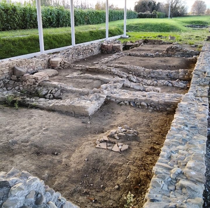
An east–west street giving access to the archaeological area is flanked by first-century AD houses. One domus, an urban Roman house, was arranged around a courtyard enclosed by a peristyle, a colonnaded passage, with residential rooms opening onto it. Houses with craft workshops and shops stood along the opposite side of the street. The surviving buildings are generally preserved at foundation level and include residential structures, workspaces, commercial premises, public buildings, cult areas, and roads.
Sacred Complex
The central excavated sector contains the crossing of two major roads beside the principal sacred area. A broad north–south street with porticoes separated the residential blocks from the sanctuary and led to a large square room probably used for gatherings of worshippers. The sacred complex occupied a wide area crossed by a clearly visible road and contained ritual and ceremonial rooms, purification installations, and accommodation for priests.
Temple of Isis
The temple of Isis dates mainly to the middle of the first century AD. It had a rectangular plan enclosed within a peristyle. Its entrance porch, or pronaos, was divided into two rooms, while the single cella, the principal sacred chamber, formed the inner part of the temple. An entrance stairway stood on the east. Behind the temple, structures formed part of a processional route used during ceremonies.
Temple of Serapis
The processional route led toward the temple of Serapis, built in the second century AD as the sacred area expanded. The sanctuary’s layout included a large open semicircular court originally surrounded by porticoes. One end terminated in a monumental exedra, a semicircular architectural space, flanked by two small temples. The opposite side faced the high podium and monumental staircase of a temple connected with the forum. The temple of Serapis formed a monumental complex with a large central court and a semicircular surrounding corridor. At the rear centre stood a polygonal sacred chamber flanked by two small temples.
The earliest construction phase used carefully worked local stone with limited brick. Later development placed the temple of Isis within a regular system of streets, buildings, and planned open spaces. The enlargement associated with the temple of Serapis involved demolishing earlier buildings and constructing a portico around the forum area.
Bronze Objects and Inscriptions
The excavated bronze finds include a dancer, a priestess, a faun, a tripod, several statuettes of the bull Apis, an image of Isis Soterica, and a sistrum, a ritual rattle used in ceremonies. Other ritual objects include figures of Isis-Fortuna and Tyche, second-century AD votive lamps, small bulls dedicated to Serapis, animal figurines, and a situla, a votive bucket shaped like a young person’s head.
A bronze tripod bears figures of Bes, sphinxes, and winged Victories, with small shrubs associated with Bacchus above them. Another refined object is a high relief of a veiled dancer. A group of statuettes once decorated a balteus, a ceremonial horse breastplate, and depicts a battle between Romans and barbarians. A finely made Silenus has been attributed to a Hellenistic-Pergamene workshop and dated to the second century BC.
One bronze plaque records the local college of the pastophoroi, the priests of Isis, and bears the signature of the craftsman Trophimus Graecanus. Another records a dedication to the college by L. P. Herennianus and lists his public offices. The bronze assemblage combines locally produced and imported works, including ritual, decorative, and figurative pieces associated with Industria’s metalworking activity. The finds are preserved in Turin’s Museum of Antiquities or the Royal Museums of Turin. A bronze inscription, a stele with a lion, and other Roman materials from Industria were incorporated into the facade or walls of the parish church at Monteu da Po.