Belfort Citadel: A French Fortress on the Belfort Gap


Site at a Glance
- Rating
- 4.6
- Popularity
- Medium
- Country
- France
- Primary era
- Early Modern
- External website
- Open
- Eras represented
- Medieval, Early Modern, Modern
- Civilizations
- French, Holy Roman Empire
- Site type
- Military
- Remains
- Citadel
On this page16 sections
History
Belfort citadel is a fortified complex in Belfort, France, developed from a medieval castle into a bastioned royal fortress, with major Vauban works carried out between 1687 and 1703. Rising above the city on a limestone promontory, it reflects successive changes in defensive design from the Middle Ages through the nineteenth century and played a central role in the defense of the Belfort Gap.
Medieval castle and early defenses
The first recorded reference to the medieval Château de Belfort dates to 1226. The site was occupied by the Château de Belfort-sur-la-Roche, while the nearby Château de Montfort on Miotte hill was later abandoned. The medieval stronghold occupied a naturally defensible rocky position, and its northern side extended toward the Tour des Bourgeois, an advanced post established for the castle under the initiative of Jeanne de Chalon-Montbéliard, daughter of Belfort’s count, Renaud of Burgundy.
By the sixteenth century, the growing power and technological development of artillery had made many medieval defenses obsolete. Habsburg authorities planned a modern fortification scheme for Belfort from 1579, but insufficient funding prevented its implementation. Gaspard de Champagne, Comte de la Suze, later began converting the medieval castle into a bastioned citadel. His design, known as the Comte de la Suze’s Crown, occupied the site of the second ditch and included three bastions.
French conquest and Vauban’s royal fortress
After the French conquest of Franche-Comté during the Dutch War, Belfort became strategically important as an approach to the Alsatian plain. The town was incorporated into Vauban’s defensive frontier and acquired the status of a royal fortress, meaning a stronghold held under the authority of the French crown. Sébastien Le Prestre de Vauban, a French military engineer and Marshal of France, and Jacques Tarade directed major works between 1687 and 1703.
Vauban’s project of 1687 responded to the formation of the League of Augsburg, a coalition created against French expansion. It organized the defenses into two concentric enclosures, with one intended to engage attackers at longer range and another prepared for close combat. The design also adapted the fortress to its terrain by diverting the Savoureuse River and adding protective works toward Miotte and the castle glacis, a sloping embankment designed to expose attackers to defensive fire.
Haxo and the nineteenth-century fortress
Following the French Revolution and the dismantling of Huningue under the Second Treaty of Paris, Belfort became a first-line fortress. Lieutenant General of Engineers François Nicolas Benoît Haxo directed extensive modifications from 1817 until his death in 1838, and the works were completed in 1842. Haxo, a French military engineer who modernized fortifications to withstand improved artillery, made the citadel the principal element of Belfort’s defenses, although it had not been the center of Vauban’s original system.
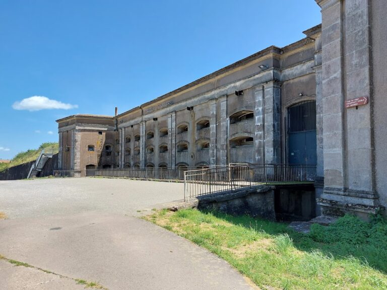
Haxo strengthened the citadel, joined Vauban’s outer works into a continuous fortified perimeter, and created an intermediate enclosure. He also protected the approach with a casemate and fortified access bridge, added two powder magazines, and built a large bomb-resistant barracks for 300 men. His broader fortified camp formed a quadrangular enclosed area between the citadel, Fort de la Justice, Fort de la Miotte, and the Horn of Hope, providing an assembly area for an army.
Pierre Philippe Denfert-Rochereau made comparatively limited changes to the citadel in 1870 while constructing Fort des Barres and the Upper and Lower Perches redoubts to protect Belfort and its railway approaches. He is associated with the city’s defense during the Franco-Prussian War, the conflict between France and Prussia and their allies from 1870 to 1871.
The citadel played an important role in the 1870–1871 Siege of Belfort, one of the final major engagements of that war. After Prussian forces left in 1873, General Raymond Adolphe Séré de Rivières developed the surrounding defensive network rather than substantially altering the citadel. His forts and batteries formed a protective belt toward Montbéliard and Lomont, intended to prevent the bypassing of Belfort and secure the Belfort Gap, the lowland passage between the Vosges and Jura mountain ranges.
Archaeology, memory, and present use
The fortress’s reputation as an “impregnable” position was commemorated by the Lion of Belfort and later by the Monument of the Three Sieges of Belfort. A plan of the city and medieval castle was surveyed in 1889 by the future General Alexis Papuchon and slightly corrected after archaeological excavations carried out in 2013 by the French National Institute for Preventive Archaeological Research.
The citadel received several French historic-monument protections. The Brisach Gate was classified in 1907, with the protection expanded in 1913. In 1923, advanced works, sections of the rampart and their coverings, and the ditches completing the seventeenth-century defensive system were classified. The covered industrial canal was listed in 1993, and the group of works forming the castle and its fortifications was classified in 1997.
In October 1944, the fourth ditch provided the setting for the photograph known as Le Fusillé souriant. It shows Resistance fighter Georges C. F. Blind facing Wehrmacht soldiers, the unified armed forces of Nazi Germany, beside a wall. Later research established that the supposed execution was staged to make Blind speak. He died two months later at the Blechhammer labor camp. Originally a military citadel, the site now houses Belfort museums and is administered as a Belfort monument.
Remains
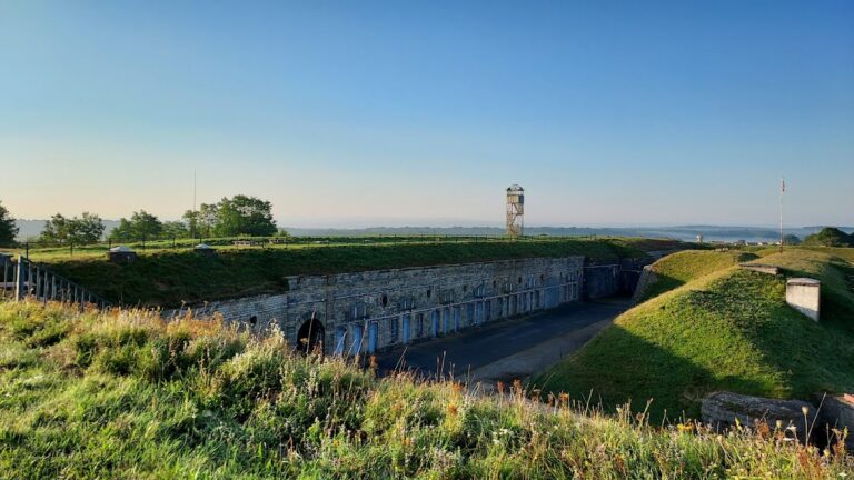
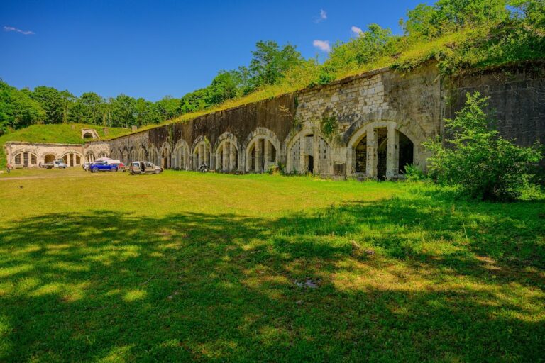
The citadel occupies a limestone rocky promontory east of Belfort’s old town and above the city. Its surviving complex includes the fortress, extensive fortifications, and a sequence of ditches. The layout preserves the evolution from a medieval castle to bastioned defenses and later artillery works, with the rocky cliff forming a natural defensive edge and constructed walls, embankments, bridges, and enclosed courts extending across the site.
Medieval and early bastioned remains
Medieval castle and Tour des Bourgeois
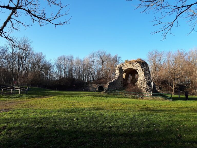
The medieval castle consisted of a round tower and a fortified seigneurial residence. The settlement occupied the western edge of the cliff, while the eastern side was protected by two walls and a ditch. The Tour des Bourgeois formed an advanced post on the northern side, and together with a large underground passage later altered by Vauban, it comprises medieval fabric identified within the citadel.
Comte de la Suze’s Crown
The Comte de la Suze’s Crown occupied the position of the second ditch and comprised three bastions. A bastion is a projecting part of a fortification whose sides provide flanking fire along adjoining walls. The northern bastion protected the area around the Tour des Bourgeois, linking the earlier castle defenses with the citadel’s first bastioned transformation.
Vauban’s defensive arrangement
Vauban’s system combined an outer enclosure of detached bastioned works overlooking the surrounding ground with an inner enclosure intended for close combat. An enceinte is an enclosing defensive wall or fortified perimeter. The inner enceinte included Towers 27, 41, and 46, while the wider arrangement incorporated bastions, ditches, access defenses, and external works adapted to the ground around the fortress.
Horn of Hope and glacis works
Toward Miotte, Vauban built a hornwork known as the Horn of Hope. A hornwork is an external fortification with projecting arms. Another protective work occupied the castle glacis. Together with the bastions and ditches, these works extended the defensive system beyond the central citadel and helped protect its approaches.
Nineteenth-century structures
Citadel defenses and access
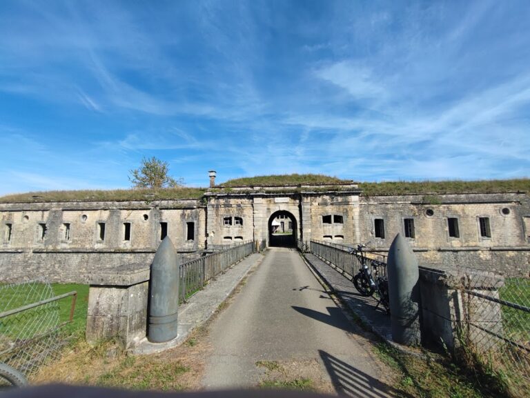
Haxo altered the upper court and created firing batteries directed toward the glacis, in areas now occupied by a restaurant and a lower hall. He also built the Denfert-Rochereau casemate, fortified the access bridge, added two powder magazines, and constructed the large Haxo barracks. The approach from the town ditches passes through a fortified bridge and drawbridge, with the Denfert-Rochereau casemate at its far end.
Fortified camp and connecting rampart
Haxo’s fortified camp formed a quadrangular enclosed area between the citadel, Fort de la Justice, Fort de la Miotte, and the Horn of Hope. Fort de la Justice and Fort de la Miotte were connected by a rampart called the Vallon Front, crossed by a gate completed in 1842. The camp was designed as an assembly area for an army.
The wider defensive system associated with the citadel included Fort des Barres, the Upper and Lower Perches redoubts, Fort de la Justice, Fort de la Miotte, and additional forts and batteries forming the later protective belt around Belfort and the Belfort Gap.
Monuments and commemorative features
The Lion of Belfort, created by Auguste Bartholdi in 1880, stands at the foot of the cliff on the western side of the barracks. It commemorates the citadel’s defensive reputation. The Monument of the Three Sieges of Belfort was begun by Bartholdi and completed after his death by Louis Noël and Jules Déchin. Other surviving features and viewpoints include the Tour des Bourgeois, a panoramic terrace, the Vauban hornwork, the Grand Crown of the Comte de la Suze, the courtyard of honor, the Haxo barracks, the access drawbridge, and the ascent through the citadel’s ditches.
Fourth ditch and wartime memory
The fourth ditch is associated with the October 1944 photograph Le Fusillé souriant. The image depicts Georges C. F. Blind beside a wall, facing the Wehrmacht soldiers who staged a supposed execution during an attempt to force him to speak.
Nearby sites