Château de Thoraise: A Medieval Castle in France


Site at a Glance
- Rating
- 4.1
- Popularity
- Very Low
- Country
- France
- Primary era
- Medieval
- External website
- Open
- Eras represented
- Medieval
- Civilizations
- Holy Roman Empire
- Site type
- Military
- Remains
- Castle
On this page7 sections
History
Château de Thoraise is a medieval castle in Thoraise, France, founded in 1250 by Hugues de Montferrand in the feudal period. Its history was tied to the lords of Montferrand and their network of fortified estates across the Doubs region. The earliest surviving written reference to the castle dates from 1273.
The Montferrand Seigneury
The seigneury of Thoraise was established in 1250 by Hugues de Montferrand, one of Jean de Montferrand’s seven sons and the founder of the family’s Thoraise branch. From the thirteenth to the fifteenth century, the castle belonged to a wider group of Montferrand strongholds that included Montferrand-le-Château, Torpes, Corcondray, Fourg, and Avanne.
In 1268, Pierre de Montferrand became involved in a conflict of interests with his uncle Hugues, who had sworn allegiance to Othon IV, count of Burgundy. During the dispute, Pierre destroyed Château de Thoraise. Despite this period of unrest, the seigneury remained prosperous. Medieval feudal records describe a large, well-stocked cellar, and one account states that Jean d’Abbans stopped at the castle in 1336 and pierced barrels with his halberd, a pole weapon fitted with a spear point and cutting blade, to provide drink for his soldiers.
Changes of Ownership and Reconstruction
As the influence of the Montferrand lords around the northern Doubs declined, Château de Thoraise passed to the dukes of Burgundy in 1385. The dukes were the rulers of Burgundy who acquired the castle during this change in regional power. In 1534, the property came into the possession of the lords of Achey.
A document from 1584 refers to earlier ruins on the site and confirms that the castle had already been reconstructed at least once. It does not establish whether that work followed Pierre de Montferrand’s destruction in 1268 or resulted from later partial or complete rebuilding. After the castle was demolished again sometime after 1584, it was rebuilt during the seventeenth century and continued to serve the feudal interests of successive owners.
The seigneury also acquired a mill in 1584. Its activity became central to the village economy, continuing until the mill ceased operating in 1900. In 1793, during the French Revolution, Maximilien d’Izelin de Lanans, the last local aristocrat and a senior general officer in the king’s armies, emigrated. The estate was then sold as national property, meaning that it was placed on the market or confiscated by the revolutionary state.
Nineteenth-Century Restoration
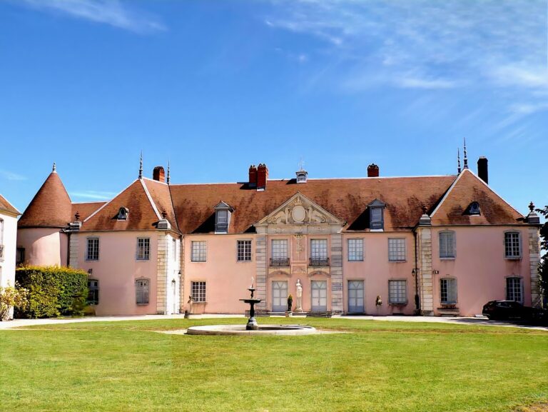
During the nineteenth century, Château de Thoraise was restored in a neo-Renaissance style. This approach used Renaissance-inspired forms and decoration while seeking to preserve the castle’s medieval balance. Gustave Courbet made the castle the subject of a painting dated 1865. The building occupies a strategic position on a loop of the Doubs, within a regional landscape associated with fortified sites, including the former fortified city of Besançon farther upstream.
Remains
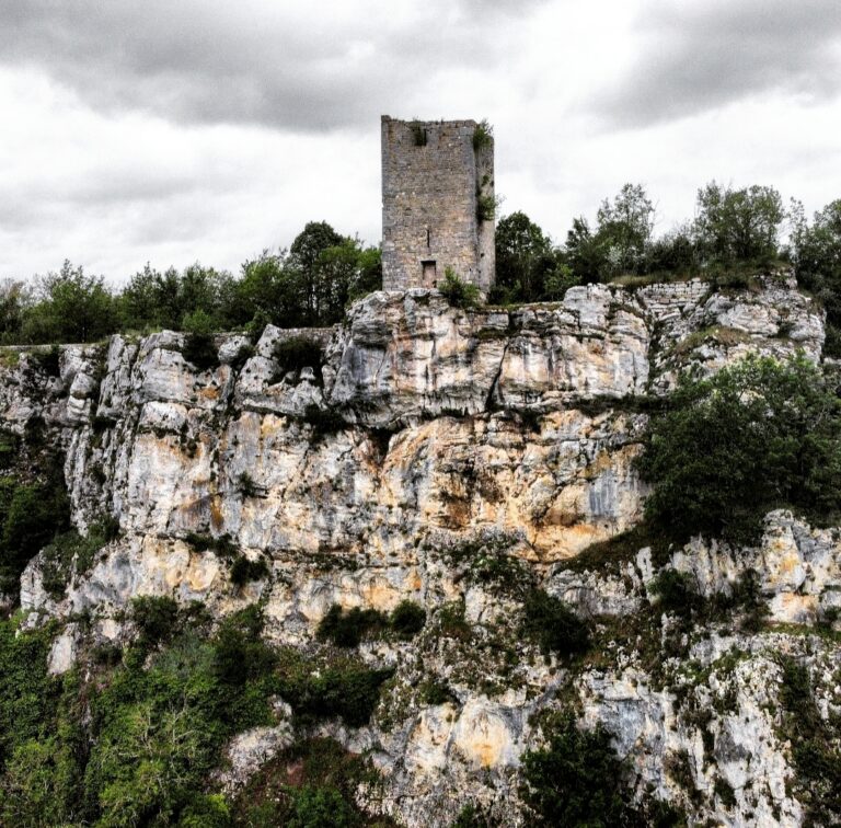
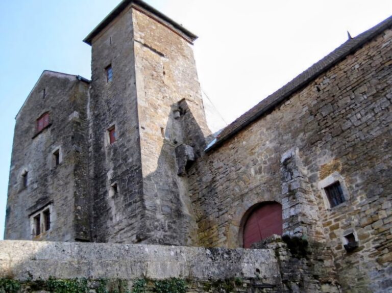
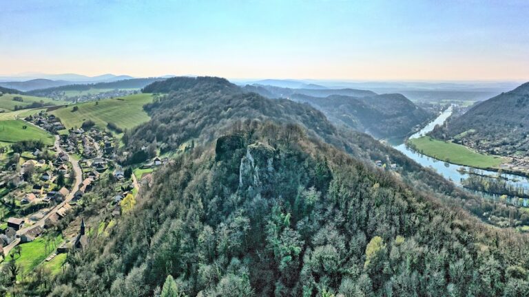
Château de Thoraise stands above the Doubs on a meander whose loop is closed by a rocky outcrop. Its present layout centers on a rectangular building flanked by two square towers and a square keep. Medieval remains survive within this later architectural composition, while the estate park is enclosed by a perimeter wall.
Castle Buildings
The central building has a rectangular plan and is currently framed by the two square towers and square keep. These elements express the castle’s fortified architectural organization, while the nineteenth-century neo-Renaissance restoration shaped its later appearance. A large cellar forms part of the castle and is associated with the well-stocked storage space described in medieval feudal records.
Grounds and Setting
The castle rises above the river from a rocky outcrop that closes the Doubs meander. The enclosed park extends around the building within a perimeter wall. This position connects the surviving structure to the river landscape and to the fortified sites historically distributed through the surrounding Doubs region.