Fort of Planoise: A French Defensive Fortification at Besançon
Site at a Glance
- Popularity
- Medium
- Country
- France
- Primary era
- Modern
- Eras represented
- Modern
- Civilizations
- French
- Site type
- Military
- Remains
- Fort
On this page14 sections
History
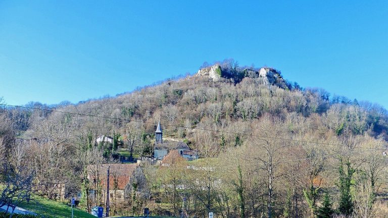
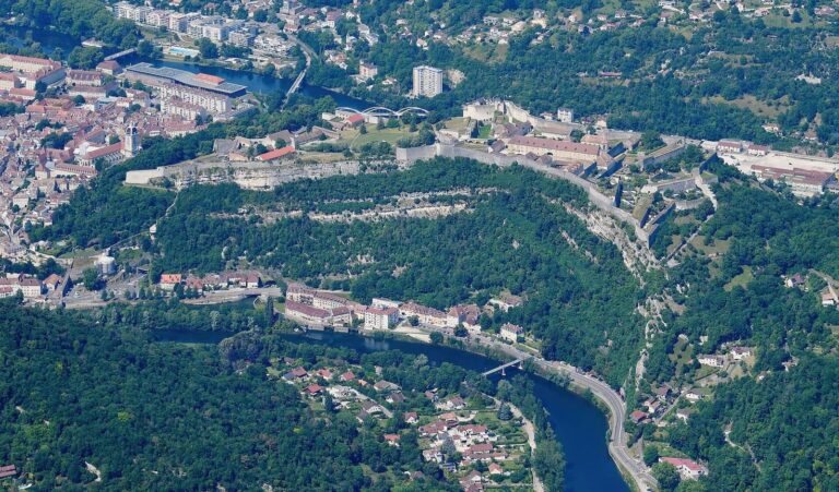
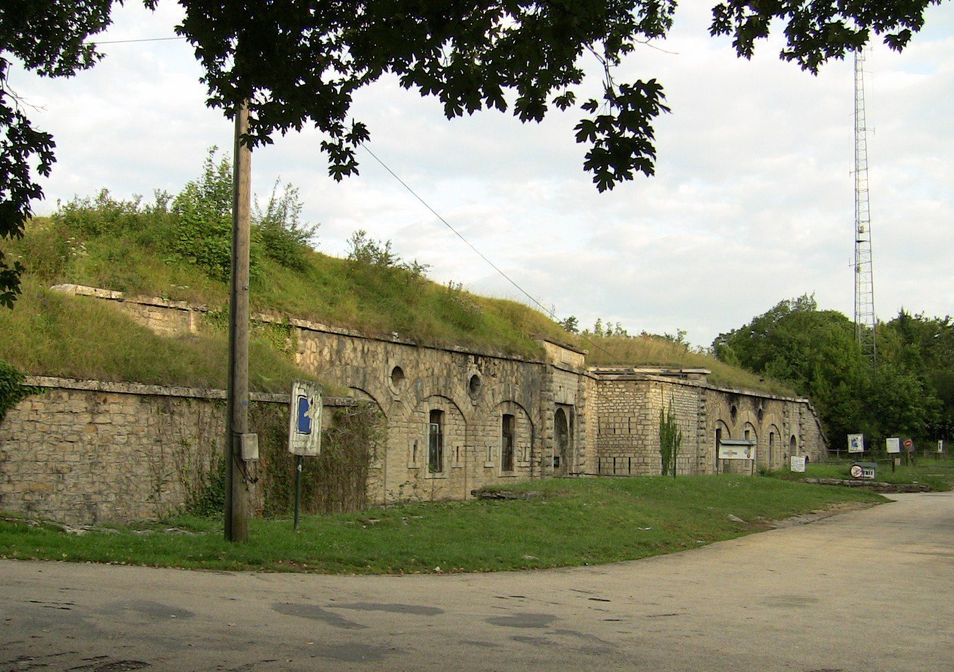
Fort of Planoise is a French military fortification on a ridge above the Doubs at Besançon, France, built between 1877 and 1892 as part of the Séré de Rivières system. The fort’s redoubt, a strong defensive work, was constructed earlier, from 1877 to 1880. The wider French network of forts and fortified positions was organized by General Raymond Adolphe Séré de Rivières after the Franco-Prussian War of 1870–1871, to protect strategic passages and block invasion routes.
Construction and military purpose
The project reflected concerns about Besançon’s vulnerability, especially from high ground such as Brégille and Chaudanne. Planoise was one of 25 defensive works built within 50 km of the city and one of five forts within Besançon. Construction replaced a farm, which was demolished to make way for the fort.
Planoise was intended to command the roads toward Dijon and Lyon, the Dole–Dijon railway, and the railway connection at Franois toward Lons-le-Saunier. Its duties also included supporting nearby forts at Pugey, Bois, Ferme-de-l’Hôpital, Montboucons and Rosemont. It could provide fire support for attacks and counterattacks, and serve as a central redoubt for forces in the entrenched camps, particularly west of the Fontain–Tilleroyes line. After a bridge was built across the Doubs between Avanne and Aveney in 1893, the fort also defended that crossing.
The fort was officially named Fort Moncey in honor of Bon-Adrien Jeannot de Moncey, a French marshal of the Empire, although Fort of Planoise became its more familiar name. That name is associated with the relatively level summit of the hill. One proposed arrangement included two 220 mm mortars. The planned complex could accommodate 305 people, including 15 officers, and its supplies included six months of provisions, a 30-bed infirmary, two bread ovens and 592 m³ of water held in three cisterns.
Military use and later reuse
The fort was still in military use on 20 December 1889, when influenza affected its garrison. It may also have housed Besançon brigades soon after its construction. Meteorological studies and observations took place there in the late nineteenth and early twentieth centuries. Its precise abandonment date is unknown, but it was no longer in military use before the Second World War. Despite its strategic purpose, the fort did not take part in battles and was not used in either World War.
Emmaüs, a charitable movement initiated by French priest and social activist Abbé Pierre, began using the fort as a place of sale in 1976. Its local community was formally established in December 1980. Staff restored recovered goods for Sunday sales, and the operation remained until 2013. A sheepfold below the fort became part of the premises in 1983. In 2002, a 1 kW radio antenna was installed on the northwestern battery to improve radio coverage in the Planoise district.
Remains
The fort occupies a southwest–northeast ridge on the right bank of the Doubs. Its works lie between 459 and 489 m in elevation, while the hilltop reaches about 490 m. The ridge is 100–140 m wide, and the fortifications cover a plateau of nearly 10 hectares. The site contains 22 works grouped into eight major batteries and is the largest military complex within Besançon, as well as the second largest in its urban area after the defensive complex at Montfaucon.
Four batteries were set around the plateau, at its southwest end, the middle of its northwest side, its northeast edge and the southeast flank. A covered way, a protected route between defensive works, linked them. Earthen traverses, barriers separating exposed positions, incorporated protected traverse shelters. A central mortar battery supported the surrounding positions, while the main redoubt also served as headquarters and was placed so that its rear received cover from as many batteries as possible. The wider complex includes an underground shelter beneath a central quarry, a rock-cut powder magazine, other ridge shelters, a vaulted entrance passage, and northern and southern sections of an outer earthwork. Two quarries were opened for construction, one near the plateau’s centre and another to the northeast.
Main redoubt
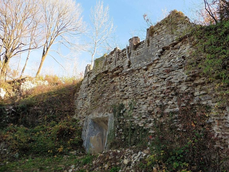
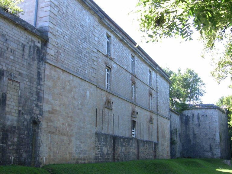
The redoubt is an irregular quadrilateral surrounded by defensive ditches. A double caponier, a protected position for firing along a ditch, guards one corner; a double gallery along the outer face of the ditch protects another. Both are built of masonry. Along the rear side, rifle openings in two groups of three chambers allowed defenders to fire outward. The entrance porch adjoins one group. The remaining sides have a full inner ditch face and a lower face above earth masses.
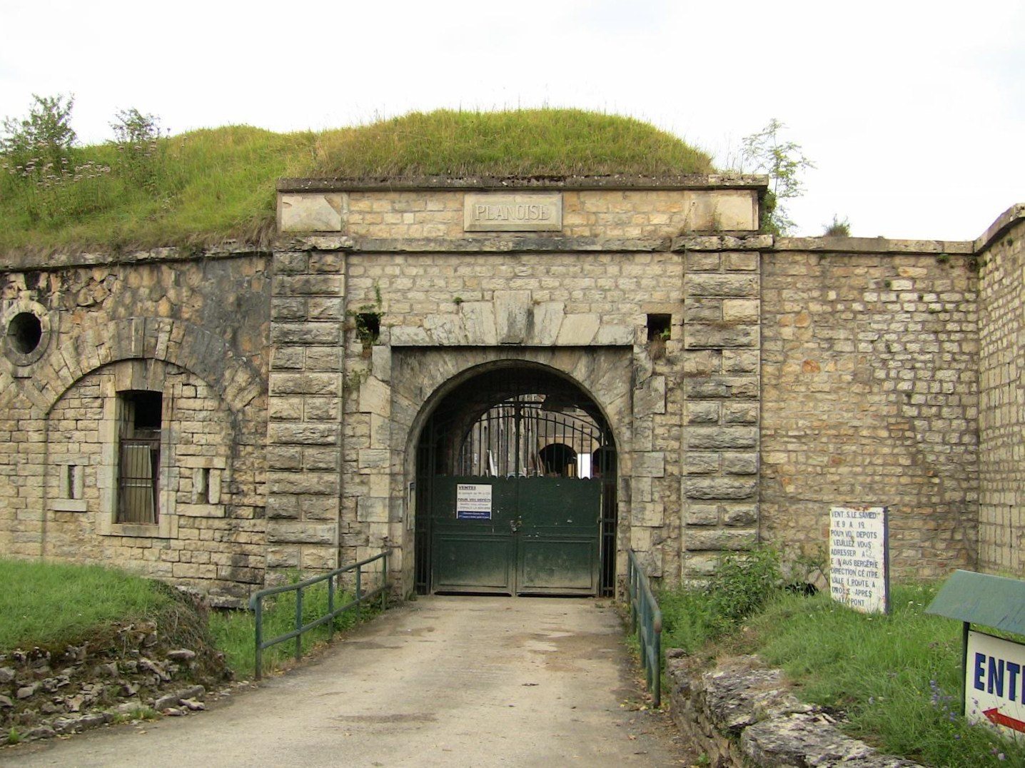
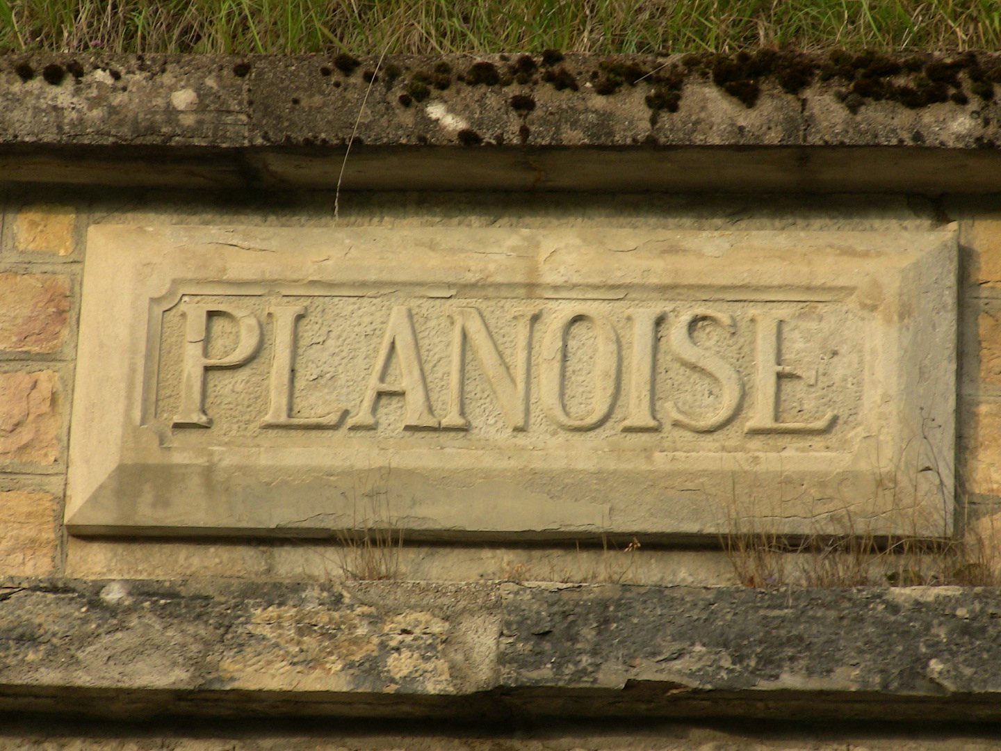
The unusually large entrance porch measures 4 m high by 3.55 m wide, and the centres of the drawbridge pulleys are 4.45 m apart. A plaque above the central doorway carries the inscription "Planoise." The porch is set back from the rear wall. A wall extends to its right and turns at a right angle to meet the rear of the redoubt, enclosing the courtyard. A second entrance was later added at another corner.
The interior courtyard is an elongated trapezoid. Seven chambers occupy one side and eight the other, with two rows of openings facing across the space. A light well, 10.50 m above the floor and measuring 6 × 2.5 m, brought light through a window into two powder magazines. Each magazine measures 12.5 × 6 m, and together they held 97 tonnes of powder. Their shallow arched vaults contain three aligned recesses for lamps. A cartridge store lies between the magazines and the circulation corridor; four stone troughs in the same area may have served a stable.
Raised protective walls for infantry run along the redoubt’s upper surfaces. Two openings connected its upper and lower levels and served as communication points and shelters along the defenses. Each flank had two infantry firing benches, and marks left by shell bases remain in places on the circulation corridor floor. The redoubt’s general state of preservation has been assessed as satisfactory.
Artillery batteries
Central mortar battery
Completed in 1881 at an elevation of 480 m, the central mortar battery was designed for de Bange 200 mm mortars, Models 1880 and 1881. Their maximum range was 7,100 m, including areas screened by bends in the Doubs. Three traverse shelters, protected rooms incorporated into earthen barriers, form a line with a parados, a rear earthwork that protects a position from fire coming from behind. The battery stands about 50 m in front of the underground shelter beneath the quarry. A separate room beside the third chamber measures 4 × 3.5 m and was probably intended for personnel.
The first chamber is divided into two compartments, while the other two each have three, separated by partitions. The latter chambers have two small windows apiece. Beyond the arm of the first chamber is a small room. The third chamber has one arm and the second has two, each formed as a sloping stairway for moving projectiles weighing up to 102.75 kg. Sliding doors closed these passages, and most of their upper guides remain nearly intact. The door ramps directed rainwater away to reduce rust.
The firing platforms have gently sloping bases, and their low protective walls are set well in front of the passage openings. The two firing positions suggest a harassing-fire role; the mortars could discharge only three rounds per minute. The battery is generally in excellent condition, although the first chamber has fire damage, badly deteriorated partitions and accumulated refuse.
Southwestern battery
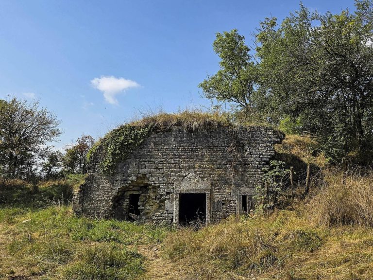
Built in 1877 at an elevation of 489 m, this battery occupies the southwest end of the outer earthwork. Its five masonry works, or six when the attached underground shelter is included, stand among dense boxwood. The sloping cleared ground before the defenses overlooks Avanne-Aveney and includes an infantry position. Mostly buried beside the northern ridge parapet, the barracks contain four rooms, each measuring 9 × 5.5 m. A carriage passage from the second room connects to the first traverse shelter, a semi-buried, slotted defensive structure measuring 6 × 3 m with a side entrance. The four barracks rooms are understood to have housed the battery’s guns. Two other slotted rooms may have served as a magazine or accommodation for gun crews.
A short tunnel-like passage beside the head of the work, associated with the second traverse shelter, crosses the parapet to the forward infantry position. The battery’s secondary earthwork is 40 m long. A horizontal entrance tunnel at its southern end leads to a 14 × 4 m room and a 14 × 3 m powder magazine. Brick lining inside the magazine is separated from the rubble-masonry wall. At the northern end, a 7 m vertical passage reaches a small shelter room with a window into the magazine and the work’s only lamp recess. Grooves opposite one another at the north entrance could hold beams or planks as a barrier; steps mark the southern exit.
The tunnel vault follows the change in level, and its angle resembles that of an opening for a direct-fire enclosed gun chamber. A mortar position here could have reached Arguel, behind its ridge, though the earthwork’s use as a casemate, an enclosed chamber for troops or guns, remains uncertain. The second and third traverse shelters have a similar form, with the second slightly larger. An underground shelter is attached to the battery’s southeastern tip. The works are generally in good condition.
Western battery
The western battery lies midway along the northern ridge, before the mortar battery, and faces Franois. Four traverse shelters frame two double platforms separated by solid earthen barriers. Three shelters are hollow, and the largest, measuring 9 × 5.5 m, served as barracks. The works are entered from their sides.
Northern batteries
Two small batteries near the redoubt occupy the northern tip. The northwestern one follows a corner of the redoubt’s sloping outer ground. The northeastern battery overlooks the entrances to the rock-cut powder magazine. It includes a traverse shelter with a lift shaft, stairs arranged around the shaft, a room measuring 14 × 4 m and an ascending ramp to the battery’s left side. Below the northwestern battery, two more positions lie along the ridge. One faces Beure and may be the position built during the Franco-Prussian War in early 1871; the other faces Chateaufarine and appears to be a later auxiliary battery.
Underground works
Shelter beneath the central quarry
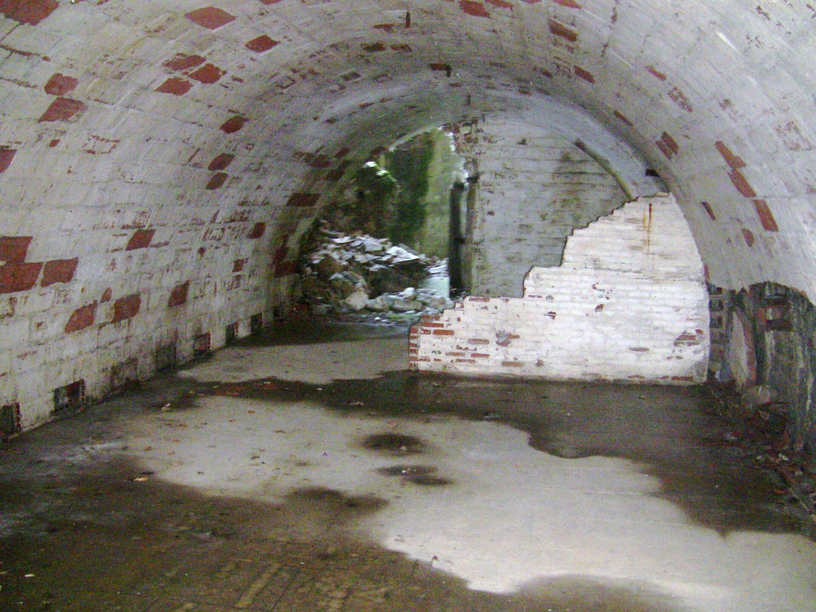
Built in 1891–1892 at an elevation of 465 m, this shelter contains four rectangular chambers measuring 17 × 6.5 m. A rear corridor connects them, with a cistern at each end. One chamber can now be reached only by a corridor beyond a collapse. A 1.50 m-thick concrete protective wall shields the entrances, while a covered passage beyond the chambers helps guard against falling rock. Brick lining allows air to circulate between the interior finish and the rubble masonry. The shelter is in very poor condition: the outer corridor roof has collapsed, large areas of brick lining have fallen, and the walls and ceilings are unstable.
Rock-cut powder magazine
Built in 1889 at an elevation of 450 m, this magazine is cut into rock nearly beneath the northeastern battery and below the face of the second quarry. Its layout comprises an outer courtyard, two parallel entrances, a cross-gallery and two storage rooms. It is in very good condition apart from a major bulge in the left access corridor.
Ridge shelters and perimeter defenses
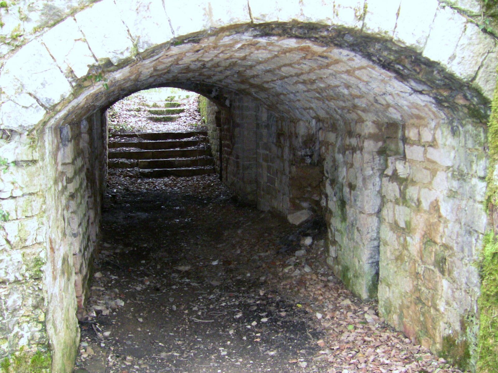
An infantry parapet follows parts of the fort’s perimeter, sometimes in front of the batteries. At least two shelters with observation wells stand along the northern ridge, and a third shelter on the southern ridge is almost completely buried and has no well. The entrance to the outer earthwork lies on the sloping ground at the level of the redoubt’s first two fronts. Its inner ditch face is topped by an infantry parapet, and access passes through a vaulted passage.