Beit Guvrin-Maresha National Park: Ancient Towns and Underground Caves in Israel



Site at a Glance
- Rating
- 4.7
- Popularity
- Medium
- Country
- Israel
- Primary era
- Classical
- External website
- Open
- Eras represented
- Iron Age, Classical, Medieval
- Civilizations
- Byzantine, Crusader, Israelite, Kingdom of Jerusalem, Roman
- Site type
- City
On this page18 sections
History
Beit Guvrin-Maresha National Park in Israel preserves the remains of two historic towns, Maresha in the south and Beit Guvrin in the north. Maresha was an important city of the Kingdom of Judah during the Iron Age, or biblical period, and continued as a settlement through the Persian and Hellenistic periods. Beit Guvrin later developed nearby and became the principal town of the region.
Maresha under Judahite, Persian, and Hellenistic rule
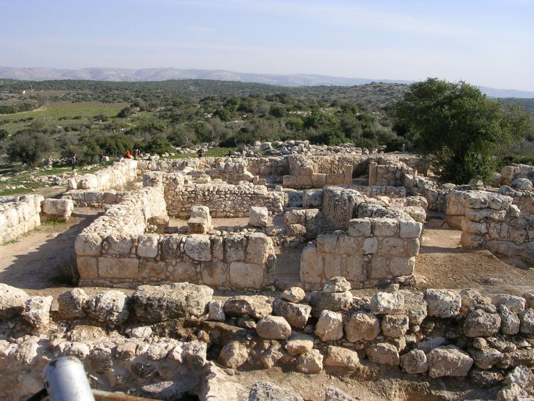
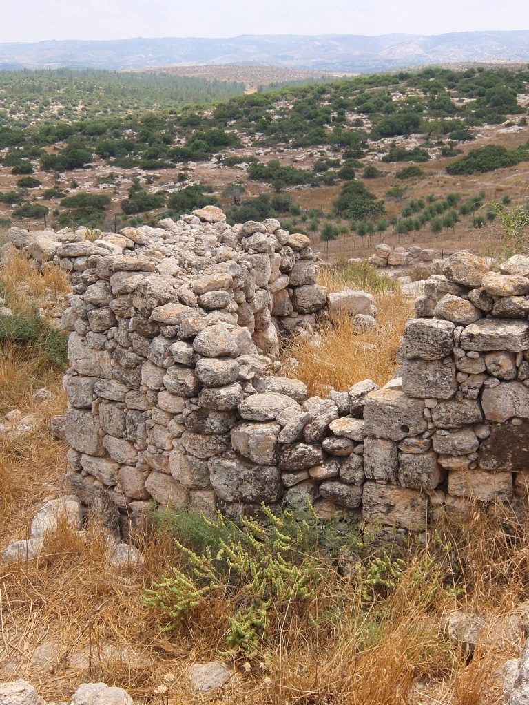
Maresha is first identified in writing as a city of Judah in the biblical Book of Joshua. The Hebrew Bible also says that King Rehoboam fortified it against an Egyptian attack. The Iron Age was the period in which the kingdoms of Judah and Israel developed, placing Maresha within the political landscape of the Judahite kingdom.
After the destruction of the Kingdom of Judah, Maresha became part of the Edomite kingdom. A Sidonian community settled there during the late Persian period. The Persian period followed the fall of the Babylonian Empire and preceded the Hellenistic age, when the conquests of Alexander the Great brought Greek political and cultural influence to the region. Maresha is mentioned in the Zenon Papyri of 259 BCE and was also known as Marisa or Marissa during the Hellenistic period.
During the Maccabean Revolt, a Jewish uprising against Hellenistic rule, Maresha served as a base for attacks against Judea and suffered retaliation from the Maccabees. Hasmonean king John Hyrcanus I captured and destroyed the city in 112 BCE. The Hasmoneans were the Jewish ruling dynasty that emerged from the revolt, and Idumea, the region south of Judea, remained under their control after Maresha’s destruction.
The Parthians completely destroyed Maresha in 40 BCE, and the city was never rebuilt. Beit Guvrin developed after that destruction, first as a suburb of the older city and then as its regional successor. The identification of Maresha with the city called Mu-ukh-ra-ash-ti, or Muhrashti, in the fourteenth-century BCE Amarna Letters remains unlikely because excavations have not revealed remains at the site older than the Iron Age.
Beit Guvrin and Eleutheropolis
Roman forces reached Beit Guvrin during the Jewish War, and the general Vespasian conquered the settlement in 68 CE. The town was completely destroyed during the Bar Kokhba Revolt of 132 to 135 CE, a major Jewish uprising against Roman rule. It was later re-established as a Roman colony.
In 200 CE, under Emperor Septimius Severus, Beit Guvrin was raised to city status and granted the ius Italicum, a legal privilege associated with communities on Italian soil. It was renamed Eleutheropolis, meaning “City of Freemen.” The name continued during the Byzantine period alongside forms derived from the earlier Aramaic name.
Byzantine evidence shows that Jewish and Christian communities lived in Eleutheropolis. A large Jewish community remained present during the Roman and Byzantine periods, including Tannaim and Amoraim, successive groups of Jewish legal scholars whose teachings contributed to rabbinic literature.
Later settlement and archaeological investigation
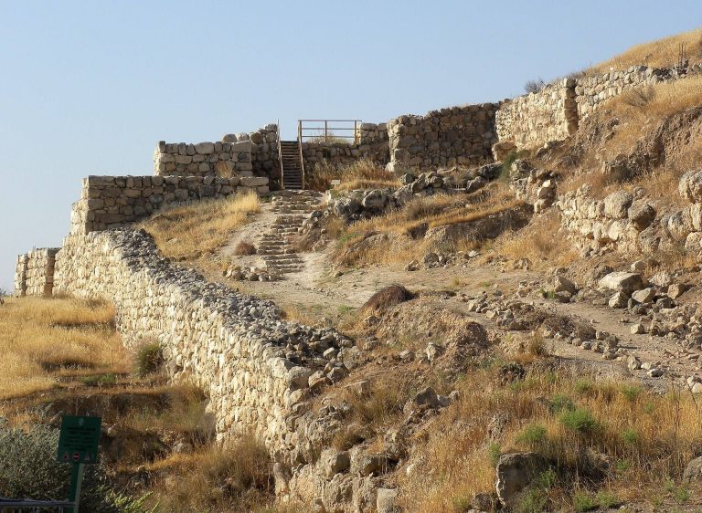
Following the Muslim conquest, the settlement became known as Bayt Jibrin and continued as a village through the early Muslim and later periods. During the Crusader period, it was also known by several Latin and European forms. A royal castle was built around 1135 and transferred to the Hospitallers in 1136. They held it until 1187 and again from 1240 to 1244. The village was depopulated in 1948.
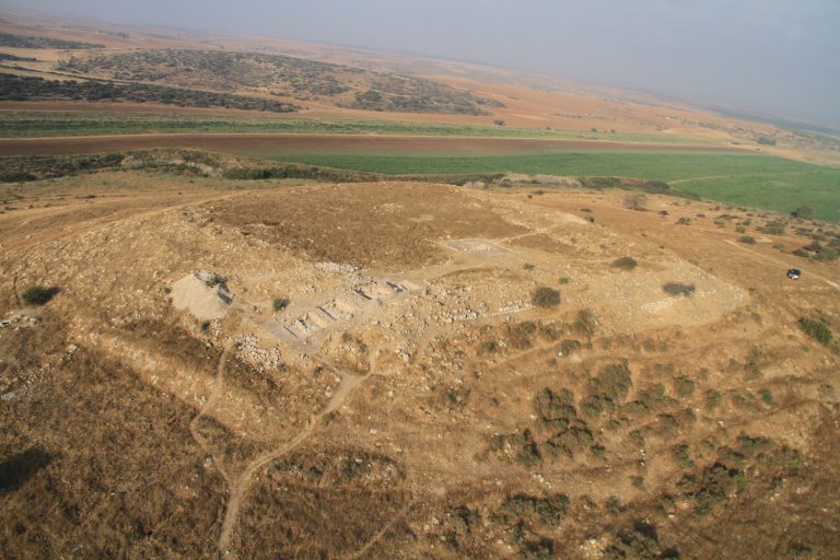
Maresha was first excavated between 1898 and 1900 by Frederick J. Bliss and R. A. Stewart Macalister. Their work identified a planned and fortified Hellenistic city and distinguished three strata on the mound, two Hellenistic and one Israelite. Excavations at Maresha from 1989 and at Beit Guvrin-Eleutheropolis from 1992 investigated the Roman amphitheater, a large Roman bathhouse, a Crusader fortress, and an attached church.
The national archaeological park was established in 1987 and opened to the public in 1989. In 2014, UNESCO inscribed the site as the World Heritage property “Caves of Maresha and Bet-Guvrin in the Judean Lowlands as a Microcosm of the Land of the Caves.” The designation recognizes the long use of underground limestone formations and the creation of artificial caves and networks for economic, social, and symbolic purposes from the Iron Age through the Crusader period.
Remains
The park covers approximately 5 square kilometres, or 5,000 dunams. Its southern complex corresponds to Maresha and contains the principal cave systems, while the northern complex lies outside the Maresha mound and contains the main Roman and Crusader remains. Soft chalkstone beneath a harder limestone layer made it possible to carve dwellings, cisterns, quarries, pigeon houses, and burial chambers below ground. Excavated chalkstone was also used as building material.
Underground caves and Maresha’s outer settlement
Bell-shaped caves
About 800 artificial bell-shaped caves are distributed through the area. Their openings are narrow and widen toward the base, creating spacious chambers that can exceed 18 metres in height. Many are linked by underground passages into groups of roughly 40 to 50 caves. The largest examples lie in the eastern part of the park, where excavation began in prehistoric times and intensified during the Hellenistic, Byzantine, and Early Arab periods as chalkstone blocks were extracted for construction.
A group of these caves functioned as quarries, particularly during the Byzantine period. One cave is occasionally used for events. Together, the chambers and connecting passages form the principal underground landscape associated with the southern park complex.
Columbaria
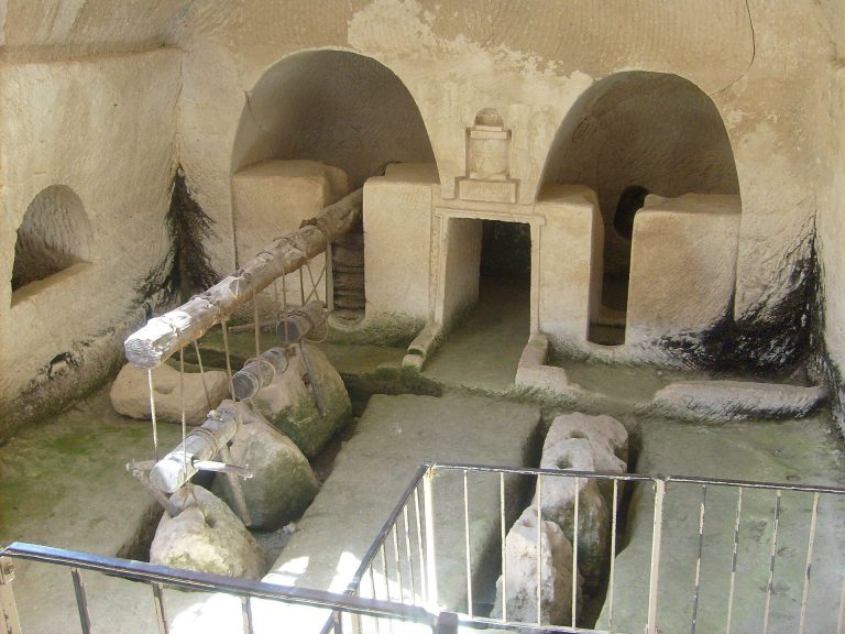
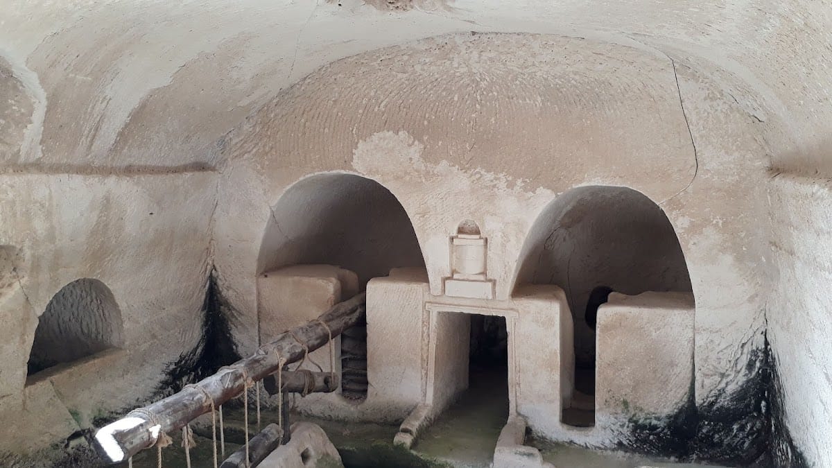
Maresha’s underground columbaria were pigeon houses cut into the local chalkstone. Their regularly arranged niches could accommodate hundreds of birds. One of the largest lies west of Tel Maresha and was once known locally as Es Sûk. Another, called the Market Cave, contains about 2,000 niches, along with corridors, stairs, and ladders.
Pigeons kept in these structures had several uses in antiquity. They carried messages, provided food, and were used in sacrifice and religious worship. The form and scale of the columbaria reflect the way underground spaces were adapted for practical and ritual purposes.
Cave dwellings and the Maze
Outside the summit of the Maresha mound, interconnected rooms and passageways were carved into the chalkstone for domestic use. Staircases descended into the bedrock, while cisterns stored water and millstones were used to grind olives. A later enclosing wall incorporated these dwellings and the city’s expanded suburbs into Maresha.
The largest and most elaborate complex lies southeast of the mound. Formerly called the Cave of Saint Anne and now known as the Maze, it contains connected rooms, bathing spaces, cisterns, and passages. The complex also served as an elaborate burial area.
Burial caves and religious remains
Sidonian burial caves
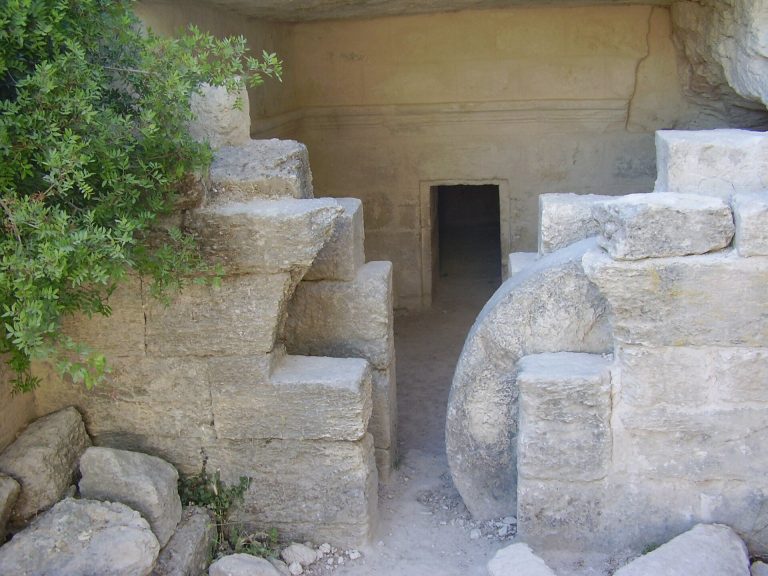
The Sidonian burial caves were family tombs associated with Apollophanes, leader of the Sidonian community at Beit Guvrin. They were also used for Greek, Sidonian, and Idumean burials. These are the only caves at the site described as having painted interiors, and they were discovered in 1902 by two British archaeologists.
The largest tomb, the Apollophanes Cave, also called the Sidonian Tomb or Tomb E I, resembles a small temple. Paintings of real and mythical animals appear above the burial niches. They include a rooster intended to frighten demons, Cerberus, the three-headed dog said in Greek mythology to guard the underworld, and a bright red phoenix associated with life after death. Damage to the original paintings means that some of the images visible today are reconstructions.
Tomb of the Musicians
The Tomb of the Musicians contains reconstructed paintings of a man playing a flute and a woman playing a harp. These images form part of the painted decoration associated with the Sidonian burial caves and provide evidence of the artistic traditions represented in the underground cemetery.
Church and southern remains
Saint Anne’s Church was first built during the Byzantine period and rebuilt by the Crusaders in the twelfth century. Its freestanding apse, the curved end of the church sanctuary, remains relatively well preserved. The ruin is known as Khirbet Sandahanna, while the nearby Maresha mound is called Tell Sandahannah.
The southern complex also contains a Byzantine church, bath caves, olive presses, domestic structures, additional cisterns, and the Polish Cave. Polish soldiers discovered the latter during the Second World War and carved Polish inscriptions into its walls. Byzantine mosaics depicting birds and animals were found on the summit of the Maresha mound in 1924.
Roman and Crusader buildings
Roman bathhouse
A large Roman bathhouse stands in the northern complex. It is one of the largest Roman bathhouses discovered in Israel and was the first Roman bathhouse built in the land of Israel. Its water-drainage system directed water into the building, forming part of the infrastructure required for the baths.
Roman amphitheater
The Roman amphitheater was built in the second century CE on the northwestern outskirts of Beit Guvrin. It served Roman troops stationed in the region after the suppression of the Bar Kokhba Revolt and held approximately 3,500 spectators for gladiatorial contests.
The elliptical structure was built from large rectangular limestone blocks. Its packed-earth arena was enclosed by walls and included underground galleries. Connected barrel vaults formed a circular corridor, supported the stone seating above, and joined stairways leading to the tribunes. The amphitheater was uncovered in the mid-1990s and may have remained in use until its destruction in the Galilee earthquake of 363.
Crusader fortress and church
A small Crusader fortress was built above the Roman amphitheater and incorporated its walls and those of the bathhouse. The northern complex also preserves the remains of an attached Crusader church. Rows of marble columns formed its aisles, linking the later religious building to the fortified complex.
Objects and archaeological evidence
Several hundred astragali, small ankle bones used as gaming pieces, dice, or tools of divination, have been found at the site since 2000. They date to approximately 2,300 years ago, in the Hellenistic period. The Heliodorus Stele was also found at the site. Its inscription records events in Judaea before the Maccabean Revolt and provides historical evidence related to events later commemorated by Jews during Hanukkah.
Other archaeological remains include a large Jewish cemetery, additional burial caves, public baths, mosaics, churches, fortifications, cisterns, olive-processing installations, and the extensive underground cave networks that connect the park’s historical phases.