Tell Goded: An Ancient Fortified Settlement in Israel
Site at a Glance
- Popularity
- Medium
- Country
- Israel
- Primary era
- Classical
- Eras represented
- Iron Age, Classical, Medieval
- Civilizations
- Byzantine, Israelite, Roman
- Site type
- Military
- Remains
- Fortified Town
On this page18 sections
History
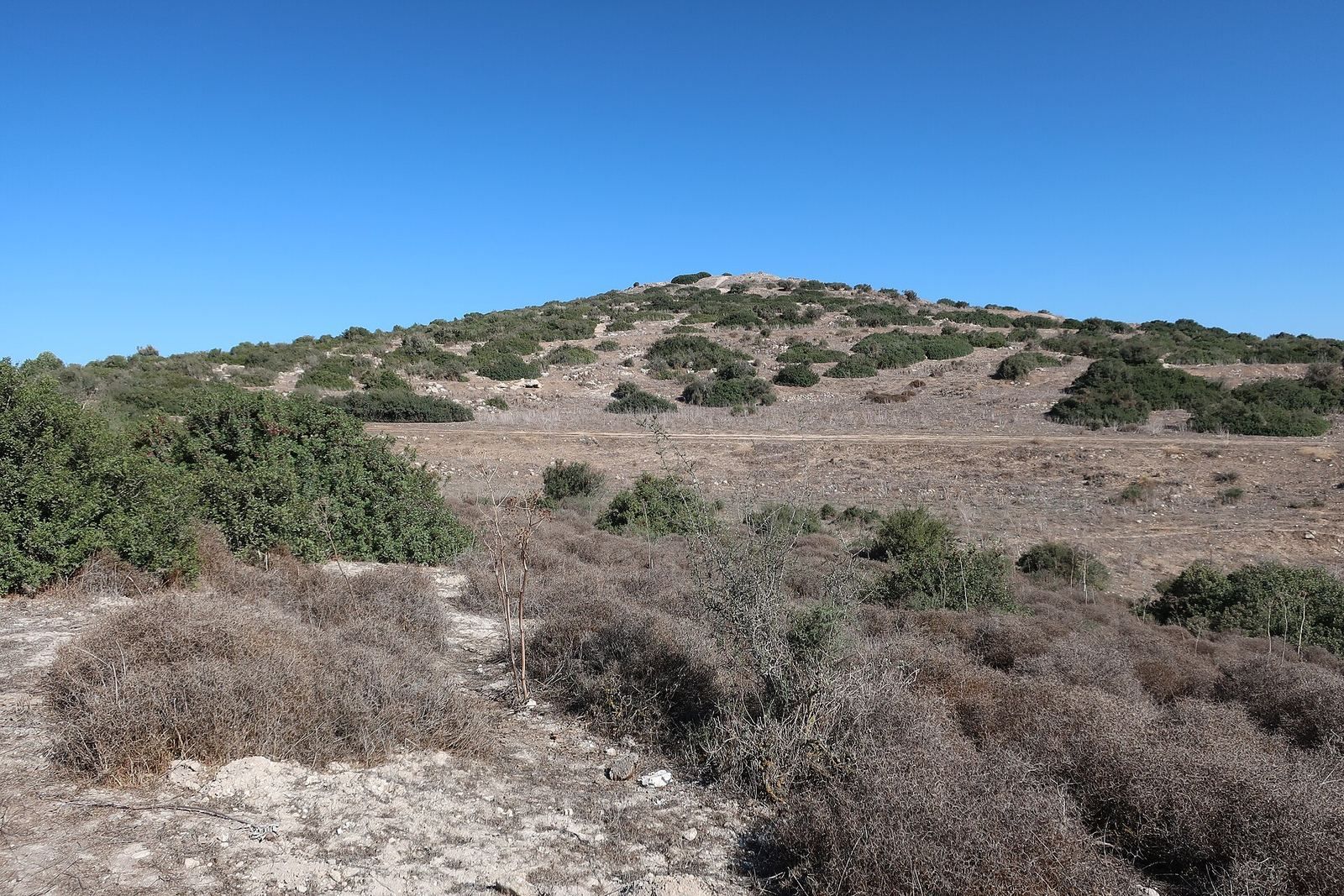
Tell Goded is an ancient hilltop settlement in the Judean Shephelah of Israel. Its archaeological layers show occupation in the Bronze Age, Iron Age II, and Hellenistic-Roman periods. The modern Hebrew form Tel Goded echoes an Arabic name understood as “Mound of the dykes.”
Bronze and Iron Age occupation
Excavations identified three principal occupation levels: a Canaanite settlement of the Middle Bronze Age, an Israelite settlement of Iron Age II, and a later Hellenistic-Roman phase. The Iron Age settlement belonged to the era of the kingdom of Judah. Tell Goded was probably destroyed in 701 BCE, during the Assyrian king Sennacherib’s campaign to suppress the revolt of Hezekiah, king of Judah.
The surrounding region had earlier been inhabited by Philistines and later came under Israelite rule. After Assyrian and Chaldean campaigns, Idumeans settled in the area, followed by other groups, including Arabic-speaking communities.
Proposed biblical identities
Tell Goded has been proposed as the biblical sites of Moresheth-Gath, Ashan, Gath, Libnah, Gederah, or Gedud, but none of these identifications is established. Y. Aharoni argued that it was Gath and that Gath and Moresheth-Gath referred to the same place, drawing on the fourth-century Christian geographer Eusebius. William Foxwell Albright proposed Gederah, while Zvi Ilan identified the site as Gedud in 1975. The Ashan proposal partly reflects that place’s textual proximity to Libnah and Ether. Some researchers have also suggested that the site appears on the Byzantine-era mosaic map known as the Madaba Map. A reconstruction of Sennacherib’s campaign account describes Gath as a ridge-top city with prominent towers, a detail considered in support of the proposed identification. Tell Goded has not been positively identified with any of these places.
Hellenistic and Roman periods
A settlement called Khirbet Tabaq stood at the foot of the tell during the Hellenistic and early Roman periods. Its position near a spring, a main route, and the large town of Beit Guvrin, then known as Eleutheropolis, helped shape its setting. On the hilltop, a Roman villa occupied the center of the site. It remains uncertain whether settlement extended throughout the entire enclosed area.
During the Bar Kokhba Revolt, a Jewish uprising against Roman rule from 132 to 136 CE, people in the region joined the rebellion and built extensive underground hiding complexes at Khirbet Tabaq. The village was probably destroyed after the revolt failed. Burial activity in nearby caves also appears to have ended around this time.
Survey and excavation
Frederick Jones Bliss surveyed the tell in 1897. He and R. A. S. Macalister excavated it in 1899–1900, although their work paused for a season after C. Clermont-Ganneau identified Gezer at Tell el-Jezer and attention shifted to that site. In 1990, the Israel Antiquities Authority surveyed the tell and carried out a salvage excavation of rock-cut tombs on its southern and southeastern slopes.
Remains
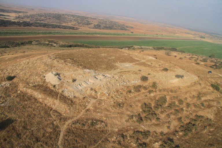
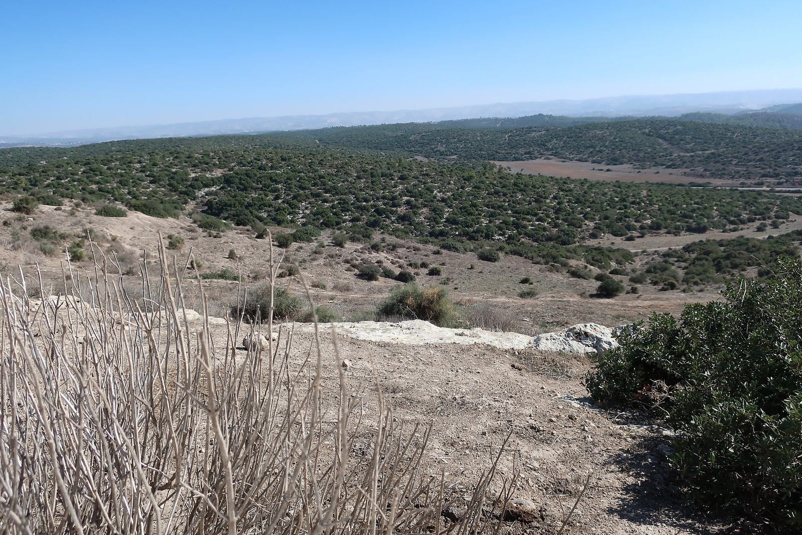
Tell Goded occupies a natural hill with a level summit and steep sides, rising about 400 metres above sea level. It is the highest point in Britannia Park, about two kilometres from Beit Guvrin and 9.7 kilometres southeast of Tell es-Safi. The enclosed area covers about 14 acres and extends approximately 580 metres.
Hilltop enclosure and settlement
Wall, gates, and towers
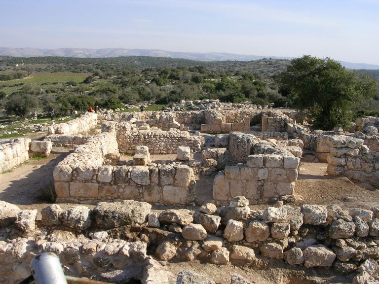
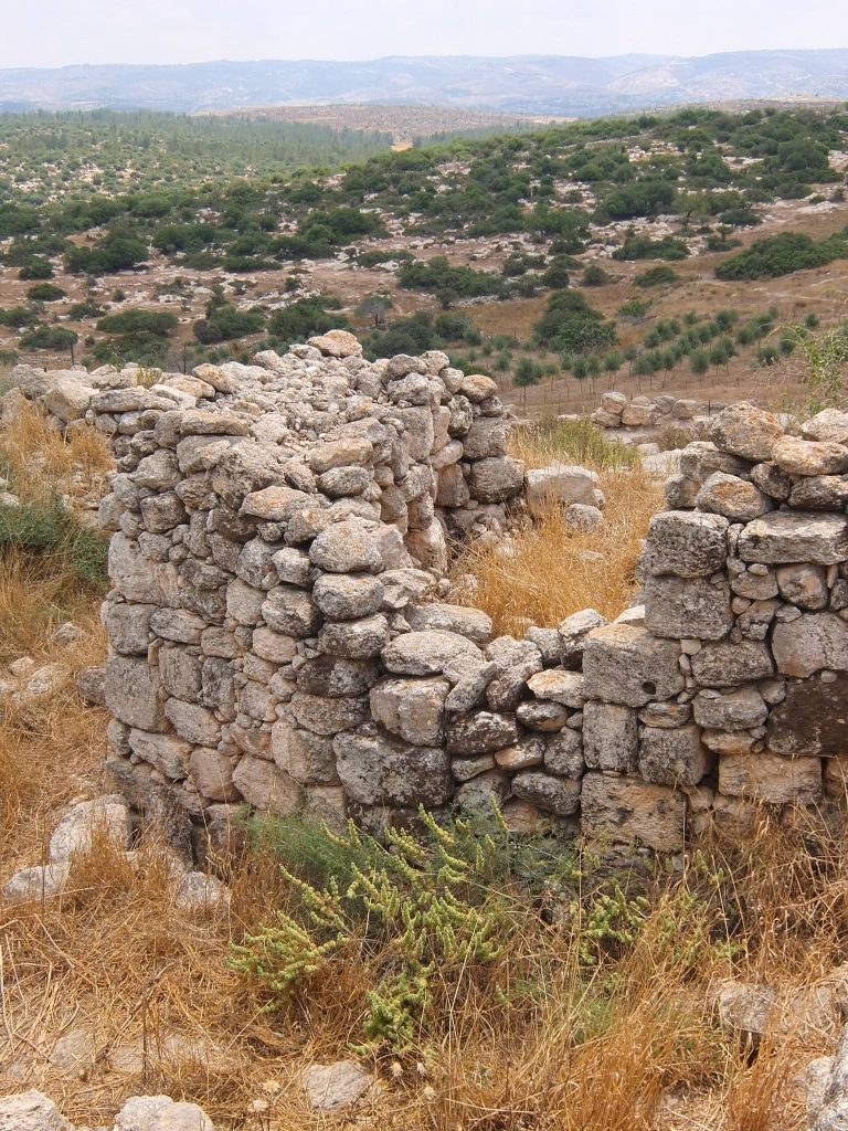
A stone-and-rubble wall follows the hill’s contours. Built without mortar and about three metres thick, it survives mostly as a single course, with sections retaining two or three. Its date is associated with the Roman phase, though it may be later. Gates stood on the north, south, and east sides, with traces suggesting a possible western entrance. Grooves in each gate’s lower stone threshold held an iron securing bolt. Excavators counted 24 inward-facing masonry projections. Two flanked each of the four gates, while the other 16 were solid buttresses.
Central villa and houses
A natural rise at the center supports structures interpreted as a Roman villa. Fallen pillars may have belonged to its central court and a basin for collecting rainwater. A paved causeway ran from the southern entrance toward this complex. Small houses occupied relatively level ground along the north-south axis, with the raised central area between them. Bliss compared their winding arrangement with settlements on Elephantine and Philae and suggested it might reflect Philistine origins.
Khirbet Tabaq and water systems
Underground hiding complexes
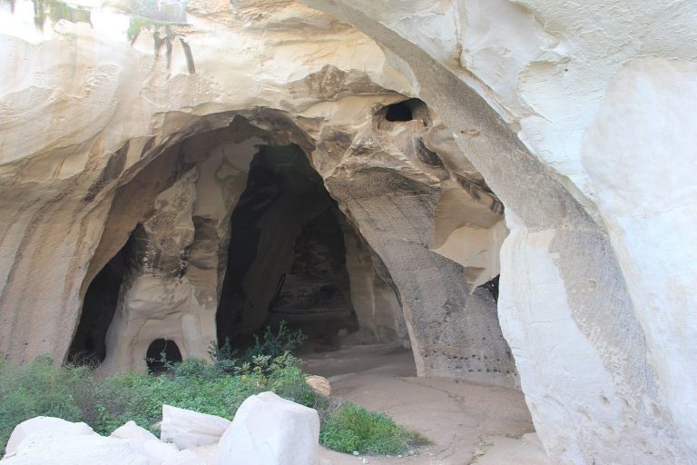
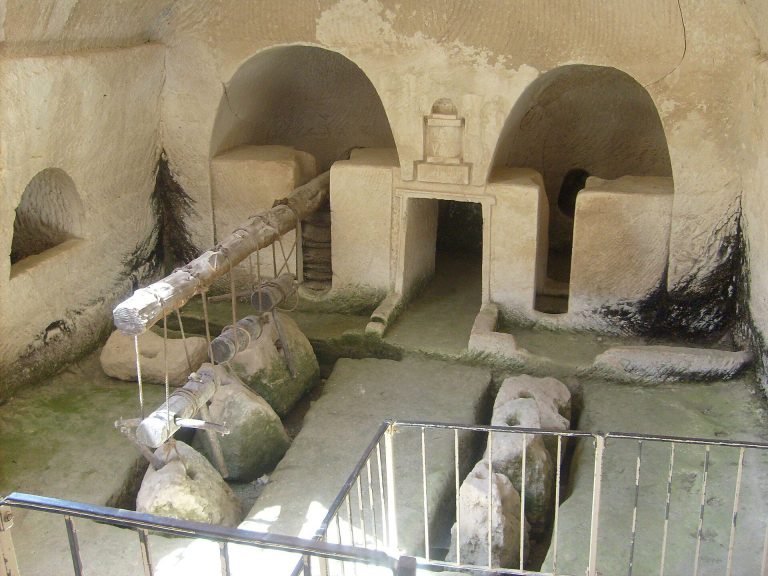
At Khirbet Tabaq, underground complexes lay beneath residential buildings and incorporated facilities from earlier use. These included storage rooms, a Jewish ritual bath, bell-shaped caves, cisterns, and installations with niches for doves or pigeons. The complexes were constructed during the Bar Kokhba Revolt.
Spring, aqueduct, and well
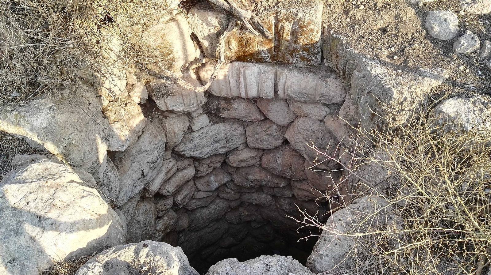
Roman-period waterworks at the foot of the tell included a spring, a water tunnel, and an aqueduct. The aqueduct regularly carried spring water to Beit Guvrin, supplementing a longer supply line that brought water from springs on the slopes of the Hebron hills. Milestones found near the tell marked regular intervals along the Roman main road. A later well called Bir Rasaq retains its well-preserved built lining, although its groundwater reservoir has dried up. The well formed part of the water-supply system serving Beit Guvrin.
Burial caves
Cemetery distribution
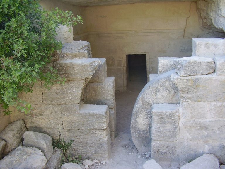
Burial caves lie between the summit and Khirbet Tabaq, as well as on the southern and southeastern slopes. About 25 entrances were recorded, several cut along the edges of ancient quarries; two lead to unfinished caves. Approximately 15 caves were assigned to Iron Age II, seven to the Hellenistic and Roman periods, and three to the Byzantine period. Four Hellenistic and early Roman caves were fully excavated. Their excavators considered them part of a larger Jewish cemetery used from the first century BCE to the mid-second century CE, although it is uncertain whether the cemetery served Khirbet Tabaq or Tell Goded.
Cave 1
Cave 1 has a trapezoidal chamber combining burial niches with arched burial recesses. This arrangement is known from only a small number of tombs in Jerusalem’s late Second Temple-period cemetery. Bone-container fragments and pottery place the cave in the first and second centuries CE, and its use probably continued until the Bar Kokhba Revolt. The bone containers indicate that a Jewish family used the tomb.
Cave 2
Beside Cave 1, Cave 2 has a vaulted chamber with a central standing pit surrounded by 15 burial niches. Two smaller niches were probably used to gather bones after burial. Most of its pottery and metal finds belong to the same general period as those from Cave 1. A few older pottery fragments suggest the chamber may have been cut about two centuries before its later use.
Caves 3 and 4
Cave 3, damaged by quarrying and modern looting, has a vaulted plan with 23 burial niches. A small amount of pottery recovered in a limited excavation is consistent with the general period of the other caves. Cave 4 lies at the base of a disused quarry beside Cave 3. Its square chamber contains eight completed niches and an incised line marking where a ninth was planned. Finds included bone containers, pottery, lamps, beads, and glass fragments dated to the first and second centuries CE.
Stamped jar handles and inscriptions
Finds from the site include 37 jar handles stamped with Hebrew words meaning “for the king.” They date to the early Israelite period and are associated with the reign of Hezekiah in the eighth century BCE. One impression in Paleo-Hebrew, an early script used to write Hebrew, reads Hošeaʻ Ṣefan, with the two names arranged one above the other and separated by a double horizontal line. A separate private stamp bears the name Menaḥem Lebanah. At the request of the Ottoman authorities, the original stamped objects were transferred to Istanbul after casts had been made. The originals are now in the Istanbul Archaeology Museums, while the casts remained in Jerusalem.