Beit She’an National Park: A Multiperiod City in Israel


Site at a Glance
- Rating
- 4.7
- Popularity
- Medium
- Country
- Israel
- Primary era
- Medieval
- External website
- Open
- Eras represented
- Bronze Age, Iron Age, Classical, Medieval, Early Modern, Modern
- Civilizations
- British, Byzantine, Canaanite, Crusader, Egyptian, Israelite, Kingdom of Jerusalem, Mamluk, Ottoman, Ptolemaic, Roman
- Site type
- City
On this page45 sections
History
Beit She’an National Park in Israel preserves a settlement occupied from the Neolithic period through the medieval era, at a strategic crossroads between the Jezreel and Jordan valleys. Successive Canaanite, Egyptian, Israelite, Hellenistic, Roman, Byzantine, Islamic, Crusader, Mamluk, and Ottoman communities used the site. Its fertile land, abundant water, and routes toward the Mediterranean coast, Jordan Valley, Gilead, Galilee, and the interior made Beit She’an a coveted location.
Early settlement and Egyptian rule
The site was first occupied during the Neolithic period. Between 18 and 20 settlement layers reach back to the fifth or fourth millennium BCE, while the earliest substantial remains belong to the Early Bronze Age. These repeated occupations formed the tell, an artificial mound created as successive settlements were built over earlier remains.
During the Late Bronze Age, Beit She’an became an Egyptian administrative and military centre in northern Canaan. Egyptian control lasted for more than 300 years, from approximately the sixteenth to the twelfth century BCE. The city included government buildings, temples, administrative offices, and a garrison quarter, reflecting its role in managing Egyptian interests in the region.
A large sanctuary was dedicated to Mekal, the “Lord of Beit She’an,” and successive temples were erected on the same sacred complex. Inscriptions and monuments connected with Seti I and Ramses II describe military campaigns and the suppression of regional rebellions. Another inscription names an Egyptian official from the reign of Ramses III. The sacred and administrative buildings show how closely religious authority, government, and military control were joined in the Egyptian settlement.
The Iron Age city
Egyptian authority ended during the period associated with the Israelites and the Sea Peoples, no later than approximately 1127 BCE. The settlement was rebuilt in the eleventh century BCE with locally Canaanite characteristics. Philistine control may have been brief. Philistine-associated anthropoid clay coffins were found in the cemetery, although the archaeological evidence for a substantial Philistine settlement remains limited.
Biblical tradition states that the Canaanite inhabitants resisted the Manassite conquest. It also relates that, after the Battle of Mount Gilboa, conventionally dated around 1004 BCE or approximately 1000 BCE, the Philistines displayed the bodies of King Saul and his sons on the walls of Beit She’an. Inhabitants of Jabesh-Gilead later removed the bodies and took them for burial.
Beit She’an was incorporated into the kingdom associated with David and became part of Solomon’s administrative system. It was later listed among the cities captured by Pharaoh Shishak, probably during his campaign of 925 or 924 BCE. Occupation continued during the Israelite monarchy, but a major destruction layer is associated with the Assyrian conquest under Tiglath-pileser III in 732 BCE. Evidence for settlement between the Assyrian conquest and the Hellenistic period is sparse.
Scythopolis and the Hellenistic city
After Alexander’s conquest, the settlement expanded beyond the ancient tell. During the Ptolemaic period, probably under Ptolemy II, who ruled Egypt from 282 to 246 BCE, it was refounded or reorganized as Scythopolis, meaning “City of the Scythians.” The name may have referred either to Scythian soldiers or to settlers associated with the Ptolemaic army.
Under Seleucid rule, Antiochus IV granted Scythopolis the status of a polis, a self-governing Greek city, and enlarged its territory. The city was also called Nysa, probably in connection with Dionysus and his nurse Nysa. Dionysus, the Greek god associated with wine, festivity, and vegetation, became an officially prominent deity at Scythopolis, and his cult became linked with the city’s identity and foundation traditions.
The city came under Hasmonean control in the late second century BCE. Jewish traditions describe the expulsion of its non-Jewish inhabitants during this period. After Pompey’s conquest of the region in 63 BCE, Aulus Gabinius rebuilt the city, restored its Greek civic identity, and incorporated it into the Decapolis. This was a group of semi-autonomous, Greek-oriented cities in the southern Levant during the Hellenistic and Roman periods. Scythopolis was the only one of the ten cities west of the Jordan River.
Roman prosperity and a diverse population
In the Roman period, Scythopolis was the leading city of the Decapolis. Its lower city developed across the plain at the foot of the tell, while the tell itself continued to serve as an elevated citadel and religious centre. The city prospered particularly during the second century CE, when major streets, temples, theatres, baths, fountains, and civic monuments were constructed.
Scythopolis contained pagan, Christian, Jewish, and Samaritan communities. Jewish and Samaritan communities continued during the Roman and Byzantine periods, while the city became predominantly Christian from the fourth century onward. Textile production, especially fine linen, was important to the local economy. In later centuries the region was also associated with sugar-cane cultivation and sugar processing.
The First Jewish Revolt, a rebellion against Roman rule that began in 66 CE, brought violence to the city. Scythopolis’s non-Jewish inhabitants distrusted its Jewish population. A Jewish attack on the city was followed by a massacre said to have killed approximately 13,000 Jews.
The Byzantine capital
The city suffered damage in an earthquake in 363 CE but reached its greatest extent during the fifth and sixth centuries. Around 400 CE, Beit She’an became the capital of the province of Palaestina Secunda and the seat of a metropolitan bishop. At least four churches and several monasteries operated there. Pagan temples were destroyed, converted, or fell out of use as Christianity became the dominant religion.
At its maximum extent, the walled city covered approximately 1,500 dunams, or about 1.5 to 1.6 square kilometres, and its population may have numbered roughly 30,000 to 40,000 people. Suburbs, houses, shops, and streets increased urban density, and some later buildings occupied earlier public spaces. The city’s textile economy continued, while agricultural and industrial activity also supported its population.
Beit She’an passed to Muslim rule in 634 or 636 CE. It ceased to be the provincial capital, and administrative changes, declining maintenance, neglected drainage, and flooding contributed to its deterioration. The city was severely destroyed by the earthquake of 18 January 749 CE, traditionally called the “Seventh Earthquake.” Streets, monuments, and buildings collapsed. The site was only partly reoccupied afterward and was largely abandoned.
Crusader, Mamluk, and later history
Crusaders captured Beit She’an in 1099, after its long period of decline, and established a small fortress. The fortress served as a lordly residence, administrative and judicial centre, tax-collection point, storage facility, and refuge. The bishopric was transferred from Beit She’an to Mount Tabor in 1103 and later to Nazareth in 1125.
During the Mamluk period, the fortress was converted from a primarily military installation into a sugar-processing facility. A roadside khan, or caravanserai, was established in 1308 along the Mamluk route between Cairo and Damascus. A mosque was built in the fifteenth century and remained in use until 1948. It later housed the municipal museum.
Excavation and conservation
A University of Pennsylvania expedition excavated the tell between 1921 and 1933, exposing remains from the Bronze Age through the early Islamic period. Excavations resumed under the Hebrew University of Jerusalem in 1989 and continued in several campaigns. Major excavations in the Roman-Byzantine city were conducted from 1980 to 1996 by teams from the Hebrew University and the Israel Antiquities Authority, and a further major programme began in 1986 as a joint effort of those institutions.
Excavation and conservation have exposed and partly reconstructed streets, civic buildings, baths, theatres, temples, churches, and commercial areas. The ancient tell, the lower city, bridges, walls, and later fortress remain part of the archaeological fabric of Beit She’an National Park. Portions of the ancient city remain unexcavated. The archaeological area was submitted to UNESCO’s Tentative List in 2000 under cultural criteria (ii), (iv), (v), and (vi).
Remains
Beit She’an’s physical remains are organized around the steep-sided, flat-topped tell and the extensive Roman-Byzantine city that spread across the plain below it. The tell, identified with Tel Beit She’an or Tel el-Husn, rises approximately 80 metres and contains the principal remains of the earlier settlement. In the Roman and Byzantine periods it served as the acropolis, while the lower city eventually extended across both sides of the Harod River. Streets followed the irregular terrain, river channels, surrounding hills, and the large mound rather than a regular grid.
The tell and early settlements
Early Bronze Age buildings
Early Bronze Age remains include a public mud-brick building destroyed by intense fire. The excavated section contains a hall about 7 metres wide, benches along its walls, storage jars, construction timber, charred grain and pulses, and later structures with three copper axes. Early Bronze Age III remains include a street, buildings, and a courtyard.
Middle Bronze Age settlement
The Middle Bronze Age settlement consisted of houses on both sides of a street. Infant burials in jars and a human skeleton were found within the houses. These remains represent a small settlement that may have been short-lived.
Late Bronze Age temples
The earliest excavated temple is a rectangular mud-brick building from Late Bronze Age I, measuring approximately 14.6 by 7.11 metres. It contained an entrance hall, a principal room, and an inner sanctuary. Plastered benches lined the walls, and the plan was asymmetrical.
The later Egyptian-period sacred complex contained several temples built successively over earlier structures. Finds include locally made Canaanite-style bowls, lamps, and cooking vessels, a distinctive Egyptian-period bath chamber, and a clay cylinder bearing a letter connected with the political situation of the Amarna period. Monuments of Seti I and Ramses II also belonged to the complex. A monumental building with food-preparation installations, pottery, and bronze objects may have formed part of a fortress of the twentieth dynasty.
Egyptian administrative quarter
The administrative quarter included a governor’s residence, government buildings, temples, offices, and military housing. Excavated houses contained Egyptian and Canaanite pottery, coloured wall paintings, fragments of gold plating, a ram’s-head-shaped object, earrings, pendants, silver rings, ruby beads, hoards of silver ingots, and faience amulets with Egyptian characteristics.
Iron Age buildings
Iron Age remains include buildings associated with the Israelite period. A substantial building, probably a fortress, was destroyed by intense fire, probably during Shishak’s campaign. A large, carefully planned mud-brick building of the eighth century BCE was also destroyed by fire, probably during Tiglath-pileser III’s conquest. A pottery jar from this period bears Hebrew ink inscriptions that apparently record names and quantities of goods.
Walls, gates, bridges, and streets
Byzantine walls and Roman gate
The Byzantine city was enclosed by a wall approximately 4.5 kilometres long and about 2.5 metres thick. Square towers formed part of the circuit, which enclosed roughly 1,500 dunams on both sides of the Harod River, including Tel Iztaba north of the river. An inscription records repairs in 508 CE. Six gates are known or proposed for the Byzantine circuit.
A major Roman gate north of the Harod River was built in the second century CE as a single-arched triumphal gateway. It was approximately 22.8 metres wide and 9 metres high, with a passage 7.3 metres wide. Its lower elements were built of basalt and its upper parts of limestone. Vaulted rooms occupied the gate, which originally carried a large inscription in bronze letters that was later removed.
Bridges
The eastern bridge, known as the Broken Bridge, was integrated into the city wall. It stood on three arches approximately 14 metres above the riverbed and measured about 37 metres long and 18 metres wide. Large embankments containing vaulted rooms connected it to the gate and street. A second Roman bridge stood on the western side of the city.
Palladius Street
The main street, later called Palladius Street or the cardo, ran for approximately 150 metres between the theatre and the foot of the tell. Its basalt paving included a herringbone-patterned section and an underground drainage channel. A colonnaded walkway, shops, and mosaics lined the street. An inscription attributes the construction of its portico to the governor Palladius. The street was partly reconstructed, and its columns have been restored.
Valley Street
Valley Street ran northeast from the central junction toward the northeastern gate. Its paved section was about 8 metres wide, while the full width including sidewalks and colonnades was approximately 24 metres. The columns, including their bases and capitals, stood about 6.9 metres high. Shops opened onto the covered sidewalks, and the street crossed the Harod River by a large bridge.
Silvanus Street
Silvanus Street ran southeast from the central monument. Its Roman paving lay more than a metre below the later Byzantine street, and its drainage channels survived particularly well. A colonnade about 56 metres long and 7 metres high bordered the street. An elongated ornamental pool in front of it measured approximately 48.7 metres in length and 70 centimetres in depth. The colonnade collapsed in the earthquake of 749 and was restored in 1992.
Civic and religious monuments
Roman basilica
The Roman basilica measured approximately 70 by 30 metres and stood north of the Nahal Amal channel. Its basalt exterior walls enclosed a broad central hall, lower side aisles, upper galleries, and a basement created by the slope. Two rows of Ionic columns supported the building, whose surfaces were coated with stucco. The basilica served business, legal, administrative, and social functions before later falling out of use.
Agora and central monument
The Byzantine agora occupied part of the earlier civic centre. This open market and gathering place was bordered by colonnades paved with mosaics. Its western portico contained a colourful mosaic of wild animals, including a lion, zebra, and ram. In the sixth century, the agora was reduced in size and a bazaar of 21 shops arranged in four rows was built near the northeastern gate.
The central monument stood where Silvanus Street and Valley Street met, on a trapezoidal basalt and limestone podium about 3.95 metres above the surrounding plaza. Its superstructure probably included green marble columns imported from Greece, Corinthian capitals, arches, an acanthus frieze with animals in medallions, and statues. The monument was approximately 15 metres high, while its podium measured roughly 14 by 12 metres.
Roman temple and propylon
The Roman temple near the central monument was built mainly in the second century CE, replacing an earlier first-century structure. It probably fell out of use during the fourth century. The principal section was circular and stood above well-built basalt vaults. Its façade had a pronaos, or columned entrance porch, with four monolithic granite columns about 9.5 metres high and weighing approximately 25 tonnes each. A gable rose above them. The temple’s deity is uncertain, although Dionysus and Nysa have been proposed.
A Greek inscription on the temple steps records a dedication by the inhabitants of “Nysa Scythopolis,” described as a sacred city and city of refuge, to the emperor Marcus Aurelius. The dedication was made through a curator named Theodorus. North of the temple stood a monumental propylon, or gateway, with three entrances, large stone piers, and an associated hall with wall niches. It probably formed the ceremonial entrance to a route leading from the lower temple toward the sanctuary on the tell associated with Zeus Akraios.
Nymphaeum and water system
The nymphaeum, a monumental public fountain, was first built in the second century and rebuilt around 400 CE. It had a large apsidal façade, projecting wings, two levels of columns, Corinthian capitals, and a shallow basin supplied by pipes behind the structure. Its basalt core was faced with limestone or marble, and the building rose approximately 13 metres above the street. An aqueduct beginning on Mount Gilboa, about 7 kilometres southwest of the city, formed part of the water system that supplied the city and the fountain. The nymphaeum collapsed in the earthquake of 749.
Entertainment buildings
Roman theatre
The Roman theatre was built around the late second or early third century CE. It was expanded or repaired in the fourth century and used again during the fourth or fifth centuries after an earlier period of abandonment. The theatre accommodated approximately 7,000 spectators. Its semicircular seating area opened northward and had a diameter of about 110 metres.
The lower seating block retains 23 rows divided by nine stairways. The upper seating block survives mainly as a basalt core, while a third external seating tier probably collapsed in the fourth century, perhaps during the earthquake of 363 CE. Eight vaulted passageways led into the theatre. Each was associated with an unusual oval domed chamber that may have improved acoustics.
The orchestra had a separate entrance for distinguished spectators. The limestone-paved stage rested on vaults, arches, and passageways. The stage façade rose approximately 21 metres and contained three monumental entrances, statue niches, and two or three levels of alternating black and red granite columns with decorated marble beams. Architectural fragments preserved in the collapse allowed much of the façade to be reconstructed.
Amphitheatre
The amphitheatre began as a hippodrome and was later converted for gladiatorial contests and animal combats. It is an elongated oval structure measuring approximately 102 by 67 metres, built mainly of basalt with limestone internal walls and seating. The arena measured about 82 by 47 metres and was enclosed by a protective wall 3.2 metres high.
The building probably had 10 to 12 seating rows and held approximately 5,000 to 7,000 people. Three partial rows survive. The arena wall retained traces of coloured plaster, possibly depicting a painted woodland. During the Byzantine period, after arena spectacles were prohibited, residential, commercial, and craft buildings developed in the area.
Baths, shops, and commercial buildings
Western bathhouse
The western bathhouse was built in the late fourth century and used throughout the Byzantine period. It measured approximately 100 by 90 metres. A monumental propylon led from Palladius Street to a mosaic-paved portico and a courtyard surrounded on three sides by colonnades. The courtyard functioned as a palaestra, an exercise courtyard associated with ancient gymnasia and bathhouses, and contained rooms paved with mosaics or coloured marble.
Eight principal halls were arranged in a cross-shaped plan. They included a dressing room, a cold room, and several heated rooms using hypocausts, underfloor heating systems in which hot air circulated beneath floors and through wall channels. Four open bathing pools and fountains stood at the eastern end of the colonnades. Nine heating furnaces and two toilet rooms were found, together with painted plaster, Greek inscriptions, mosaics, and evidence of repairs during the first half of the sixth century.
Eastern bathhouse
The eastern bathhouse was probably built in the second century, rebuilt in the fourth or fifth century, and modified during the Byzantine period. Its square cold room measured approximately 20 by 20 metres and had a large dome, three marble-lined pools, an apse with a fountain, and niches for statues. Finds included fragments of statues of Dionysus, Aphrodite, Athena, and an emperor.
Its latrine contained a mosaic-paved colonnaded courtyard and 57 marble toilet seats. Running water flowed through channels beneath the seats, while shallow channels in front served washing and drained into the urban sewage system.
Shops and the Sigma
Roman shops below Palladius Street opened eastward toward the basilica plaza. Some contained counters incorporating jars with their tops removed, together with large quantities of pottery and coins. Later shops along Silvanus Street incorporated architectural elements from earlier Roman and Byzantine buildings.
The Sigma was a semicircular Byzantine commercial and recreational concourse beside Palladius Street. Built around the beginning of the sixth century, it was surrounded by 12 rooms or shops and three apses. Its mosaic floors carried geometric, floral, and animal designs. One famous mosaic depicts Tyche, the Greek and Roman goddess of fortune and the protective fortune of a city, wearing a mural crown and holding a cornucopia containing fruit and a palm tree.
The Sigma was used until the sixth century, when the commercial centre shifted toward Silvanus Street. The Tyche mosaic was stolen during excavations, concealed, and recovered approximately two years later.
Churches, synagogues, and houses
Church on the tell
A circular church on the summit of the tell replaced earlier Canaanite and Philistine temples during the Byzantine period. It had two concentric walls, an outer diameter of approximately 38.8 metres, an eastern apse, and a rectangular western narthex, or entrance hall.
Church on Tel Iztaba
A church on the western summit of Tel Iztaba had a basilica plan with two rows of arches, three apses, a bishop’s throne, a raised presbyterium around the altar, a marble altar screen, and a reliquary containing holy bones. Its mosaic floors depicted geometric designs, plants, fruits, vegetables, and animated hunting scenes.
A damaged inscription preserves part of the church’s dedication and names an otherwise unidentified martyr. The excavators proposed identifying him with Procopius, a local martyr associated with a church mentioned in late antique historical writing. The complex also included a side chapel, baptistery, refectory, and kitchen.
Monastery of the Lady Mary
The Monastery of the Lady Mary stood near the Byzantine wall on the north bank of the Harod River and existed by 567. Named after its donor, it contained rooms and a chapel with mosaics depicting animals, plants, and the zodiac. The designs include lions, camels, boars, ostriches, agricultural workers, grape harvesting, and birds. The remains are protected by a shelter.
Leontis House
The Leontis House was a large Byzantine residence named after an owner identified in an inscription. One room served as a Jewish prayer hall and contained a mosaic with a seven-branched menorah and dedicatory inscriptions in Aramaic and Greek. Other mosaics depict water landscapes and scenes from the Odyssey. Part of the mosaic is displayed at the Israel Museum.
Synagogue near Tel Iztaba
A second synagogue stood approximately 300 metres outside the Byzantine city wall near Tel Iztaba. Built in basilica form and facing west, it retains much of its mosaic floor. Two menorahs flank a small shrine, while shofars and censers appear among the designs. A Samaritan inscription has led researchers to interpret the building as a Samaritan synagogue.
Byzantine residence and industrial installations
A wealthy Byzantine residence near the Leontis House contained an elaborate water-supply system with numerous clay pipes and installations for dyeing. Thousands of objects made of pottery, bone, glass, and bronze were found there, providing evidence for domestic life and craft activity in the later city.
Crusader and Mamluk remains
Crusader fortress
The Crusader fortress stood on a ridge east of the Roman-Byzantine centre, with visual connections toward the fortresses at Belvoir and Mount Tabor and a commanding view of the Beit She’an Valley. Its nearly square moat measured approximately 68 by 70 metres and was probably water-filled. Plaster and travertine deposits support this interpretation.
The enclosure measured approximately 42 by 40 metres, with walls about 2.5 metres thick built mainly of basalt and coated with plaster. It contained corner towers, a well in the northwestern tower, a courtyard, and a central donjon. A donjon is the principal fortified tower of a medieval castle. A drawbridge crossed the moat, although only one support survives.
The donjon was a square limestone structure approximately 17.3 metres on each side. Its blocks were reused from seats in the nearby Roman amphitheatre. Two vaulted rooms occupied the tower, whose northern entrance had both a lifting door and a hinged door. Stairs led to an upper floor. The visible upper storey was added during the Ottoman period after the original roof collapsed.
Sugar-processing rooms
During the Mamluk period, rooms installed along the fortress walls contained vessels used to concentrate liquid sugar. Thousands of conical pottery vessels associated with sugar production were found there. A school later occupied the second floor during the late Ottoman period.
Khan al-Ahmar
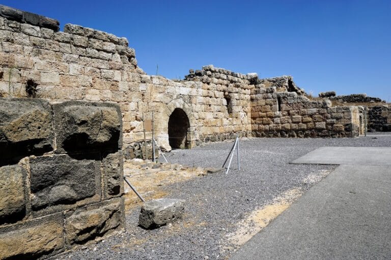
Khan al-Ahmar, established in 1308, had a square courtyard surrounded by vaulted covered halls. Its northern gate, central covered water cistern, and four granite columns survive in part, while one vaulted hall remains standing.
Ottoman government building
The Ottoman government building, or Saraya, originally had one storey, a rear courtyard surrounded by rooms, and an arched façade. During the British Mandate, the arches were sealed and a second storey was added. Its entrance incorporates reused granite columns and Corinthian capitals.