Archaeological Site of Tharros: A Multiperiod Settlement on Sardinia


Site at a Glance
- Rating
- 4.6
- Popularity
- Medium
- Country
- Italy
- Primary era
- Classical
- External website
- Open
- Eras represented
- Bronze Age, Iron Age, Classical, Medieval
- Civilizations
- Byzantine, Carthaginian, Nuragic, Phoenician, Roman, Vandal Kingdom
- Site type
- City
On this page27 sections
History
The Archaeological Site of Tharros is an ancient settlement in Italy, located on the eastern coast of the Capo San Marco peninsula near Cabras, on the Gulf of Oristano. Developed through successive Nuragic, Phoenician, Punic, Roman, Vandal, Byzantine, and medieval phases, it occupies the slopes of Su Muru Mannu and San Giovanni, which offered some shelter from the Mistral winds. Its long history reflects Sardinia’s connections with the wider western Mediterranean.
Nuragic and Phoenician beginnings
The peninsula was inhabited during the Nuragic period, the prehistoric culture of Sardinia associated with stone towers and settlements. On Su Muru Mannu, a village represents activity during the Middle Bronze Age, approximately 1600–1300 BC, and occupation probably continued until at least the eighth century BC. The settlement’s position also encouraged contact with distant shores. Prevailing winds and currents linked the western Mediterranean and the Iberian Peninsula with the Gulf of Oristano.
A possible earlier port lay at the Mistras Lagoon, about 3 kilometres northeast of Tharros. A submerged wall approximately 100 metres long has been interpreted as part of a port structure older than the Phoenician settlement. The wall and associated buildings may have been submerged after a rise in sea level around 1200 BC, although the exact development of the port remains uncertain.
Phoenician presence at Tharros dates from the eighth century BC. Earlier interpretations placed the city’s foundation in that century, while more recent research, particularly in the cemeteries, places the emergence of the Phoenician urban centre in the final decades of the seventh century BC. The precise foundation date and the location of the first urban nucleus remain uncertain. Phoenicians were maritime traders and settlers from the eastern Mediterranean who established commercial and colonial networks across the western Mediterranean.
Punic expansion
The later Punic city was probably founded or substantially developed through Carthaginian initiative. It expanded, acquired major fortifications, and prospered through maritime exchange with North Africa, the Iberian Peninsula, and Massalia. It may also have served as a Carthaginian provincial capital. During this period, Tharros was monumentalized with defensive works and sanctuaries, while Phoenician and Punic cemeteries developed to the north and south of the inhabited area.
The tophet, an open-air Phoenician or Punic sacred area where cremated remains were placed in urns, was established over or beside the earlier Nuragic settlement. Cremated remains, particularly those of children, could be accompanied by sandstone stelae. At Tharros, the installation of the tophet partly destroyed later levels of the earlier village, while its stones were subsequently reused in Roman construction.
Roman rule and urban reorganization
Rome conquered Sardinia in 238 BC. Tharros then underwent extensive reorganization, reaching a major phase of urban development during the Roman Imperial period. Roads, drainage systems, baths, an aqueduct, and other public buildings reshaped the settlement, which received the status of a community of Roman citizens.
In 215 BC, Tharros was associated with the revolt against Rome led by Ampsicora. A later inscription records the repair of the road from Tharros to Cornus during the reign of the Roman emperor Philip. These references place the city within the political and administrative changes that followed the Roman conquest while also showing its continuing connection with the surrounding territory.
Late antique Christianity and medieval decline
During the Vandal period, the public quarter facing the Gulf of Oristano was renovated and a place of worship was established in the area of the second baths. Christian occupation is also represented by the conversion of one bath complex into a Christian cult building. The bishopric of Tharros was established around 400. From about 700 it was known as the bishopric of Sinis-Tharros, and around 1000 it was raised to a metropolitan archbishopric.
In 1070, the territory of the bishopric was reorganized, and pressure from Saracen raids led to the transfer of the seat of government, the bishopric, and the population to Oristano. Tharros was associated with the medieval Giudicato of Arborea, one of the Sardinian states governed by judges whose authority combined territorial and administrative functions. The relocation marked the effective end of the ancient urban centre. The final abandonment of the site remains uncertain, with proposed dates ranging from the tenth to the early eleventh century. The bishopric was formally suppressed in 1093, when its territory was assigned to the metropolitan archbishopric of Oristano.
After the population declined, ancient structures were systematically stripped for building materials, and the site was used for centuries as a quarry. This continuing removal of ancient fabric has made the later history and urban layout difficult to reconstruct. Medieval settlement continued nearby at San Giovanni di Sinis, whose church was originally built in the sixth or seventh century and rebuilt in the eleventh century.
Later history and archaeological investigation
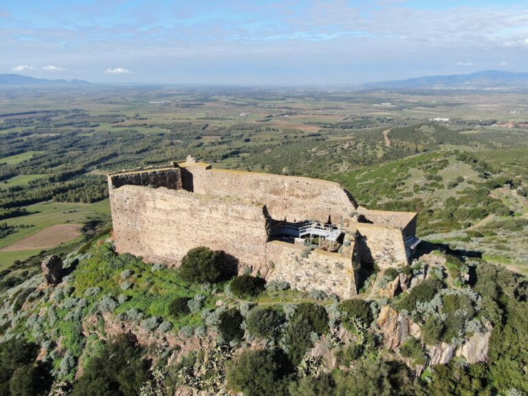
Because the area remained exposed to raids by Saracen pirates, Philip II of Spain ordered the construction of the San Giovanni Tower as part of Sardinia’s defenses. Its exact construction date is uncertain. The tower is documented by 1591, and its construction has also been placed between the late fifteenth and early sixteenth centuries.
The ruins have been only partially excavated. Older levels are in places covered by or destroyed by later construction, and the Byzantine structures are particularly poorly documented. Excavation and research have nevertheless revealed successive phases from the Nuragic period through the medieval era. Investigations continue in the urban area and in both necropolises. Nineteenth-century excavations substantially damaged the northern necropolis, while extensive plundering affected the southern one. Ancient DNA research on 14 people buried in the southern Punic necropolis identified ancestry connected with North Africa and the Iberian Peninsula. Many excavated artefacts are held in museums in Cagliari, Oristano, Cabras, and London.
Remains
The excavated urban area is organized into two principal sectors, the summit of Su Muru Mannu and the zone at the base of the Su Muru Mannu and San Giovanni hills. Roman roads divide areas of houses and public buildings between the hills. The surviving remains include fortifications, religious buildings, baths, roads, sewers, water installations, houses, cemeteries, and areas interpreted as artisan workshops.
Early settlement and fortifications
Nuragic village
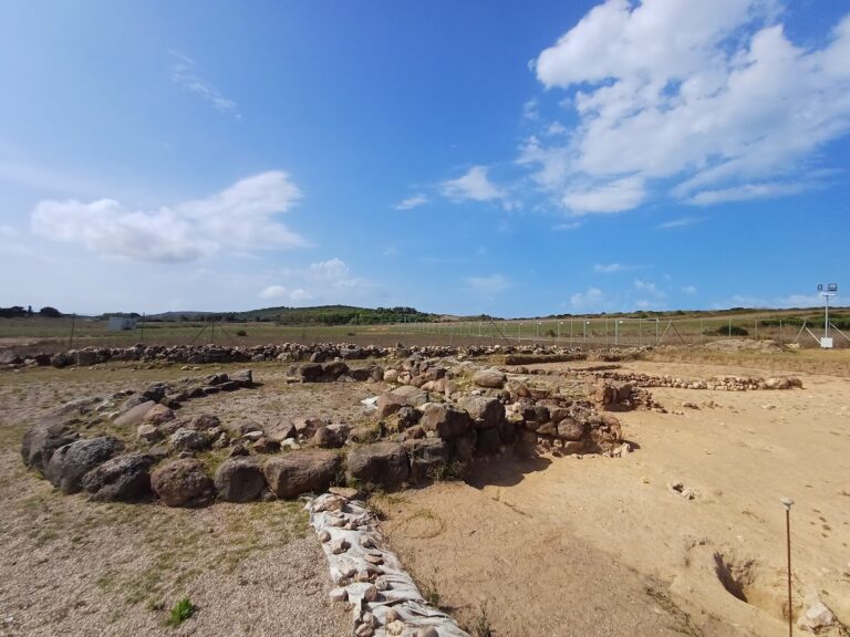
The Nuragic settlement on Su Muru Mannu consisted of a small group of circular huts. Some stood separately, while others were arranged around a courtyard. The question of whether the village also contained a nuraghe remains uncertain. Later occupation levels were partly destroyed when the Punic tophet was installed across the area.
Mistras Lagoon port structure
At Mistras Lagoon, about 3 kilometres northeast of Tharros, a submerged wall approximately 100 metres long forms part of a structure interpreted as an earlier port. Associated buildings may have been submerged after the sea-level rise around 1200 BC. The precise development of this port remains uncertain, but its position relates the peninsula to maritime movement through the Gulf of Oristano.
Su Muru Mannu fortress
The fortress on Su Muru Mannu is among the best-preserved fortifications in Sardinia. Its surviving wall encloses the summit and is especially well preserved on the western and northern sides. Large irregular basalt blocks were laid without mortar, and the wall was repaired and renovated in antiquity.
A western postern incorporated regular blocks of light sandstone, apparently as decoration. It was later blocked, probably around 50 BC. A second wall built with the same technique lies opposite it, creating a long moat between the two walls. The fortress’s present form, once considered Punic, is now attributed mainly to renovations during the Roman Republican period, particularly in the second century BC. The moat was taken out of use and partly filled during the second half of the first century BC. A small funerary chamber was then built opposite the blocked postern, and the filled moat later contained an Early Imperial Roman necropolis with mainly beehive-shaped tombs.
Tophet and urban organization
Punic tophet
Behind the fortress wall, the former area of the Nuragic village became a Phoenician and Punic tophet. Cremated remains were deposited in terracotta urns, sometimes with sculpted stones or sandstone stelae. The sacred area had little substantial structural construction. During the Roman period, later buildings were erected there, and stones from the tophet were reused in their foundations.
Entrance area and amphitheatre
Immediately south of the tophet is an open area that originally formed an entrance through the city walls. It has also been identified as a small amphitheatre, initially surrounded by earthen terraces.
Roman roads and water supply
Two large Imperial Roman roads on the southern slopes of Su Muru Mannu are paved with basalt. Each has a central sewer connected to drains from neighboring houses. Together they divide the area into three large blocks, with houses toward the upper part of the slopes and public buildings, including baths, toward the lower part.
Roman roads also organized the central urban area into defined blocks. A large triangular block contained public religious buildings toward the sea and houses toward the hillside. Smaller paved roads and an efficient sewer network served the residential quarters. At its northwestern end stood a small building, probably a sacred aedicula, or shrine, which is no longer visible. Opposite it was the castellum aquae, a Roman water-distribution reservoir supplied by the aqueduct and placed in front of a public fountain.
Temples and sacred buildings
Punic semi-column temple
The Punic semi-column temple had long sides decorated with semi-columns carved in relief from the underlying rock. The structure was covered over in the second century AD, and later buildings were erected above it.
Semitic-style temple
The so-called Semitic-style temple occupies an area bounded on three sides by naturally cut rock and open toward the road. Its excavated remains include foundations and walls belonging to two small sacred buildings, traces of mosaic floors, and an unpaved corridor around them. These structures date to around the third century AD.
Roman Republican temple
A Roman Republican temple was built in the second half of the first century BC on a podium made from large blocks. Its reconstructed form is that of a four-column temple. The two columns now visible are modern reconstructions.
Temple K
The slopes of San Giovanni contain the remains of a large staircase built in the third or second century BC. The staircase led to Temple K, a small temple with a portico. Distinctive architectural cornices from the building were found at the foot of the slope.
Temple K was extensively redesigned during the second and third centuries AD. Its portico was divided into rooms, its entrance was blocked, and materials from the earlier structure were reused. These included fragments of a Punic inscription.
Baths and residential quarters
Thermal Baths 1
Thermal Baths 1 is a large coastal bath building north of the Roman temple. Repeated renovations and alterations affected its plan. At excavation, its heated rooms and praefurnium, the furnace area used to heat the baths, remained identifiable, while its cold rooms had already been heavily damaged.
The northern part of the complex was incorporated into a Late Roman or Paleo-Christian basilica. A hexagonal baptismal font survives from this conversion, linking the bath building with Christian use during late antiquity.
Convento Vecchio baths
The Convento Vecchio baths form a better-preserved Roman bath complex in the coastal public quarter. The sea has eroded the eastern sector, while much of the remaining building survives to considerable height. Its layout preserves the sequence of a dressing room, a cold room, and heated rooms.
Built shortly after AD 200, the complex included an apodyterium, or changing room, a frigidarium, or cold room, three calidaria, or hot rooms, and a tepidarium, or warm room. A Byzantine tomb at the entrance was incorporated into a later concrete structure and used as a dressing room. The name Convento Vecchio may reflect a later association with monks.
Houses and domestic installations
Roman and Late Roman houses occupy much of the remaining urban area. Ancient adaptations and reorganizations make their functions and exact plans difficult to define, while their different elevations reflect the sloping ground. Many houses included a second floor or gallery. Numerous rainwater cisterns and wells supplied the residences, drawing on collected water and groundwater. Some rooms were later adapted for agricultural production, including spaces with millstones used to grind cereals.
Necropolises
Northern necropolis
The northern necropolis lies near the present settlement of San Giovanni di Sinis. It contains Phoenician cremation tombs and Punic coffer tombs, which were burial chambers constructed with stone slabs or masonry. One Phoenician cremation tomb dates to the seventh century BC.
Southern necropolis
The southern necropolis extends between the urban area and the coast. It consists mainly of Punic hypogeum tombs, underground burial chambers, dating from the fifth to the third centuries BC. Access wells led down into the chambers, often with narrow, high steps along one wall. The cemetery also provided evidence for movement across the western Mediterranean, including North African and Iberian ancestry among individuals buried there.