Dougga: An Ancient Numidian and Roman City in Tunisia



Site at a Glance
- Rating
- 4.8
- Popularity
- Medium
- Country
- Tunisia
- Primary era
- Classical
- Eras represented
- Bronze Age, Iron Age, Classical, Medieval
- Civilizations
- Aghlabid, Byzantine, Carthaginian, Numidian, Roman
- Site type
- City
On this page24 sections
History
Dougga is an ancient Libyco-Punic, Numidian, and Roman city in Tunisia, founded in the sixth century BC on a hill above the fertile Oued Khalled valley. Before the Roman annexation of Numidia, it was an important settlement and was probably the first capital of the Numidian kingdom. By the time of the Roman conquest, the city had already existed for more than six centuries.
Libyco-Punic and Numidian beginnings
Dougga, also known as Thugga, developed within the Libyco-Punic cultural sphere, where indigenous North African traditions existed alongside Punic language and institutions associated with Carthage. Its elevated position, overlooking the valley and protected by the surrounding terrain, helped support early occupation. The city’s oldest known archaeological evidence is its dolmen necropolis, while a sanctuary of Ba’al Hammon, Neo-Punic votive stelae, a Libyco-Punic mausoleum, and a sanctuary or memorial associated with the deified Massinissa reveal the importance of the settlement before Roman rule.
The city may have been founded in the sixth century BC. An alternative proposal identifies Dougga with Tocae, a city captured by a lieutenant of Agathocles of Syracuse in the late fourth century BC, but that identification remains uncertain. Libyan and Punic inscriptions provide evidence for local institutions and have prompted debate about the balance between Punic and Berber traditions. Punic-style sufetes, magistrates of Punic civic tradition, continued to operate at Dougga during the Roman period.
The discovery of the Massinissa sanctuary and a second-century BC building established that the area later occupied by the Roman forum was already urbanized before Roman colonists arrived. This evidence overturned the earlier idea that Numidian and Roman communities had occupied separate sites. Instead, the Roman city was inserted into an existing urban landscape.
Roman administration and municipal development
After the Roman conquest of Numidia, Dougga was treated as a civitas, an indigenous civic community under Roman rule. During the reign of Augustus, it was incorporated into the territory of the Roman colony of Carthage, while a pagus, or smaller Roman civic district, was established beside the existing community. For about two centuries, the two communities shared the same city but retained separate institutions. The civitas had magistrates and a council of local elites, while the pagus possessed its own council and administrators who remained legally dependent on Carthage.
Dougga’s inscriptions also show that the city preserved its dual magistracy of sufetes during the imperial period. Romanization gradually brought the two communities closer together. Under Marcus Aurelius, the civitas received Latin rights, and its magistrates automatically gained Roman citizenship. The pagus acquired greater independence from Carthage, including the ability to accept bequests and administer public funds.
In AD 205, during the reign of Septimius Severus, the civitas and pagus were united as the municipium Municipium Septimium Aurelium Liberum Thugga. A municipium was a Roman town with a defined legal status. The union took place as Carthage’s territory was reduced, and it encouraged a period of public construction and civic generosity. Wealthy local families financed buildings, banquets, spectacles, and other benefits for the community, a practice known as euergetism.
The meaning of Liberum in the municipal title remains debated. It may have referred to the god Liber, expressed the city’s civic freedom and dignity, or indicated specific privileges, possibly including exemption from certain taxes. Inscriptions honor Severus Alexander and Probus as protectors of Dougga’s liberty. An appeal by Aulus Vitellius Felix Honoratus under Gallienus is also associated with the city’s claims concerning its public freedom.
Under Gallienus, probably in AD 261, Dougga became a separate Roman colony. Its formal name was Colonia Licinia Septimia Aurelia Alexandriana Thuggensis. The city prospered particularly from the reign of Diocletian to that of Theodosius I, although its surviving monuments show that most of its principal building activity belonged to the second and third centuries AD.
Late antique transformation and later occupation
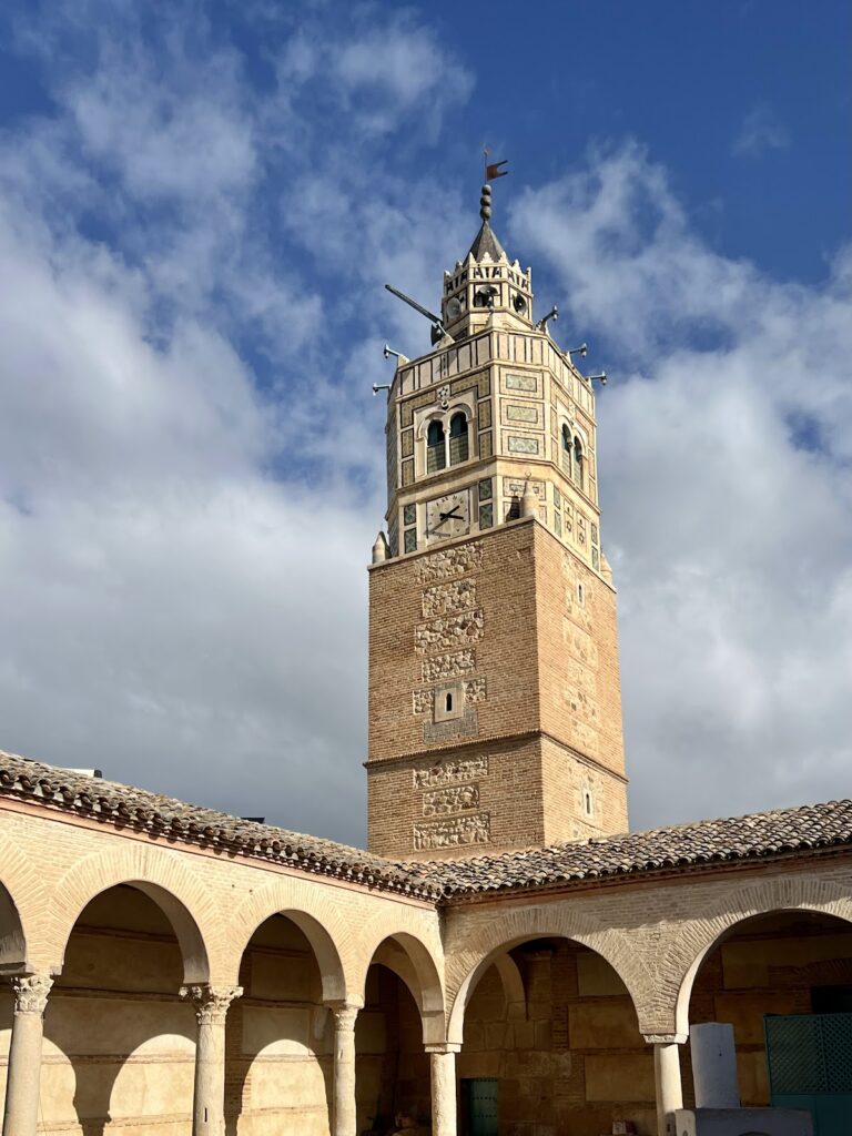
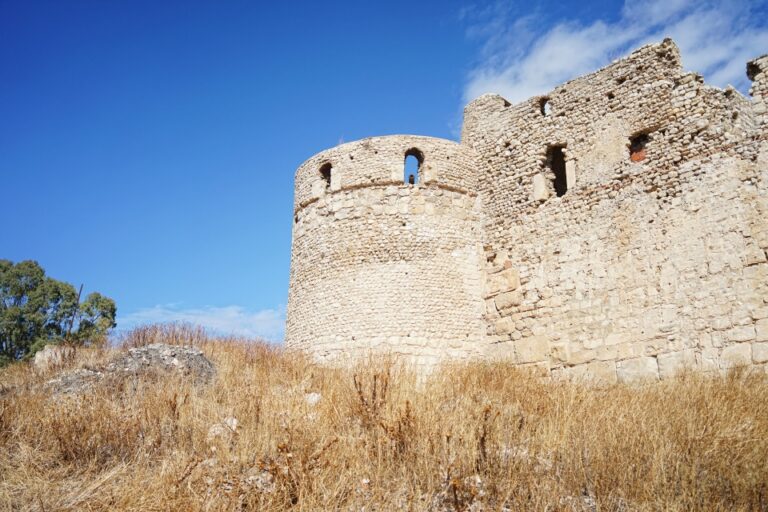
Dougga declined from the fourth century onward. Christianity left relatively modest archaeological remains, while during the Byzantine period the forum was converted into a fort. Important ancient buildings were demolished or quarried for building materials, although occupation continued in parts of the city. Following the Muslim conquest, a village remained at Dougga for a long period and was inhabited by descendants of the earlier population. A small mosque and baths from the Aghlabid period preserve evidence of this later settlement.
The final inhabitants were relocated after Tunisian independence to a settlement in the plain known as New Dougga. The site therefore preserves evidence of successive indigenous, Punic, Hellenistic, Roman, Christian, Byzantine, and later occupations rather than representing a single, undisturbed historical phase.
Excavation, conservation, and interpretation
Western visitors began recording Dougga’s ruins in the seventeenth century, and architectural studies increased during the eighteenth and early nineteenth centuries. After the French protectorate was established in 1881, the antiquities service made Dougga a priority for excavation from 1901. Paul Gauckler initially directed the work, followed by Louis Poinssot. Excavations concentrated on the forum and continued in broadly continuous campaigns until 1939.
Investigation and restoration continued after Tunisian independence, including work on the Temple of Caracalla’s Victories. Dougga became a national archaeological park in 1991 and was inscribed on the UNESCO World Heritage List in 1997 under criteria recognizing cultural interchange and the testimony provided by the site. The World Heritage property covers approximately 75 hectares and has a 91-hectare buffer zone. Its protection is also governed by Tunisian heritage and agricultural-land legislation.
The site retains an unusually high degree of authenticity partly because restoration and conservation during the previous century were limited. The Libyco-Punic mausoleum is an important exception. It was reconstructed between 1908 and 1910, and the extent and methods of that reconstruction remain debated. Dougga’s more than 2,000 Libyan, Punic, bilingual, Greek, and especially Latin inscriptions have been central to the decipherment of the Libyan language and to the study of Numidian social and municipal life, particularly during the third and second centuries BC.
Later traditions also remain connected with the ancient landscape. At the Aïn El Hammam water installations, an annual observance venerates Mokhola, traditionally described as a Moroccan saint and benefactor. The observance includes animal sacrifice and has been interpreted as a survival of older pagan veneration of the spring known as fons moccolitanus. Dougga’s theatre continues to host classical performances, including events associated with the Dougga festival.
Remains
Dougga occupies the summit and slopes of a 571-metre hill above the Oued Khalled valley. The archaeological area covers approximately 75 hectares and preserves the remains of a complete ancient city. Its buildings and urban fabric combine Numidian, Punic, Hellenistic, Roman, Byzantine, and later phases. Roman monuments were inserted into an essentially Numidian framework rather than imposed on a regular Roman grid.
Urban layout and funerary landscape
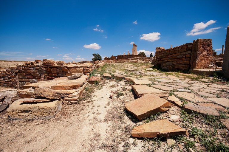
The city follows the irregular slope and earlier construction. Its highest area remained the civic center, where the Roman forum replaced the Numidian agora, while later development spread down the hillside. Streets are winding and irregular rather than organized around the conventional Roman main avenues. The central area was probably paved, and surviving access covers belong to the sewer system. Roads at the foot of the hill connected with the route from Carthage to Theveste.
Early tombs and the Libyco-Punic mausoleum
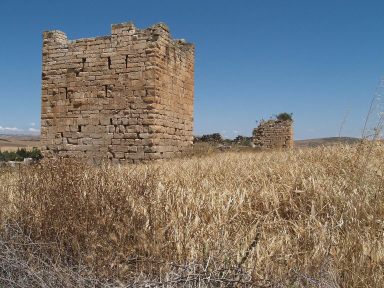
The dolmen necropolis provides the oldest known archaeological evidence at Dougga. Excavations recovered human skeletons and modeled ceramics. The dolmens are difficult to date because some may have remained in use until the beginning of the Christian era, but they probably belong no later than the second millennium BC. Numidian bazina tombs, circular funerary monuments, also occur at the site. Two structures once understood as Numidian towers in the later city walls have instead been identified as funerary monuments reused in late-antique fortifications.
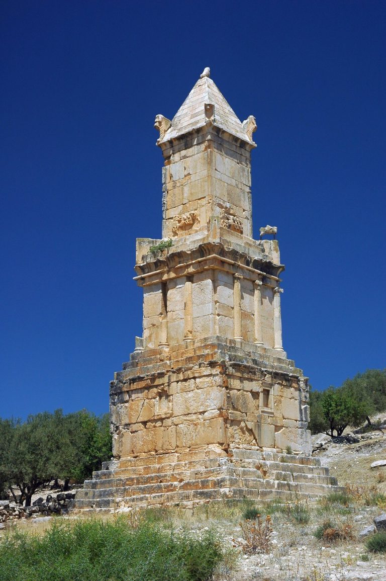
The Libyco-Punic mausoleum, built in the second century BC, is one of the rare surviving examples of royal Numidian architecture. It rises 21 metres within an urban necropolis rather than in an isolated rural setting. The inhabitants may have built it for a Numidian prince, and its possible connection with Massinissa remains an interpretation rather than a certainty. Five steps lead to the podium, whose northern side has a slab-closed opening to the burial chamber. False windows and four Aeolic corner pilasters decorate the other sides. Above them is a temple-like colonnade with Ionic columns, followed by an upper level with further pilasters and a crowning pyramidion.
A bilingual Libyan-Punic inscription was originally placed beside a false window on the podium. It is now in the British Museum and helped decipher the Libyan characters. Sir Thomas Reade severely damaged the mausoleum in 1842 while removing the inscription, after which Louis Poinssot reconstructed much of the monument from fallen blocks. Some carved pieces of statuary also survive.
Roman necropoleis and the hypogeum
Five Roman burial areas have been identified. They lie around the Temple of Saturn and Victoria Church in the north-east, around the dolmens in the north-west, between the Aïn Mizeb and Aïn El Hammam cisterns and north of the Temple of Juno Caelestis in the west, and around the mausoleum and Arch of Septimius Severus in the south and south-east. Some tombs are partly overgrown by olive trees.
The third-century hypogeum, a partly underground funerary building, was constructed within an older necropolis. Small wall niches were intended for funerary urns, but sarcophagi found during excavation in 1913 show that the structure was used over an extended period. The late fourth- or early fifth-century Victoria Church lies north-east of the city below the Temple of Saturn. It was built within a pagan cemetery and has an irregular plan near the hypogeum.
Civic center and public buildings
The forum covers 924 square metres. The Byzantine fort destroyed much of its surrounding fabric, but the area still includes the Capitol, porticoes, the Rose of the Winds Square, the Temple of Mercury, and probably the curia and a speaking platform. A Numidian residence discovered beneath the auditorium of the Temple of Liber shows that this central area was occupied before the Roman civic buildings were constructed.
The Capitol and Rose of the Winds Square
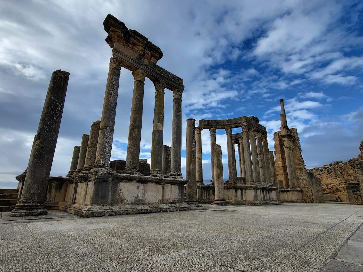
The Capitol is a second-century Roman temple dedicated principally to Jupiter Optimus Maximus, Juno Regina, and Minerva Augusta, the three principal protective deities of the Roman state. Honors for Lucius Aurelius Verus and Marcus Aurelius suggest that it was completed around AD 166 or 167. An eleven-step staircase leads to the façade, whose Corinthian columns rise eight metres. The pediment preserves an image of Antoninus Pius being carried heavenward by an eagle.
Inside the cella, the enclosed chamber for the principal cult images, three statue niches remain, including the central niche associated with a colossal Jupiter. A crypt lies below the cella. The walls use opus africanum, a North African masonry method combining large stone blocks or pillars with smaller masonry panels. The portico entablature and other elements were restored between 1903 and 1910, and further work took place from 1994 to 1996. The temple’s incorporation into the Byzantine fortification helped preserve it.
Near the Capitol, the Rose of the Winds Square takes its name from a compass-rose design engraved in the paving. Its form is better understood as an esplanade leading toward the Temple of Mercury than as a large open forum.
Temples beside the forum
The Temple of Mercury faces the market across the Rose of the Winds Square. Dedicated also to Tellus, it is badly ruined and has three cellae but no courtyard. The temple stands on a low podium reached by four steps. It was excavated and consolidated between 1904 and 1908.
The small Temple of August Piety was built during Hadrian’s reign through the benefaction of Caius Pompeius Nahanius. Part of its vestibule survives beside the Rose of the Winds Square. Its low podium, about one to 1.5 metres high, was approached by seven steps on the south side. A later mosque stands behind it on foundations associated with temples of Fortuna, Venus Concordia, and Mercury.
Two sanctuaries of Minerva are known. The first dates from the late first century and was provided by the patron of the civitas. The larger complex was built under Antoninus Pius and included a temple and porticoed area financed by Julia Paula Laenatiana, priestess of the imperial cult. Its design accommodated the slope: the podium reached the level of the portico roofs, while the temple stood beyond the surrounding enclosure.
Imperial and religious monuments
Temple of Caracalla’s Victories
The Temple of Caracalla’s Victories is the only imperial-cult building at Dougga whose location has been precisely established. It stands beside the road from the forum to the Aïn Doura Baths and is backed by a monumental fountain building from the reign of Commodus. Fragments of its lintel inscription were found in 1835, but the temple was not identified until 1966.
The building measures 41.5 by 14.2 metres and is associated with a triumphal arch over the adjacent road. Its courtyard contains four rainwater basins arranged around a cross-shaped pavement. Six lateral niches in the cella held statues of Apollo, Liber Pater, Neptune, Mercury, and two unidentified deities. The temple has seven columns along the visible side of its narrow cella and uses a four-column Tuscan design with columns set between projecting wall ends. Its unusual form reflects the difficult terrain.
An inscription dated to AD 214 dedicates the temple to deified Victories associated with Caracalla’s military campaigns and to the welfare of Caracalla and Julia Domna. Gabinia Hermiona financed the 100,000-sestertius construction through her will. Her bequest also funded an annual banquet for the local council and provided the land for the circus. At the end of the fourth century, the temple became a church. The courtyard basins were filled, chancels were added to the cella, and its decoration was altered.
Temple of Saturn and Temple of Juno Caelestis
The excavated Temple of Saturn stands on a promontory overlooking the Oued Khalled cereal valley, about 160 metres from the theatre and outside the city limits. Excavations beneath it revealed an earlier open-air sanctuary of Ba’al Hammon, dating at least to the second century BC, with ritual pits containing votive offerings. The earlier sanctuary was filled to support the Roman temple.
Built during the reign of Septimius Severus, the Temple of Saturn has three cellae, a porticoed courtyard, and a vestibule. Roof water was collected in cisterns. Lucius Octavius Victor Roscianus provided at least 150,000 sestertii through a bequest. The extensive leveling and filling required by the site may explain the cost and the later need for repeated repairs and consolidation.
The Temple of Juno Caelestis stands at the edge of the city within a remarkably well-preserved sacred enclosure, or temenos. Its substantial boundary wall has two symmetrical entrances, a partly paved court, and a portico with 25 bays along the curved section. A frieze above the portico depicts the construction of the temple. Built between AD 222 and 235, the temple proper stood on an eleven-step podium and was a Corinthian, six-columned temple surrounded by columns. The cella has disappeared, while the pediment carries a dedication to Severus Alexander. The circular enclosure measures 52 metres across and has been interpreted as resembling a crescent moon.
Q. Gabinius Rufus Felix financed the temple and donated two silver statues of Juno valued at 35,000 sestertii. The building was described in the seventeenth century, excavated in the 1890s, substantially restored between 1904 and 1914, and studied again between 1999 and 2002.
Dar Lacheb and the Temple of Pluto
Dar Lacheb, or the House of Lacheb, was built between AD 164 and 166 about 50 metres from the Capitol. Its purpose is uncertain, and it may have been a temple or a sanctuary of Aesculapius. The entrance and one porch column survive, together with the outline of a courtyard formerly surrounded by porticoes. The southern cella has disappeared.
The building identified as the Temple of Pluto lies near the Arch of Septimius Severus in a partly excavated area. It consists of a podium with a one-niche cella in a courtyard, and its altar survives. The identification depends mainly on a bust found in the courtyard and is not secure. Architectural study took place between 2000 and 2002, while a nearby excavation revealed probable pre-Roman occupation.
Entertainment buildings and private houses
Theatre and Temple of Liber
The theatre was built in AD 168 or 169 and is among the best-preserved theatres in Roman Africa. It could hold approximately 3,500 spectators, while the city’s population has been estimated at about 5,000. The structure was adapted to the hillside instead of following a rigid standard plan. It measures 63.5 metres across, and its cavea rises 15 metres with 19 rows divided into three sections. Five broad rows were reserved for local notables, leaving an unusually small orchestra only eight metres wide.
The stage measures 36.75 metres in width and 5.5 metres in depth. Most of the stage wall has disappeared, but its foundation retains three curved recesses and several columns near the actors’ entrances. A dedication on the stage pediment and the overlooking portico names P. Marcius Quadratus as the builder. He paid for the theatre, theatrical performances, food distributions, a banquet, and athletic games for its dedication.
The auditorium beside the Temple of Liber is an annex rather than a performance theatre. Its small-theatre form probably served the initiation of novices and measures about 20 by 20 metres. Faint Numidian domestic remains occur within its foundations.
Trifolium Villa
The Trifolium Villa lies in the southern part of Dougga, halfway down the natural slope, and is the largest private house excavated at the site. Dating from the second or third century, it had two storeys, although little survives from the upper level. The entrance descends toward a courtyard around which the rooms were arranged. A clover-shaped room, probably a triclinium, or formal dining room, gave the house its modern name.
Circus and market
The circus was intended for chariot racing and is now represented mainly by a long depression in the north-west. In AD 214, the Gabinii donated a field for it. In AD 225, the magistrates developed and constructed the racing ground after a request from the whole population. The design followed the natural landscape to reduce costs and speed construction. It was approximately 393 metres long, with a central barrier, or spina, measuring 190 metres in length and six metres in width.
The market, or macellum, dates from the middle of the first century AD. Its approximately 35.5-by-28-metre square was bordered by porticoes and shops on two sides. A northern portico and southern curved recess completed the plan, and the recess probably held a statue of Mercury. Extensive earthworks compensated for the slope. The market was almost entirely demolished when the Byzantine fort was built and was excavated in 1918 and 1919. A large elliptical depression north-west of the site has traditionally been called an amphitheatre, but its identification remains unresolved.
Baths and water management
Bath complexes
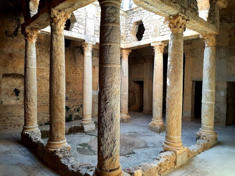
Four bath complexes are known at Dougga. Three have been fully excavated and a fourth has been only partly exposed. One belonged to the private house west of the Temple of Tellus, while the Aïn Doura and Antonine complexes were probably public. The Baths of the Cyclopes are harder to classify.
The Baths of the Cyclopes preserve well-built latrines and a late-third-century mosaic showing Cyclopes forging Jupiter’s thunderbolts. Their cold room, or frigidarium, measures less than 30 square metres. This size has led to proposals that the baths served a private or neighborhood community. The Antonine Baths, long called the Licinian Baths, are a multi-storey complex of the third century. Their date was once assigned to Gallienus but is now generally connected with the reign of Caracalla on epigraphic grounds, although a broader Severan-period date has also been proposed.
The Antonine complex covers approximately 1,700 square metres without its exercise area, or palaestra, and its cold room measures 175 square metres. Construction required substantial cutting, filling, and leveling of the slope. Sections built on raised fill have largely disappeared, while much of the original walling survives. A long tunnel used by bath workers is also preserved. At an unknown later date, the baths were converted into an olive-oil installation.
The partly excavated Aïn Doura Baths may have been the city’s largest bath complex. Their mosaics suggest a date in the late second or early third century, with renewed mosaic decoration in the fourth century. The exposed area includes cold rooms and appears to belong to a symmetrical plan. A smaller bath covering 75 square metres was accessible from both a house and the street. Its relationship with the house suggests that it was added after the original construction, although its date is unknown.
Cisterns and aqueducts
Dougga preserves two principal groups of cisterns and an aqueduct. The six Aïn El Hammam cisterns near the Temple of Juno Caelestis had a combined capacity of about 6,000 cubic metres and were supplied by a spring 12 kilometres away. Their aqueduct was constructed under Commodus and restored during the last quarter of the fourth century. The cisterns are now badly ruined.
The eight vaulted Aïn Mizeb cisterns near the Temple of Minerva are much better preserved and could hold approximately 9,000 cubic metres. They include a settling basin and received water from a spring about 200 metres away through an underground aqueduct. Secondary cisterns also occur near the Aïn Doura Baths. The aqueduct near the cisterns remains among the best-preserved examples of its kind in Tunisia. Individual temples also managed water locally, including the roof-water collection system at the Temple of Saturn and the rainwater basins beside the Temple of Caracalla’s Victories.
Sculpture, mosaics, and inscriptions
Most movable works recovered at Dougga were transferred to museums, especially the Bardo National Museum in Tunis. A sculpture of a togatus, a figure wearing a Roman toga, remains in the Rose of the Winds Square, while some mosaics survive at the site, including works in the House of Venus and the Aïn Doura Baths. Exposed mosaics left in place have suffered from weathering.
The Bardo collections include a Carrara-marble portrait of Lucius Aurelius Verus with traces of colored paint, a third-century statue of a togatus, and several major mosaics. The mid-third-century Cupbearers mosaic shows a scene of drinking and hospitality with Latin and Greek inscriptions. The related Omnia tibi felicia mosaic expresses a similar welcome.
A mosaic of the victorious charioteer from the second half of the fourth century depicts Eros, the horses Amandus and Frunitus, the starting gates of a circus, and the inscription Eros omnia per te. Its discovery in a private residence suggests that it commemorated games sponsored by the householder. The Ulysses mosaic, made around AD 260 to 268 in the House of Ulysses and the Pirates, shows Ulysses bound to a mast while his companions resist the Sirens. A related Neptune and the Pirates mosaic from the same peristyle combines maritime and Dionysiac themes. Both scenes have been interpreted as protective imagery.
The late-third-century mosaic in the Baths of the Cyclopes shows Brontes, Steropes, and Pyracmon forging Jupiter’s thunderbolts, while Vulcan holds them on an anvil. The anvil itself has been lost. Together with the buildings, water systems, tombs, and inscriptions, these works illuminate the continuity of indigenous and Roman traditions at Dougga and the later Christian, Byzantine, and medieval transformations of the city.