Qula Crusader Fortress: A Hospitaller Administrative Center in Israel


Site at a Glance
- Rating
- 5
- Popularity
- Very Low
- Country
- Israel
- Primary era
- Medieval
- Eras represented
- Classical, Medieval
- Civilizations
- Crusader, Knights Hospitaller, Roman
- Site type
- City
On this page14 sections
History
Qula Crusader Fortress is a twelfth-century Hospitaller administrative and tax-collection center near Giv’at Ko’ah in Israel. Established by the Hospitallers, a medieval Christian military-religious order also known as the Knights of St John, it comprised a fortified tower and a vaulted building on a limestone hill overlooking the plain. The settlement later developed into a Palestinian village whose history continued through Ottoman rule, the British Mandate, and the fighting of 1948.
Qula in the Crusader period
Qula was a settlement on the western slope or edge of a limestone hill, at the transition between the central coastal plain and the hill country. Medieval records use the forms Chola, Cola, and Chole for the place. The name is described as Aramaic and derived from a personal name, while another tradition connects it with Muhammad Ali Pasha and an Albanian place-name.
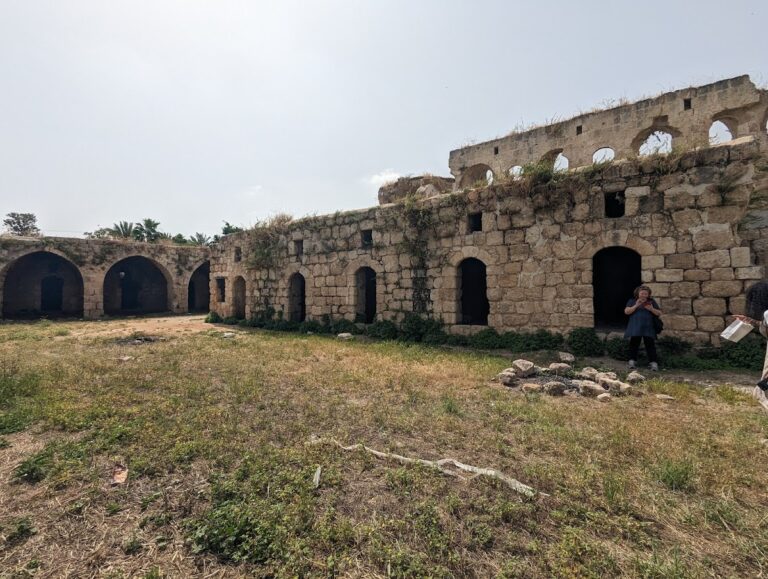
During the twelfth century, the Hospitallers organized Qula as an administrative center where taxes were collected and local affairs were managed. Its fortified tower was a defensible administrative or residential building rather than necessarily a large castle. A larger vaulted structure stood alongside it, forming part of the same center.
Ottoman and Mandate-era village
In 1596, Qula belonged to the Ottoman Empire within the nahiya, an Ottoman administrative subdivision, of al-Ramla in the Gaza district. The village contained 69 Muslim households, with an estimated population of about 380 people. Its taxes included payments on goats, beehives, and a press used for olives or grapes, together with a fixed sum. The total assessment was 6,650 akçe, an Ottoman monetary unit.
An Ottoman village list from about 1870 recorded 159 inhabitants in 38 houses, counting only men. Edward Robinson observed Qula from the White Mosque in Ramla in 1838, and a Palestine Exploration Fund survey in 1882 described medieval remains at the village. By the nineteenth century, the larger vaulted building had been divided into private dwellings, while the tower was still used for defense.
Under the British Mandate, the territory administered by Britain under a League of Nations mandate from 1920 until 1948, Qula expanded along the Ramla to Tulkarm highway. Its center contained a mosque, shops, and a school founded in 1919. The population was recorded as 480 Muslims in 1922 and 697 in 1931. In 1945, Qula had 1,010 inhabitants, all Muslim, and its lands covered 4,347 dunams, a regional unit of land area. Cereal cultivation occupied 2,842 dunams, while irrigated land and orchards covered 105 dunams and the built-up area covered 26 dunams. A separate estimate placed the population at 1,172 in 1948.
Conflict and destruction in 1948
Hasan Salama, a Palestinian commander and prominent leader of the 1936 Palestinian revolt, came from Qula. During the revolt, British forces raided the village, demolished numerous houses including his home, and arrested and tortured his elderly father. Salama later led Palestinian forces in the central-western region and fought at al-Qastal and Bab al-Wad. After he was wounded near Ras al-Ayn, he died in a Ramla hospital on 3 June 1948.
Salama was buried at Qula with a military funeral. His body was later reburied in the courtyard of the northern neighborhood mosque, and the grave was levelled because of fear that it would be desecrated.
Qula became a battlefield during Operation Dani, an Israeli military operation in the 1948 Arab-Israeli War. Israeli forces, the Arab Legion of Transjordan, and the Arab League’s First Brigade fought for control of the village. The initial attack took place on 10 July 1948, after which most inhabitants fled eastward to neighboring villages. Fighting continued, and Qula was captured on 18 July, shortly before the Second Truce. An Israeli report then recorded the discovery of the mutilated bodies of 19 members of the Alexandroni Brigade.
Testimonies recorded in the late 1990s stated that six women and one man who remained in Qula were killed by gunfire or died in fires in their homes. The village was scheduled for destruction in September 1948, and its houses were subsequently demolished. No Israeli settlement was established on Qula’s territory. Giv’at Koah, founded in 1950 on the land of al-Tira, lies about 2 kilometers southwest of the site.
Remains
The Crusader complex
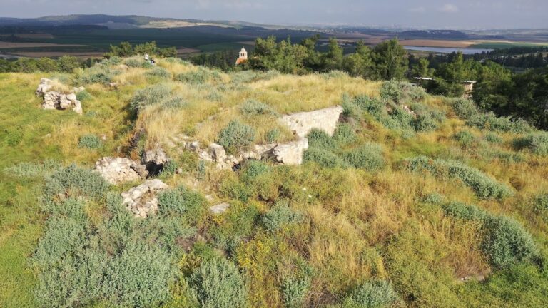
The remains occupy the western edge of a limestone hill overlooking the plain. Qula’s position connected the coastal plain with the hill country, while the main Ramla to Tulkarm road passed several hundred meters away and secondary roads linked the settlement with neighboring villages. The principal Crusader remains are the tower, a vaulted building, and a nearby reservoir, all associated with the medieval administrative center.
Fortified tower
The principal surviving Crusader feature is the tower known in local archaeological records as Burj Kuleh. Its lower courses consist of very large dressed or bossed stones. The upper part was built considerably later, showing that the structure was altered after its medieval phase. In the nineteenth century, the tower continued to serve as a defensive building.
Vaulted building
A larger vaulted building stood near the tower. It was constructed from cut stones, some apparently reused from earlier buildings, and by the nineteenth century had been subdivided into several private dwellings. Its construction has been considered either Christian or Muslim, with a possible origin in the Crusader period.
Birket er-Ribba
The nearby pool known as Birket er-Ribba measured approximately 18 paces by 12 paces. Part of it was cut into the bedrock, while the remainder was built from large polygonal blocks bonded with thick cement. The Palestine Exploration Fund survey attributed the reservoir to the Crusader period. A birket is a constructed or rock-cut reservoir or pool.
Religious and village buildings
Village mosque
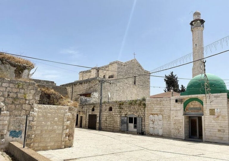
The village mosque stood about 10 meters east of the Crusader tower. It contained a large vaulted iwan, a hall or recess open on one side, and a smaller room with an inscription above its entrance. Moulded elements in the doorway were thought to predate the Muslim conquest, and at least some of the building material appeared ancient.
Houses and schools
Qula’s houses were closely grouped and built of stone, with walls approximately 1.5 meters thick. The built area included shops, the mosque, an older school, and a newer school. The school building was made of good-quality white stone and contained four rooms. In front of it were a concrete platform or enclosure, a water trough for pupils, a latrine, and a large yard used for morning assembly. By the mid-1940s, the school had 134 pupils and, by 1948, four teachers as well as the same recorded number of pupils. In 1992, the school on the western side was described as the only prominent surviving building; the newer school was demolished in 2004.
Other village features
Other recorded features included a southern courtyard mosque, a northern neighborhood mosque, and towers associated with the Al-Dabur and Al-Ghanim families. A Roman-period observation point, gardens, and numerous wells also formed part of the village landscape. The wells included Ammar, al-Tarbiya, al-Qasr, al-Wadi, Hamdan, Abu Rishiq, al-Hasan, al-Atrash, al-Hara, and al-Shajara.
Landscape and surviving traces
The ruins now lie within Kula Forest. In 1992, collapsed houses and terraces were visible among the trees, while scattered rubble marked the former built area. The surrounding hills were used for grazing, and other land was cultivated. The village territory included olive groves, cereal fields, orchards, and wooded hills, with grapevines, figs, olives, prickly pear, mulberries, peaches, apricots, oak, carob, cypress, pine, and eucalyptus among the recorded vegetation.
Nearby sites