Château Pèlerin: A Crusader Fortress near Atlit, Israel
Site at a Glance
- Rating
- 4.5
- Popularity
- Very Low
- Country
- Israel
- Primary era
- Medieval
- Eras represented
- Iron Age, Medieval
- Civilizations
- Crusader, Kingdom of Jerusalem, Knights Templar, Mamluk, Phoenician, Teutonic Order
- Site type
- Military
- Remains
- Castle
On this page18 sections
History
Château Pèlerin, also known as Atlit and Magdiel, is a Crusader fortress and fortified settlement near Atlit in Israel. Built by the Crusaders in the early thirteenth century during the Fifth Crusade, it protected the coastal route between Acre and Jerusalem and became one of the principal strongholds of the Knights Templar.
From Le Destroit to Château Pèlerin
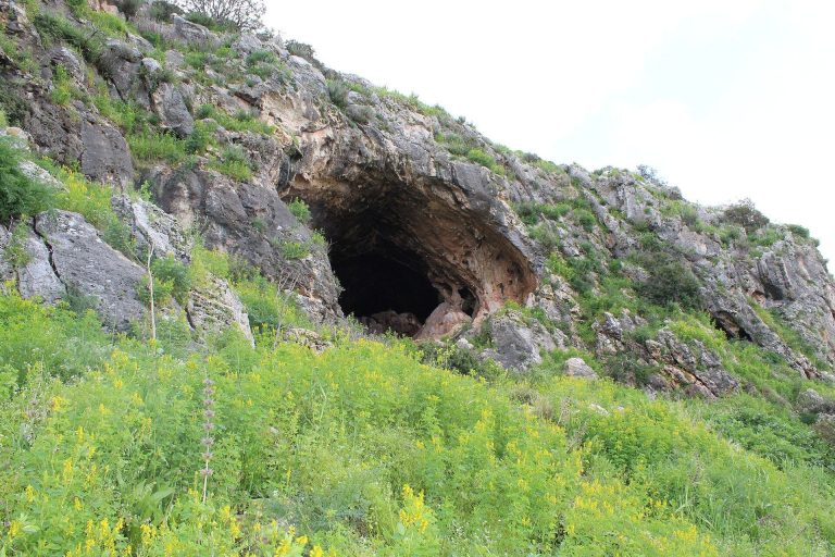
The fortress replaced the smaller Crusader castle of Le Destroit, also called Detrois, which had been founded in 1103 to protect pilgrims and traffic along the coast. A larger settlement began to develop at Atlit in 1217, partly in response to the construction of a strong Muslim fortress on Mount Tabor. The Crusaders intended the new position to deter attacks through the narrow coastal passage and possibly to serve as a base for an assault on Jerusalem. That offensive was never undertaken.
Construction began in February or early spring 1218, while the Fifth Crusade was directed mainly against Egypt. John of Brienne, king of the Kingdom of Jerusalem, initiated the project, and the Knights Templar carried it out with help from the Teutonic Knights, the king’s builders, Christian pilgrims, and refugees from failed Crusades. The work was managed by the Flemish knight Gautier d’Avesnes, and the fortress was completed on 15 April 1218.
After its completion, Château Pèlerin was placed under Templar control. Its name, Castellum Peregrinorum, meaning “Pilgrim Castle,” referred both to the pilgrims who had helped build it and to its role in protecting travelers along the coast. The fortress was enlarged through several building phases. Changing frontiers after the Battle of La Forbie, also called the Battle of Hyrbia, and later Mamluk conquests increased the need for a strong refuge for displaced populations.
Sieges and Crusader rule
In autumn 1220, the Ayyubid ruler of Damascus, al-Malik al-Mu’azzam Isa, besieged Château Pèlerin after capturing Caesarea. The Ayyubids were the Muslim dynasty founded by Saladin and his successors. The Crusaders destroyed Le Destroit and concentrated their forces at Château Pèlerin, where approximately 4,000 defenders held out for about two weeks. Al-Mu’azzam withdrew after learning that reinforcements had been summoned from Beirut, although his forces burned the surrounding agricultural land before departing.
A civilian Crusader town grew between the citadel and the outer defensive wall. Its inhabitants came from different parts of the Crusader kingdom and could retreat into the fortress during an attack. The settlement supported agriculture, vineyards, orchards, grain cultivation, charcoal production, fishing, salt making, and the collection and distribution of supplies.
In late 1228, Frederick II, Holy Roman Emperor and leader of the Sixth Crusade, attempted to take control of Atlit because of its strong defenses, access to the sea, relatively small population, and Templar ownership. The Templars admitted him but then closed the gates and held him temporarily. Frederick abandoned his claim, promised not to seek the fortress again, and returned to Acre.
During the captivity of Louis IX of France, his wife, Margaret of Provence, was held at Château Pèlerin under Templar protection. Several months after Louis returned to the Kingdom of Jerusalem, Margaret gave birth there to one of their children. After returning to Acre in 1250, Louis undertook improvements and repairs to coastal Crusader fortifications, including Château Pèlerin.
The Mamluk conquest and abandonment
Sultan Baybars attacked Atlit in 1265. His forces breached the outer wall and destroyed the fortified town below the citadel, while the main fortress resisted the siege. The inhabitants took refuge inside the fortress before later dispersing through the Crusader kingdom.
An agreement made in 1283 provided that the Mamluks would not attack Château Pèlerin in exchange for half of the fortress’s annual income and that of its adjoining lands. This arrangement protected the stronghold until the final Crusader withdrawal. After Acre fell to the Mamluks on 28 May 1291, Château Pèlerin became the last remaining Crusader stronghold in the Kingdom of Jerusalem.
The garrison evacuated by sea between 3 and 14 August 1291. On the night of 14 August, the last Templar defenders sailed for Cyprus. About six weeks later, a Mamluk force found the fortress abandoned, destroyed its gates, and brought down its towers. Under Mamluk rule, Atlit became the capital of a provincial district and was partly resettled by Muslims. The outer walls were partly repaired, but the fortress was not restored as an active stronghold. The settlement gradually declined toward the end of the Mamluk period and was deserted by the time the Ottomans conquered the region.
Later reuse and archaeological work
In the fourteenth century, the Mamluks relocated a large community of Oirat Mongols to Atlit. During Ottoman rule, the site was described first as a port of call and later as a taxed farm. In the nineteenth century it became a small fishing village influenced by the al-Madi family. Ottoman records and surveys listed small populations, including 33 people around 1870, about 180 in 1887, and 86 in the 1922 census.
Officials connected with Acre, including Jezzar Pasha, Sulayman Pasha, and Ibrahim Pasha, reused and transported stones from the fortress for construction in Acre, Haifa, and Beirut. In the 1880s, the Ottoman governor of Haifa reportedly sold 50,000 stones from Château Pèlerin for the jetty and customs house at the entrance to Jaffa harbor. Weather, salt-laden air, and the Galilee earthquake of 1837 caused further deterioration. Ibrahim Pasha also used the stones to strengthen Acre in 1840, and dismantling continued until the end of the nineteenth century.
C. N. Johns directed major excavations between 1930 and 1934 under the British Mandate. During the later Mandate period, part of the site was used to house Jewish refugees classified as illegal immigrants. Atlit’s Palestinian inhabitants were displaced in 1948. In the modern period, the fortress became part of Atlit Naval Base, including a training area and the headquarters of the Israeli Navy’s Shayetet 13 naval commando unit. It remains within a closed military zone.
Remains
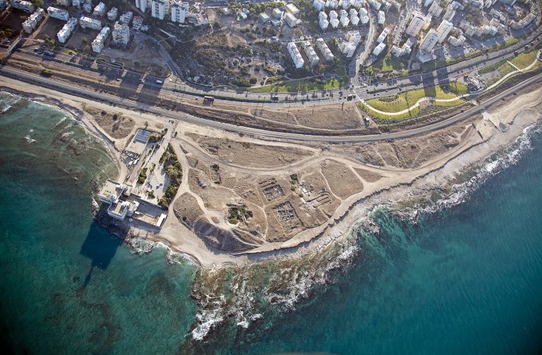
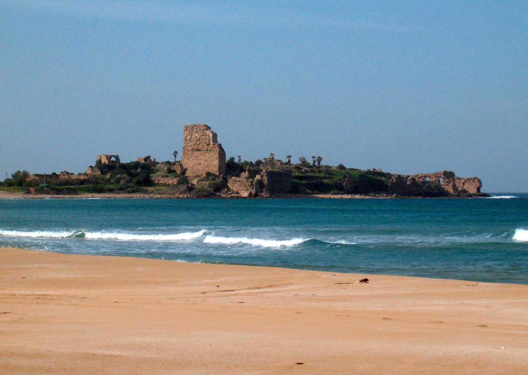
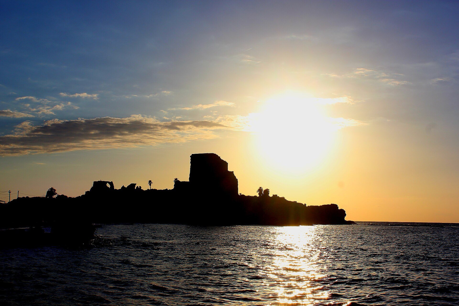
Château Pèlerin occupies a small promontory projecting into the Mediterranean, about 2 kilometres north of modern Atlit and 13 kilometres south of Haifa. Its natural harbor protected most sides of the position, while the principal defenses faced east toward the land. The fortified area covered approximately 280 metres from north to south and 160 metres from east to west. An outer defensive system enclosed a civilian settlement and an independent inner citadel.
Outer defenses
Walls, ditch, and gates
The outer defenses included two long perimeter walls, smaller warning forts on the eastern kurkar ridge, and the earlier castle of Le Destroit. Kurkar is sandstone formed from consolidated coastal dunes. The eastern outer wall extended for about 600 metres and the southern wall for about 200 metres, while the defensive circuit stood roughly 1 kilometre from the coast.
A wet ditch, or water-filled defensive moat, crossed the landward neck of the promontory. It was about 18 metres wide and 2 metres deep, paved with stone, and extended for approximately 200 metres. Seawater could flood it, and its ends were cut into the sea to prevent cavalry from bypassing it through shallow water. The outer wall rose directly from the ditch without a sloping bank known as a glacis, an unusual arrangement in Crusader fortifications. Entrants had to pass through one of three outer towers, since the ditch had no bridge.
Outer towers and twin towers
The three square outer towers stood about 16 metres high and approximately 44 to 46 metres apart. They projected from a massive wall containing about 40 arrow slits arranged on two levels. Each firing position could accommodate two archers, allowing one to shoot while the other prepared a bow. The tower gates had double-leaf doors, an iron portcullis, or vertically sliding gate, and other contemporary defensive devices.
A second wall behind the first contained passages and vaulted spaces that reinforced the defenses and allowed mounted movement along the firing positions. Two large twin towers projected from this wall between the three towers of the first line. Their upper platforms had crenellations, the raised sections and openings along a defensive wall, for archers and slingers, as well as artillery directed against siege machines.
The twin towers rose approximately 43 metres. Their lower levels formed part of the defenses, while their upper levels contained large halls about 16 metres high. Each hall was supported by a central column and polygonal vaults and probably served a ceremonial purpose.
Seaward defenses
The seaward sides were protected by a single wall with relatively few watchtowers. Its foundations were cut below sea level, making undermining difficult because tunnels would quickly have flooded. During a second construction phase in the 1250s, eight semicircular halls were added along the seaward wall. Their arrangement created a developed concentric stronghold and brought the defensive circuit closer to the shore.
Inner citadel
Citadel walls and passages
The inner citadel occupied the northwestern corner of the area enclosed by the outer wall. A second ditch separated its eastern side from the mainland. This ditch was cut through massive dressed stone to a depth of approximately 6 metres, and two gently sloping passages crossed it, one for pedestrians and one for carts.
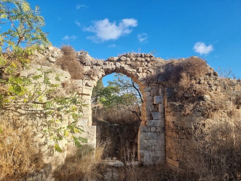
The first citadel wall stood about 16 metres high and contained broad internal corridors and arrow slits. Three square towers projected from it and covered the ground immediately below the wall. Each tower had openings to the north and south, leading toward the ditch and providing concealed exits for sorties during a siege. The southern tower is the best preserved. The Mamluks repaired it with smaller stones, heightened it, and added further arrow slits.
A higher inner wall stood behind the first citadel wall and incorporated two massive square towers that formed the eastern face of the inner fortress. These towers reached approximately 34 metres, rising above the outer wall by roughly the same distance that the outer wall rose above the ditch. Their height allowed defenders on the inner wall to shoot over those positioned on the outer wall.
Entrances and tower rooms
The regular entrance lay on the southern side between the inner and outer walls. It opened into a long passage controlled by the defenses of both walls, although the gate is now completely ruined. A northern sea gate faced the water and was rarely used. The entrance into the inner fortress lay in the northern part of the inner wall and opened into a narrow corridor. Vaulted spaces stood along its northern side, while a wall formed the southern side.
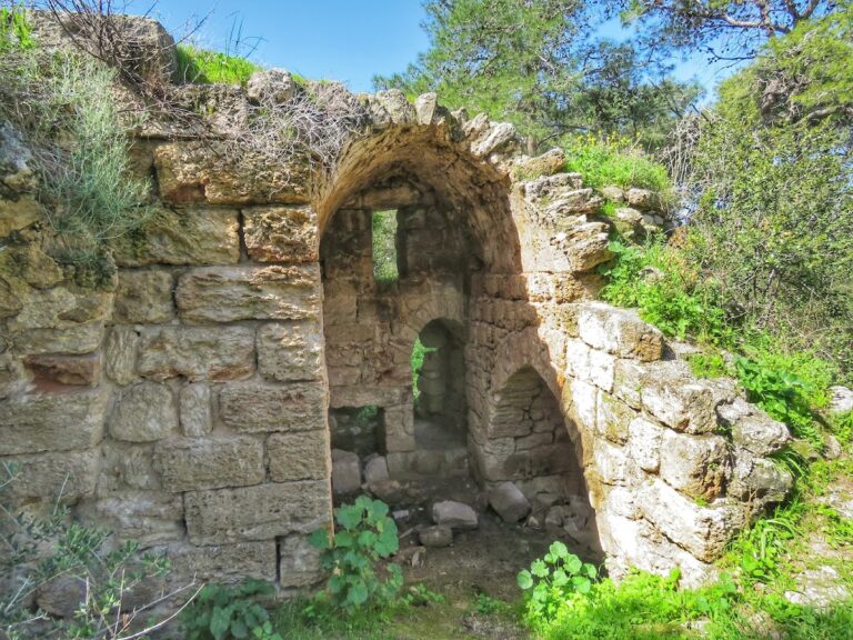
A narrow corridor within the inner wall connected the two massive towers, linked rooms around the inner courtyard, and led to a staircase ascending to the upper level. The northern tower retains substantial remains and was divided into three stories. Its upper hall was as high as the two lower stories together, used cross vaults, and carried reliefs on the vault ribs that indicate its importance to the builders. Only the foundations survive from the southern tower, although it probably had a similarly elaborate design.
Church and domestic buildings
The fortress church stood near the center of the citadel. It was an asymmetrical Gothic building with a principal eastern apse, or semicircular sanctuary end, and three additional apses. The earthquake of 1837 destroyed it almost to its foundations. Fragments of its walls, including windows, remain in the central part of the fortress.
A small decorated hall stood west of the church. Numerous halls extended along the western wall, including a kitchen and a large dining hall. Little survives of these sea-facing rooms. South of the storage rooms, a courtyard provided access to a quay on the southern side, where boats could moor. The protected harbor enabled the fortress to receive supplies by sea. Three freshwater wells within the enclosure supplied drinking water to the garrison and inhabitants.
Settlement and cemeteries
Excavations east of the fortress revealed houses, stables, granaries, a church, and a cemetery containing approximately 1,700 grave markers. A separate Crusader cemetery on the beach north of the castle measured about 80 by 100 metres and contained hundreds of graves, some with carved markers.
Earlier harbor and settlements
Harbor installations
The natural harbor north of the promontory contains submerged remains of earlier settlements and harbor installations. Underwater investigations identified a stone-built breakwater about 130 metres long, several piers and quays made from dressed stone, and three nearby towers. The longest quay measured about 100 metres.
Stone anchors of a Phoenician type and imported wooden fragments dated to the late ninth or early eighth century BC were recovered underwater. These remains are associated with a Phoenician settlement founded no later than the Persian period, probably in the eighth century BC, and likely established for trade with the Kingdom of Israel. The Iron Age settlement lies below sea level, and its foundations were not covered by later buildings, making the site valuable for studying Phoenician life.
Ancient settlements and finds
The settlement continued in the area from the Middle Bronze Age through the Hellenistic period, although it shifted northward. A cast-bronze naval ram from a Greek warship, dated to the second century BC, was found in the northern bay about 130 metres from the shore. The decorated ram weighs 465 kilograms.
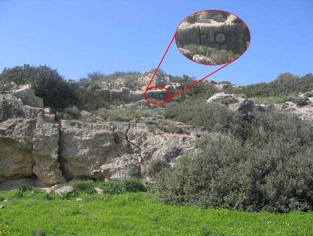
The ancient settlement was destroyed at the end of the Hellenistic period, after which its inhabitants moved to nearby Kartha, identified with Tel Megadim. The Roman-period town is identified in the Bordeaux Itinerary by the Latin name Certa. South of Le Destroit, a carved kurkar wall bears what appear to be the first two letters of the name Atlit in an ancient Canaanite script. The carving may have marked the eastern boundary of the Phoenician town, although that interpretation remains uncertain.
The medieval names of the site reflected its landscape and functions. Districtum referred to the narrow passage between the sea and marshes formed by Nahal Oren, while Castellum Peregrinorum and Château Pèlerin meant “Pilgrim Castle.” Muslim writers also called the fortress al-Husn al-Ahmar, or “the Red Fortress,” probably because of the reddish-brown kurkar used in its construction.