El Wad: A Natufian Cave and Settlement Site in Israel
Site at a Glance
- Popularity
- Medium
- Country
- Israel
- Primary era
- Stone Age
- Eras represented
- Stone Age
- Civilizations
- Unclassified
- Site type
- Domestic
- Remains
- House
On this page19 sections
History
Natufian settlement
El Wad is a prehistoric cave and terrace site in the Nahal Me’arot area of Mount Carmel, Israel. Its richest occupation belongs to the Natufian, a late Epipaleolithic culture whose communities combined hunting and gathering with relatively settled ways of life. El Wad’s Natufian layers date to about 15,000–11,700 years before present (BP), with BP counted from 1950. The cave was occupied later than some other caves in the area, and its wider sequence spans roughly the last 50,000 years.
The changing landscape shaped life at the site. During the last glacial maximum, about 19,000 years ago, lower sea levels left the Mediterranean farther from the cave and broadened the coastal plain. When Natufian occupation began, the sea was still about 60 metres below its present level, and the coast lay roughly 14 kilometres away. The plain’s sandstone ridges and hollows, together with access through Nahal Me’arot to the wooded mountain plateau, offered a range of environments. Animal and plant remains point to a mix of woodland and open ground, broadly like the present landscape. Waterbirds hunted throughout the Natufian occupation indicate that wetlands formed seasonally on the plain, probably in winter.
Natufian inhabitants intensively hunted and gathered across Mount Carmel and the coastal plain, including plants that required substantial processing. Their prey included a wider variety of animals than the large hoofed mammals mainly hunted by earlier occupants. Repeated cereal harvesting is also evident. El Wad’s excavated layers were central to identifying the Natufian as a distinctive society during the transition from mobile Paleolithic lifeways toward Neolithic farming. Dorothy Garrod named the culture after Wadi en-Natuf, near Shuqba Cave, and initially made a tentative comparison between its small stone-tool technology and that of the European Mesolithic.
Use of El Wad shifted over the Natufian period, serving at different times for burial, residence, or both. The earlier occupation was substantially richer and more extensive than the later phases. In the later phase, burials and occupation debris suggest that burial and living areas may have been separated. More than a hundred people were buried at the site across early and later phases. The contrast between graves with many ornaments or offerings and more simply furnished burials has been interpreted as possible evidence of emerging social differences, although that interpretation remains disputed.
Later occupations
Layer A represents later occupations spanning the Holocene, the geological epoch that began about 11,700 years ago, from the Neolithic into historical periods. A statue of Aphrodite, a major Greek goddess associated with love and beauty, found in this layer dates to the Hellenistic period. This period followed Alexander the Great’s conquests, when Greek culture spread widely across the eastern Mediterranean and Near East. In medieval times, herders used the site mainly as a stopping place.
Excavation and recognition
Systematic investigation began in 1928, when Charles Lambert was sent to assess the caves. He dug six test trenches across the terrace, cave entrance, and interior. Three exposed prehistoric layers containing walls, installations, and burials. In the terrace, Lambert found a carved bone handle shaped like an animal, among the earliest prehistoric artworks recorded in the Near East. The discovery established the site’s archaeological importance and helped prevent the caves from being destroyed by quarrying for the Port of Haifa.
Dorothy Garrod then paused her work at Shuqba Cave to investigate Nahal Me’arot. Between 1929 and 1933, her large excavations expanded Lambert’s trenches and reached bedrock across the central terrace and the cave’s first two chambers. They established much of the site’s Paleolithic sequence and helped define the Natufian. A book on Garrod’s Carmel excavations, written with paleontologist Dorothy Bate, brought the site wider attention. François Valla and Ofer Bar-Yosef tested the terrace in 1980–1981, examining Garrod’s Natufian sequence and identifying a final settlement phase. Mina Weinstein-Evron carried out a small rescue excavation in the third chamber in 1988–1989. A broader multidisciplinary excavation program began there in 1994 under Weinstein-Evron, Daniel Kaufman, and Reuven Yeshurun of the University of Haifa’s Zinman Institute of Archaeology, and is ongoing.
El Wad forms part of the Nahal Me’arot prehistoric site, inscribed as a UNESCO World Heritage Site on 29 June 2012 under criteria 3 and 5.
Remains
Cave and terrace
Position and form
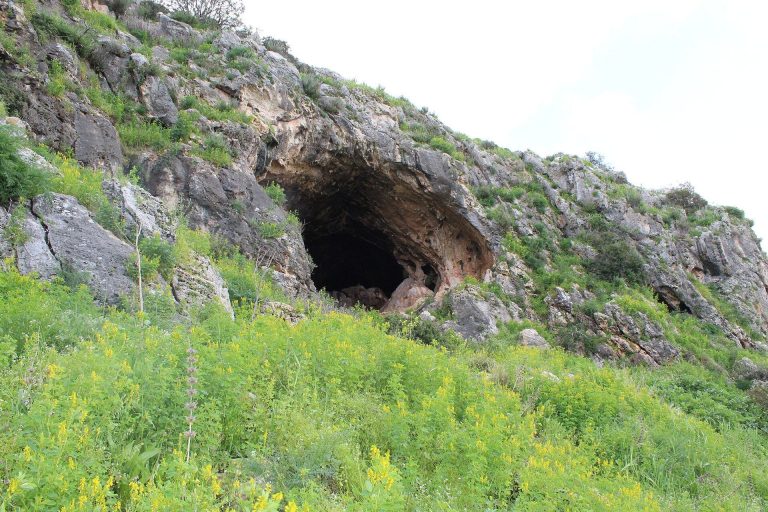
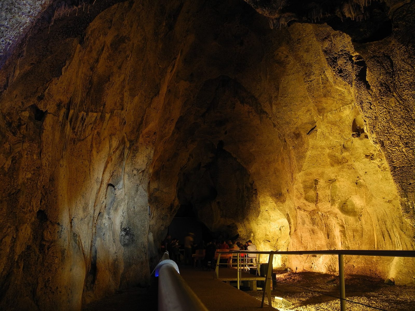
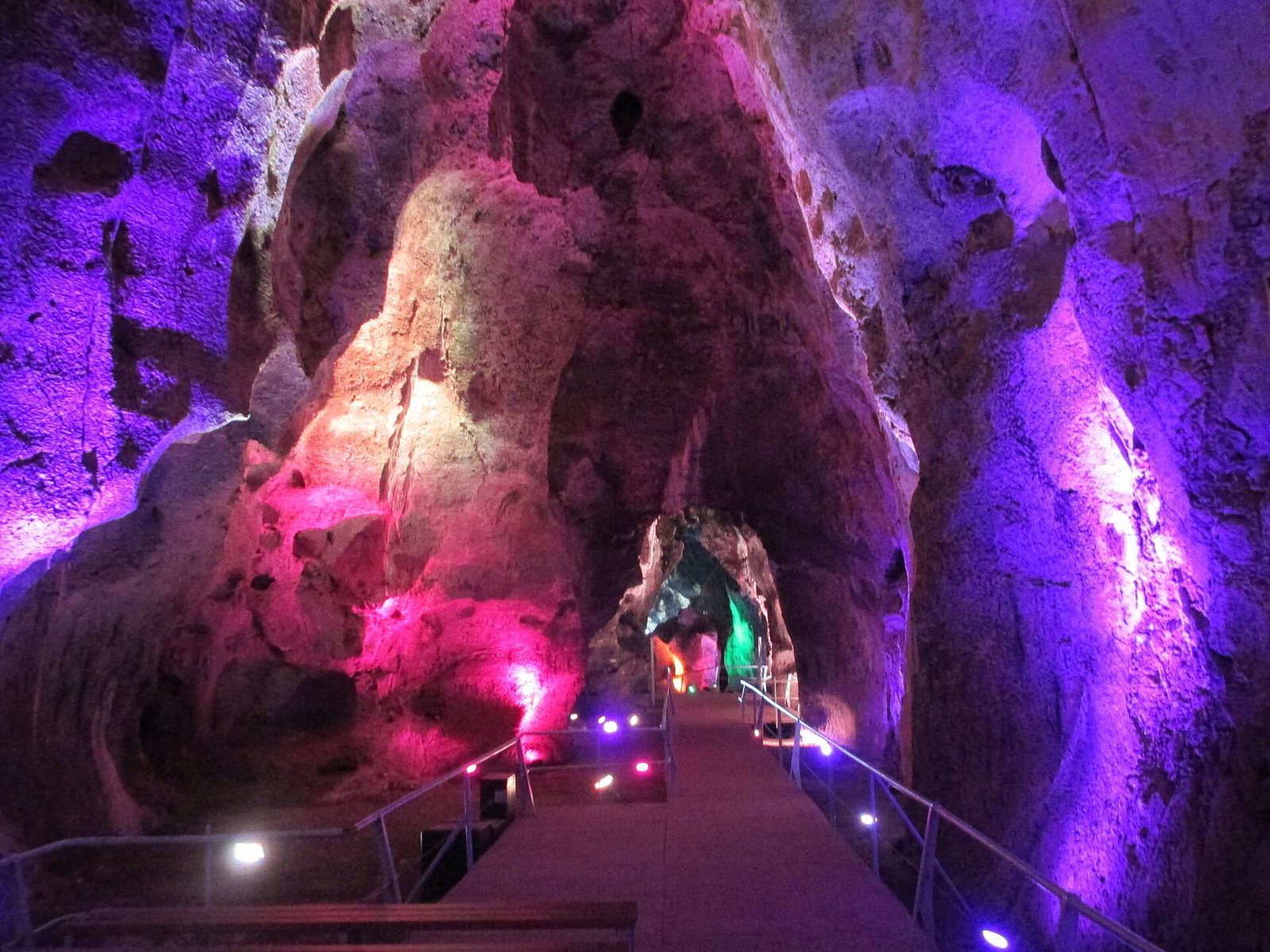
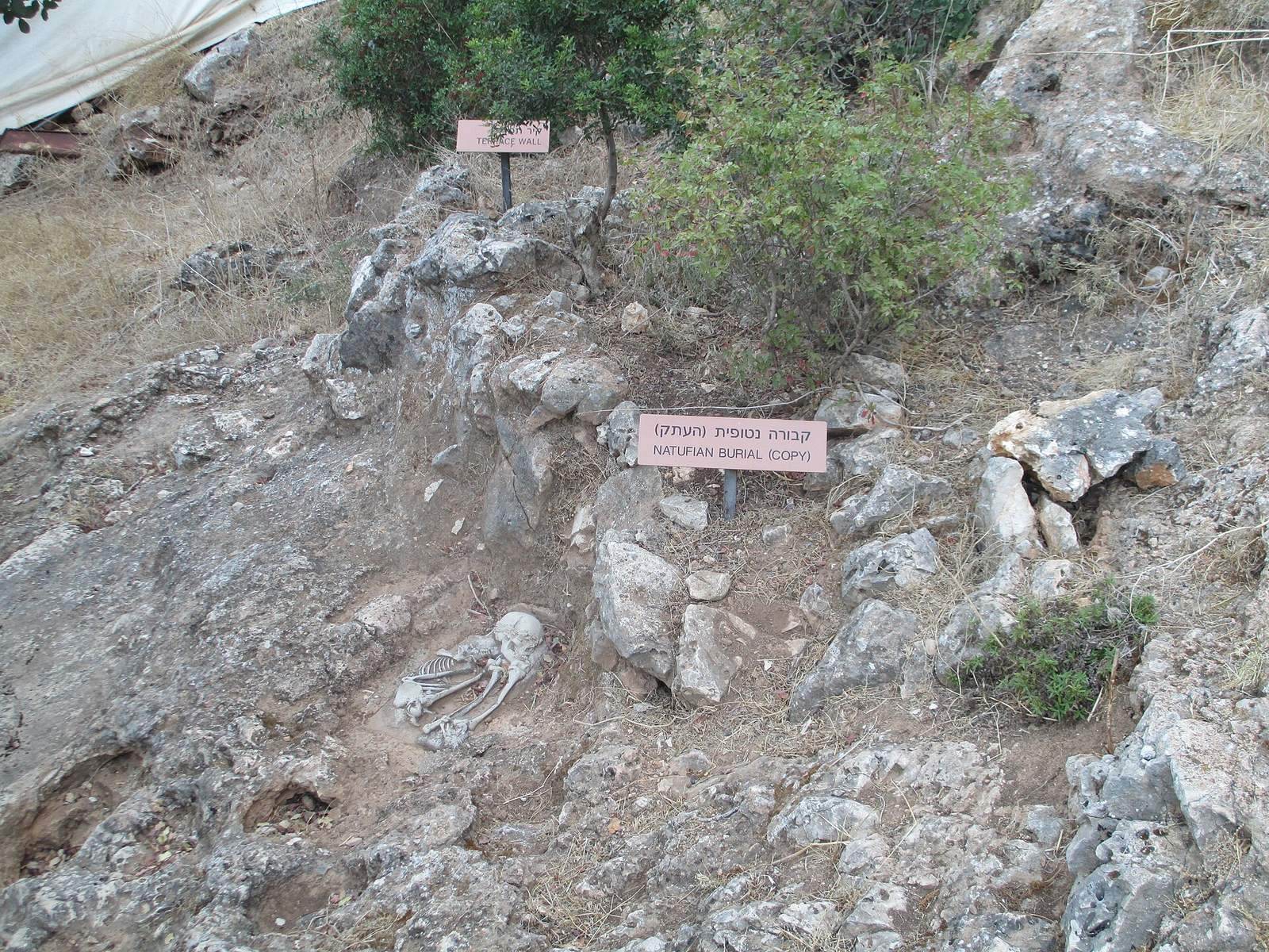
The site comprises a large cave and a broad natural terrace directly outside its entrance. The cave lies on Mount Carmel’s western slopes, where the stream emerges onto the coastal plain, about 17 kilometres south of Haifa and four kilometres east of today’s Mediterranean shore. Its entrance is about 45 metres above present sea level. The cave extends roughly 70 metres and covers about 700 square metres; it is the largest cave in Nahal Me’arot and among the largest on Mount Carmel. The terrace lies roughly 10 metres above the streambed. A retaining wall made of cobbles and four mortars have also been identified there.
Archaeological sequence
The excavated cave sequence begins with layer G, which contains Mousterian remains, a Middle Paleolithic stone-tool tradition, more than 45,000 years old. Layer F is a disturbed mixture of Middle and Upper Paleolithic material, including Emireh points. Layers E and D contain Aurignacian remains, an Upper Paleolithic tradition, probably dating to about 35,000 years ago; layer D is divided into D1 and D2. Layer E includes El-Wad points, scrapers, and burins, stone tools used for engraving. Layer C represents the Atlitian, an Upper Paleolithic tradition named after Atlit, probably about 33,000 years old. It contains more flakes than blades, as well as borers. Layer B holds Natufian Epipaleolithic remains dating to about 15,000–11,700 BP, while layer A contains finds from later Holocene occupations. Only layers A and B were found on the terrace.
Natufian architecture and burials
Early installations and cemetery
The earliest proposed Natufian architectural stage is represented by mortars cut into the terrace rock, small installations, and a built hearth. These features occur on the terrace and in the cave’s first and third chambers. A subsequent stage saw use of the site as a cemetery. At least two concentrations, each containing dozens of graves, lay in the northern terrace and the first cave chamber.
Residential buildings
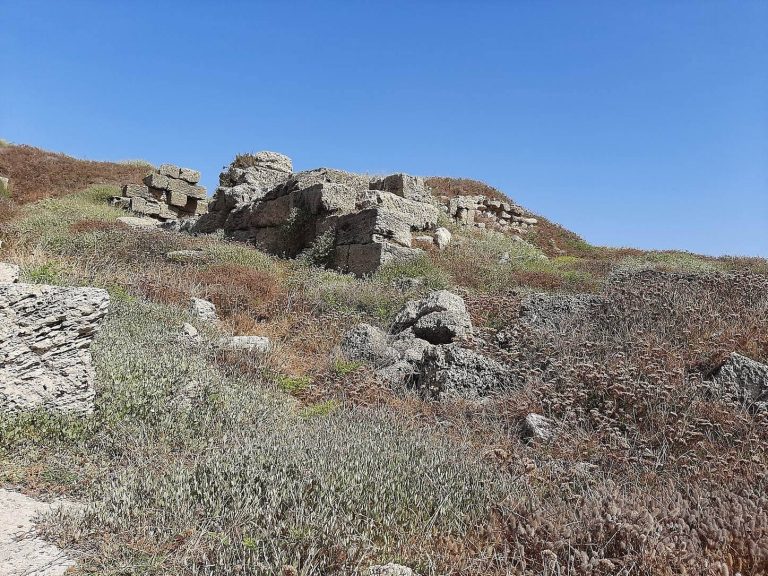
The main early Natufian residential stage includes numerous stone-built walls and floor remains. At least three building complexes can be reconstructed from large retaining walls and associated houses. The houses were partly dug into the ground; their pits were lined with stone and sometimes paved. One well-preserved house had successive floors, showing repeated rebuilding in the same place. It is unclear whether the three complexes were occupied simultaneously or represent separate settlements within this stage. Later settlement deposits lie over the buildings.
Later occupation
The uppermost architectural stage belongs to the later and final Natufian phases. Concentrations of graves on the terrace and substantial occupation debris point to continued use for both burial and habitation.
Burial practices and grave goods
The cemetery contained single and multiple burials of men, women, and children, whose bodies were placed in positions ranging from extended to flexed. Collective burials appear characteristic of the early Natufian phase, while individual flexed burials belong to the later phase. Early graves included ornaments made from marine shells and animal parts, along with stone objects. Some later graves were reopened after soft tissue had decomposed, and the skull was removed. A shell necklace remained beside the head in burial 25; a replica is displayed at the site. More than a hundred skeletons were recovered, most from the terrace.
Tools, food remains, and other finds
Stone and bone tools
Flint tools are the most common finds. They include microliths, small stone tools often fitted into composite implements, especially crescent-shaped examples called lunates in the early Natufian phase. Some have Helwan retouch, a form of shaping on both faces. Hundreds of flint sickle blades were also found. Wear on their edges indicates repeated cereal harvesting and the cutting of ears from stalks after reaping. Bone tools include points and awls probably used in weaving and basket-making, hooks that may have served for fishing, and sickle handles. Some decorated bone pieces carry finely worked patterns.
Grinding equipment
Grinding tools include mortars cut into the terrace rock, mortars made in stone blocks found mainly in the first cave chamber, and numerous basalt pestles. Basalt grinding implements, querns, and bowl fragments also occur. The basalt came from the Sea of Galilee region, at least 80 kilometres away. The objects were probably transported as finished tools; inhabitants may have obtained them through exchange or made them on long journeys to the region.
Ornaments and figurines
Many beads made from Mediterranean marine shells came from both graves and habitation layers. Finds also include figurines, decorated tools, and a carved and engraved human head made from calcite. Twenty-five clay body ornaments, in the form of beads and discs, include pieces shaped like cereal or legume seeds. Fingerprints on some show that children worked on them, while microscopic traces of pigment and plant-fibre cord remain on some objects.
Animal and plant evidence
Animal remains include abundant mountain gazelle, alongside tortoise, hare, fox, glass lizard, Persian fallow deer, roe deer, wild boar, and aurochs. Other finds include badger, weasel, stone marten, mongoose, mole rat, ducks and other waterbirds, raptors, rock partridge, and small quantities of Mediterranean fish. Microlith-tipped arrows were used to hunt hoofed animals; traps may have caught smaller prey. Waterbirds were probably taken on short trips to seasonal wetlands on the coastal plain. Cut marks on the vertebrae of black whip snakes and coin-marked snakes show that large snakes were caught and eaten during all phases of occupation.
Charcoal, charred seeds, pollen, and phytoliths, microscopic silica remains formed in plant tissues, indicate the use of plants including oak, tamarisk, olive, myrtle, and grasses for building, fuel, and food. The charred seeds include broad beans, probably from an ancestor of the species later domesticated in the Neolithic. These have been described as the earliest known broad-bean seeds worldwide.
Settlement refuse
Large amounts of settlement refuse lay inside and around the Natufian houses. Flint-knapping waste and animal bones from butchery and meals were often found on or between paving stones. The bones show burning, trampling, and weathering after disposal; some were pressed into floors and remained relatively intact. This pattern suggests that refuse accumulated among living and working areas rather than being routinely cleared away.