Burgstall Warberg: Medieval Hilltop Castle Site in Germany


Site at a Glance
- Rating
- 3.5
- Popularity
- Very Low
- Country
- Germany
- Primary era
- Medieval
- Eras represented
- Medieval
- Civilizations
- Holy Roman Empire
- Site type
- Military
- Remains
- Castle
On this page10 sections
History
Burgstall Warberg is a medieval hilltop castle site in Germany, near Warberg and now within Neunburg vorm Wald in Bavaria. The castle originated in the twelfth century and occupied a fortified spur above the Ascha valley. The name Burgstall is used for a former castle whose buildings have largely disappeared, leaving archaeological remains such as earthworks, foundations, or short sections of wall.
The Warberg family and twelfth-century origins
The castle was formerly known as Wartberg and first appears indirectly in records around 1138. In that year, Countess Adelheid of Warberg donated her estate near Traitsching to Ensdorf Abbey. Adelheid and her first husband, Kuno of Horburg-Lechsgemünd, also made further donations to the church of Bamberg. Around 1140, Adelheid was identified in a charter as comitessa de Wartperch, meaning countess of Wartberg, when she made additional donations to St. Michael’s Abbey in Bamberg.
Adelheid was the daughter of Heinrich of Limburg and the granddaughter of Bodo of Pottenstein. Kuno died in 1139, after which she married Count Konrad II of Dachau. Her last documented mention dates to around 1144. Count Gebhard III of Sulzbach then asserted inheritance claims to her estates. Because Gebhard’s father, Count Berengar I, was Kuno’s half-brother, the Sulzbach family inherited Warberg. Adelheid probably had no direct heirs from either marriage.
Transfer to the Ortenburg family
Around 1159, Elisabeth of Sulzbach, the daughter of Count Gebhard III, married Count Rapoto I of Ortenburg and received Warberg as a bridal gift. After Gebhard’s death in 1188, Elisabeth’s sons Heinrich I and Rapoto II of Ortenburg inherited the castle. Warberg therefore became part of the possessions of the Ortenburg family during the later twelfth century.
A probable first destruction took place during the war fought from 1192 to 1199 between the counts of Ortenburg and the counts of Bogen, Passau, Bohemia, and Austria. No document confirms that the castle was destroyed in this conflict, but an archaeological destruction layer at Warberg supports the possibility.
Decline and abandonment
Warberg remained in Ortenburg possession until 1261. In that year, the son of Count Friedrich of Truhendingen and Anna of Ortenburg, who was Heinrich I’s daughter, sold the castle to Duke Louis the Strict.
A second destruction layer may be related to incursions by King Ottokar II of Bohemia during the second half of the thirteenth century. Ottokar II was a Přemyslid ruler whose military expansion influenced central European politics during that period. The precise cause of the destruction remains uncertain because documentary evidence is lacking. By 1283, the castle was already described as dilapidated. Records referred to fields and woodland beside it, while nearby Neunburg vorm Wald was described as built up and serving as a new administrative seat in the Nordgau.
The castle was probably abandoned between 1261 and 1283. Abandonment may have occurred as early as 1278 if the second Bohemian war caused the site’s decline, since Ottokar II died that year at the Battle of Marchfeld. Members of the Warberg family continued to appear in records until 1495, including Balthasar of Warberg of Kürnberg. They were probably a ministerial lineage, meaning a family of dependent nobles or officials who served a ruler or powerful lord, and may have continued using the name of the destroyed castle.
Archaeological recognition
The Bavarian State Office for Monument Protection records the site as the medieval archaeological monument “Burgstall Warberg,” under monument number D-3-6640-0009. Excavations carried out by the office between 1991 and 1993 exposed several lines of wall and helped clarify the surviving archaeological evidence.
Remains
Hilltop fortification
The former castle occupied the elongated summit of the 567.2-metre Warenberg, also called Warnberg, about 180 metres above the Ascha valley. The river surrounds the mountain to the west and north. The southern slopes are also very steep, while the eastern side rises across a saddle only a few metres lower than the castle area toward a second summit at 572 metres. This terrain gave the site a naturally restricted approach on the spur.
Ring wall
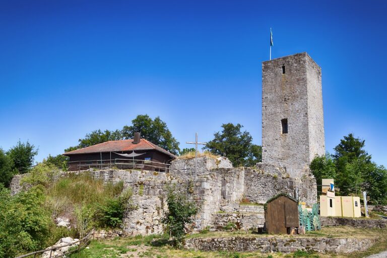
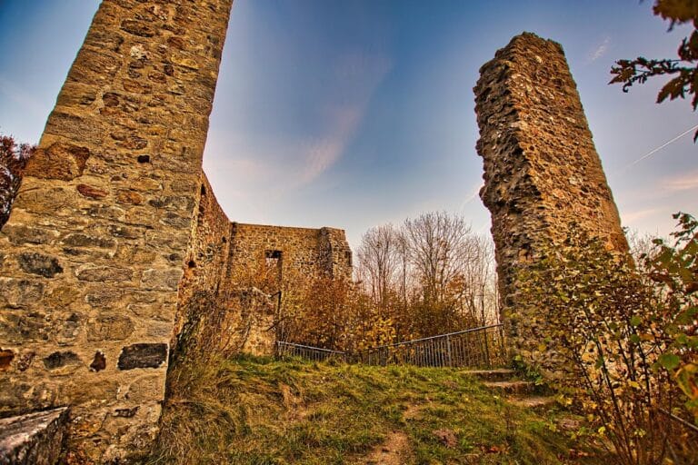
The castle complex measured approximately 150 by 50 metres and formed a hilltop spur fortification. Its enclosure was defined by a ring wall attributed to the Salian and Staufen period, broadly the eleventh and twelfth centuries, when those dynasties shaped the political and architectural history of the German kingdom and empire. The wall was built in ashlar masonry, using regularly shaped stone blocks laid in courses. Only slight wall remains survive today.
Well and eastern summit
A well remains at the site and reaches a groundwater-bearing layer. The second hill east of the castle is considered a possible location for a tower-like building, although that identification is uncertain. The physical evidence on the main summit therefore consists chiefly of limited wall remains and the well, together with the archaeological traces revealed during excavation.
Nearby fortification and archaeological finds
Burgstall Bach lies about 150 metres east of Warberg’s neck ditch. A neck ditch is a defensive trench cut across the narrow land connection of a spur, separating the fortified area from adjoining ground. Burgstall Bach is a rectangular fortification enclosed by an earthen rampart and ditch and is now heavily overgrown. Its relationship to Warberg has not been established because archaeological evidence linking the two sites is lacking.
Finds from Burgstall Warberg are held in the Schwarzachtal Local History Museum in Neunburg vorm Wald.
Nearby sites