Burgstall Altenschneeberg: A Medieval Noble Castle in Germany


Site at a Glance
- Rating
- 4.5
- Popularity
- Very Low
- Country
- Germany
- Primary era
- Medieval
- Eras represented
- Medieval
- Civilizations
- Duchy of Bavaria, Holy Roman Empire
- Site type
- Military
- Remains
- Castle
On this page9 sections
History
Burgstall Altenschneeberg is the site of a high-medieval noble castle in Germany, near Altenschneeberg in Tiefenbach, Bavaria. Also called Schneeberger Schloss, it was probably built by the Ortenburg family during the first half of the thirteenth century. The castle controlled a lordship in a strategically elevated position, and its ownership became closely connected with the territorial struggles of competing Bavarian dynasties and noble families.
Ortenburg and Sigenhofen Rule
A Marquardus Snebergarius mentioned in Regensburg in 1180 may have been connected with Altenschneeberg, although that relationship remains uncertain. The first securely identified member of the family was Dietricus iudex de Sneberc, who appeared as a witness in documents issued by the counts of Ortenburg in 1237, 1238, and 1250. These appearances indicate that Altenschneeberg belonged to the Ortenburg lordship of Murach.
The castle soon came under the possession or feudal control of the Lords of Sigenhofen. A fief was property held from a superior lord in return for obligations. Altenschneeberg then became involved in a dispute between Duke Ludwig II of Upper Bavaria and Duke Heinrich XIII of Lower Bavaria. After the Bavarian partition of 1255 placed the castle within Heinrich’s territory, an agreement made in 1280 required Ludwig to return it to the younger Sigenhofer.
Control remained unsettled. In 1296 Friedrich of Sigenhofen transferred the castle and lordship to Duke Otto III of Lower Bavaria through an exchange. A Straubing land register written shortly after 1301 states that the duke had purchased the castle and its jurisdiction from Friedrich. Yet another register, dating from about 1311 to 1312, still described Altenschneeberg as Sigenhofer property.
Territorial Changes and Noble Feuds
Altenschneeberg changed its territorial allegiance during the Bavarian partitions of 1349 and 1392. After 1339, the Lords of Satzenhofen held it as a pledged possession, meaning that the property had been transferred as security for a debt or agreement. From 1349, it belonged permanently to Lower Bavaria, while the Satzenhofers also received it as a fief and adopted the designation “of Schneeberg.”
The lordship and castle were probably divided around 1396, when Parzifal Zenger, chamberlain to Dukes Ernst and Wilhelm III of Bavaria-Munich, received them as a fief. The Zengers later also called themselves “of Schneeberg.” Their tenure brought the castle into the conflicts between regional nobles and the Bavarian dukes. It was probably attacked in 1429 during Tristram I Zenger’s continuing feud with the dukes. In 1459, Tristram II declared Altenschneeberg an open castle, a fortified residence formally made available to a specified political ally or side in a conflict, in opposition to Duke Ludwig IX of Bavaria-Landshut.
Palatine Control and Abandonment
From 1488, the Zengers belonged to the landed nobility of the Upper Palatinate, apparently after overlordship had passed to the Palatine Wittelsbachs, the dynasty associated with Bavaria and the Palatinate. In 1489, Wilhelm and Hans Satzenhofer transferred their fief to Count Palatine Otto II. On 10 July 1489, Jörg and Jobst Zenger joined the Löwlerbund, a league of Upper Palatinate nobles formed in opposition to expanding princely authority. In 1490, King Wladislaw II of Bohemia placed the castles belonging to members of the league, including Altenschneeberg, under his protection.
Georg and Christoph Zenger were still recorded at the castle in 1507. Afterward, the knight Thomas Fuchs of Wallburg and his son gradually acquired the divided lordship from the Zengers and Satzenhofers. They did not adopt the name Altenschneeberg until 1526. In 1527, Thomas Fuchs received an extensive charter of liberties from Emperor Charles V, who ruled the Holy Roman Empire, in his capacity as imperial captain for Schneeberg and for his Bohemian fiefs of Reichenstein and Schönsee.
Thomas Fuchs submitted again in 1530 to Count Palatine Friedrich II and his brother, Elector Ludwig V, who feared that the territory was being detached from their control. By that time, the castle had already been abandoned and the seat of the lordship had moved to Tiefenbach. A record from 1557 described Altenschneeberg as an old, ruined castle. Its remains were being quarried for stone, and stones from the site were allegedly used to build the tower of the nearby church at Heinrichskirchen. The exact date of abandonment is unknown.
Burgstall Altenschneeberg is listed by the Bavarian State Office for Monument Protection as a medieval castle site and archaeological monument under monument number D-3-6541-0005. No archaeological excavation had taken place by 2010, leaving the original buildings only partly understood.
Remains
Burgstall Altenschneeberg occupies the southern end of the Signalberg, on a projecting ridge known as the Schlossberg immediately southwest of Altenschneeberg. This spur castle used the steep natural slopes of the ridge as part of its defenses. The site reaches 765 metres above sea level and stands about 250 metres above the surrounding valleys. The Schwarzach valley bounds the eastern side of the spur and the Ascha valley the western side.
Castle Areas
Upper Castle
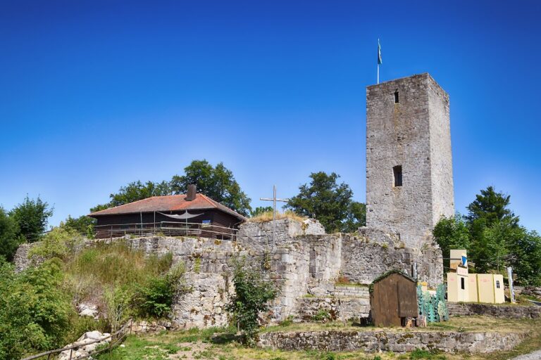
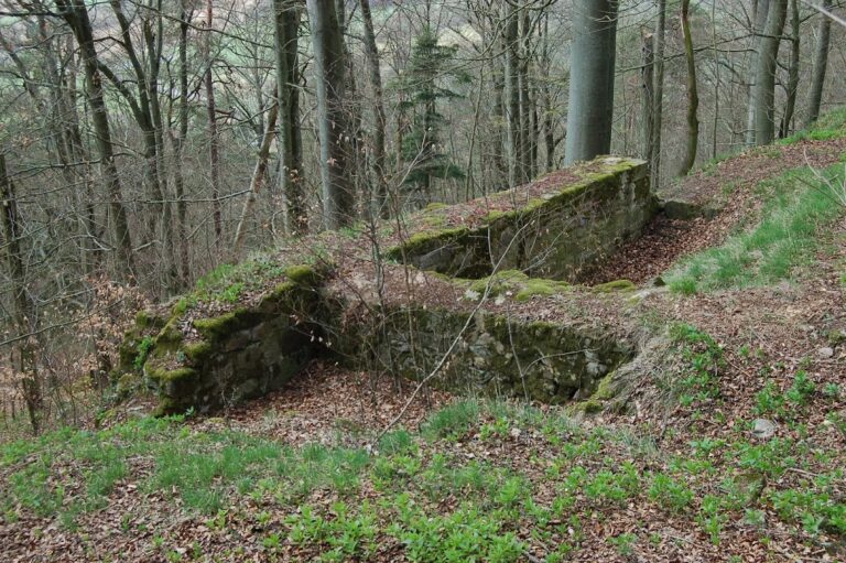
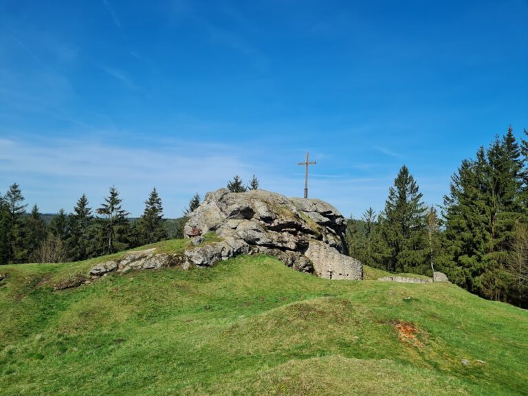
The upper castle stood on a rocky ridge about 70 metres long, running from north to south and rising approximately 10 metres above the lower castle. Its plateau was divided into two sections, while the sides of the ridge fell very steeply, in places almost vertically. At the southern end, the ridge continued downward as a rocky crest. The plateau sloped about 2 metres toward the west. Foundation remains of a former building survive at the highest point, and another building probably stood on the broad, level southern part of the upper castle.
Lower Castle
The lower castle formed the outer bailey and extended around the northern and northwestern sides of the rocky ridge, as well as along its entire eastern side. The roughly oval castle area measured about 160 by 75 metres. On the northern side of the lower castle, weak remains of a probably multi-room building survive among numerous rocks. The northwestern section formed an approximately triangular terrace that descended in a steep step.
The eastern lower castle was up to 30 metres wide and descended southward in a terrace-like step, dividing it into two areas. Its position on the side facing the enemy made this part particularly dependent on artificial defenses. A steep terrain step about 5 metres high and an additional bank protected it to the south.
Earthworks and Surviving Fabric
The southern and western sides of the spur descend toward the valleys and supplied natural protection. The northern and eastern sides rise toward the surrounding terrain, where the castle required constructed defenses. A U-shaped neck ditch, about 13 to 20 metres wide and up to 6 metres deep, protected the eastern lower castle. Its northern section was cut into the rock and survives only weakly, while the northwestern part ran out into the steep slope.
A slight outer bank remains from the middle of the ditch. Because the ground descends in a step toward the ditch bottom, the bank continues southward as an earthwork about 1.5 metres high, then turns west and joins the steep edge of the lower castle. The surviving physical evidence consists of the southern neck ditch and outer bank, small foundation fragments, terrain terraces, and the rocky upper ridge. The site is largely grass-covered, and the upper castle is used as a resting place and viewpoint reached by a hiking path.
Nearby sites