Festung St. Luzisteig: A Swiss Fortress on the Graubünden Pass
Site at a Glance
- Rating
- 4.8
- Popularity
- Very Low
- Country
- Switzerland
- Primary era
- Modern
- External website
- Open
- Eras represented
- Medieval, Early Modern, Modern
- Civilizations
- French, Habsburg, Swiss
- Site type
- Military
- Remains
- Fort
On this page20 sections
History
Festung St. Luzisteig is a Swiss military fortification on the St. Luzisteig pass in Switzerland, at 713 metres above sea level. Developed over several centuries and incorporated into the Swiss Army’s defensive system, it guarded the approach to Graubünden and its Alpine passes. The position forms part of the Sargans fortress area and is regarded as a military-historical monument of national importance.
From medieval barrier to early modern fortress
St. Luzisteig served as a crossing and settlement site from prehistoric times. From the Roman period until the nineteenth century, the road along the right bank of the Rhine was the main north-south route through the region. The narrow passage behind Fläscherberg therefore became strategically important during major European conflicts. Its position near the border, on the road between Maienfeld and Vaduz, allowed the fortifications to control movement toward northern Graubünden.
The Letzi Grafenberg, a medieval defensive barrier at the foot of Grafenberg Castle, dates from the fifteenth century. Fighting took place around it during the Swabian War in 1499, a conflict between the Swiss Confederation and the Swabian League together with the Habsburg monarchy. The wall represents an early effort to block the route before the later fortress systems were constructed.
During the Bündner Wirren, or Troubles of Graubünden, a seventeenth-century conflict involving local factions and intervention by Austria and France, outside forces developed extensive defenses at St. Luzisteig. Austrian troops under Colonel Brion destroyed the fortress in 1621. After the Bündner forces recovered the position, it was rebuilt in 1622 according to plans by Johannes Ardüser, a Zurich master builder and captain. Around 1631, the Duke of Rohan commissioned the Kleine Schanze, a detached defensive work, on the summit of the pass.
The baroque blocking fortress
Between 1703 and 1705, the government of the Three Leagues commissioned a new baroque fortress designed by the Zurich fortress builder Hans Caspar Werdmüller. The Three Leagues were the political alliance that governed Graubünden before the modern Swiss canton was formed. Earlier medieval defenses could no longer resist contemporary artillery, so a masonry line with projecting bastions was built across the pass saddle.
The new arrangement included a wall running from the principal front toward the Herzog battery on the right-hand valley slope. A second wall was built farther north between the Rhine and the rocky slope of Fläscherberg. Together, these works blocked the principal route and made it harder for an attacking force to pass around the fortified position.
Wars of the revolutionary era
In October 1798, Austrian troops under Franz Xaver von Auffenberg reinforced the forces of the Three Leagues. The Three Leagues had formally requested Austrian assistance against the Helvetic Republic and France after a referendum held on 6 August 1798. The Helvetic Republic was the French-backed state established in Switzerland in 1798.
French troops commanded by General André Masséna attacked from Balzers on 5 March 1799 and defeated the Austrian garrison. Eight hundred soldiers were taken prisoner, and parts of the fortress were destroyed. On 14 May, General Friedrich von Hotze recaptured the position for Austria after advancing from Feldkirch.
St. Luzisteig was also involved in the movements of the Russian army during the Second Coalition War against revolutionary France. In October 1799, General Vasily Suvorov’s defeated and exhausted army reached the fortress during its retreat. After failing to unite with the forces of Generals Rimski-Korsakov and Hotze, approximately 15,000 soldiers arrived on 12 October. They had to be supplied before continuing through Liechtenstein toward Feldkirch.
Nineteenth-century rebuilding
In 1831, General Guillaume-Henri Dufour identified the restoration of the fortifications at Gondo, Saint-Maurice, Aarberg, and Luzisteig as an urgent task. Dufour was a Swiss general, engineer, and cartographer who directed major improvements to Swiss fortifications. In the same year, a Bernese sapper company led by the Chur-based engineer and chief of engineers Richard La Nicca rebuilt the old eighteenth-century bastioned front as the centre of the fortress. It also created a new blocking fortress on St. Luziensteig. A detached fortification known as a lunette was built to cover the rear toward Maienfeld, while also serving as barracks.
During the 1850s, General Henri Dufour directed the construction of blockhouses on Fläscherberg to prevent an attacking force from turning the left flank. An arsenal and blockhouse were established on the pass summit. During the Crimean War, the defenses near the Guscha battery were strengthened with the Guscha Tower, also called the Hunger Tower, and a blocking wall through the Guscha forest. The elevated tower supported long-range reconnaissance.
Further nineteenth-century works included barracks, protected chambers known as casemates, a raised rampart, a gently sloping glacis, the Herzog battery, and the Felsenweg with its rifle gallery. Additional defenses were constructed on the northern plain between Ellwand and the Rhine. These additions expanded the fortress from a crossing barrier into a wider defensive landscape.
Twentieth-century military use
Plans prepared in army engineering-officer courses between 1934 and 1936 called for a major expansion. Anti-tank obstacles were built in 1937, followed by bunkers, galleries, other fortress installations, and Barracks Building B in 1940 and 1941. The St. Luzisteig blocking position, designated Army No. 1317, was developed during the Second World War and the Cold War and continued to be expanded until 1965. It extended south from the fortress over the descent toward Fläsch and focused on the north-south transport route from Liechtenstein.
From 1964 to 2003, the area served as a training ground for the Swiss Army’s Train troops, transport and logistics units historically responsible for moving personnel and supplies. Infantry and close-combat training also took place there. The Train troops left the Luzisteig military training area with Army XXI. Since 1995, the training ground has belonged to the Walenstadt and St. Luzisteig military-site command.
Conservation and later adaptation
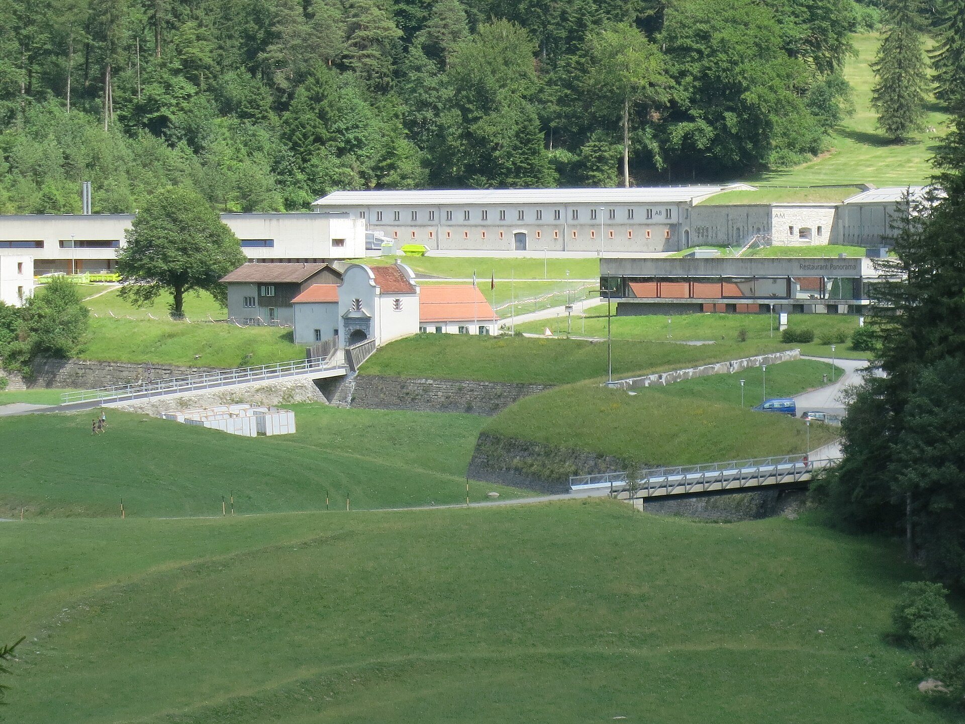
Between 1994 and 2005, three elongated, two-storey concrete buildings with flat roofs were constructed east of the cantonal road according to a concept by Peter Zumthor. They provided troop accommodation, catering, and a canteen. A command-centre building was later added west of the road. The historic nineteenth-century buildings and walls were subsequently restored and renovated.
The former arsenal at the pass summit was taken over by the Military History Foundation of Graubünden and converted into a museum. In 2010, the municipality of Fläsch adapted the former upper station of the MSB106 military cableway from Fläsch to Fläscherberg as a public multipurpose space. The cableway had been withdrawn from service in 1985.
Remains
Festung St. Luzisteig survives as a layered defensive landscape across the pass saddle, the summit, the slopes of Fläscherberg, and the northern and southern approaches. Its remains combine a fifteenth-century land wall, seventeenth-century and baroque works, nineteenth-century masonry and artillery defenses, and installations from the Second World War and Cold War. The principal blocking lines were arranged across the route, with additional walls and batteries extending toward the Rhine and the valley slopes.
Historic fortress core
Main fortress
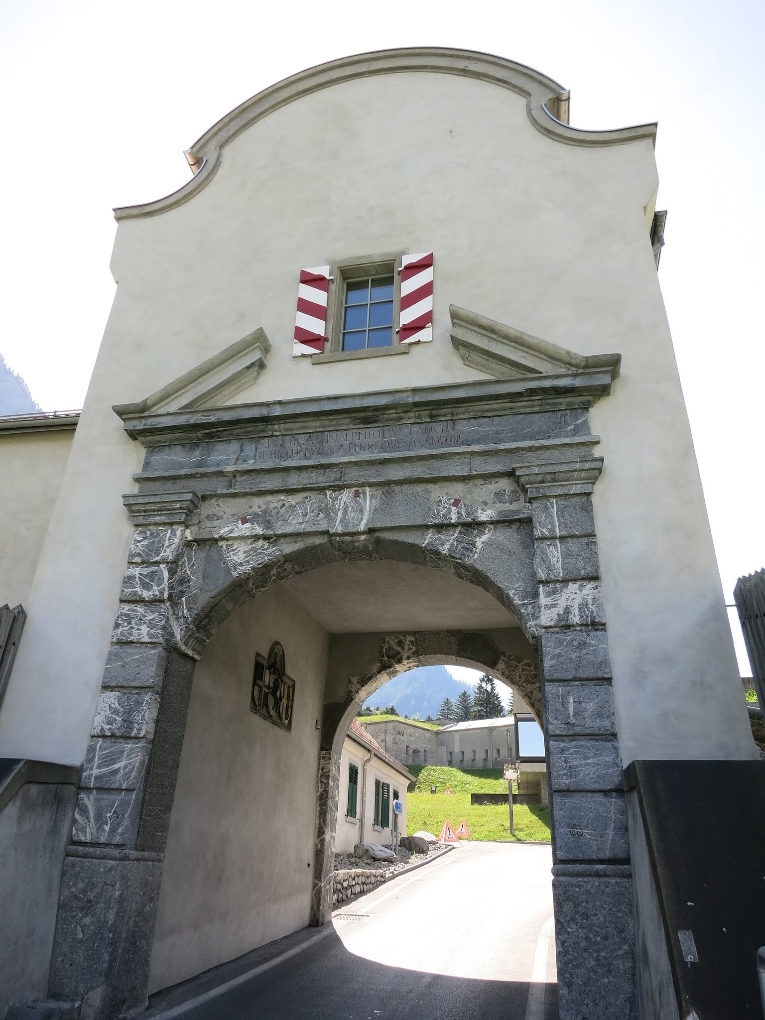
The historic core includes the 1703 gatehouse and the main baroque defensive arrangement, whose masonry bastioned front runs transversely across the pass saddle. The connecting wall toward the Herzog battery forms a saw-like work, while another blocking wall extends north between the Rhine and the rocky slope of Fläscherberg. The surviving complex also contains Casemates D, E, F1, and F2, built in 1859. Casemate F3 was identified as a battery and was later used as a smithy in 1917.
Herzog battery buildings
The 1880 stable and accommodation building belongs to the group associated with the Herzog battery. A separate ammunition magazine from 1859 served the same artillery position. These structures form part of the nineteenth-century expansion that added barracks, casemates, a raised rampart, a glacis, and the Herzog artillery position to the older fortress.
Summit works
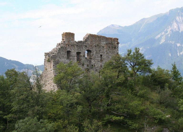
The Kleine Schanze Luzisteig is a redoubt, or detached enclosed defensive work, built on the pass summit around 1631. The summit also retains the former 1859 arsenal and blockhouse, which now houses the military museum. The Letzimauer Grafenberg, a fifteenth-century land wall, stands at the foot of the ruins of Grafenberg Castle and represents an earlier defensive line within the wider landscape.
External nineteenth-century defenses
Fläscherberg and Guscha works
The external fortifications include the Felsenweg rifle gallery, the main blocking wall, the Guscha Tower, and the Guscha Wall. The Guscha Tower, also called the Hunger Tower, was built near the Guscha battery during the Crimean War and provided an elevated position for long-range reconnaissance. The 1859 blockhouses named Zwingli, Naville, M, S, B, E, and G formed part of the defenses on Fläscherberg and helped prevent an outflanking movement.
Felsenweg and northern plain
The Felsenweg includes the rifle gallery and belongs to the wider system of nineteenth-century works that extended toward the northern plain between Ellwand and the Rhine. The defensive landscape also incorporated additional walls and artillery positions intended to reinforce the principal barrier across the pass.
Second World War and Cold War installations
Blocking position and infantry bunker
The later blocking position includes northern and southern terrain anti-tank obstacles on Steigstrasse. Infantry bunker Luzisteig A 6213 was armed with two infantry or anti-tank guns and two machine guns. These works formed part of Army No. 1317, which extended southward over the descent toward Fläsch and concentrated on the transport route from Liechtenstein.
Römerstrasse artillery work
Artillery Work Römerstrasse, designated A 6212, is a rock work above and west of the fortress. Around 1942, its cavern position was blasted into the northern wall of the Persaxplatten for the artillery of the Luziensteig combat group. It lies beside the old fortress path leading to Fläscherberg, with large embrasures below the path. The guns were directed toward the area in front of the Ansstein and Schollberg blocking position.
The work contained four artillery caverns, each intended for a 12-centimetre howitzer. Its supporting infrastructure consisted of an ammunition magazine, while accommodation was provided in barracks. In 1943, Motor Cannon Battery 95 occupied the position with 7.5-centimetre field guns. These were replaced in 1947 by permanently installed 12-centimetre howitzers, and a firing office was added. Because the work had no ventilation system, the guns were fitted with blow-out devices.
A gallery and a cavern were excavated from the artillery work around 1962 for Battalion Command Post A 6214. The artillery work was abandoned around 1971 and disarmed in 1985. The wider Römerstrasse complex includes the Felsenweg, the A 6212 embrasures, the northern Luzisteig terrain anti-tank obstacle, and a Second World War and Cold War infantry bunker.
Upper Römerstrasse positions
Four open artillery positions on the Upper Römerstrasse, north of Schnielskopf on Fläscherberg, were occupied by Motor Cannon Battery 96 in 1943. Their guns had to be dismantled for transport. The positions had breastworks and concrete gun beds and were camouflaged as wooden huts. In the 1980s they were covered over, although individual remains can still be identified.
Modern military buildings
East of the cantonal road, three elongated two-storey concrete buildings with flat roofs provide accommodation, catering, and canteen facilities. A command-centre building stands west of the road. The former upper station of the MSB106 military cableway survives as a separate building that has been converted into a public multipurpose space. A fortress information board forms part of the present interpretation of the site.