Burg Wersau: A Medieval Water Castle in Germany


Site at a Glance
- Rating
- 4.1
- Popularity
- Very Low
- Country
- Germany
- Primary era
- Medieval
- External website
- Open
- Eras represented
- Medieval, Early Modern
- Civilizations
- Electoral Palatinate, Holy Roman Empire
- Site type
- Military
- Remains
- Castle
On this page10 sections
History
Burg Wersau is a former lowland water castle near Reilingen in Germany, built and developed within the medieval political sphere of the Bishopric of Speyer. Its existence is recorded by 1155, although it may be older and possibly began as royal property. Positioned between the former royal forests of Lusshardt and Schwetzinger Hardt, it helped secure nearby forests and transport routes while serving as the center of a lordship that included Reilingen and Hockenheim.
From Royal Forests to Speyer Rule
The castle stood among territories shaped by changes in royal and ecclesiastical authority. In 1056, Emperor Henry III transferred the Lusshardt forest to the Bishopric of Speyer. Seven years later, his son Henry IV, then a German king, enlarged the bishopric’s forest holdings. Wersau and the settlements associated with it are consequently thought to have come under Speyer’s control. For a time, the castle’s lordship also extended to Oftersheim and St. Leon.
The bishopric governed this territory through the Schenks of Wersau, a family belonging to the medieval service nobility. Ministerials held offices, lands, and administrative responsibilities for greater lords, and the Schenks exercised authority connected with the castle on behalf of Speyer. Dietrich appears around 1155 as a Schenk of the bishopric, Eberhard, son of the Schenk of Hockenheim, is mentioned in 1198, and a Schenk of Wersau appears by 1236. From that point, the family was closely identified with the castle.
Transfer to the Wittelsbachs
Control of Wersau shifted between the Schenks, Speyer, and the Wittelsbach dynasty. Around 1280, Eberhard of Wersau sold half of the castle to the Bishop of Speyer. In 1286, the bishop granted that half as a fief to Louis II, Count Palatine of the Rhine, who had already obtained the other half from Markward of Annweiler, also known as of Kropsberg, and from the brothers of Erligheim, relatives of the Wersau Schenks. Reilingen and Hockenheim were again listed as possessions attached to the castle.
After the Palatine Feud, Wersau passed to the Wittelsbach branch of Palatinate-Mosbach. In 1429, Count Palatine Otto I assigned the castle to his wife, Johanna of Bavaria. She later pawned Wersau and its surrounding villages to Stephen of Palatinate-Simmern-Zweibrücken. Following the Battle of Seckenheim in 1462, the castle came permanently under the increasingly powerful Electoral Palatinate, a major principality of the Holy Roman Empire ruled by the count palatine, who also held the electoral office involved in choosing the German king.
Religious and Electoral Connections
Wersau also had a connection with the foundation of Heidelberg University. In 1386, envoys of Pope Urban VI delivered the papal bull establishing the university at Burg Wersau to Rupert I, Count Palatine and Elector of the Rhine, rather than in Heidelberg itself. Urban VI was head of the Catholic Church from 1378 to 1389, while Rupert I was a fourteenth-century Wittelsbach ruler of the Rhine.
A confraternity dedicated to Saint Wendelin existed at Reilingen by 1451 and was directly associated with Wersau and its chapel to the saint. Members of the electoral family belonged to the confraternity, linking the castle’s religious life with the ruling house of the Electoral Palatinate.
Destruction and Later Estate Use
The castle was damaged in 1622. By the end of the Thirty Years’ War, a conflict fought from 1618 to 1648 that caused widespread military and economic disruption in central Europe, only parts of the palace, vaulted cellars, stables, and a deteriorated tower with bells remained. The ruins were repaired provisionally and continued to serve for an extended period as a favored hunting residence of the electors. The complex was also developed as the seat of an electoral administrative official.
Wersau was completely destroyed in 1689 during the War of the Palatine Succession, a European conflict from 1688 to 1697 that brought extensive devastation to the Palatinate. In the late seventeenth century, an agricultural and sheep-farming estate was built east of the palace under Electoral Palatinate administration. Later known as Wersauer Hof, it was administered from Schwetzingen. After the lordship was dissolved, the estate passed into peasant ownership, was acquired by the Barons of Wamboldt around 1900, and was sold to the Protestant Pflege Schönau in 1927. It remains in that institution’s ownership.
Archaeological Rediscovery
Archaeological research began in 2007 on the initiative of regional historian Otmar Geiger. Geophysical investigations followed in 2008, and excavations by the Baden-Württemberg State Office for Monument Preservation and Heidelberg University began in 2009. A Heidelberg University teaching excavation in 2012 produced numerous finds, including material reaching into early historical periods. No confirmed Roman building or settlement remains, or evidence of still earlier settlement, had been demonstrated in the castle area, leaving the older assumptions of historian Franz Josef Mone archaeologically unconfirmed.
When nineteenth-century mill buildings were demolished in late 2014, investigations exposed foundations belonging to the former outer bailey. Further work by Heidelberg University, the Friends of Reilingen History, and the Spurensuche working group recovered many finds and established Wersau as a previously underestimated castle and fortified complex. The recovered materials were catalogued and deposited with the Baden-Württemberg State Office for Monument Preservation. Burg Wersau is protected as an archaeological monument under Baden-Württemberg’s monument-protection law, and its remains, together with those of the mill, are preserved as evidence of public value for scholarly and local history.
Remains
Burg Wersau occupied low moorland surrounded by watercourses belonging to the former Kinzig-Murg channel, later the Kraichbach lowland, within the natural region of the Hardtebenen. At its greatest extent, the oval water castle had a ring wall, a principal residential building, probably four towers, and numerous associated structures. The complex included an outer bailey, a chapel, a mill, and a sheep farm, with about 24 additional buildings. Because the ground was low and wet, the outer walls were strengthened with buttresses. A plan from around 1690 preserves the oval outline of the estate.
Castle Complex
The principal residential building was the palas, the main living and representational structure of a medieval castle. It formed part of the fortified enclosure with the ring wall and towers, while the outer bailey lay beyond the main defensive area and contained service and economic buildings. By 1686, the castle estate included 154 morgen of arable land and 30 morgen of meadow in the Ketschau lowland between Hockenheim and Ketsch.
Destruction in 1689 burned the palace mill and farm buildings, which had been constructed beside the palace in 1596, down to their foundations. Stones from the ruined complex were reused in a cemetery wall at Reilingen and in the first stone bridge over the Kraichbach at Hockenheim, built by the electoral master builder Rabaliatti. By the eighteenth century, almost nothing of the castle could be seen above ground. An old deep well remained the principal visible indication, while much of the structure lay beneath soil and grass.
Mill and Water Power
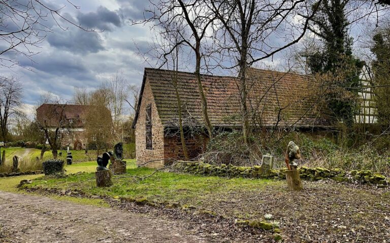
A mill driven by the Kraichbach is known from 1596 and may have existed earlier. The mill complex demolished in 2014 and 2015 consisted mainly of buildings dating from 1869. Its owner, C. L. Zahn, is identified by a foundation stone preserved on the exhibition grounds. Milling ended in 1959. The main building was then used for several years by a wholesale company, while the machine house was converted for residential use and retained the stump of a chimney until the complex was demolished.
Until 1956, the mill was powered by a Francis shaft turbine designed for medium-pressure water flow. In this arrangement, the turbine mechanism was set within a vertical shaft, making it suitable for the mill’s small channel. The historical turbine, including its runner and blades, was displayed at the entrance to the planned archaeological park in 2021.
Buried Archaeological Features
Excavations beneath the former mill revealed foundations of the castle’s outer bailey. Work across the castle and mill areas also recovered numerous ceramic sherds and other archaeological material, with some finds reaching into early historical periods. These remains, together with the buried foundations and surviving evidence of the water-castle complex, make it possible to identify the former site despite the destruction and the later reuse of its building materials.
Nearby sites