Jaromarsburg: Rani Temple Fortress on Rügen


Site at a Glance
- Rating
- 3.7
- Popularity
- Very Low
- Country
- Germany
- Primary era
- Medieval
- Eras represented
- Medieval
- Civilizations
- Unclassified
- Site type
- Military
- Remains
- Fort
On this page16 sections
History
Jaromarsburg was a Rani temple fortress in Germany, built at Cape Arkona on the northeastern tip of Rügen from approximately the ninth century. The Rani were a medieval Polabian Slavic people who controlled Rügen and neighbouring parts of the southern Baltic region. Dedicated to the god Svantovit, the site developed into a religious, political, and economic centre before its destruction during the Danish conquest of Rügen in 1168 or 1169.
Foundation and religious authority
The Rani settled on Rügen from about the ninth century and probably established the sanctuary at that time. They later built the castle and its defensive works in several stages. In the eleventh century, the main earthwork was raised with soil taken from within the fortified area. Medieval chronicles generally called the site Arkona or used related forms of that name. The name Jaromarsburg is later and derives from the Rani prince Jaromar I; it was not the original name used for the temple fortress in historical documents.
The destruction of Rethra, an important pre-Christian Slavic cult centre, in 1068 increased Arkona’s religious importance among the Slavs of the southern Baltic. The sanctuary served as an oracle. Merchants who sought to trade with the Rani had to make offerings there, probably including honey and wax. The priests also controlled a herring-fishing harbour and horse herds, among them a white horse used for divination. Around 300 attendants lived with the priests in the castle.
Jaromarsburg combined religious authority with political and economic power. A separate settlement on Rügen, probably at present-day Korzhenitsa, functioned as a craft centre. The influence of the priests may have competed with that of the tribal elite and the princely dynasty, giving the sanctuary a role that extended beyond ritual practice.
Danish attacks and destruction
Danish forces captured the temple fortress in 1136 under King Eric II the Memorable. The defeated Rani agreed to accept Christianity, but abandoned the arrangement after the Danish army withdrew. In the late 1150s, a storm destroyed a large Slavic fleet off the Norwegian coast, weakening the Rani. King Waldemar I of Denmark then began an offensive against Rügen, with attacks and raids preceding his landing at Arkona on 19 May 1168. Bishop Absalon, Waldemar’s close ally and army commander, accompanied him.
The fortress resisted for four weeks before falling in 1168 or 1169. The precise year remains uncertain. Saxo Grammaticus does not give one, Helmold of Bosau gives 1168, and a papal document dated 4 November cannot distinguish between the two years. The attackers set fire to an unguarded part of the fortification. The defenders were unable to put out the flames because they lacked sufficient water.
The settlement imposed after the conquest required the Rani to adopt Christianity, destroy their idols, hand the temple treasure to the Church, and free Christian prisoners without ransom. The statue of Svantovit was cut apart and burned, and the temple itself was destroyed. Afterward, the Rani rulers Tetzlav and his brother Jaromar submitted to Waldemar I at Charenza, their capital. Tetzlav had previously been regarded as king of the Rani. Following his death in 1170, Jaromar became prince and remained in that position until 1218, as a Danish vassal after the conquest of Rügen.
Christianisation and archaeological investigation
Waldemar seized the temple treasure but had to share it with his ally Henry the Lion in 1171. The sanctuary’s extensive landed possessions passed to the Christian clergy. In 1169, Rügen came under the authority of the bishops of Lund, who supervised the Christianisation of the population. Chapels were later built on former cult and burial sites, and the first Christian church on Rügen was erected in the area of the former Svantovit sanctuary.
Jaromarsburg is the only rampart in Germany described in detail by a contemporary written account. Coastal erosion prompted repeated archaeological investigations. Carl Schuchhardt investigated the site in 1921, Wilhelm Petzsch examined the wall and gate in 1930, and the monument was included in East German lists in 1964. Further extensive work took place around 1969 and 1970, followed by excavations in 1994 and from 2003 to 2005. Emergency archaeology continued as the cliffs steadily collapsed into the sea. A new campaign began with preparations in December 2019, and excavations led by Sebastian Messal of the German Archaeological Institute took place from July to October 2020 on behalf of the Mecklenburg-Vorpommern State Office for Culture and Monument Preservation. The campaign was planned as part of an investigation of the fortification’s construction phases lasting at least six years.
Excavations in the 1920s and around 1970 produced evidence interpreted as belonging to a temple and a deliberately cleared cult area. Later work identified a rectangular space with no artifacts, interpreted as the temple location, surrounded by finds that may have been offerings, including broken weapon parts. Schuchhardt’s 1921 interpretation placed the statue of Svantovit in a particular part of the cliff, but later archaeologists questioned the conclusion. That section of the cliff has since fallen into the sea, so the interpretation can no longer be tested there.
Several layers of fighting and burning were identified during excavation and observation. One was associated with the Danish conquest of 1168, another with the Danish capture of 1136, and a deeper burnt layer was dated by Petzsch to about 1000. No major battle corresponding to this earliest layer is known.
Remains
Promontory and fortifications
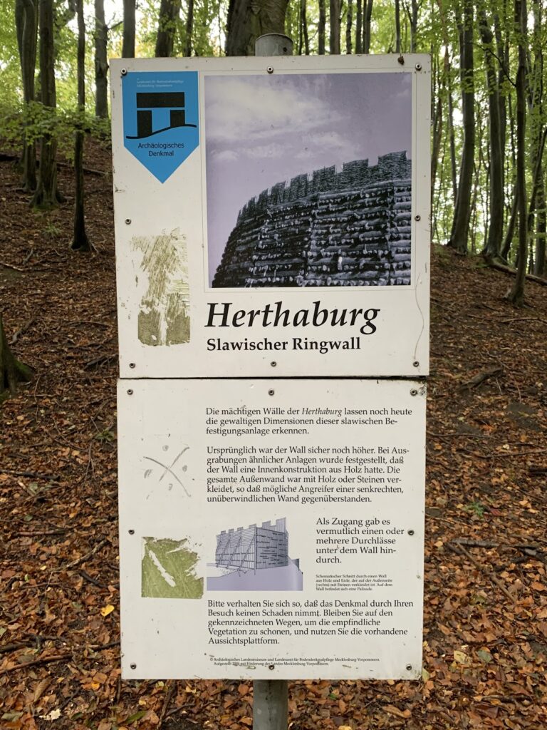
Jaromarsburg occupied a high promontory about 50 metres above sea level. Water bordered it on three sides, while the landward approach was defended by fortifications. Two successive earth ramparts, strengthened by additional defensive works, enclosed the stronghold. The ramparts reached approximately 13 metres in height, and both the fortifications and the temple were constructed from wood.
The original fortified area measured about 300 metres from north to south and 350 metres from east to west. Coastal erosion has repeatedly carried sections of the cliff and high shore into the sea. Between about 1000 and the 2000s, the coastline retreated by an estimated 100 to 200 metres, or roughly 10 to 20 metres per century. The area now enclosed by the ramparts is therefore believed to represent only about one-third of the original fortress.
Western rampart and residential area
Archaeological work identified a smaller western rampart, which has since been levelled. Between it and the larger rampart lay a residential area. Its intended use remains uncertain: it may have housed only the priests and their attendants, provided refuge for nearby settlements, or also accommodated craftsmen.
Water installation
A cistern, a built structure for storing water, was excavated at the cliff edge in 1994 after concern that the relevant section would collapse into the sea. In 2020, archaeologists also uncovered rows of stones running in the same direction as the upper part of the rampart.
Temple and cult area
The temple stood near the centre of the settlement within a rectangular open space. Saxo Grammaticus, a Danish historian whose Gesta Danorum provides the principal detailed medieval description of the sanctuary, portrayed it as a finely constructed wooden building with one entrance, a richly carved outer wall, and two enclosures. The outer enclosure joined the surrounding walls and had a red or purple roof. Inside it, a second enclosure rested on four columns and used curtains instead of solid walls.
Sanctuary and statue
The inner sanctuary contained a larger-than-life wooden image of Svantovit, approximately four metres high and carved from an oak trunk. The four-headed figure faced in different directions and held a drinking horn made from several metals in its right hand. Each year, the priest filled the horn with mead and interpreted the amount that had disappeared as an omen for the coming harvest.
Cult enclosure
A carved fence surrounded the temple, while heavy hangings or tapestries divided the inner room. The area around the building was kept clear of ordinary objects and has yielded very few finds. This arrangement corresponds with Saxo Grammaticus’s description of a sanctuary that the priest was not permitted to breathe inside, because doing so would defile it. Finds around the cleared space may represent offerings, including fragments of weapons.
Associated remains and interpretations
Weapon find
In 1933, approximately 25 metres beyond the rampart, archaeologists found a broken sword and a spearhead. The surviving decoration on the sword’s guard was dated to the Viking Age.
Nearby settlements
Settlements associated with the temple are believed to have occupied the areas now associated with the fishing villages of Vitt and Putgarten. The name Putgarten has been interpreted as meaning “at the foot of the castle.”
Priest Stone
A relief stone known as the Priest Stone or Svantevit Stone lies built sideways into the nearby church of Altenkirchen, directly above the foundation base. It may be a pre-Christian relief showing the priest of Svantovit holding or touching the god’s decorated drinking horn. Another interpretation identifies it as the gravestone of Prince Tetzlav. Its sideways placement has also been understood as a sign of Christianity’s superiority over the earlier religion.
Claims about Jomsburg
Finds from the surrounding sea area led some researchers to propose a connection between Jaromarsburg and the lost Viking or Slavic city of Jomsburg. Reported discoveries included stone pillars, walls, stones for sling engines, and a runestone bearing the name “Ulf.” These finds did not confirm the identification, and the original form and meaning of the site’s earlier name remain uncertain.
Nearby sites