King Charles’s Castle: A Tudor Artillery Fort on Tresco


Site at a Glance
- Rating
- 4.7
- Popularity
- Very Low
- Country
- United Kingdom
- Primary era
- Early Modern
- External website
- Open
- Eras represented
- Early Modern
- Civilizations
- English
- Site type
- Military
- Remains
- Fort
On this page14 sections
History
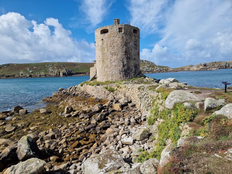
King Charles’s Castle is a ruined granite artillery fort on Tresco in the United Kingdom, built by the English Crown between 1548 and 1551 during the Tudor period. It formed part of a programme to strengthen the Isles of Scilly against French attack, guarding the narrow northern entrance to New Grimsby harbour and providing accommodation for guns and a garrison.
Tudor coastal defence
The fort emerged from renewed Anglo-French tensions during and after the reign of Henry VIII. Edward VI, the Tudor king of England from 1547 to 1553, continued his father’s development of coastal artillery forts. After Thomas Seymour, Lord High Admiral, inspected the Isles of Scilly and judged them vulnerable to invasion, the government began improving the islands’ defences.
Edward Seymour’s fall from power in 1549 brought a further survey by Captain William Tyrell. Work continued across the islands through 1552, although expenditure was reduced at the end of that year. About £3,123 had been spent on the fortifications between 1548 and 1552. A survey made in 1579 placed the total cost, including garrisons, at £6,000.
In February 1558, Sir Francis Flemming, Lieutenant-General of the Ordnance, was assigned to improve the islands’ defences. John Killigrew, captain of Pendennis Castle, directed the work on Tresco. The building programme drew on lead, timber from South Wales, money raised from the dissolution of the monasteries, and supplies of weapons and gunpowder. Queen Mary I intended to establish a garrison of 150 soldiers, although it is uncertain whether that number was ever reached.
Military shortcomings and later Tudor defence
The castle’s elevated position, about 40 metres above the harbour, proved militarily unsatisfactory because its guns could not fire effectively downward. A small blockhouse was probably built below it by 1554. Star Castle was then constructed on St Mary’s between 1593 and 1594 as the principal defensive fortification of the Isles of Scilly.
Royalist occupation and Parliamentary capture
During the English Civil War, a series of conflicts between supporters of the monarchy and Parliament in the 1640s and early 1650s, the Isles of Scilly supported Charles I. The islands briefly came under Parliamentary control before rebelling in his favour in 1648. Royalist defenders probably added earthworks around the castle, although some of these may instead date from about 1627. The fort acquired its present name during this period. Charles I was a Stuart king, and his supporters were known as Royalists.
Tresco became a base for Royalist privateers, leading Parliament to send a force under Sir Robert Blake in 1651. Blake captured Old Grimsby in an amphibious assault on 18 April, bypassed the castle, and used Tresco as a base for taking St Mary’s. William Edgecumbe, the Royalist commander, withdrew on 19 April. The defenders blew up part of the fort as they departed, and it passed to the Parliamentary commander Colonel George Fleetwood. Some of its stonework appears to have been reused in Cromwell’s Castle, which was built below it in a more effective position overlooking the harbour.
Decline, guardianship, and investigation
In 1660, while soldiers were housed in the castle, Edward Sherburne inspected the islands’ defences for Charles II and recommended repairs. Charles II, the son and successor of Charles I, was restored to the throne that year. By the eighteenth century the castle was described as ruinous. William Borlase criticised its military design in 1752, and John Troutbeck later also remarked on its thick walls and poor position.
The Crown, through the Duchy of Cornwall, leased the islands to the Godolphin family in 1687 and to Augustus Smith in 1834. In 1922, Arthur Dorrien-Smith placed several Tresco properties, including the castle, under the guardianship of the Ministry of Works. Archaeological excavation in 1954 recovered coins, pottery, and a buckle, while fallen stonework was used to reconstruct parts of the battery’s first floor.
King Charles’s Castle is now controlled by English Heritage. It is protected in the United Kingdom as a scheduled monument, a site safeguarded by law for its archaeological or historical importance, and as a Grade II* listed building, a nationally important building of particular architectural or historic interest. The scheduled-monument designation dates from 1981 and the Grade II* listing from 1992.
Remains
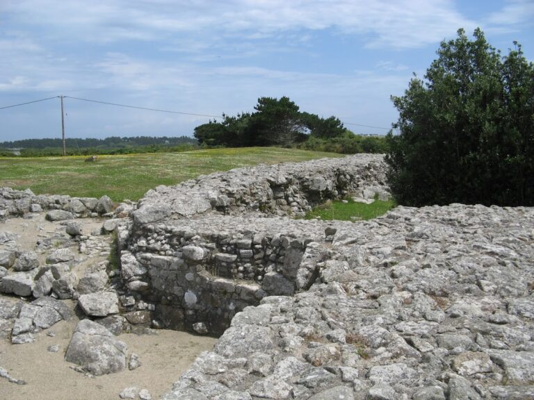
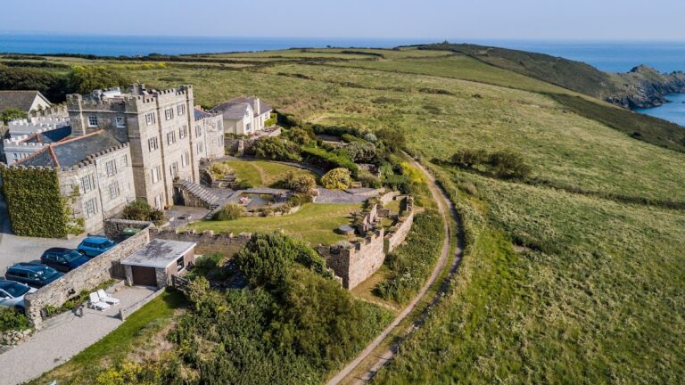
The castle is a ruined polygonal granite fort on the high ground of Castle Down, overlooking New Grimsby harbour and the narrow passage between Tresco and Bryher. Its approximately 20-metre-long plan is cross-shaped. Dressed and rubble granite form the structure, while an underlying rocky outcrop is incorporated at the north-west and south-west corners. Surviving walls reach 3.4 metres in height and 1.65 metres in thickness in places, with average surviving dimensions of about 1.5 metres high and 0.8 metres thick.
Main fort
Gun battery
The west side contains the principal gun battery, a large room facing the sea. Its almost hexagonal form was originally two storeys high and incorporated embrasures, openings through which cannon could be fired, for five guns. The openings allowed fire in five directions towards vessels approaching the harbour. The battery’s upper level would have accommodated additional guns.
The north-east embrasure was later blocked when an internal chamber measuring 4.5 by 2.3 metres was inserted into the battery. It was subsequently reopened as a window. A broader opening in the south-east corner of the upper battery has been reconstructed. Excavation in 1954 led to the rebuilding of parts of the first floor with fallen stonework.
Hall and living quarters
Behind the battery is an east-facing hall and kitchen measuring 8.8 by 6 metres. The rooms contain a fireplace and a bread oven and were associated with two bedrooms, each approximately 2.9 metres square. A small brazier may have heated the northern bedroom. The castle may originally have had two storeys throughout, or two storeys only in the battery while the living quarters remained single-storeyed.
Entrance and guardroom
A guardroom measuring 3.5 metres square forms the entrance and leads into the hall. Its square-headed arch retains a socket for a locking bar. Together with the domestic rooms, the entrance shows how the fort combined a gun position with accommodation for its garrison.
Surrounding earthworks
Rectangular defensive enclosure
A rectangular earthwork surrounds the castle and extends towards the north-east. Its bank of earth and rubble reaches up to 2 metres high and 8 metres wide. Bastions, projecting parts of a defensive line that provided covering fire, occupy its corners, with a demi-bastion, or half-bastion, at one position. A ditch along the north and east sides reaches 0.4 metres in depth and 3 metres in width. The enclosure was probably constructed around 1627 as a landward defence, although it may have been added during the English Civil War.
Concealed earthwork line
A second line of earthworks survives about 40 metres south-east of the first. Its bank is approximately 0.3 metres high and its ditch reaches 0.2 metres in depth. Set just behind the hill crest, it may have been intended for concealment. The line includes bastions and rounded or projecting flank protections called orillons, but appears unfinished and probably dates from the mid-sixteenth century.
Outer court and northern battery
Additional traces of a low earthwork extend eastward from the castle and probably represent an outer court. The bank has a complete bastion at its centre and a demi-bastion at its eastern end, with construction features suggesting a date around 1550.
A further battery lies north of the fort and is associated with the English Civil War. Between the fort and this battery, a trench in the landscape was used briefly for an attempted tin-mining operation in the seventeenth century.
Nearby sites