Fort de Brimont: A Séré de Rivières Fortification near Reims
Site at a Glance
- Rating
- 3.9
- Popularity
- Very Low
- Country
- France
- Primary era
- Modern
- Eras represented
- Modern
- Civilizations
- French
- Site type
- Military
- Remains
- Fort
On this page12 sections
History
Fort de Brimont is a French detached fort on the ridge north of Reims, built between 1875 and 1877 as part of the Séré de Rivières system. This network of forts, batteries, and defensive positions was created mainly after France’s defeat in the Franco-Prussian War of 1870–71 to protect important cities and approaches. The fort formed part of the fortified belt intended to make Reims a fortified place.
Construction and defensive purpose
Built on the territory of Brimont, the fort was constructed in stone masonry by about 500 workers, with the main effort concentrated in 1876. The project required land expropriations, including the removal of a brickworks occupying part of the site. Its position allowed French forces to control the northern approaches to Reims, the Aisne valley, the Oise-Aisne Canal, the roads toward Laon and Rethel, and the railway lines serving those towns. The Loivre Battery supported the fort from the west, while the Brimont Cran Battery covered the east. Fort de Saint-Thierry lay farther west and Fort de Fresne to the east.
Unlike the fortified works at Toul and Verdun, Fort de Brimont was not modernized. Improvements in artillery and propellants made the older defensive system obsolete, and the fort was demobilized in 1910. The wider fortified position was dismantled during the 1910s, although the site soon returned to military use when the First World War began.
First World War
French troops reoccupied Fort de Brimont at the beginning of the war but abandoned it during the retreat of September 1914. German forces then held the fort for most of the conflict and used it to house French prisoners of war. The position saw heavy fighting during the Battle of the Aisne, including the Nivelle Offensive, the major French assault of 1917. A French 400 mm howitzer shelled the fort, although it remains uncertain whether the projectile actually struck the structure.
Later military and civilian uses
Between the two world wars, the fort initially provided shelter for families whose homes in Brimont had been destroyed. It was later used as a stone quarry during the rebuilding of the village. On 10 June 1940, during the Second World War, the 61st Artillery Regiment took refuge there from German Stuka dive-bomber attacks. From 1944, the site served as an army depot and as a radar station belonging to Reims-Champagne Air Base 112. The municipality of Brimont now owns the overgrown, abandoned site.
Remains
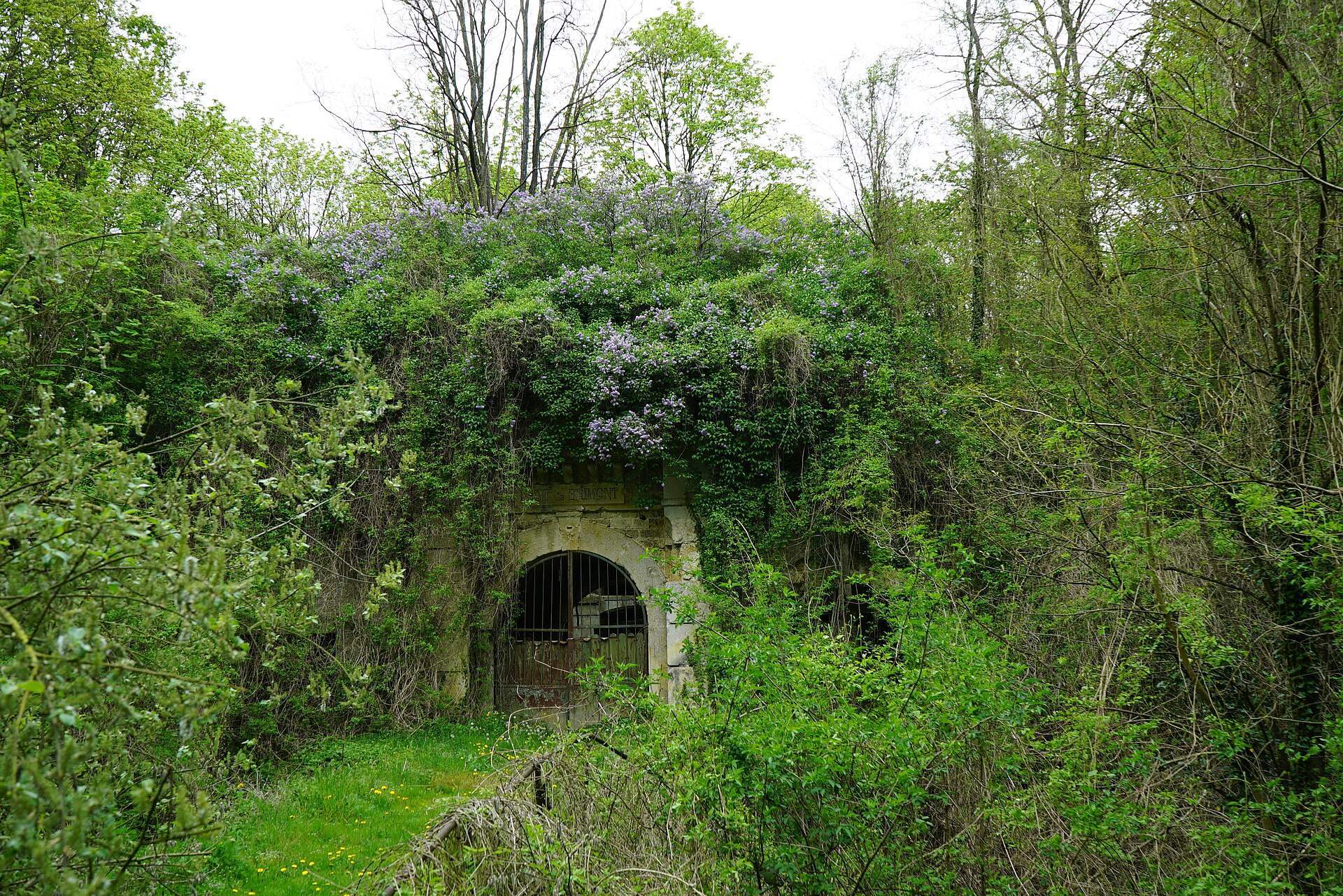
Fort de Brimont is a large stone fortification with a symmetrical plan adapted to the ridge on which it stands. Its arrangement is altered by the flanking caponiers, covered defensive structures projecting into the ditch to fire along its length, including an additional caponier on the east side. The powder magazine is also slightly displaced from the fort’s north-south axis. Much of the surviving structure is heavily overgrown.
Entrance and defensive ditches
Southern entrance
The southern entrance lies beyond a ditch about four metres wide. A drawbridge, portcullis, and gatehouse protected the approach, while the gatehouse itself contained several rooms for the guard force. The inner and outer ditch walls are masonry structures at least 3.5 metres high. The inner wall, or escarp, and the outer wall, or counterscarp, formed the principal defensive sides of the ditch.
Flanking defenses
Caponiers protected the ditches from within the fortification. An east-west underground tunnel connected the barracks with these structures and continued toward the powder magazine. A northern passage led to a central domed structure with six firing openings for close defense, then onward to rooms serving the northern caponier.
Central buildings and underground passages
The entrance opens into the central living area, where the fort’s forge, stable, kitchen, and barracks were arranged on two levels. Their windows faced the courtyard only, and the buildings were placed within the central mass of the fort to shield them from direct artillery fire. Service rooms, the powder magazine, underground passages, and covered ammunition reserves formed part of the same protected internal arrangement.
Upper artillery position
Cavalier and gun positions
The upper fort, or cavalier, held open firing positions for seven 155 mm model 1877 de Bange guns and four mortars. De Bange guns were French rifled muzzle-loading artillery pieces designed by Charles Ragon de Bange. The gun positions were divided by hollow traverses, masonry tunnels covered with earth that also served as ammunition-storage spaces.
Flanking armament
The listed flanking armament included nine 138 mm guns. Together with the caponiers and the central domed defense position, these weapons formed the fort’s arrangements for covering the ditches and the approaches around the ridge.