Burg Sichelnstein: A Medieval Hill Castle Ruin in Germany


Site at a Glance
- Rating
- 4.2
- Popularity
- Very Low
- Country
- Germany
- Primary era
- Medieval
- Eras represented
- Medieval
- Civilizations
- German, Holy Roman Empire
- Site type
- Military
- Remains
- Castle
On this page12 sections
History
Burg Sichelnstein is a hill-castle ruin in Staufenberg, Germany, whose origins are placed before 933 and possibly in the ninth century. It belonged historically to the ministerial class, a service nobility that held administrative and military duties for rulers and lords. The castle stands within a landscape shaped by the early medieval estates and settlements associated with the families of Amelung and Hiddi.
Early origins and the Sichelnstein family
The castle’s name and construction date are not firmly established. Its beginnings may reach back to the ninth century, when descendants of Amelung are thought to have built a fortified site to protect their landed estates. An 811 charter places the Saxon nobles Amelung and Hiddi in the political world created by Charlemagne’s conquest of Saxony. Charlemagne, the Frankish ruler who became emperor in 800, had incorporated large parts of Saxony into his realm. Amelung and Hiddi had been forced to leave their lands because of their loyalty to him and settled in the area of present-day Wolfsanger.
The families remained associated with nearby settlements. Hiddi’s son Esiko founded Esikerode, now Escherode, while Amelung’s son Bennit founded Benniterode, now Benterode. Both places, like Sichelnstein, now lie within the municipality of Staufenberg.
At the end of the Battle of Merseburg in 933, Amelung’s great-grandson was already using the name Wittilo of Sichelnstein. He was knighted and received permission from King Henry I to bear a white shield with a yellow border, two silver sickles, and a central marble column. Henry I ruled as German king from 919 to 936. The sickles and column remain elements of the coats of arms of Sichelnstein and Staufenberg, linking the medieval family tradition with the modern municipalities.
Legend and military conflict
A local tradition connects Sichelnstein with Sensenstein Castle, located 4.6 kilometres to the south. According to the legend, Duke Otto the Quarrelsome of Brunswick built Sichelnstein below the Staufenberg to make raids into Hessian grain lands easier. Landgrave Hermann the Scholar supposedly established Sensenstein opposite it, with the larger agricultural implement in its name expressing wider ambitions. This explanation for the two names belongs to local tradition rather than established history.
Sichelnstein entered a clearly documented military phase during the Sterner War. This fourteenth-century conflict began in 1372 as a revolt by members of the knightly nobility against the Hessian landgrave. Duke Otto the Quarrelsome had the castle completely refortified and used it as a base for raids into Hesse. Skirmishes, sieges, and plundering continued until a Hessian victory in 1373. The following year Otto was compelled to surrender Sichelnstein together with its associated administrative district.
Changing lordship and administration
The castle and its district later passed between owners through pledging. By 1379 Sichelnstein had returned to Brunswick control. It was assigned, along with Münden Castle and the town of Münden, to Otto’s second wife as her life endowment and dower gift. The castle subsequently served as her widow’s residence.
Around 1500, the Hessian landgrave again administered Sichelnstein and appointed his vassal Friedrich Trott as bailiff and district official. Trott supervised the Obergericht, an administrative term for the settlements on the plateau above Münden. The name continued to be used for villages between the Nieste and Werra rivers.
The castle’s authority extended across substantial possessions, including the Kaufunger Forest. In 1557, farmers from Nienhagen, Sichelnstein, Benterode, Wahnhausen, Lutterberg, Escherode, Landwehrhagen, Laubach, Spiekershausen, Speele, Hedemünden, Oberode, and Bonaforth were still required to deliver their share of grain rent. This obligation reflects the continuing administrative and economic reach associated with the castle.
Decline, reuse, and restoration
The later history of Sichelnstein and the circumstances of its destruction are unclear. The ruin probably suffered during the Thirty Years’ War, the European conflict fought from 1618 to 1648, although this remains an inference rather than a recorded event. Stone from the castle was later reused in houses in Sichelnstein and Benterode. In 1787, further material was quarried for a new church in Benterode when the old village church was at risk of collapse.
Between 1973 and 1979, the municipality of Staufenberg carried out a thorough restoration that halted further deterioration. The precinct subsequently became a meeting and assembly place for local residents and associations, as well as a setting for cultural events and weddings. Its later use has included an open-air stage for summer concerts, with the courtyard capable of being covered by a retractable tent roof.
Remains
Burg Sichelnstein occupies a hill and slope in the western foothills of the Kaufunger Forest, within the Münden Nature Park. It stands north of the valley of the Ingelheim Stream, a northeastern tributary of the Nieste, at about 325 metres above sea level. The castle follows an irregular horseshoe-shaped plan. Its curved side faces west, while the straight side faces east, and the two corner angles differ in sharpness.
Enclosure and defensive features
Enclosing wall
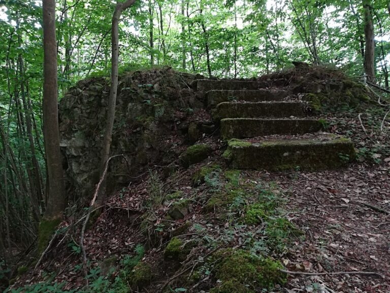
The principal surviving structure is an enclosing wall between 7 and 10 metres high. It combines ashlar blocks, which are carefully shaped building stones, with rubble stone. The surviving height indicates that the castle once rose higher. The lowest window sills and openings on the front wall begin at roughly 10 metres, showing how elevated the accessible openings were within the former enclosure. The interior walls have disappeared, leaving the enclosing circuit as the main surviving framework of the ruin.
Eastern entrance
The only entrance lay on the eastern side. A gate passage led across the wall ditch by means of a drawbridge and continued to a castle gate with a Gothic pointed arch. The drawbridge and the approach to the entrance disappeared more than a century ago, but the pointed-arch gate survives and still gives access to the interior of the ruin.
Western ditch
Deep ditches once formed part of the castle’s defenses. The western ditch survives as a visible element of the site, helping define the relationship between the enclosure and the surrounding slope.
Medieval residential building
The remains of the medieval residential building can be recognized through several surviving details. Slit-like windows, some set within niches, belonged to the building’s wall fabric. The remains of a continuous chimney indicate the former arrangement for heating and smoke removal, while interior corbels supported ceiling beams. Exterior consoles are associated with the walls of an oriel, a projecting upper structure that contained a private latrine. Together, these features identify the residential function within the surviving enclosure.
Present physical use
The ruin retains its enclosure, eastern gate, western ditch, and elements of the medieval residential building, while the lost interior walls leave the courtyard open. An open-air stage has been installed within the castle precinct, and a retractable tent-roof structure allows the entire courtyard to be covered for cultural events and other gatherings.
Nearby sites