Ruine Freienstein: A Medieval Hilltop Castle Ruin in Switzerland


Site at a Glance
- Rating
- 4.5
- Popularity
- Very Low
- Country
- Switzerland
- Primary era
- Medieval
- Eras represented
- Medieval
- Civilizations
- Holy Roman Empire
- Site type
- Military
- Remains
- Castle
On this page6 sections
History
Ruine Freienstein, also known as Alten-Teufen Castle, is a medieval hilltop castle ruin in Freienstein-Teufen, Switzerland, built around 1250 by a baron of Tengen. The castle became the seat of a noble family whose name was later adopted by the nearby village.
Foundation and the Barons of Freienstein
In 1254, Conrad de Tengen transferred the castle to his daughter Ita and her husband, Baron Egolf von Hasle, also known as Egilolf de Hasli. This transfer provides the first written record of the castle. Egolf and his descendants subsequently styled themselves Barons of Freienstein, and the village nearby came to be called Freienstein.
The later coat of arms associated with the family contained a hazel branch, probably referring to descent from the Barons of Hasli, and a lion that probably derived from the Kyburg lion. In 1302, Egolf, with the consent of his sons Heinrich and Johannes, sold the Freienstein demesne farm to Töss Convent, a medieval religious institution in the Zurich region. Heinrich was married to Nertha von Tüfen, served as a regional judge in the Zürichgau in 1282, and died after 1314.
Destruction and Rebuilding
Citizens of Zurich apparently destroyed the castle in 1334 or 1338. It was later rebuilt, but the Freienstein family died out in the male line in 1360, and the castle then passed through several owners. By 1436 it belonged to the Schaffhausen knight Herrmann Künsch.
In 1443, Künsch captured a man from the County of Kyburg, a historical territory whose name and heraldic lion became associated with political history in the Zurich region. Forces from Winterthur and Diessenhofen marched against the castle under Heinrich Schwend, a regional governor who later became mayor of Zurich. They burned the castle, and the prisoner, left in the dungeon, suffocated in the smoke.
A local legend gives a different account of the destruction. It tells of a robber knight who abducted the daughter of a respected free man from Embrach after she rejected him. Her father rescued her by disguising himself as a Swabian falconer, but he was imprisoned. The Landgrave of Kyburg, a high-ranking territorial lord, then besieged Freienstein, burned its tower, and captured the fortress. According to the tale, the rescuers forgot the father in the dungeon, where he suffocated. This story is a legend rather than a documented explanation of the castle’s destruction.
Later Owners and Conservation
Knight Felix Schwarzmurer acquired the castle in 1485. After his death in 1492, the ruin passed to Hans Erhart and Urban zum Thor of Teufen. The judicial lordship and lordship of Teufen came to the Zurich family von Meiss in 1600 and remained with them until the property was sold in 1838. The last owner was Lieutenant Colonel Gottfried von Meiss-Trachsler, who lived from 1785 to 1862.
Much of the castle stone was quarried in 1806 and reused to build the Töss Bridge. In 1975, the heirs of the von Meiss-Trachsler family donated the ruin to the Canton of Zurich. Conservation followed in 1976 through a donation from the castle enthusiast Franz Xaver Arnet, together with contributions from the federal government, the canton, and the municipality. The ruin was also placed under the protection of the Swiss Confederation.
Remains
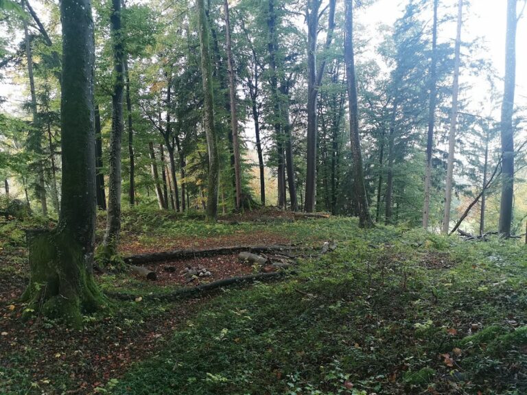
Ruine Freienstein stands at approximately 460 metres above sea level on a hill above a vineyard. The surviving site is centered on the castle tower and its surrounding ditch, with a deep well positioned west of the tower. The well was cut into the local molasse bedrock, a sedimentary rock formed from material eroded from rising mountain ranges and widespread across the Swiss Plateau.
Castle Well
The well was discovered in 1968 and completely excavated in 1981 and 1982. From the bottom of the castle ditch, its builders cut a shaft measuring 2.30 by 2.40 metres into the bedrock. The shaft reached 26.40 metres below the ditch, while the well’s total depth is 33.5 metres. Tuff blocks found at depths of 10 and 15 metres show that the shaft was lined with masonry up to the level of the tower’s foot.
Nearby sites