Kerkouane: A Phoenician-Punic City in Tunisia



Site at a Glance
- Rating
- 4.4
- Popularity
- Low
- Country
- Tunisia
- Primary era
- Classical
- Eras represented
- Classical
- Civilizations
- Carthaginian
- Site type
- City
On this page15 sections
History
Kerkouane is the archaeological site of an ancient Phoenician-Punic city in Tunisia, built within the cultural world shaped by Phoenician settlements and their Carthaginian successors. The earliest known evidence dates to the sixth century BC, while the visible ruins belong mainly to the late fourth and first half of the third century BC. The settlement stood on the tip of Cape Bon for almost 400 years and preserves an extensive picture of a Punic town that combined Carthaginian traditions with Libyan, Greek, and wider Mediterranean influences.
Origins and Punic urban life
The city’s ancient name is unknown. Archaeologists assigned it the name Kerkouane, a Libyco-Berber place-name associated with a verb meaning “to wall up.” Its religious and architectural traditions were predominantly Carthaginian, while its burial customs also reveal Libyan influence. Contacts with the Greek world and other Mediterranean communities appear in imported and related objects, including an Ionian cup, a black-figure wine jug showing a scene from the Odyssey, and Greek architectural elements incorporated into wealthy houses.
Kerkouane appears to have been a small settlement, probably with no more than about 1,200 inhabitants. Most residents were fishermen and craftsmen. The town’s economic activities included purple-dye production, probably using the abundant murex shells found at the site, together with salt production and the manufacture of garum, a fermented fish product. Its port, workshops, shops, streets, residential districts, temples, defenses, and cemetery formed an organized coastal community rather than an isolated group of dwellings.
Destruction during the First Punic War
The First Punic War was the conflict between Rome and Carthage from 264 to 241 BC. Kerkouane was probably abandoned during this war, around the middle of the third century BC. UNESCO associates the destruction with Marcus Atilius Regulus, a Roman consul and commander who led Roman operations in North Africa, around 255 BC. The town may also have been pillaged after Rome captured Aspis in the same year. Later Roman settlement did not replace the Punic community, leaving its urban fabric available for archaeological study.
A military episode had already affected the town’s defenses in 309 BC, when Agathocles, the tyrant of Syracuse, invaded Carthaginian territory and reached the Cape Bon region. A northern tower was built after this attack. The defenses were suited to the needs of a small settlement and were not designed to resist an assault by a large army.
Discovery and protection
The site was discovered in 1952, and excavations were carried out by Tunisia’s National Institute of Archaeology and Art. The Punic town and the Arg el Ghazouani Necropolis were inscribed on the UNESCO World Heritage List in 1985 under criterion (iii), with a boundary modification recorded in 1986. Tunisia protects Kerkouane under Law 35-1994 on archaeological and historical heritage and traditional arts. The state owns the property, the National Heritage Institute manages it, and affiliated teams undertake safeguarding and daily management.
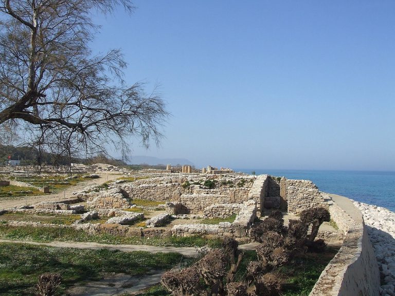
The coastal position continues to expose the remains to sea erosion. A supporting wall was built along the sea cliff to slow this process and protect the archaeological fabric. The necropolis is enclosed and permanently guarded, helping preserve the relationship between the settlement and its burial grounds.
Remains
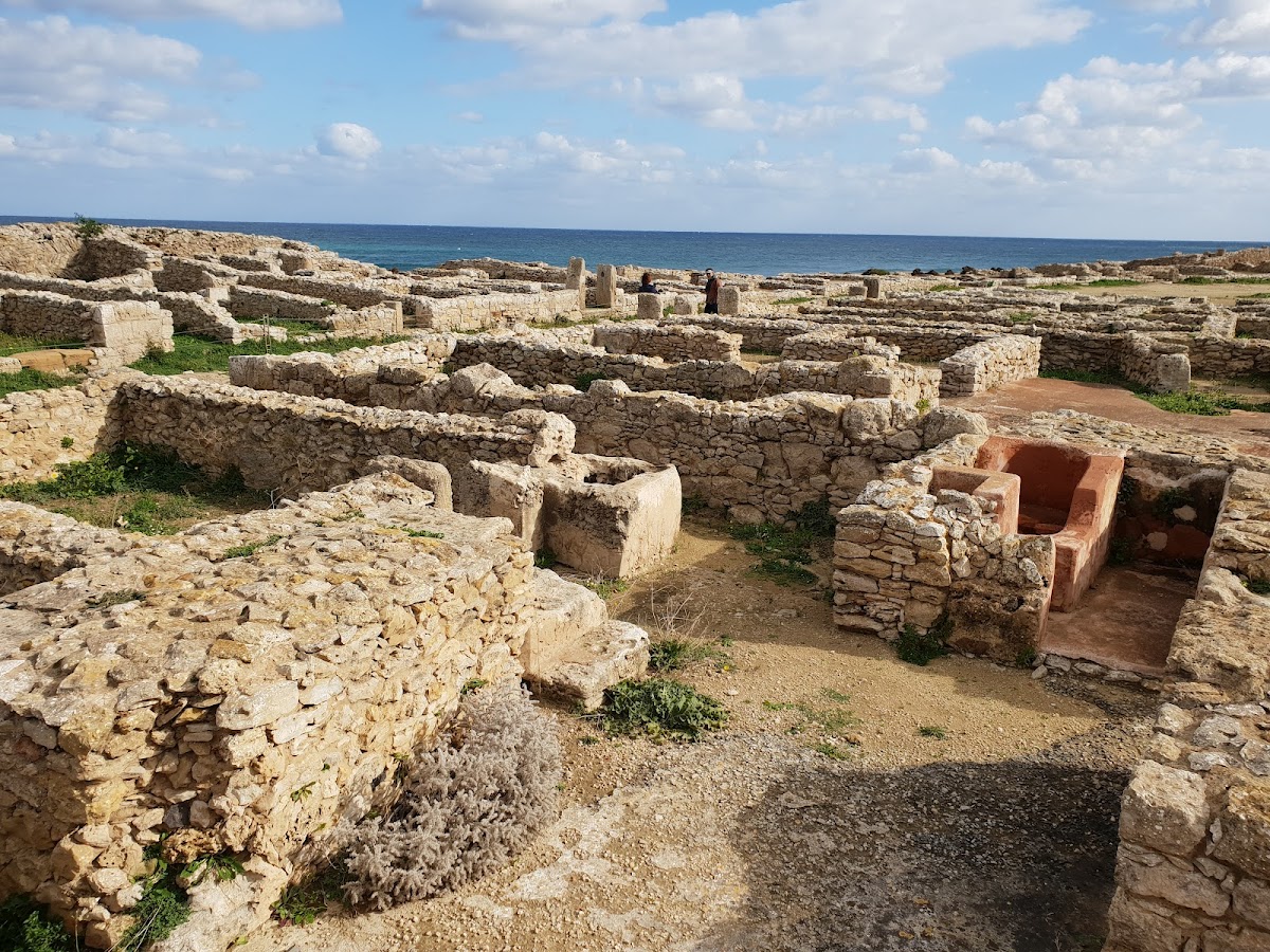
Kerkouane occupies a sea-facing cliff at the tip of Cape Bon. Its surviving urban components include the port, ramparts, residential quarters, shops, workshops, streets, squares, temples, and necropolis. The settlement follows a standardized plan, with broad, fairly straight streets forming a checkerboard network of insulae, or city blocks enclosed by streets. Most excavated houses, however, follow a crescent-shaped street rather than a wholly rectangular grid, giving the preserved town a more varied layout.
Residential quarters and domestic features
Most houses followed a long rectangular plan. A hall immediately inside the entrance served as the public part of the dwelling. Steps at its far end led to an upper storey containing bedrooms, while a passage opened onto a small courtyard that supplied the principal source of light. This arrangement shows how domestic spaces were organized around a controlled transition from the street to private rooms and the courtyard.
House of the Central Courtyard
The House of the Central Courtyard contains a well, a waterproof basin that may have been used as a bathtub, and a channel carrying household waste toward sewers in the street. A small floor mosaic lies beside these facilities. Together, the water features and drainage channel provide evidence of domestic installations integrated with the wider street system.
Many houses retain portions of their walls, and colored clay remains visible on some facades. Floors range from simple mosaics to surfaces made with broken terracotta jars mixed with small pieces of white limestone. One floor carries the geometric symbol of Tanit, a major Carthaginian goddess associated with fertility, protection, and the moon. Peristyle courtyards, in which rooms opened around a colonnaded space, and stucco decoration in wealthy homes reflect Greek architectural influence. Curbstones, doorsteps, thresholds, and mosaic floors survive across the excavated area.
Temples and ritual spaces
Central temple complex
A central group of three adjoining halls is interpreted as a temple. Animal bones, ashes, and fragments of wine jars were found in association with activities understood as sacrifices. A podium supported a cella, the principal enclosed chamber of a temple, which contained statues of deities, probably three in number. The combination of the halls, podium, ritual remains, and statues gives the complex a prominent religious function within the town.
Second sanctuary
Another sanctuary preserves some columns and parts of mosaics in a small atrium. An area for ritual banquets and a sacrificial altar have also been identified. The dedication remains uncertain, although the associated artifacts have led archaeologists to suggest Melqart, Sid, and Tanit. Terracotta heads showing two men in conical hats resemble imagery connected with Sid and Melqart, Phoenician and Punic deities represented in the town’s religious tradition.
Proposed bath establishment
The central area may also have included a public bath establishment. Its proposed arrangement forms part of the interpretation of Kerkouane’s civic spaces. The baths lacked a hypocaust, an underfloor heating system used in ancient bathing buildings, and a swimming pool.
Defenses and harbor
City walls and northern tower
The western gate and sections of the city walls remain visible. The northern tower overlooks the sea and was added after Agathocles’s invasion of the region in 309 BC. Its construction reflects a defensive response to a specific military threat, while the scale of the surviving defenses corresponds to the needs of a small coastal settlement.
Ship ramp
At the southern end of the town, a ramp for dragging ships ashore survives as the clearest physical evidence of the harbor facilities. Its position and form connect the settlement’s urban area with maritime activity on the coast.
Arg el Ghazouani Necropolis
The Arg el Ghazouani Necropolis lies on a rocky hill less than one kilometer from the town. It is the best-preserved sector of the larger Kerkouane cemetery, whose tombs are distributed among the coastal hills at the tip of Cape Bon. The necropolis provides evidence for Punic funerary architecture and forms a functionally related part of the same archaeological property as the city. Their relationship can also be perceived visually across the intervening landscape.