Fort Kelibia: A Historic Coastal Fortress in Tunisia


Site at a Glance
- Rating
- 4.4
- Popularity
- Low
- Country
- Tunisia
- Primary era
- Medieval
- Eras represented
- Classical, Medieval, Early Modern, Modern
- Civilizations
- Byzantine, Carthaginian, French, Ottoman, Roman
- Site type
- Military
- Remains
- Citadel
On this page17 sections
History
Fort Kelibia is a historic fortress in Kelibia, Tunisia, occupying a rocky promontory above the Mediterranean, the city, and a natural harbour. Its earliest fortified phase belongs to the Carthaginian world, while the principal plan and appearance of the present citadel date to Zirid rebuilding in the medieval Islamic period. Its position controlled coastal and inland routes, the Cap Bon plain, and maritime approaches toward Sicily, Malta, and Gibraltar. The fortress was also regarded as the principal military stronghold of Tunisia’s Mediterranean coast.
Punic and Roman foundations
The settlement below the promontory was first known as Aspis and later as Clupea. Both names were associated with the shape of a shield, reflecting the rounded form of the headland. Carthaginians probably established a fortified port southeast of the promontory in the fifth century BC. The port supported a naval fleet until the sixteenth century, while Aspis grew around it.
In 320 BC, Agathocles, the tyrant of Syracuse, captured Kelibia and used it as a base for operations against Carthage and other coastal areas. He established a shipyard and probably built a fort on the site of the present fortress. Roman consuls Regulus and Manlius destroyed that fort completely in 256 BC during the First Punic War, the long conflict between Rome and Carthage for control of the western Mediterranean.
The Carthaginians then built a much larger stronghold on the promontory. It protected the city, the approaches to Carthage, and the agricultural resources of Cap Bon, while also providing a base for naval forces policing ports and trade routes. During the Second Punic War, the fortress resisted attacks led by the Roman commander Laevinus. In the Third Punic War, Roman forces blockaded Kelibia by land and sea in 148 BC. The fortress held out for two years and surrendered only in 146 BC, when Carthage fell. The city was looted, destroyed, and burned, its territory was devastated, and the fortress was demolished.
After the Roman conquest, the large Punic stronghold lost much of its strategic importance, although Clupea itself developed substantially during the second and third centuries AD. The fortress was not rebuilt at first.
Byzantine fort and Islamic ribat
Around 580, the Byzantines, the eastern Roman Empire, constructed a smaller fort on the promontory. After the Arab conquest of Carthage in 698, it became the last refuge of the Byzantine army in the region. The remaining Byzantine forces sailed from Kelibia to Pantelleria, which the Arabs captured in 847.
Under Muslim rule, the Byzantine fort became a ribat, a fortified religious establishment combining coastal surveillance, military service, religious practice, and hospitality. Its residents watched the coast and instructed young volunteers preparing for military expeditions. In peacetime they practiced agriculture, fishing, and mysticism. The establishment also accommodated travelers temporarily, operated as a postal station, and served as a place where Muslim prisoners were ransomed.
Kelibia became an important naval base in the tenth century and supported campaigns against southern Italy. The transfer of the Fatimid caliphs to Cairo contributed to the decline of the Tunisian fleet under the Zirids, leaving the town vulnerable to Norman attacks from Sicily. During the rule of the Zirid amir Tamim Abu Yahya ibn al-Muizz, from 1068 to 1108, the Normans captured Kelibia and used it as a base for attacks on northern Tunisia.
Zirid rebuilding and Hafsid use
Tamim’s son, Yahya Abu Tahir ibn Tamim, recaptured the town around 1112 after a long and violent war. The conflict destroyed the Byzantine-Aghlabid fortress. Yahya then began constructing a large citadel across the rocky promontory to prevent another Norman return. This Zirid rebuilding created the principal plan and appearance of the fortress seen today.
During the Hafsid period, the Zirid citadel became an important centre for a mystical Islamic movement. Sufis, whose religious tradition emphasizes spiritual discipline and direct devotional experience, had volunteered for religious warfare and held mystical gatherings near the edge of the rock. Major construction is not recorded again until the reign of Sultan Abu Faris in the fifteenth century. At that time, the older Zirid fortifications were restored and a dovecote was built.
Ottoman defenses and modern history
During the sixteenth century, Kelibia’s fortifications were drawn into repeated conflicts between Ottoman forces and Spanish troops. Osta Murad, a dey of Tunis, strengthened the fortress and enlarged its garrison, improving the defense of the port and its flotilla of small vessels. French naval forces shelled the fortress in 1669 and 1671.
The beys of Tunis paid less attention to the fortress during the eighteenth century. In 1860, the French traveler Victor Guérin found it filled with stone debris and overgrown with fig trees and thorn bushes. Parts of the walls were deteriorating and increasingly cracked. During the mid-nineteenth century, Suleiman ben Mustafa initiated restoration work, but it was limited to the eastern wall.
From 1881, the French installed a lighthouse at the fortress and established a maritime distress-signaling center there. German and Italian forces occupied it in 1942 and 1943 during the Second World War and dug trenches at the foot of the promontory. Some of these trenches remain visible. The fortress is now a restored historical monument and is described as the largest surviving Muslim fortification in Tunisia.
Remains
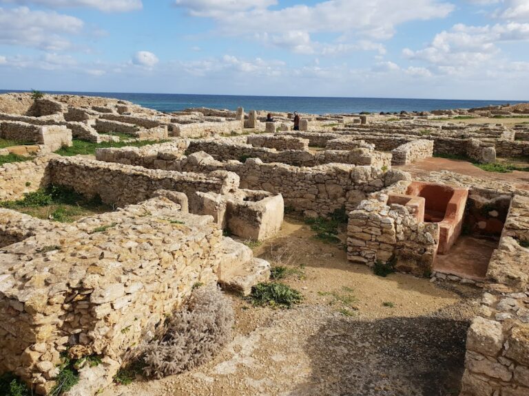
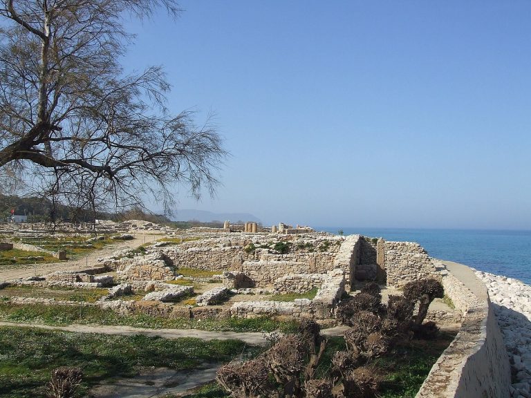
Fort Kelibia is a polygonal citadel integrated into the rocky promontory and covering approximately 1.5 hectares. Its present form brings together construction and rebuilding from many centuries. The enclosed site contains the remains of Punic, Byzantine, Zirid, and Ottoman defenses, arranged around a walled inner courtyard and connected with the settlement that once occupied the foot of the hill.
Early fortifications
Punic walls
Excavation has revealed surviving sections of the Punic walls, particularly in the northwestern sector, together with the foundation of a tower 17.5 metres wide. These remains indicate that the Punic fortress probably followed a pentagonal plan adapted to the landscape and included six quadrangular towers. Wall masonry between the bastions and fragments of black-glazed pottery date to the third century BC.
Byzantine fort
The Byzantine fort, built around 580, was quadrangular and had attached square towers. Its builders used dressed stone blocks taken from the ruins of the earlier Punic citadel. One of its arches remains visible inside the later Muslim fortress. The fort also protected an ancient reservoir that collected rainwater.
Zirid citadel and connections
Promontory walls
The Zirid rebuilding occupied the entire rocky promontory. The exterior walls rise 10 to 12 metres and have lower courses built mainly from large dressed stones, while natural stone masonry forms much of the upper work. Rubble set in mortar fills the space between two faces of dressed stone up to the cordon marking the medieval level. The walls were substantially reconstructed during the Ottoman period, and the upper level and present form of the wings correspond largely to that restoration. The first level broadly represents the Zirid citadel, which incorporated material from the Punic fortress.
Towers
The foundations of all the towers except the northeastern counterguard date to the Zirid period, although the towers were comprehensively modernized under the Ottomans. They are hollow, average about 12 metres in width, and each contains two guard rooms. Their design allowed them to operate as relatively autonomous small forts as well as defensive elements incorporated into the main wall.
Protected passage
A protected passage on the western side connected the citadel with the settlement at the foot of the hill. It was approximately 200 metres long and 4 metres wide, with a concealed entrance into the citadel. The passage enabled troops to move between the fortress and the town.
Entrances and inner courtyard
Outer and principal entrances
A small doorway in the nineteenth-century outer facade forms the entrance to the fortress. It opens onto an uncovered terrace running along the northeastern wall. The principal entrance, rebuilt during the Ottoman period, leads into a covered vestibule whose walls contain recessed niches.
Courtyard installations
The walled inner courtyard contains several separate elements. These include the Byzantine fort, the Roman rainwater reservoir, and traces of a mosque whose remains were levelled in recent times. The Roman reservoir forms part of the installations preserved within the enclosed interior of the fortress.
Later military evidence
Trenches dug at the foot of the promontory by German and Italian forces during their occupation in 1942 and 1943 remain visible. They form part of the modern military evidence preserved around the older fortress.