Castell de la Clusa (Castell dels Moros): Roman Frontier Fortifications in France


Site at a Glance
- Rating
- 4.4
- Popularity
- Very Low
- Country
- France
- Primary era
- Classical
- Eras represented
- Classical
- Civilizations
- Roman
- Site type
- Military
- Remains
- Fort
On this page9 sections
History
Castell de la Clusa (Castell dels Moros) is a group of Roman-origin fortification remains at Les Cluses, France, in the Vallespir of northern Catalonia. Developed mainly during Late Antiquity, the period from the later Roman Empire through the seventh century, it controlled the narrowest part of the valley and the route between ancient Gaul and Hispania.
A Roman road and frontier passage
The site consists of two fortified complexes on opposite sides of the Roma River, together with the former Porta de la Clusa lower in the valley. This arrangement allowed the passage to be watched from both banks. The route formed both a communications corridor and a frontier point, linking the Mediterranean world of Gaul with the Iberian Peninsula.
The Via Domitia was built between 118 BC to connect Italy with the Iberian Peninsula through Narbonese Gaul. At Les Cluses, an inland branch passed toward Ad Centuriones and the Panissars pass, where it joined the Via Augusta. The fortifications therefore guarded a route that connected major roads across the western Roman world.
Late Roman and Visigothic phases
The earliest elements of the Clusa d’Amunt complex may date from the third century. Parts of the Castle of the Moors appear to belong to the fourth century, while pottery and military equipment found there indicate occupation during the late fourth and early fifth centuries. These remains place the fortifications within the period when Roman frontier installations were being adapted to changing military conditions.
During the seventh century, under Wamba, a Visigothic king, the fortification may have maintained a permanent garrison. This possible military presence has been connected with Wamba’s war against his former dux, a high-ranking military commander, Paulus. The site thus continued to have a strategic role after the end of Roman rule in the region.
Decline, tradition, and protection
Flooding by the Roma is believed to have destroyed the Roman road during the Middle Ages. With the road damaged, the fortifications lost part of their military importance, although sections of the complex remained in use until the eighteenth century. The Clusa d’Amunt was then levelled into terraces, changing the form of the upper enclosure.
The name “Castle of the Moors” belongs to a later tradition rather than to a known Moorish association. A thirteenth-century legend claimed that Charlemagne, the eighth- and early ninth-century ruler of the Frankish Empire, named the place after Marsile, a legendary Moorish king who had taken refuge there. The same tradition attributed the fortification to the Moors.
The Clusa d’Amunt fort, the Castle of the Moors, the Porta de la Clusa, and the associated cadastral land received designation as a French historic monument on 18 March 2010.
Remains
The two fortified complexes
Clusa d’Amunt
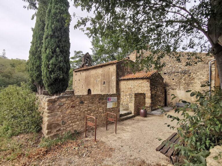
Clusa d’Amunt occupied a triangular enclosure on the right bank of the Roma River, near the village and the church of Santa Maria or Sant Nazari. Eighteenth-century terracing levelled the site, which is now occupied mainly by the church. The eastern castle wall and its supporting buttresses remain visible.
Schist blocks covered with lime mortar formed the principal construction material. Large sandstone blocks also survive within the remains. These appear to have been reused from Pompey’s Trophy at the Panissars pass, while medieval and modern infill reflect later alteration of the complex.
Castle of the Moors
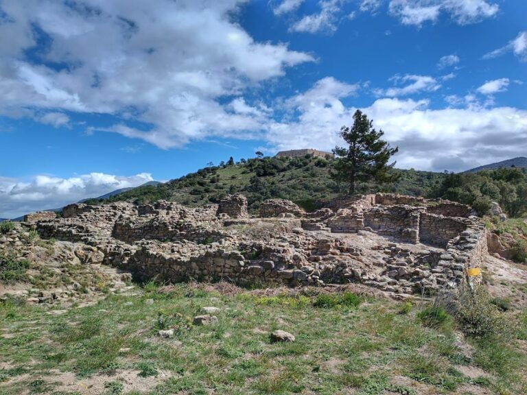
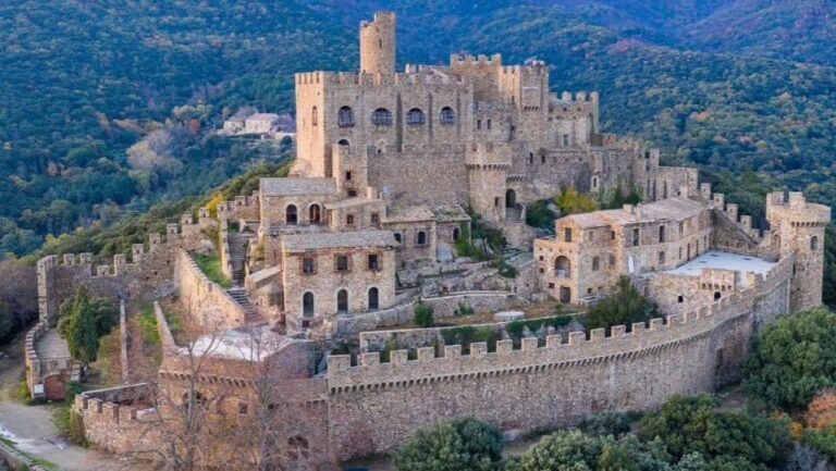
The Castle of the Moors stands on the left bank of the river, opposite Clusa d’Amunt, on cliffs above the Via Domitia. Its trapezoidal plan measures about 80 metres in width and 140 metres in length. Three square-based towers stood along the northern side, while a higher southern tower, the donjon or keep, formed the strongest part of the fortification.
Much of the western wall survives, together with a walkway and a postern, a small secondary gate. The southern wall contains a compartment interpreted as a sentry position for watching the road below. Excavations produced pottery and military equipment from the late fourth and early fifth centuries, linking the surviving structures with the period of occupation.
The Porta de la Clusa and the road
The Porta de la Clusa was a fortified gateway that closed the Via Domitia lower in the valley. Fragments of its walls survive on a trapezoidal base measuring about 7 by 11 metres. The gateway probably rose more than 10 metres above the road, making it a substantial structure within the controlled passage.
The road measured up to 3 metres across but narrowed to 2.20 metres at the entrance. Two leaves closed the gateway, each about 1.50 metres wide, and traces of their wear remain. Its restricted width may indicate that traffic passed in only one direction, with movement the other way possibly using the Panissars pass. Excavations also found construction blocks reused from Pompey’s Trophy.