Kastabala Ancient City: A Cilician Urban and Religious Center

Site at a Glance
- Rating
- 4.5
- Popularity
- Low
- Country
- Turkey
- Primary era
- Classical
- External website
- Open
- Eras represented
- Iron Age, Classical, Medieval
- Civilizations
- Byzantine, Kingdom of Cilicia, Roman, Seleucid
- Site type
- City
On this page11 sections
History
Kastabala Ancient City is the remains of an ancient city in Türkiye, near modern Kırmıtlı in Osmaniye Province. Located in Cilicia near the Ceyhan River, known in antiquity as the Pyramus, the city has a history reaching back to the Late Hittite or Iron Age period. Its foundation remains unknown, and the pre-Roman phase is still only partly understood.
Persian and Hellenistic rule
Kastabala was captured by the Achaemenid Empire, the Persian imperial state that ruled much of Anatolia before Alexander the Great, and incorporated into the Cilician satrapy, an administrative province governed for the Persian king. Alexander later took the city. Kastabala is first mentioned in connection with Alexander’s halt there before the Battle of Issos in 333 BC.
From around 200 BC, the city issued its own coins. Antiochus IV, a Hellenistic ruler of the Seleucid Empire, refounded it as a Hellenistic city under the name Hierapolis. Literary writers generally used Hierapolis, while coin legends retained Kastabala. During the reign of Commodus, who ruled as Roman emperor from AD 180 to 192, the two names began appearing together on imperial coinage.
The Tarkondimotid kingdom
During the first century BC, Hierapolis Kastabala became the capital of a small Cilician client kingdom. Its ruler, Tarkondimotos I, was probably formerly a Cilician pirate leader and became a close ally of Marcus Antonius, the Roman triumvir and military commander also known as Mark Antony. Tarkondimotos identified himself on coins as a “friend of Antonius.” Marcus Tullius Cicero, while governor of Cilicia in 51 BC, called him Rome’s most loyal ally beyond the Taurus and the best friend of the Roman people.
Tarkondimotos was defeated alongside Marcus Antonius at Actium in 31 BC, the naval battle in which Octavian defeated the forces of Antonius and Cleopatra. Tarkondimotos’s successor, Philopator, was deposed by Octavian in 30 BC. Octavian, the name later used by Augustus before becoming the first Roman emperor, assigned the territory around Hierapolis Kastabala and Anazarbus to the Cappadocian king Archelaus. Augustus returned it in 20 BC to the Tarkondimotid dynasty as a small kingdom dependent on Rome.
After the death of the dynasty’s last ruler, also named Philopator, in AD 17, the territory was at least partly placed under direct Roman administration. Kastabala’s involvement in the struggles of the late Roman Republic and the civil war between Antonius and Octavian is associated with the city’s destruction. It continued to exist afterward and reached its greatest extent during the Roman imperial period.
Roman, Late Antique, and Byzantine phases
Kastabala remained an important city in the late Roman province of Cilicia Secunda, a province in eastern Cilicia. Its religious importance centered on the cult of Artemis Perasia, a Greek goddess to whom a temple was dedicated. The city was also associated with Cybele, a major Anatolian mother goddess. Strabo wrote that Artemis Perasia’s priestesses entered trance states during ceremonies and could walk barefoot over burning coals without injury. He may, although probably did not, have confused Kastabala with another city of the same name whose location is unknown.
In AD 260, the Sasanian ruler Shapur I conquered the city after capturing the Roman emperor Valerian. In the fourth century, during the reign of Theodosius I, Kastabala was captured by the Isaurian Balbinos. The city continued into the early Byzantine period but lost importance after the Crusades.
Kastabala’s bishopric was represented at the Councils of Nicaea in 325, Ephesus in 431, and Chalcedon in 451, major Christian councils of Late Antiquity. It later survived as a titular see of the Catholic Church, meaning that the name of the former diocese was retained without an ordinary territorial diocese. Its Latin title was suppressed in 1894.
Rediscovery and archaeological work
The ruins were identified through inscriptions in March 1890 by the British explorer J. Theodore Bent. Later surface research was conducted by Turgut Hacı Zeyrek. The archaeological site is administered through the Osmaniye Museum Directorate and is owned by Turkey’s Ministry of Culture and Tourism.
Remains
Urban setting and principal street
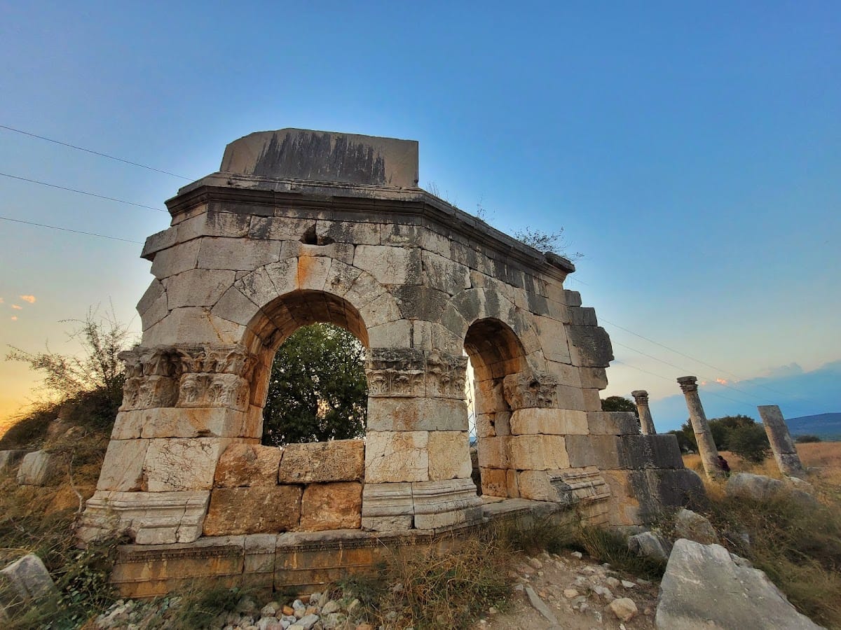
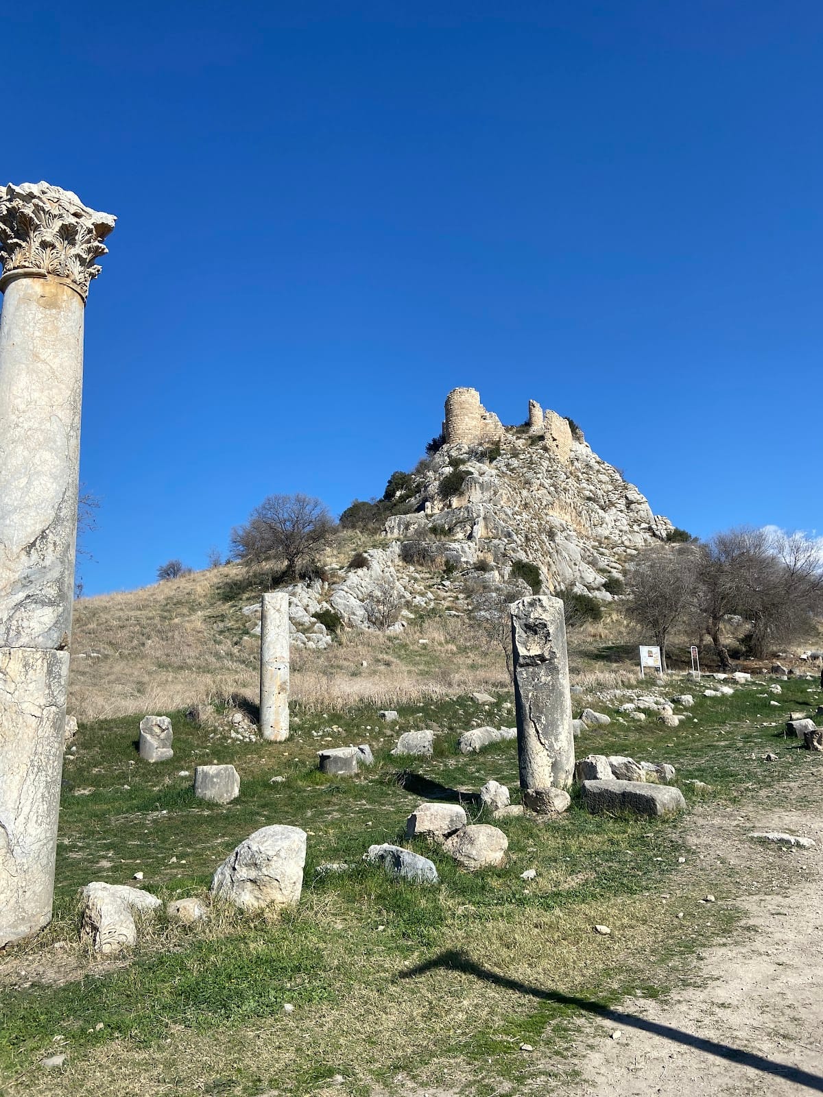
The ruins stand about three kilometres north of the Ceyhan River, at approximately 130 metres above sea level. The principal axis of the city was a west-east colonnaded street, a roadway bordered by columns that usually supported covered walkways. It extended for about 200 metres and measured approximately 11 metres wide. Parts of the street survive, including partly well-preserved Corinthian capitals, the carved column tops associated with the Corinthian architectural order.
Temple and theater area
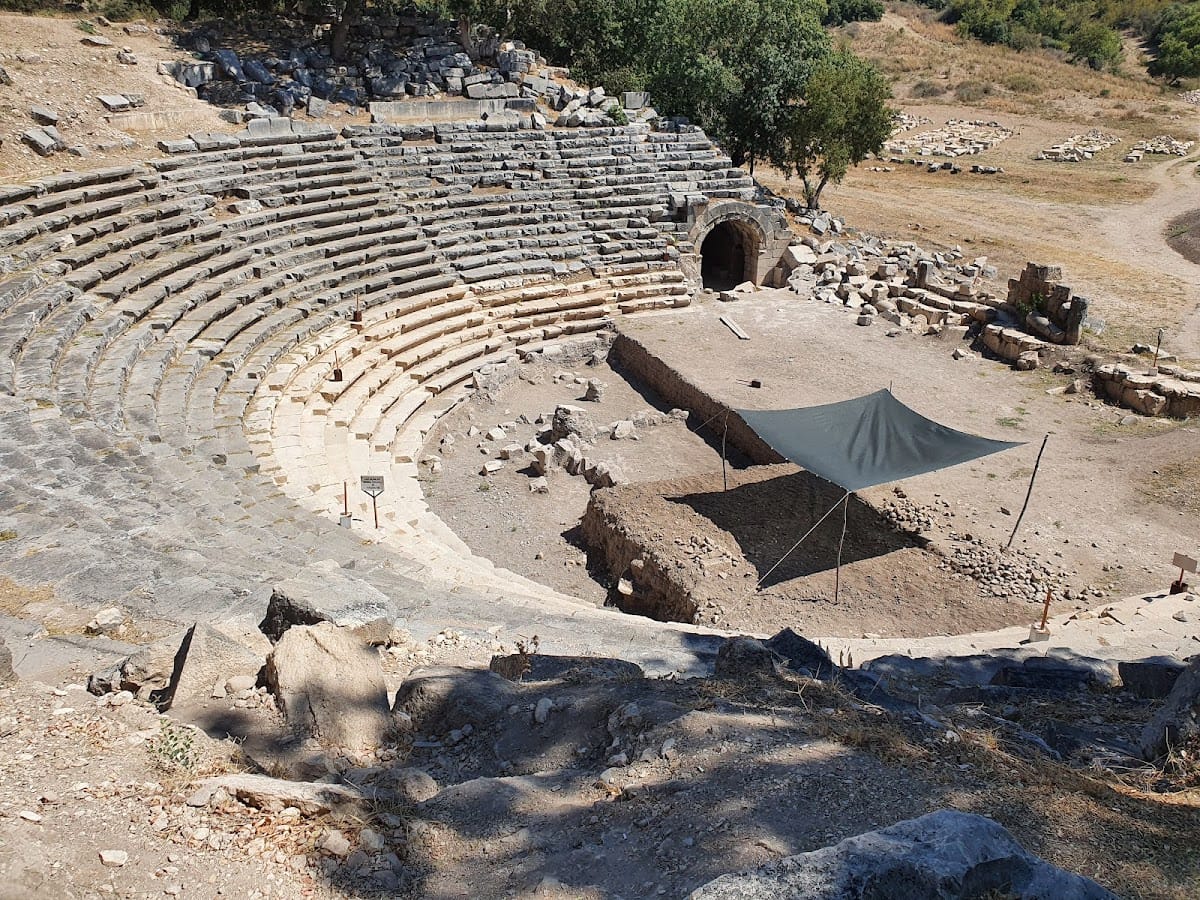
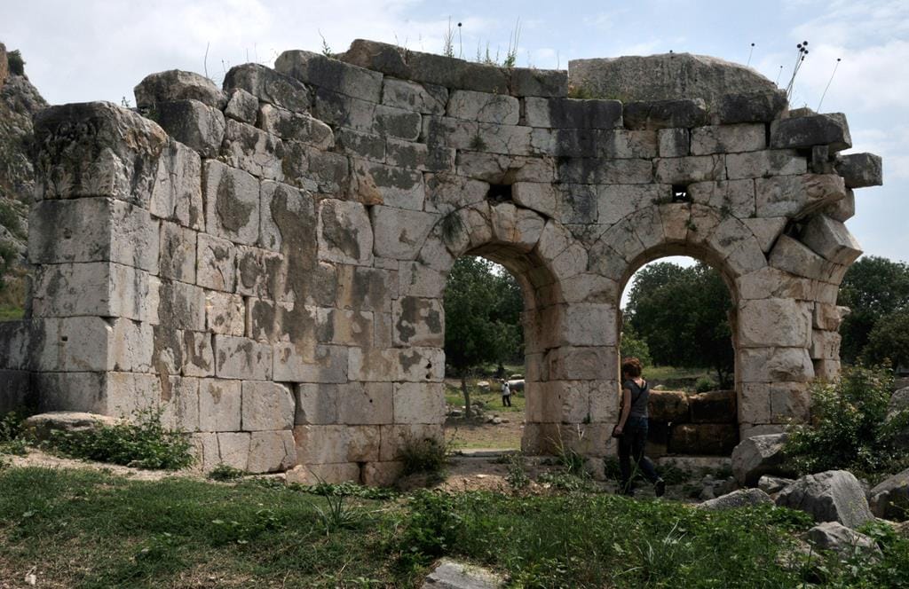
A church stood south of the principal colonnaded street. Farther east lay the temple of Artemis Perasia, probably the center of the city’s cult. East of the temple are the remains of approximately 15 rows of theater seating, preserving part of the entertainment and public architecture associated with this area of the ancient city.
Southern colonnaded street
A second colonnaded street extended parallel to the principal avenue farther south for approximately 300 metres. Remains of baths and another church occur along this street. Together with the exposed traces of shops, the theater, churches, and fortifications, the two avenues show the organization of Kastabala as an extended urban settlement.
Fortifications and the acropolis
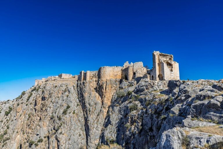
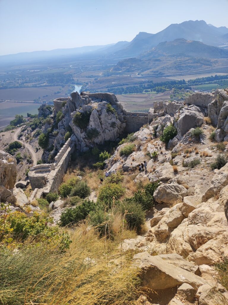
A trace of a city wall surrounds the settlement. The wall was built in the fourth century. North of the colonnaded streets, a rocky spur about 35 metres high probably formed the ancient acropolis, the elevated fortified or monumental center of the city.
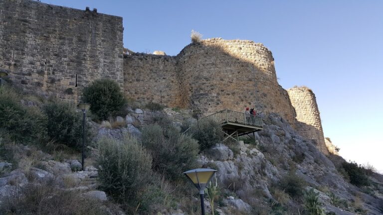
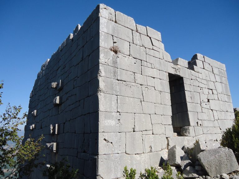
The spur is occupied by Bodrumkale, a medieval castle built during the period of the Armenian Kingdom of Cilicia, a medieval Armenian state that ruled parts of southeastern Anatolia and the eastern Mediterranean coast. Bodrumkale had six towers, and the lower part of its southern tower contains a cistern. The castle was later abandoned and was seized by the Ramazanids, a medieval Turkmen ruling dynasty in Cilicia and nearby regions, in the thirteenth century.
Churches and rock-cut tombs
North of the castle hill are additional churches and several rock-cut tombs. The northern and southern churches are early Byzantine structures of the type associated with the fifth century, adding a Christian architectural phase to the remains of the earlier city.