Knidos Ancient City: A Greek City-State and Maritime Centre in Turkey


Site at a Glance
- Rating
- 4.6
- Popularity
- Medium
- Country
- Turkey
- Primary era
- Classical
- External website
- Open
- Eras represented
- Classical
- Civilizations
- Ancient Greek, Byzantine, Roman
- Site type
- City
On this page28 sections
History
Knidos Ancient City in Turkey preserves the remains of an ancient Greek city-state on the Datça Peninsula of southwestern Asia Minor, near modern Datça. A Dorian Greek settlement, it developed especially at the western end of the peninsula from the fourth century BC, and the principal archaeological remains extend from that period to the 600s AD. Knidos was a maritime, commercial, religious, and intellectual centre whose history included membership in the Dorian Hexapolis, conflict with Persia and Athens, Roman administration, and an important early Christian community.
Origins and the Dorian city
The earliest finds at the site date to the Minoan period, but the historical city was a Dorian Greek polis, an autonomous city-state and its surrounding territory. Knidos belonged to the Dorian Hexapolis, a confederation of six Dorian communities in the southeastern Aegean that was later known as the Dorian Pentapolis. The confederation’s sanctuary of Apollo Triopios, probably in Knidian territory, hosted its assemblies and contests held every four years.
Ancient traditions connected the foundation of Knidos with colonists led by Triopas, a figure associated with the naming of Triopion. Herodotus linked the settlers with Lacedaemonian, or Spartan, colonists, while Strabo attributed the foundation to Megara. The precise circumstances therefore remain uncertain. During the Archaic period, the city probably occupied Burgaz near modern Datça before moving to Tekir at the western tip of the peninsula in the fourth century BC.
The date, initiator, and reason for the transfer are not known. One proposal associates it with Mausolus, the ruler of Caria, before the middle of the fourth century BC. Another places it after Alexander the Great’s victory at the Battle of the Granicus in 334 BC. Increased maritime trade has also been suggested as a factor. At Tekir, the city occupied both the mainland and the headland of Triopion, now called Cape Krio or Deveboynu Burnu.
Maritime power and Persian rule
Knidos prospered from its position on important sea routes. It traded with Egypt, participated in the Hellenion at Naukratis, and maintained a treasury at Delphi. The city minted silver coins from the sixth century BC. Its coinage initially followed the Milesian standard and later the Aeginetan standard, reflecting the monetary systems used in different phases of its commercial life.
Knidian activity also extended beyond the peninsula. Its colonization included Lipara, founded with Rhodian settlers around 580–576 BC, and a settlement on Melaina Korkyra, also called Corcyra Nigra, in the Adriatic.
When the Persian army threatened Knidos in the sixth century BC, the inhabitants attempted to cut through the peninsula at its narrowest point and turn their territory into an island. The undertaking failed. In 546 BC, Knidos surrendered to Harpagus, the general of Cyrus.
Athenian and Spartan conflicts
During the fifth century BC, Knidos belonged to the Athenian-led Delian League, an alliance formed under Athenian leadership after the Greek wars with Persia. The city appears in the league’s tribute lists for 452/451–427/426 BC and again for 425/424 BC.
Knidos rejected Athenian authority in 412 BC, during the Peloponnesian War between Athens and Sparta and their respective allies. The revolt followed the failed Athenian expedition to Sicily. An Athenian attempt to regain control of Knidos was unsuccessful.
In 394 BC, the Battle of Cnidus took place near the city. The combined Greek and Persian fleet commanded by Conon defeated the Spartan fleet under Peisander. The victory ended the period of Spartan dominance that had followed Sparta’s victory in the Peloponnesian War.
Government and Hellenistic prosperity
At some point during the Classical period, Knidos was governed by an oligarchy of sixty lifelong amnemones, officials selected from the aristocracy. Aristotle describes a popular overthrow of this government, or possibly two such upheavals, although their dates are uncertain. By 300 BC, Knidos was at least nominally democratic, as shown by coins depicting Democracy.
Around the transition from the fourth to the third century BC, Knidos joined an alliance that included Byzantion, Ephesus, Iasos, Cyzicus, Lampsacus, Rhodes, and Samos. Coins associated with this alliance bear the abbreviation “SYM.” During the Hellenistic period, the city flourished as a commercial centre, trading especially in olive oil and wine. From the second century BC it was also an important producer of ceramics, and it possessed a medical school.
Knidos supported Rome during the Roman–Syrian War against Antiochus III from 192 to 188 BC. Around 163 BC, it sent assistance to Calynda during that city’s revolt against Caunus. Under Roman rule, Knidos became part of the province of Asia. By the time of Pliny the Elder, and probably earlier, it held the status of a free city, including exemption from taxation.
Pirates operating in waters controlled by Mithridates later seized the city or its territory. Pompey suppressed them in 67 BC during the Third Mithridatic War, the Roman campaign that ended the wider conflict with Mithridates VI of Pontus.
Christianity, abandonment, and investigation
Knidos was an episcopal see from the fourth century AD, when the city formed part of the early Christian world of the eastern Roman Empire. Its bishops are documented at the Councils of Chalcedon in 451, Constantinople in 553, and Nicaea in 787.
The settlement was abandoned during the 600s AD in connection with Saracen activity. Repeated earthquakes may also have contributed to its depopulation. The later city had been shaped by centuries of Greek, Hellenistic, Roman, and Early Byzantine use, and many of its buildings were subsequently dismantled for their stone.
Knidos retained a strong intellectual and artistic reputation. Its associated figures included the mathematician and astronomer Eudoxus, the historian Ctesias, the architect Sostratus, the historian and geographer Agatharchides, and the physician Euryphon. Euryphon and his students were connected with the foundation of the city’s medical school. Knidos also had an important cult of Aphrodite. Pausanias described three temples dedicated to the goddess, including an older temple of Doritis, another of Akraia, and the youngest, dedicated to Knidia or Euploia, an aspect associated with seafarers.
The first Western investigation of the modern site was conducted by the Society of Dilettanti in 1812. Excavation began under Charles Thomas Newton for the British Museum in 1857–1859, continued under Iris Love from 1967 to 1977, and was later undertaken by Turkish archaeological teams from the late 1980s onward, including work under Ramazan Ozgan and Ertekin Mustafa Doksanaltı. Excavations and later investigations revealed Hellenistic, Roman, Byzantine, and late-antique remains, while finds from the site are now held in museums in İzmir and Bodrum.
Remains
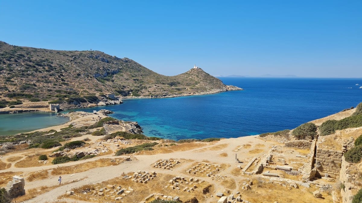
Knidos occupied the mainland and the former island or headland of Triopion, a feature approximately 550 metres long and about 140 metres wide on average. The headland is now connected to the mainland by a narrow sandy isthmus. In antiquity, a causeway and possibly a bridge linked the two sections, creating two harbours on opposite sides of the city. The smaller northern harbour served military shipping, while the larger southern harbour handled commercial vessels.
Harbours and city layout
Military harbour
The northern military harbour could accommodate approximately twenty triremes, the oared warships used in the ancient Mediterranean. Its narrow entrance lay between two high breakwaters and could probably be closed with a chain. Round control towers guarded the entrance, and the southern tower is reported to remain standing.
Commercial harbour
The larger southern harbour served commercial shipping. Its two longer breakwaters remain clearly visible, although the northern one can now be distinguished only partly beneath the water. The principal built-up area stood immediately northeast of the two harbours and the isthmus between them.
Walls and street grid
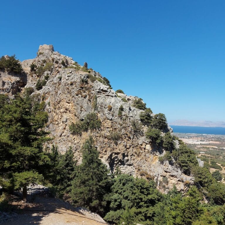
The acropolis occupied a hill northeast of the lower city. The city walls enclosed the acropolis and lower city, continued around Triopion, and can be traced around a circuit of approximately four kilometres. Substantial stretches, particularly around the acropolis, remain well preserved.
Knidos followed a Hippodamian grid plan across its mainland and island sections. Four principal streets ran east–west on the mainland, crossed at right angles by seven streets running north–south. The north–south streets incorporated slopes and stairways to accommodate the terrain. The agora lay north of the military harbour.
Sanctuaries and public buildings
Temple of Aphrodite Euploia
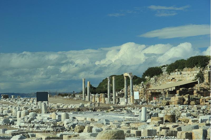
The Temple of Aphrodite Euploia stood on a slope in the northwestern part of the city. Built in the fourth century BC, it was an open monopteros, a circular temple surrounded by a single ring of columns. Eighteen columns stood in the Doric order, while Corinthian elements were used either in an interior colonnade or in a later alteration. Limestone, sandstone, and marble formed the building.
The temple was built for the famous Aphrodite of Knidos by Praxiteles, a leading Greek sculptor of the fourth century BC. The marble statue showed the goddess nude and stood in a chamber with doors at both the front and rear, allowing it to be viewed from either direction. An altar stood east of the temple beside the stairs leading to its platform. The temple was repaired at an uncertain point, and its ruins were identified in 1969.
The statue remained in the temple until it was taken to Constantinople, where it was destroyed in a fire. Only its base is reported to remain at Knidos, while later copies survive elsewhere.
Temples of Apollo
The Temple of Apollo Karneios stood lower on the slope south of the Aphrodite temple. It was a Doric building measuring approximately 19 by 11 metres. At least part of the structure dates to the second century BC, while its propylon, an entrance structure, dates to around 300 BC. The temple may have been connected with ceremonies of the Dorian Hexapolis contests.
Another Doric temple stood on a terrace west of the road leading to the Apollo sanctuary. It is also associated primarily with Apollo Karneios, although its precise cult and date remain uncertain. Called the “Pink Temple” because it was built from grey-pink limestone, it stood on a rectangular podium of limestone blocks. Its peripteral plan, meaning that it was surrounded by a colonnade, had six columns across the front and thirteen along the sides. The stylobate measured approximately 23 by 13.5 metres. Fragments of architrave and triglyphs with metopes identify its Doric order, while an Early Roman Imperial-period inscription mentions a statue dedicated to Apollo Karneios. An Early Byzantine church was later built over the temple, probably reusing its materials.
Temple of Dionysus and Corinthian temple
The Temple of Dionysus stood north of the isthmus between the harbours. It was an Ionic building, probably surrounded by a colonnade, and was identified through fragments of friezes showing episodes from the life of Dionysus. Its stones were reused in an Early Byzantine church whose ruins now occupy the temple site.
North of the Dionysus temple stood a small Corinthian temple built during the Roman period under Hadrian. It had four columns on its principal front and columns confined to that front. Other sanctuaries included temples of Aphrodite Akraia and Aphrodite Doritis. Inscriptions also attest a cult of the Dioscuri and probably a sanctuary dedicated to them.
Doric stoa
A long Doric stoa, or colonnaded hall, stood between the Temple of Dionysus and the Corinthian temple. Built in two phases, it had an earlier phase dating to the fourth century BC. The building was approximately 132 metres long and 13 metres wide. A row of small rooms, each about 5 by 3.8 metres, opened southward onto a public area.
Theatres and council house
Knidos possessed two Greek theatres. The smaller and better-preserved theatre stood east of the Temple of Dionysus near the northern shore of the commercial harbour. Originally built during the Hellenistic period, it was repaired, altered, and enlarged under Roman rule. A stage building was added, and the auditorium held approximately 5,000 people.
The larger theatre occupied the southwestern slope of the acropolis and could accommodate approximately 20,000 spectators. Little survives because stone and marble were removed and transported by ship for reuse during the nineteenth century.
A covered building in the southeastern part of the city was once identified as an odeum but is now interpreted as a bouleuterion, a council house used for meetings of the city council. Hellenistic and Roman houses have also been identified. Some retain wall paintings and stucco decoration imitating Doric, Ionic, and Corinthian forms.
Streets, shops, and changing urban use
Liman Street
Along Liman Street, which begins at the small military harbour, approximately 75 metres of the roadway were exposed between 2000 and 2006. Seven rooms stood in a row along its eastern side. The street bounded them on the west, the western end of the stoa on the south, and a second terrace on the east. The rooms opened onto the street and rose northward in stepped levels, with each floor approximately 0.50 metres higher than the room to its south.
The seven rooms were probably shops laid out within the fourth-century BC grid plan. Their functions and arrangements later changed during the Roman Imperial and Late Antique periods. Street-facing walls used large, squared, rusticated limestone blocks in regular courses of uniform height. The rear and side walls were built with mortar and plaster.
Room 4
Room 4 measured approximately 5.25 metres from north to south and 5.51 metres from east to west. Its nearly square plan differed from the other rectangular rooms. An inset, pi-shaped niche and podium occupied its eastern side, measuring approximately 3.50 by 2.40 metres. The room probably began as a modest shop or simple workshop in the Late Classical or Early Hellenistic period.
During the Roman Imperial period, Room 4 became a monumental heroon, a shrine or commemorative monument associated with an honoured individual. Its Corinthian façade included marble architrave, frieze, consoles, geison-sima blocks, column bases, and Corinthian capitals. Two corner pilasters and two central columns formed the front, which stylistic evidence places in the Severan period, the Roman dynasty that ruled from AD 193 to 235. Two monolithic columns were found fallen east–west near the entrance.
In Late Antiquity, the room was converted again into a shop or workshop. The spaces between the pilasters and columns were walled up, incorporating much of the earlier façade into the new exterior wall. A new doorway approximately 1.60 metres wide was provided with a monolithic bluish-grey marble threshold.
A fresh-water conduit made from terracotta pipes ran southward outside Room 4 and the adjoining rooms. It lay in a lime-mortar channel raised approximately 0.22–0.45 metres above the street surface. Much of the heroon’s marble wall revetment, floor slabs, exedra bench, and probable sarcophagus podium were dismantled or survive only in small fragments. An in-situ block with a lion’s-paw relief remains in the northern wall.
Room 5
Room 5 preserves part of its original Late Classical–Hellenistic construction, including the lower two courses of its western wall. Its doorway was approximately 1.30 metres wide and 0.90 metres deep. The four-part limestone threshold retains wear caused by the movement of the door leaves, while the room’s basic rectangular plan remained unchanged.
Churches and harbour chapel
Early Byzantine basilicas
Five Early Byzantine basilicas, generally dated to the fourth or fifth centuries AD, have been identified at Knidos. Church C was built over the Temple of Dionysus and retains a geometric mosaic floor. The building known as the Cleopatra Basilica also preserves floor mosaics. These churches belong to the period when Knidos was an episcopal centre of the early Christian eastern Roman world.
Church F
A small chapel known as Church F was built on the filled area of the military harbour’s breakwater. Oriented east–west, it measures approximately 10.30 by 5.88 metres. Its single nave was divided into a naos, the main worship space, a bema, the area before the sanctuary, and an apse, the curved sanctuary end.
The walls combine reused squared limestone blocks with unworked stones set in mortar. Entrances stood centrally in the west and north walls. The western threshold survives in two pieces measuring approximately 1.27 by 0.58 metres, with a step 0.47 metres high leading down to the floor. Rectangular travertine slabs paved the floor, most of which are now broken.
Necropolis and finds
Burial landscape
The necropolis extended eastward from the city walls for as much as ten kilometres. It contains sarcophagi, rock-cut graves, and several types of funerary buildings. One enclosed sacred precinct, or temenos, measured approximately 37 metres on each side and contained two or three small tomb structures.
Demeter and the Lion Monument
Knidos has yielded inscriptions written in the Doric Greek dialect and objects from its successive periods. Among the excavated finds is a seated marble cult statue of Demeter, dated to approximately 350–330 BC and now in the British Museum. The statue was discovered within a temple enclosure during Newton’s excavations.
Newton also found the remains of a monumental tomb approximately three miles southeast of the city, together with a colossal lion carved from a single block of Pentelic marble. The lion measures approximately ten feet in length and six feet in height. It has been interpreted as a possible memorial of the Battle of Cnidus and is now displayed in the British Museum.
Triopion sanctuary and wider remains
The sanctuary of Apollo Triopios, or Triopion, lay outside the city to the east and served as the meeting place of the Dorian Hexapolis. A sanctuary identified approximately fifteen kilometres east of modern Burgaz contains a small Hellenistic temple and traces of an earlier, larger temple.
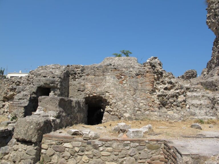
Strabo also recorded an observatory belonging to Eudoxus, from which the star Canopus was observed. The observatory and the building associated with the medical school have not been located. Despite extensive stone robbing and the reuse of building material, Knidos still preserves visible city walls, harbour installations, theatres, temples, churches, terraces, streets, tombs, and mosaic floors.