Zincirli Höyük: The Ancient City and Citadel of Sam’al
Site at a Glance
- Popularity
- Medium
- Country
- Turkey
- Primary era
- Iron Age
- Eras represented
- Bronze Age, Iron Age
- Civilizations
- Assyrian
- Site type
- City
On this page21 sections
History
Zincirli Höyük is the archaeological site of the ancient city of Sam’al, at Zincirli in Gaziantep Province, Türkiye. Its Iron Age town took shape around 900 BC and became the capital of an Aramean kingdom that endured until Assyrian annexation in 717 BC.
Bronze Age settlement
People lived at the site by at least the Early Bronze Age, and it flourished between 3000 and 2000 BC. Occupation during Early Bronze Age III and IV, around 2700–2100 BC, is also known. The settlement later came under Yamhad, a kingdom centered on Aleppo, early in the second millennium BC, and subsequently fell under Hittite power. The Hittites ruled an Anatolian empire that extended into northern Syria.
Monumental construction took place during Middle Bronze Age II, a regional archaeological period whose dating varies by region. A major complex dates to about 1800–1700 BC. By around 1700–1650 BC, Zincirli was a trading hub for wine carried in rounded flasks, within an exchange network centered on nearby Mamma, an ancient Syrian region. Complex DD was destroyed in the mid-to-late seventeenth century BC. A possible cause is a campaign by the Hittite king Hattusili I, but the destruction is more securely dated by radiocarbon to around 1632–1610 BC. The settlement continued after this destruction.
Sam’al and the Aramean kingdom
The Iron Age II town, another regional archaeological period, was established around 900 BC. This was a time when Aramean kingdoms, ruled by a Northwest Semitic-speaking people, emerged across Syria and Mesopotamia. In the area around Sam’al, Aramean rule followed a political order associated with Luwian speakers, who spoke an ancient Anatolian language. Gabbar is identified as the founder of the Aramean dynasty at Sam’al. Another reconstruction instead identifies Hayyanu as founder of the kingdom and Ahabbu of Siri’laya as his successor by 854 BC.
Sam’al grew from a city-state into a regional kingdom, reaching an intermediate level of power late in the tenth century BC. It gained territory from Carchemish and in Quwê, the Iron Age polity around Adana in Cilicia, while remaining independent of Cilicia. The regional crisis at the end of the twelfth century BC did not prevent the city from achieving political autonomy and economic prosperity. Changing economic conditions and rich local iron deposits were associated with the growth of inland cities in northern Syria, including Sam’al.
The kingdom flourished from the early tenth century BC until Assyria annexed it. Eleven Aramean kings are associated with the city-state. Its local name is given as Yādiya or Ya’diya; Sam’al is the Assyrian form, while Ya’udi or Yaudi appears as the Aramaic form. One reconstruction treats Ya’udi and Sam’al as separate royal houses, but their relationship remains uncertain.
Royal inscriptions provide important evidence for the kingdom’s rulers. Kilamuwa, identified as the dynasty’s fifth king, left a monumental inscription, and four later kings also left inscriptions. Texts associated with Panamuwa I and other rulers include inscriptions dating to around 730 BC. Their language is called Samalian or Ya’udic, and its classification as a form of Old Aramaic is debated.
Assyrian campaigns and rule
In 859 BC, the Assyrian king Shalmaneser III campaigned west to Lutibu in Sam’al and fought a coalition that included Hayyanu and Suppiluliuma of Patina, also known as Sapalulme. A further battle near the fortified city of Alimus involved Sam’al, Patina, Bit-Adini, Carchemish, and other allies. Shalmaneser defeated the coalition, and Hayyanu later paid tribute at Dabigu alongside other rulers. In 853 BC, Hayyanu did not join the Battle of Qarqar and instead paid tribute to Shalmaneser. Assyria did not then extend its expansion into the western regions.
An Assyrian campaign in 825 BC took important Sam’alian territories. Assyria defeated Quwê and reorganized it as Denyen. The political status of Ya’udi is uncertain: Shalmaneser’s annals describe it as an Assyrian satellite, while Azitawadda of Denyen later called it his satellite. Kilamuwa’s inscription, meanwhile, says that he sought Assyrian support against Denyen. After Shalmaneser’s death, Sam’al regained independence. One reconstruction proposes that it then annexed Ya’udi and took over Kilamuwa’s palace.
Sam’al’s friendly relationship with Assyria probably began under Shalmaneser III and continued into the early reign of Šamši-Adad V (824–811 BC). Access to Assyrian imperial trade was associated with prosperity and major building work. The kingdom reached its greatest development in the mid-eighth century BC under Bar-Rakib, who acknowledged Assyrian protection under Tiglath-Pileser III. Damascus, Hama, and Carchemish were violently destroyed as they fell to Assyria between 732 and 717 BC, but Sam’al avoided that fate. Bar-Rakib enlarged and rebuilt the city.
Assyria occupied Sam’al in 717 BC under Sargon II. By the seventh century BC, the city was a directly ruled Assyrian province. In 671 BC, after his victory in Egypt over the pharaoh Taharqa, the Assyrian king Esarhaddon entered Sam’al.
Excavation and changing interpretations
Osman Hamdi Bey visited the site in 1882, and German travelers photographed it the following year, when carved stone slabs were still visible at the surface. Expeditions led by Felix von Luschan and Robert Koldewey excavated there in 1888, 1890, 1891, 1894, and 1902.
A long-term project begun in 2006 by the University of Chicago’s Oriental Institute and the University of Tübingen’s Institute for Ancient Near Eastern Studies continued through 2017, with eleven excavation seasons directed by David Schloen and Virginia Herrmann. Work recovered the Kuttamuwa stele in 2008 and revised the interpretation of Hilani I. Excavations in 2021 identified Late Bronze Age occupation under Hittite power, within the broad period of about 1600–1180 BC. Occupation during Hittite and Mitanni times, when Mitanni was a kingdom of northern Mesopotamia and neighboring regions, had previously been thought to have ended.
Remains
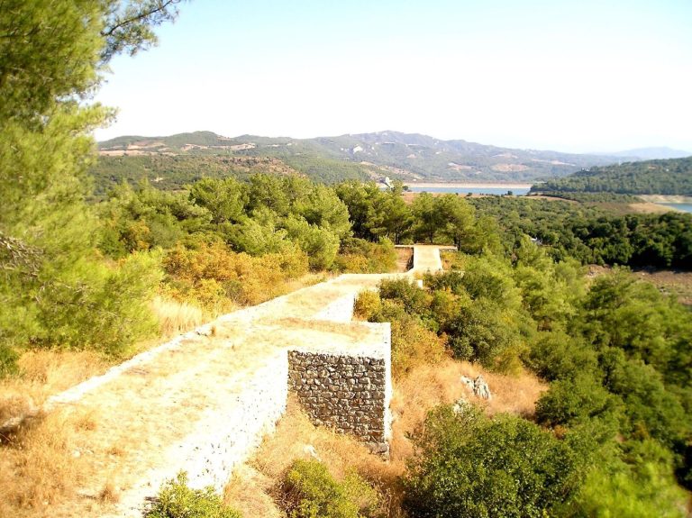
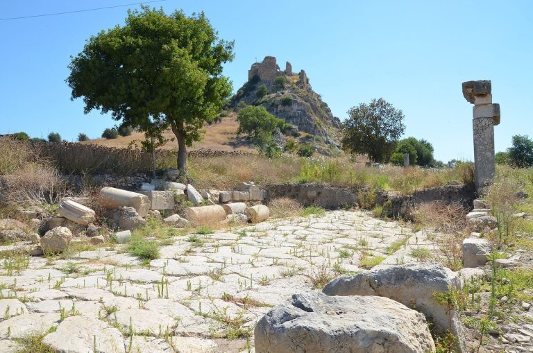
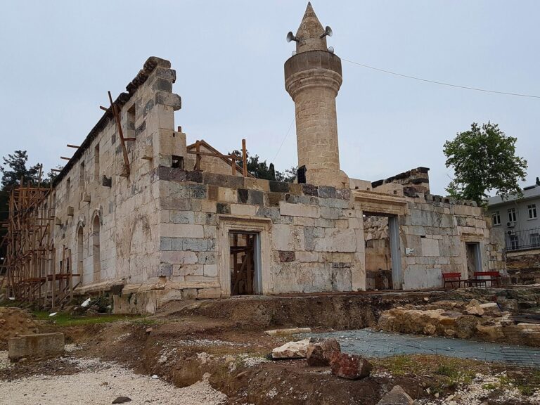
The site covers about 40 hectares at the northern end of the Kara Su valley, west of the valley floor and at the foot of the Amanus Mountains in the Anti-Taurus region. It lay on an overland route linking Carchemish with the fertile Cilician plain and, farther west, Anatolia; the settlement also commanded the course of the Karasu. The lower town developed around a citadel raised above the surrounding plain. Its surviving remains include a large defensive circuit, gates, and citadel buildings from several periods.
Settlement and fortifications
City wall
A nearly circular double wall enclosed the residential area. The circuit is described as about 720–800 metres in diameter and around 2.5 kilometres long. Its air-dried mud-brick walls were each more than three metres thick and stood seven metres apart. About 100 towers or projecting defenses reinforced the circuit, which had gates on the south, northeast, and west sides.
Southern gate
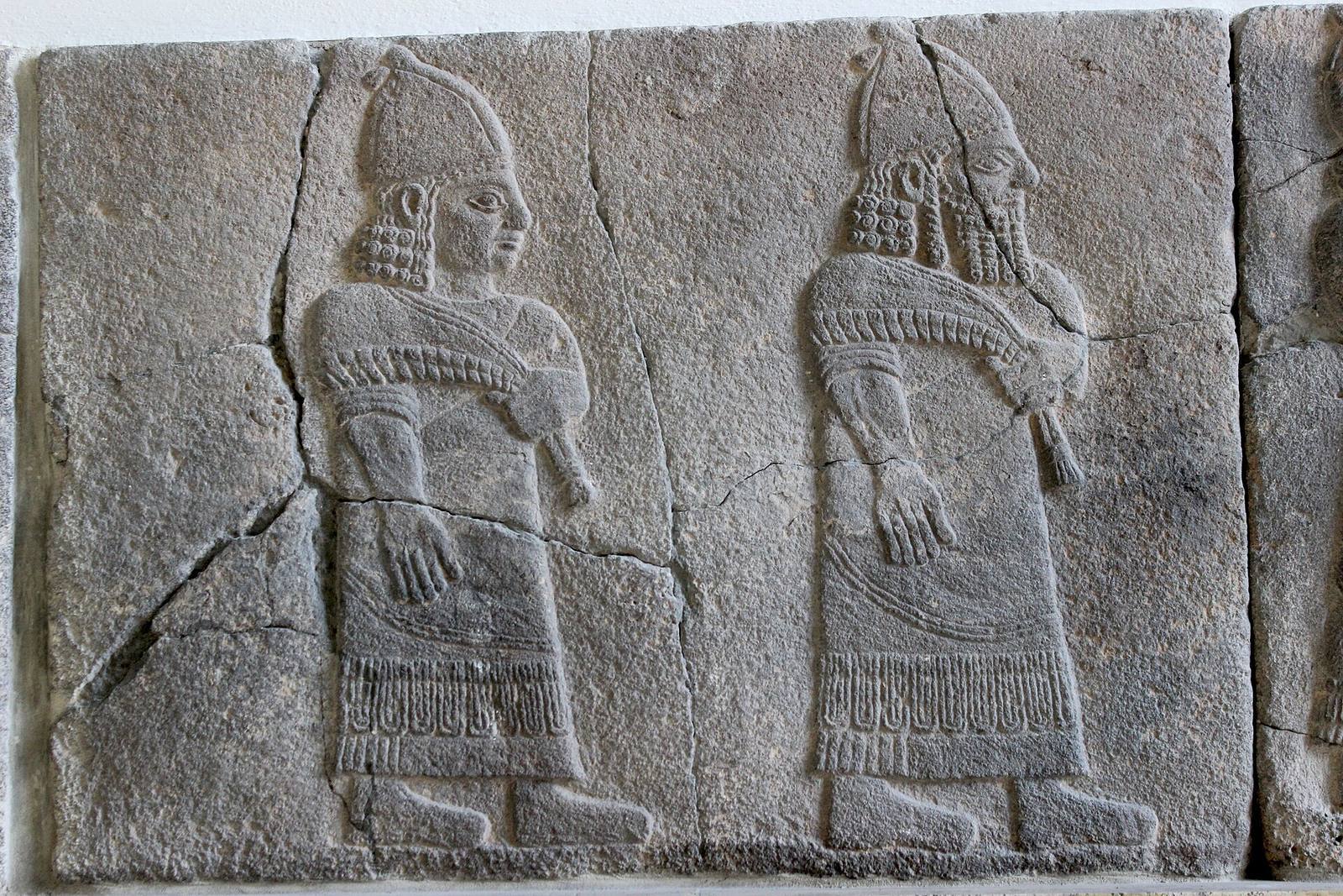
The principal entrance projected beyond the city wall and used paired projecting sections to narrow the passage. Human-height basalt slabs carved with scenes lined its outer face. Their imagery includes a chariot and fallen man, an offering bearer with a young goat, armed war and storm deities, and the goddess Kuhaba holding a mirror. Other scenes show dignitaries, a banquet, a stag hunt, musicians, soldiers, grazing rams, a tree of life, winged griffins, and sphinxes, mythical figures with human heads and lion bodies. Two lions and threatening lion-headed figures marked the outer passage; carvings within the inner passage show soldiers, hunters, bulls, animals, and protective deities.
The gate carvings are examples of ninth-century BC local Syro-Hittite art, a northern Syrian and southeastern Anatolian tradition drawing on Syrian and Hittite culture. Each scene occupies its own slab. Later inscribed monuments used Assyrian forms and imagery rather than this earlier sculptural tradition.
Citadel defenses
The citadel occupied the highest part of the mound. A walled citadel of Middle Bronze Age date, about 2000–1600 BC, stood on this upper ground. The Iron Age enclosure was heavily fortified and teardrop-shaped, with an outer citadel gate. By the early ninth century BC, defensive works enclosed about three-quarters of the citadel circuit and included outer supports. The southern quarter had a double wall and a gate with a narrowed, paired approach.
Palaces and temples
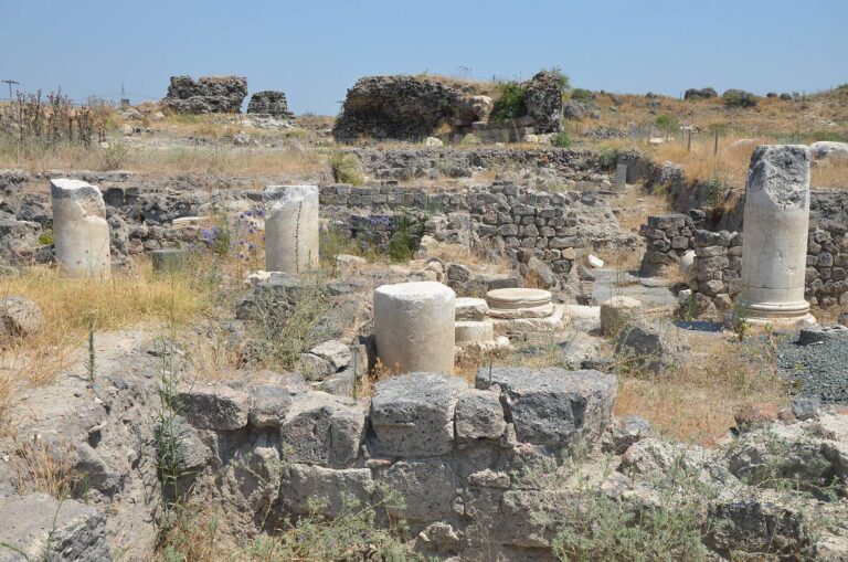
The citadel held temples, palaces, storehouses, and later Assyrian buildings. Several palaces followed the Bit-hilani form, a plan with a columned entrance and a crosswise main room.
Hilani I and the eastern citadel complex
Once classified as an Iron Age palace, Hilani I is now identified as a large Middle Bronze Age II temple with a wide main hall, dated about 1800–1650 BC. Radiocarbon dating places its destruction around 1632–1610 BC. The area was later cleared for Palace G, leaving Hilani I’s stone foundations. Nearby, Area 2 on the eastern citadel contained another destroyed Middle Bronze Age II building at a similar level. A separate monumental complex dates to about 1800–1700 BC.
Hilani J and Hilani K
Hilani J stood at the entrance to a citadel palace. A nearly three-metre statue of a seated deity stood there with the ninth-century BC Kilamuwa royal monument, found in 1902 and dated about 840–810 BC. Two lions supported by a kneeling hero decorated the statue’s base. The monument’s inscription is in Phoenician, using an older Aramaic form of the Phoenician alphabet. Hilani K was built later beside Hilani J. It was larger and had a staircase and an entrance porch supported by three columns.
Hilani IV
Under Bar-Rakib, builders created a broad entrance-porch area with three Hilani buildings. The smallest, Hilani IV, stood to the north. Its porch had a single column resting on a base carved as a freestanding sphinx. Nearby slabs show Bar-Rakib seated before a scribe holding a writing tablet, attended by a fan-bearer. Other carvings depict him at a served table with musicians and dignitaries. The scenes are finely detailed and shallowly carved.
Hilani III and Portico P
Hilani III stood west of the large porch area. One deeply carved sphinx slab survives from its southern face, beyond the line of Portico P. The southern part of Portico P had a carved monument showing two officials and a lion. These works use more projecting forms than the shallow, detailed carving at Hilani IV; the sphinxes in the porch area were carved as freestanding figures.
Palace D
Palace D, also called the upper palace, combined a Syrian Hilani plan with a central courtyard. A storage area ran along the eastern side of the fortifications.
Palace G
Palace G was built in the seventh century BC as a residence for an Assyrian governor, after the earlier building area had been cleared. The citadel also contained other palaces and storehouses from the Assyrian period.
Stone monuments and excavated objects
Excavations recovered numerous carved upright stones and inscriptions in Aramaic, Phoenician, and Akkadian. These finds, together with sculptures from the gates and palaces, preserve evidence of the settlement’s changing artistic and political traditions.
Sam’al lions and buried sculptures
Five basalt lion statues were found in a pit at the foundations of inner citadel Gate E, as deep as 4.2 metres. Their styles have been dated to the late tenth century BC and about 700 BC. The pit may date to the Middle Bronze Age. The lions may originally have stood on gate pillars, and their burial together has been interpreted as a ritual act. Sphinx statues were also found buried between the citadel gates.
Kuttamuwa’s funerary monument
Found in 2008, the basalt funerary stele, an upright stone memorial, of Kuttamuwa dates to about 740 BC. It is approximately 91 centimetres high and 61 centimetres wide, and weighs about 363 kilograms. Its inscription asks Kuttamuwa’s relatives to mark his life and death with feasts “for my soul that is in this stele.” The wording presents the soul as distinct from the body.
Other finds and collections
A small gold scepter found at the site in 1943 bears an inscription in a Phoenician-like alphabet. A victory monument of Esarhaddon was set at the southern gate to commemorate his victory over Taharqa. A small number of ivory objects were found between Hilani J and Hilani K. Excavated objects from Zincirli are held in the Vorderasiatisches Museum in Berlin and the Istanbul Archaeology Museum; the Louvre holds a carved upright slab and two sculpted sphinx fronts, while smaller sculptures are in museums in Adana and Gaziantep.