Burg Rieshofen: A Medieval Water Castle in Germany


Site at a Glance
- Rating
- 4.6
- Popularity
- Very Low
- Country
- Germany
- Primary era
- Medieval
- Eras represented
- Medieval
- Civilizations
- Holy Roman Empire
- Site type
- Military
- Remains
- Castle
On this page7 sections
History
Burg Rieshofen is a high-medieval lowland water castle in Germany, at the southern edge of Rieshofen in the municipality of Walting, Bavaria. It was probably established around 1290 as the seat of the Lords of Rieshofen, a ministerial family serving the prince-bishopric of Eichstätt, and was held as a fief of the bishopric. A ministerial was a member of the lower service nobility who carried out administrative or military duties for a territorial or ecclesiastical ruler, so the castle served as both a residence and an administrative base.
Foundation and Episcopal Administration
The Lords of Rieshofen are first recorded in 1337, when Pertholt de Rodeshouven was mentioned. Excavations east of the surviving castle have revealed remains of an older predecessor complex, and the original residence may have stood near the branch church of St. Erhard. In 1310, financial difficulties led Elsbeth von Rieshofen, the family’s widow, to sell the fief to the Eichstätt cathedral chapter even though her two sons were still alive. The family continued to live in Rieshofen and is recorded there as late as 1346.
After the transfer, the cathedral chapter appointed administrators to manage the castle. The knight Ulrich von Morsbach held this position in 1346, while Burkhard Reichtershofer was administrator in 1406 and 1407. The associated manorial farm was managed directly by the cathedral chapter and leased to the Kalteis family, which remained connected with the property into the sixteenth century. Ursula Kalteis was recorded at Rieshofen in 1544, and the castle farm was probably combined with the village’s second manorial farm around 1480. The cathedral chapter was the governing body of the cathedral clergy and administered ecclesiastical property, including this fief and its farm.
Decline and Later Interpretation
The castle gradually lost its practical purpose. Its bridge was last repaired around 1484, and by 1561 the site was described as a castle site, indicating that it had become a ruin. By 1602, the former ministerial residence had disappeared apart from sections of wall and the keep.
The surviving tower acquired the name Hunger Tower from an alleged execution in 1689. Joseph, a Jewish man from Töging, was reportedly convicted by the Eichstätt capital court of receiving stolen silver measuring instruments and sentenced to death. A capital court had jurisdiction over offenses punishable by death. According to the tradition, he was thrown into the tower and left there to starve. A commemorative plaque installed in 1861 incorrectly described the tower as Roman, and nineteenth-century literature likewise misidentified it as a Roman building.
Security work and excavations in 1985 and 1986 exposed, conserved, and partly rebuilt foundations and sections of the enclosure wall. The moat was restored and deepened, and a wooden bridge was reconstructed at the former crossing. Burg Rieshofen is protected in Bavaria both as an architectural monument and as an archaeological monument classified as a medieval water-castle site.
Remains
Castle Layout
The ruined castle lies immediately south of the branch church of St. Erhard. Its rectangular outer area measures approximately 26 by 32 metres, enclosing an inner castle of about 12 by 14 metres. A water-filled moat supplied by the Altmühl surrounded the inner enclosure. The simple fortified area had no additional towers. A small residential hall stood west of the keep as a free-standing building near the centre of the enclosure. Its foundations and those of the enclosing wall were exposed during the 1985–1986 excavations, then conserved and partly rebuilt.
The Keep
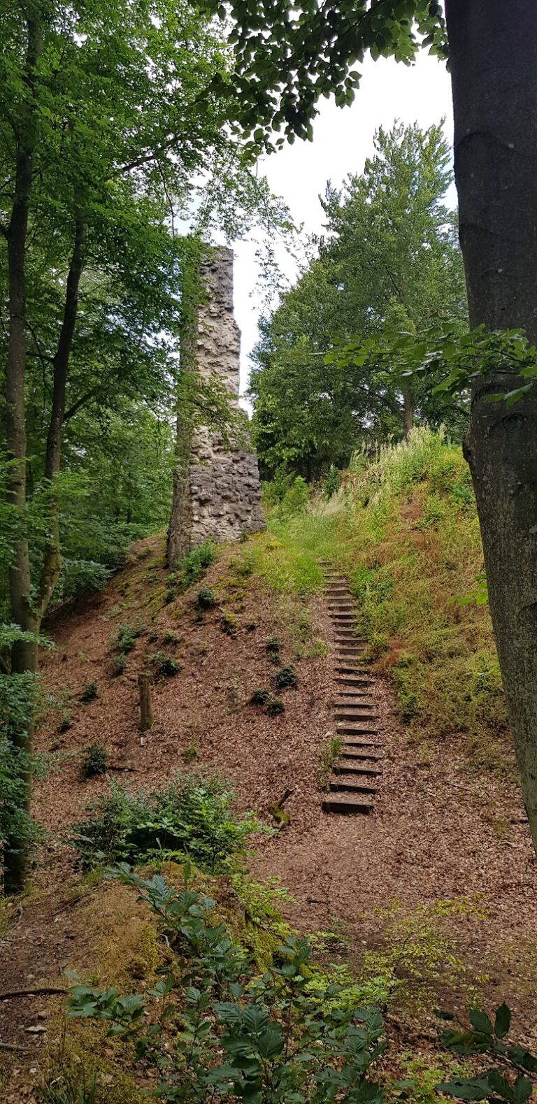
The keep occupies the southeastern part of the castle. It is approximately 18 metres high, square in plan, and has sides measuring about seven metres. Three storeys of rubble masonry rise above a base made from limestone ashlar blocks. Wooden floors originally divided the interior levels, while narrow slit windows admitted limited daylight. The basement functioned as a dungeon and has walls 1.60 metres thick. The residential floor was reached through a high entrance on the west side, a position that made direct access more difficult. The original upper termination of the tower has been broken away, and a breach at its foot has provided access for a long time.
A small staircase led from the residential floor to the defensive upper floor. This highest level is covered by a barrel vault, suggesting that the tower was probably not originally much higher. Since 1985, the keep has been capped by a low pyramidal roof. Above ground, the keep and sections of wall survive, while the exposed foundations preserve the outlines of parts of the former enclosure and residential hall.
Moat and Bridge
The moat formed the castle’s surrounding water barrier and was supplied by the Altmühl. During the 1985–1986 conservation works it was deepened again, and a wooden bridge was erected at the position of the former crossing. The surviving moat, bridge, conserved foundations, and wall fragments together show the compact arrangement of the medieval water castle.
An oak standing beside the keep is protected as one of the natural monuments of the Eichstätt district.
Nearby sites