Burg Stotel: A Medieval Lowland Castle Ruin in Germany
Site at a Glance
- Rating
- 4.5
- Popularity
- Very Low
- Country
- Germany
- Primary era
- Medieval
- Eras represented
- Medieval
- Civilizations
- Holy Roman Empire
- Site type
- Military
- Remains
- Castle
On this page7 sections
History
Burg Stotel is a medieval lowland castle ruin in Germany near Stotel in Lower Saxony, associated with the Counts of Stotel and the expansion of Bremen’s territorial influence. The castle stood on flat, marshy ground and developed through building phases represented by timber dating from around 1150–1160 and, predominantly, from around 1225–1245.
Construction and the Counts of Stotel
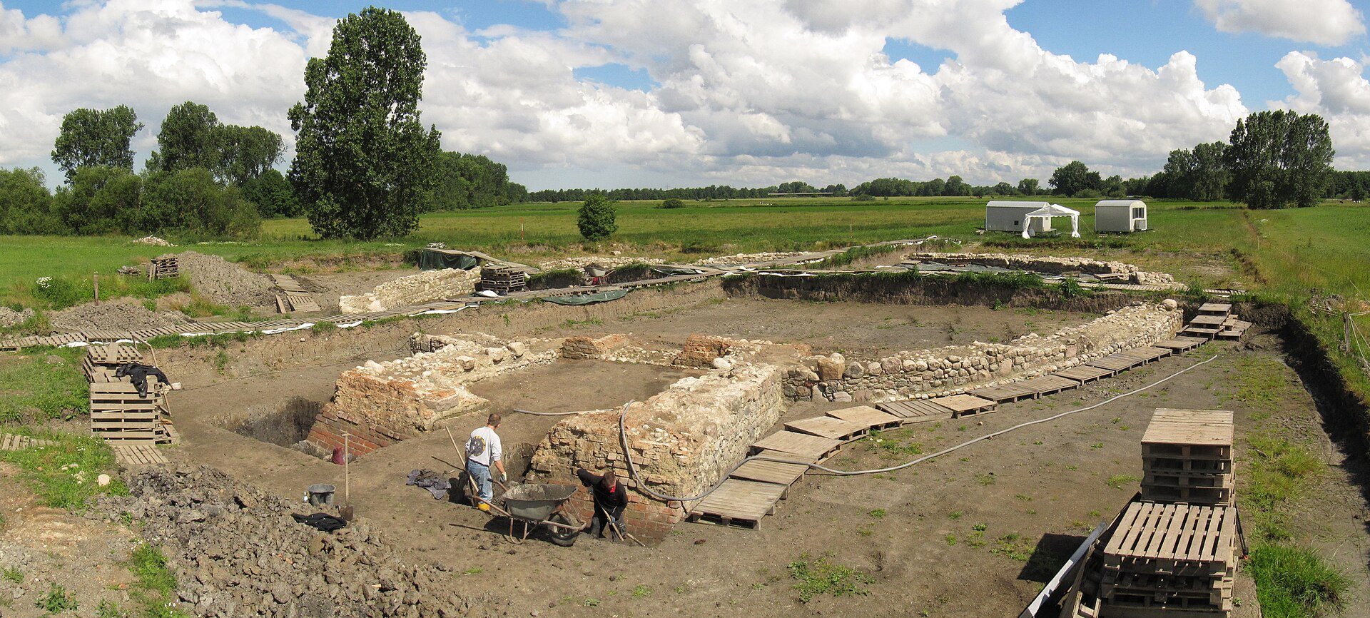
Cable-laying work exposed a boulder-built wall in 2006, bringing the castle site to attention. Archaeological excavation in 2013 revealed a nearly circular enclosure, and further work in February 2014 uncovered the foundations of a gatehouse on its southern side.
Dendrochronological dating, which estimates when construction timbers were felled by examining their annual growth rings, placed the oldest timber around 1150–1160. Most of the thirteen dated timbers belonged to the period around 1225–1245. At least this later expansion phase can be connected with Count Gerbert of Stotel, who held office from 1229 to 1267 and was first recorded in 1235 as comes de Stoltelbrocke, later appearing as de Stoltenbroke.
The name de Stoltenbroke is interpreted as meaning “the proud castle in the marsh.” This suggests that the castle may have been newly built or rebuilt under that name in 1235, although the earlier dated timber indicates activity at the site around 1150–1160.
Succession and Bremen’s control
Count Rudolf of Stotel died without a male heir in 1350. Moritz of Oldenburg, a cathedral dean, took the castle as an escheated fief, meaning a lordship that reverted to its superior lord when its holder died without an eligible heir. Moritz had been an unsuccessful candidate against Gottfried of Arnsberg for the office of Bremen archbishop.
Rudolf’s widow falsely claimed to be pregnant and sought compensation from the Archbishopric of Bremen, an ecclesiastical principality ruled by an archbishop. To meet her claim, the cathedral chapter, the body of clergy assisting in the governance of the cathedral and its territory, pawned half of Burg Stotel to the city of Bremen.
In 1365, the cathedral dean, the chapter, and Bremen’s council appointed a joint official to administer the castle. This was Bremen’s first attempt to extend its control beyond its immediate surroundings. Bremen later acquired control of Langwedel Castle in 1376, followed ten years afterward by control of Stadland and Butjadingen.
In 2018, the surviving foundations were permanently secured, supplemented, partly reconstructed, and opened to the public.
Remains
Marsh setting and enclosure
Burg Stotel lies about 170 metres northeast of Stotel village church, in marsh pasture on the southern part of a former loop of the Lune known as the Alte Lune. The site occupies the field parcel called Großer Hamm at about 1 metre above sea level. The former river loop connects with the Lune, a tributary of the Weser, while the lower Stoteler Randgraben crosses the northern part of the loop before joining the river. The artificially straightened Lune passes about 400 metres northeast of the ruin.
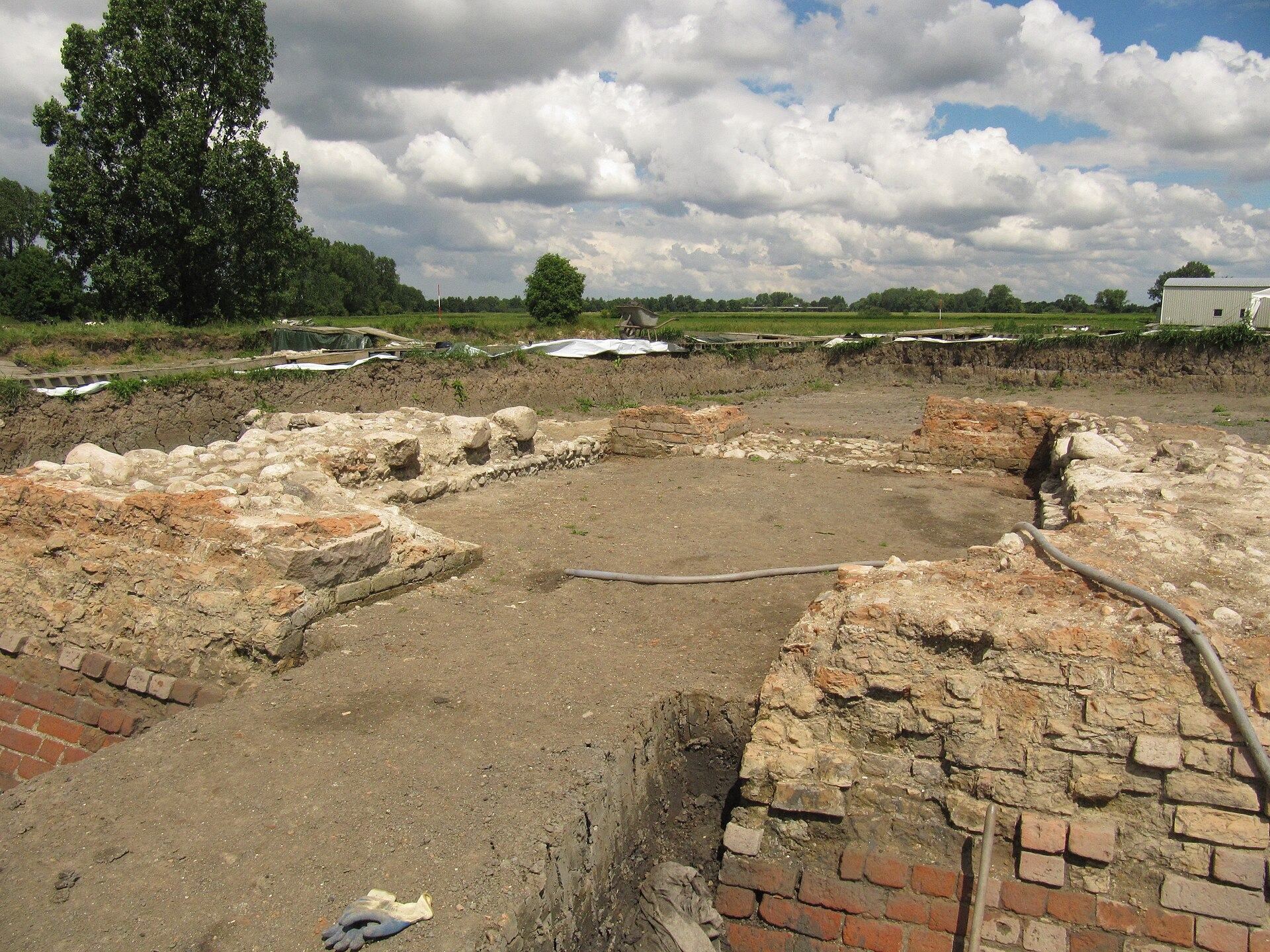
The castle was enclosed by a nearly circular wall circuit. Its wall had a base width of about 1.6 metres, and surviving masonry reaches approximately 1.7 metres in height. The physical remains consist chiefly of wall fragments and foundations, including the boulder construction exposed during the 2006 work.
Southern entrance
Gatehouse
A gatehouse occupied the southern part of the circular enclosure. Its foundation area measured about 7.65 metres in width. The entrance passage was 2.35 metres wide on the outside and 1.90 metres wide on the inside, defining the surviving access structure within the castle circuit.