Wolfsberg Castle (Steinekirch): A Medieval Fortress Above the Zusam Valley
Site at a Glance
- Rating
- 5
- Popularity
- Very Low
- Country
- Germany
- Primary era
- Medieval
- Eras represented
- Medieval
- Civilizations
- Duchy of Bavaria, Holy Roman Empire
- Site type
- Military
- Remains
- Castle
On this page8 sections
History
Wolfsberg Castle is a medieval hilltop fortress in Germany, above Steinekirch in the municipality of Zusmarshausen. It probably originated in the tenth century as the seat of the Fraß family, whose later service to the bishops of Augsburg placed the castle within the political and military structure of the region. The surviving bergfried, the principal fortified tower of a German medieval castle, probably dates from the twelfth century.
The Fraß family and Augsburg
The Fraß family was traditionally said to have distinguished itself at the Battle of Lechfeld in 955. The family served as ministerials of the bishops of Augsburg. A ministerial was a legally unfree but often influential service noble who could perform administrative, military, or court duties for a territorial lord. In 1233, members of the family were recorded under the name “von Wolfsperch,” and their coat of arms contained a wolf.
Heinrich Fraß of Wolfsberg, identified as a ministerial of the Augsburg church, witnessed a peace treaty between Bishop Wolfhart and Duke Ludwig of Bavaria in 1292. In 1333, Ulrich Fraß acted as guarantor when Zusameck Castle was sold to the Bishopric of Augsburg, the ecclesiastical principality and diocese governed by the bishops of Augsburg. The Fraß family disappears from the written record around 1350.
The Schwelchers and the road to Augsburg
The Schwelcher family then held Wolfsberg. Wieland Schwelcher was recorded in 1374 and Ulrich Schwelcher in 1382, both using the byname “of Wolfsberg.” The family had originally belonged to the ministerial service of the dukes of Teck.
The Schwelchers were said to have attacked merchant convoys. Wolfsberg stood near the road between Augsburg and Ulm, and troops from the imperial city of Augsburg besieged the castle several times without success. During the War of the Cities in December 1388, a conflict involving towns and territorial lords in the late fourteenth-century German Empire, Augsburg’s troops withdrew after bad weather, while the dukes of Bavaria devastated the surrounding area.
Ducal possession and destruction
In 1390, Wieland Schwelcher sold Wolfsberg to the dukes of Bavaria. The castle was subsequently pledged to Friedrich von Freyberg, who was recorded as its pledge-holder in 1394 and 1396. By 1434, the pledge was held by the Augsburg brothers Ulrich and Hans Nördlinger.
Augsburg mercenaries under Wilhelm von Rechberg destroyed the ducal castle on 26 January 1462. The attack took place during the Imperial War, a conflict between Duke Ludwig the Rich of Bavaria-Landshut and Emperor Frederick III, the Habsburg ruler who became Holy Roman Emperor in 1452. Wolfsberg was abandoned after its destruction.
Later lordship and archaeological investigation
In 1508, the dukes of Bavaria sold the lordship of Steinekirch to Philipp von Stain of Jettingen for 6,000 gulden. In 1589, the guardianship of Marquard von Stain transferred the property to the Augsburg Cathedral Chapter, the corporate body of cathedral clergy that administered the lordship. The chapter retained it until secularization in 1803, when ecclesiastical territories were dissolved or transferred to secular authorities.
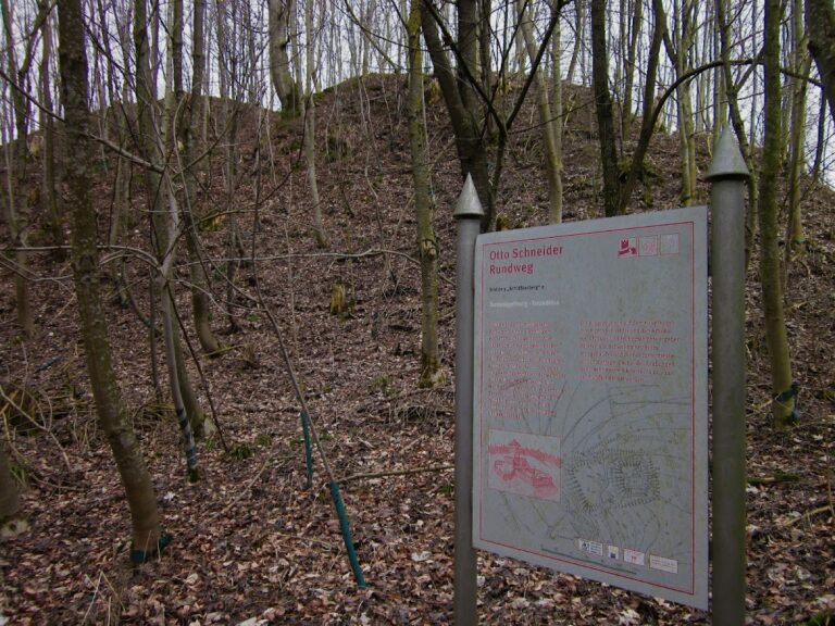
Around 1852, the ruin was quarried for stone used in the Augsburg to Ulm railway line. Larger wall remains reportedly still stood before this dismantling. The bergfried was largely spared because it had belonged to the Historical Association of Swabia since 1836. A rescue excavation conducted by Otto Schneider in 1973 investigated the earthworks. The castle is listed as an architectural heritage monument in Bavaria.
Remains
Wolfsberg occupies a wooded elevation about 525 metres high on the eastern edge of the Zusam valley above Steinekirch. Its physical remains consist chiefly of extensive earthworks, fragments of the enclosing walls, and the lower and middle portions of the large bergfried. Agricultural buildings now occupy the plateaus of the main castle and outer bailey, while a modern residential building stands beside the tower.
Earthworks and castle enclosure
The inner castle and outer bailey are divided by a neck ditch, a defensive ditch separating a castle’s central area from an adjoining elevation or outer area. The ditch is about 7 to 8 metres deep. The spacious outer bailey lies east of the main castle, and its roughly 4-metre-deep ditch has been largely filled within the access area. The ditch continues southward and ends at a semicircular slope plateau. Another change in ground level lies west of the main castle.
The northern outer ditch remains clearly traceable beside a substantial marginal rampart. Comparable ramparts surround the irregularly rectangular main-castle plateau, which measures about 25 by 50 metres. The ditches reach depths of up to 5 metres, and the ground falls steeply toward the valley on the south and west.
The 1973 investigation found that a berm, a level strip beside a defensive ditch or rampart, had apparently been laid about 10 metres below the castle plateau. It was initially secured only by a palisade, a defensive fence made from stakes or posts, and postholes from this structure were identified. The marginal ramparts were later built over the berm, with six successive construction phases recognized in the earthworks. Numerous sandstone fragments indicate that the castle once had a stone enclosing wall.
Walls and tower keep
Several stretches of brick masonry from the main castle’s curtain wall remain identifiable. A curtain wall is the enclosing defensive wall of a castle. The bricks measure approximately 35 by 16 by 7 centimetres, a form that points to construction in the fourteenth century.
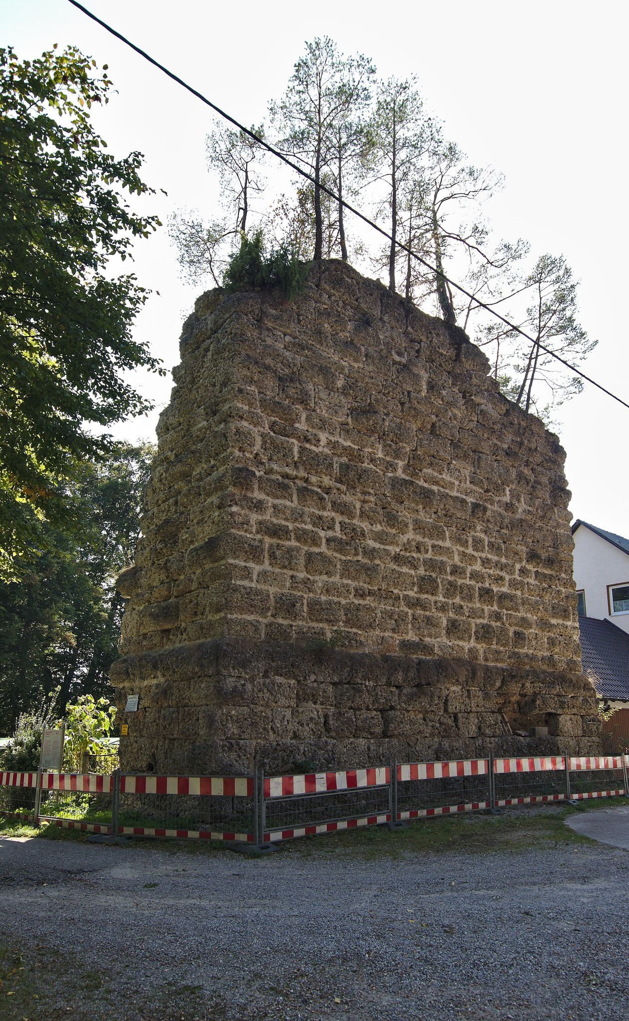
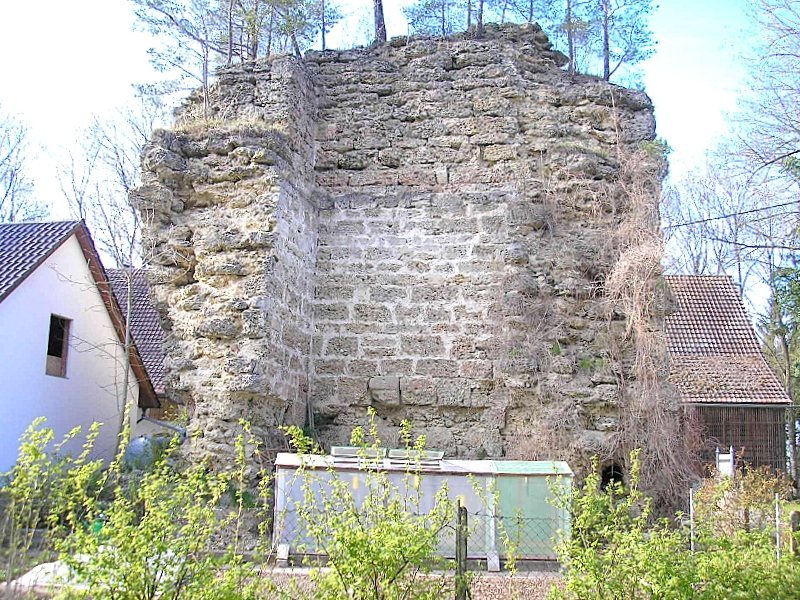
The surviving bergfried probably dates from the twelfth century. Its ground-floor walls are about 4 metres thick and are built from large Nagelfluh blocks, a naturally cemented conglomerate made of rounded stones in a hard matrix. The blocks measure approximately 0.60 to 1.10 metres in length and about 0.50 metres in height. Some were dressed as bossed ashlar, with their outer faces projecting prominently and their edges worked into margins.
The tower used shell construction. Its inner and outer masonry faces formed separate shells, while the space between them was filled with mortar containing rubble and pebbles. The north side measures about 12.30 metres, the west side survives to as much as 7 metres, and the east side extends for roughly 3.80 metres. The lowest courses form a plinth, a distinct projecting base at the foot of the structure.
Inside the tower, a masonry ledge remains visible in the upper third. The blocks facing the interior were smoothly dressed, and beam holes reveal the former division into storeys. The surviving bergfried stands about 11 metres high. Although partly dismantled in the nineteenth century, it remains one of the notable high-medieval tower keeps in southern Bavaria and the only surviving stone testimony to early knightly culture in the Augsburg district.