Libisosa: An Iberian Oppidum and Roman Colony in Spain


Site at a Glance
- Rating
- 4.4
- Popularity
- Low
- Country
- Spain
- Primary era
- Classical
- External website
- Open
- Eras represented
- Iron Age, Classical, Medieval
- Civilizations
- Iberian, Roman
- Site type
- City
On this page22 sections
History
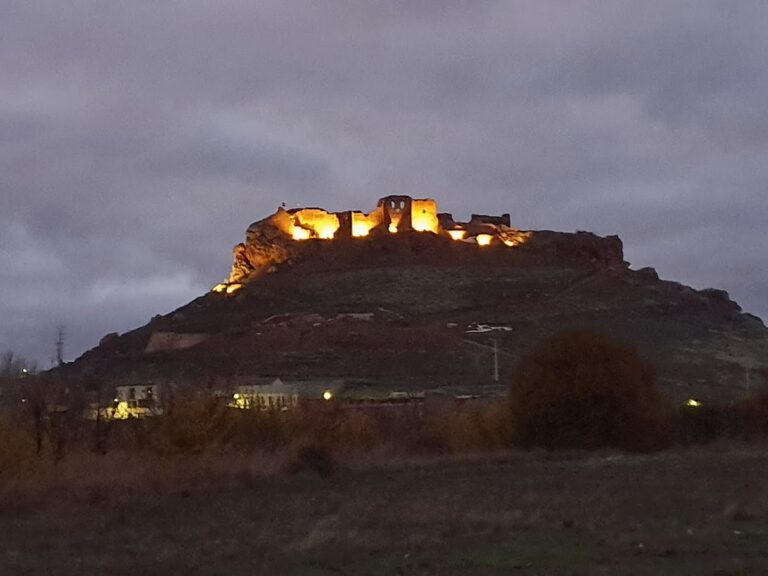
Libisosa is an archaeological site in Spain, at Lezuza in Albacete, where Oretan Iberian and Roman communities developed a settlement on Cerro del Castillo from the Late Bronze Age to the Late Middle Ages. Its sequence includes an indigenous oppidum, a substantial fortified settlement that served as a regional political and economic centre, the Roman colony Libisosa Foroaugustana, and a medieval enclave with a watchtower and religious complex.
From prehistoric occupation to the Oretan settlement
The earliest occupation belongs to the Late Bronze Age. Handmade pottery spread across the hill, particularly in Sector 2, where possible habitation traces and grey vessels indicate activity from approximately the ninth or eighth century to the sixth century BC. This period covers the transition from the Late Bronze Age to the Early Iron Age and the Orientalizing period.
Occupation continued in the ancient Iberian period. During the final phase of the Oretan oppidum, from the second century to the first third of the first century BC, Libisosa was home to an Oretan community living under Roman rule. Its inhabitants were probably peregrini, free provincial people without Roman citizenship. The settlement appears to have held a central position in its surrounding region.
Early Romanization, meaning the adoption or adaptation of Roman political, social, cultural, and material practices, was probably encouraged by Italic merchants and by an army unit or soldiers accommodated through a formal hospitium relationship. Their presence helped secure routes converging at Libisosa. At the same time, the local elite maintained an Iberian identity through imagery and an aristocratic mythology that helped preserve community cohesion and elite privileges under Roman power.
Destruction during the Sertorian Wars
The final Iberian phase ended in an abrupt and systematic destruction, probably connected with the Sertorian Wars of 82 to 72 BC. These were civil wars in Hispania between forces loyal to Sertorius and armies aligned with the Roman government, including commanders such as Metellus and Pompey. One of the armies involved occupied the highest part of the hill, although literary evidence does not confirm which side controlled Libisosa.
The destruction ended the known occupation of Sector 18 and sealed an Ibero-Roman neighbourhood beneath collapsed building material. An infant skeleton lying on a street provides direct evidence of the violence and social rupture associated with this event. The settlement also controlled an ancient route between southern and eastern Iberia, identified with the road known from the Vicarello Cups as the Way of Hannibal or via Heraclea. In 75 BC, after defeating and killing Sertorius’s legate Hirtuleius, Metellus probably used this route while moving towards eastern Hispania to join Pompey.
The Roman colony
After an intervening phase that is difficult to locate, Libisosa was transformed into the Roman colony Libisosa Foroaugustana. Rome probably granted it the ius Italicum under Augustus during his third journey to Hispania at the end of the first century BC. This privileged legal status gave selected provincial communities rights and fiscal advantages comparable to those of Italian communities, and may have helped secure population in an area important for communications.
The colonial foundation reshaped the hill through major engineering works. The southern area was cut down, while the northern area was terraced to create a central forum, the principal public square of a Roman city, on the highest and narrowest part of the summit. Libisosa remained active during the High Empire, the period broadly covering the first through third centuries AD, with particular activity in the first century.
Inscriptions from the forum identify the colony’s IIviri, the pair of chief municipal magistrates, and show that Libisosa belonged to the Galeria tribe, one of the Roman civic tribes used to register citizens and communities. A citizen of Libisosa later became a provincial flamen, a priest connected with a deity or the imperial cult, in Tarraco. An inscription found at Calle de los Caballeros 3 in Tarragona dates this office to the reign of Hadrian.
An inscription dedicated to Marcus Aurelius by the colonists of Libisosa dates to AD 166 or 167. Antiquarian notices from the sixteenth and seventeenth centuries associated it with a marble statue. The inscription remains on an exterior corner of the Casa de la Tercia beside the municipal church, where its condition is precarious.
The northern part of the forum later suffered destruction, probably through natural causes such as landslides or seismic movements, and was remodelled. Changes included restructuring the portico, adding at least one monumental fountain-like feature, and raising paving levels. These alterations formed part of the colony’s later physical history.
Medieval transformation
Medieval occupation concentrated on the summit and included a watchtower, traditionally called the castle, together with a politico-religious complex apparently associated with the Military Orders. These were religious-military institutions whose members combined religious obligations with military and territorial functions.
After the conquest of Alcaraz in 1213, the troops of Alfonso VIII took the castle of Lezuza. In 1411, Alcaraz exempted from taxation people who were willing to settle beside the tower on Cerro de Lezuza. During the fifteenth century, Lezuza became involved in conflicts between the Marquisate of Villena and the Trastámara. Under the Catholic Monarchs and throughout the sixteenth century, the town expanded after receiving town status. Habitation then shifted from Cerro del Castillo to the plain around the new church.
Excavation and protection
Archaeological excavations began in 1996 under a University of Alicante team directed by José Uroz Sáez and have continued without interruption. The archaeological complex has had Asset of Cultural Interest status since 1998, an official Spanish designation for protected cultural property. Procedures to declare the site a park began in 2021, when it was described as the second archaeological park in Albacete Province and the sixth in Castilla-La Mancha.
The medieval watchtower is undergoing consolidation and enhancement. The medieval religious complex is protected and buried pending restoration and public presentation. Together with the excavated prehistoric, Iberian, and Roman remains, these phases preserve the long transformation of the hill from an early settlement to an indigenous centre, Roman colony, and medieval enclave.
Remains
The archaeological zone covers approximately 30 hectares on Cerro del Castillo and contains remains from the Late Bronze Age, Iberian, Roman, and medieval periods. The excavated areas combine earthen and stone construction, carefully engineered Roman public buildings, defensive works, streets, commercial units, and medieval structures. The surviving layout records successive settlements occupying and reshaping the hill.
Prehistoric and Ibero-Roman quarters
Sector 2
Sector 2 contains scattered handmade prehistoric pottery, with a particular concentration accompanied by possible traces of habitation and grey vessels. The material belongs to the occupation sequence extending from approximately the ninth or eighth century to the sixth century BC, when communities on the hill moved from the Late Bronze Age into the Early Iron Age and Orientalizing period.
Sector 3
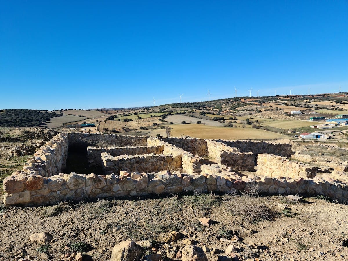
On the northern slope, Sector 3 preserves part of an Ibero-Roman neighbourhood associated with the local Iberian elite and its clientele. About twenty multifunctional departments were built mainly with adobe and rammed-earth walls resting on stone plinths. The collapse of the adobe helped preserve the contents of the buildings. Imported objects include amphorae, black-gloss and thin-walled tableware, and bronze vessels, while most of the recovered material and the construction tradition remained Iberian.
Department 127 and Department 172
Sector 18, northwest of Sector 3, contains Department 127, a trapezoidal building covering 181 square metres. It had six rooms, at least part of an upper floor, and a single-pitched roof with a porch-like opening on the west. The building was a multifunctional oligarchic complex rather than simply a workshop or domestic residence. Agricultural tools, cavalry and livestock equipment, evidence of metalworking, textile and wool processing, food storage, and wine commerce reveal the range of activities conducted there. A lead vessel was associated with wool treatment.
One room held an accumulation of amphorae, while the attached cellar, Department 172, covered 77 square metres. More than eighty identified amphora-jars were stored there, apparently as surplus goods intended either for trade or for redistribution within the community. Department 127 has been musealized in situ, preserving the complex within its archaeological setting.
Cult building and portable finds
A later investigation in Sector 18 identified another sealed context destroyed in the second century BC and apparently connected with a cult building. It produced the exceptional ritual vessel known as the “Goddess and the Iberian Prince,” now held in the permanent collection of the Lezuza museum. Other finds from the Ibero-Roman areas include an exceptional group of weapons, a substantial accumulation of coins, and a corpus of Iberian inscriptions.
Roman fortifications and streets
Defensive wall and gates
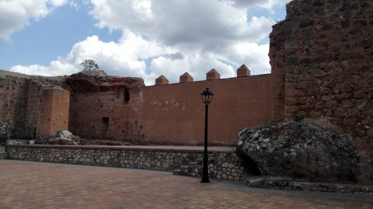
The Roman defensive wall was built hurriedly over collapsed Iberian buildings in Sector 3. Approximately 3 metres thick, it enclosed about 9 hectares. Its two faces consisted of ordinary dry masonry with an inner filling of stones and earth, a construction method comparable to the emplecton described by Vitruvius. In this method, two outer masonry faces contain an interior filling of stones and mortar or earth.
The excavated section includes the North and Northwest Gates. The North Gate affected the earlier Iberian departments and was protected by two massive, approximately rectangular bastions with external fronts about 6 metres wide. They flanked a slightly splayed opening measuring 9 metres on the exterior and 7.30 metres on the interior. The gate was later closed, probably around the middle of the first century AD, when its western tower was already deteriorating. A postern remained.
Decumanus maximus
The decumanus maximus, the principal east-west street, runs north of the forum at a lower level. Porticoes lined both sides, and numerous tabernae, commercial or workshop units opening onto public streets, faced the roadway. A large cistern stood where the street met the basilica, and a staircase connected the street with the forum plaza.
The Roman forum
Plaza and eastern entrance
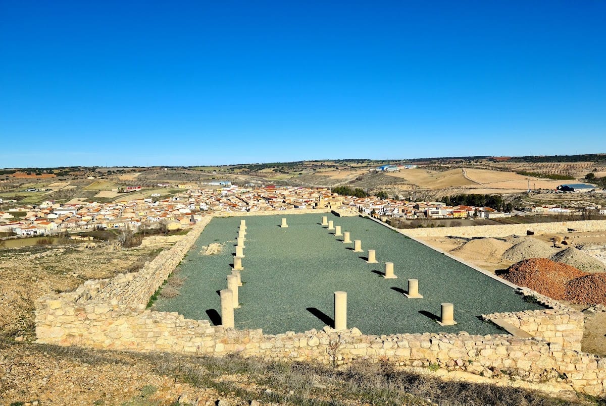
The forum was arranged around a rectangular plaza 150 Roman feet long and 100 feet wide, giving a proportion of 3:2. Its creation required the removal of material from the southern part of the hill and the terracing of the northern area. The main entrance lay on the east. Its facade contained two large rectangular niches placed symmetrically beside the doorway. The central opening was 3 metres wide, aligned with the geometric centre of the plaza, and led towards porticoes on the north and south sides.
Curia and basilica
The southern portico led to the curia, the council house of the colony. Oriented east-west, it consisted of two rooms measuring 7.15 metres in width and 19.70 metres in length. Near the podium of the basilica, on the central axis of the forum, was the mundus, a ritual underground opening associated with the foundation and sacred identity of a Roman city.
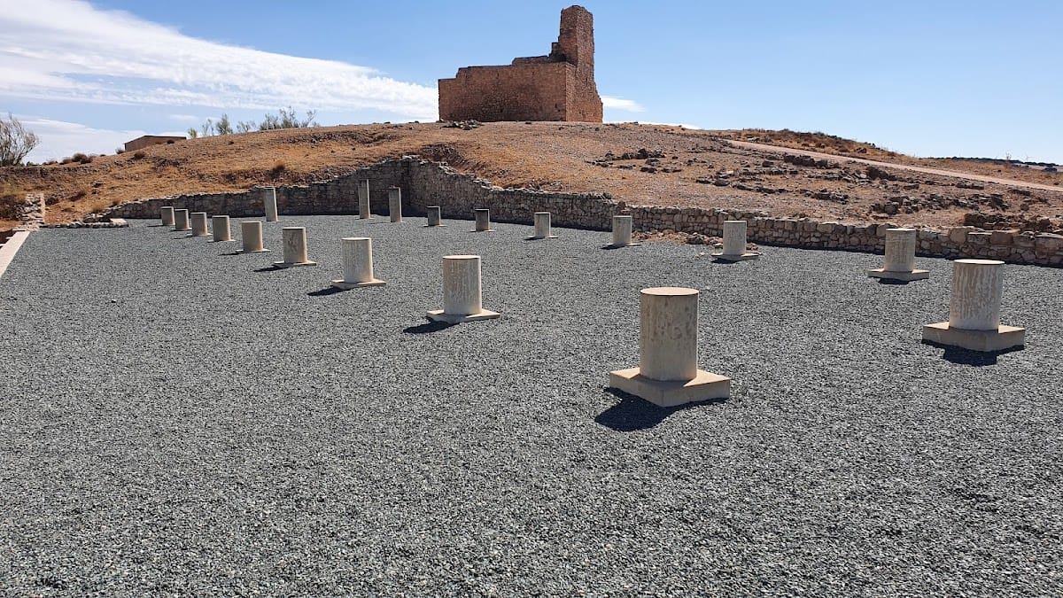
The basilica occupied the western side of the forum. This rectangular public hall measured 41 metres by 14.5 metres, had two entrances from the forum through the porticoed areas, and contained a double internal row of nine columns.
Other forum structures and finds
A possible granary extended lengthwise beside the northern portico. It measured approximately 5 metres wide by 35.50 metres long and had no internal subdivisions; its definition and presentation remained incomplete during the latest interventions. West of the basilica, beside the main north-south road between the North and South Gates, a large domus occupied an entire city block in a central area of the colony. It contained twelve rooms, had an eastern entrance, and included an area apparently intended for tabernae connected to the rest of the building by an internal staircase.
The forum yielded a large ceramic assemblage, inscription fragments, three Corinthian-type capitals, sculptural remains of figures in togas, and portraits of Julio-Claudian figures. Coins included Republican and Imperial denarii and asses. An altar pulvinus, a cushion-shaped architectural element, carried a five-petalled rosette. One portrait bears evidence of damnatio memoriae, the formal condemnation and erasure of a person’s public memory after death or political disgrace. A head now in the Museum of Albacete represents a woman of the Libisosan elite modelled on the image of the empress Iulia Agrippina Minor.
Near the mundus, a votive deposit dated to approximately a century earlier belonged to the period of the oppidum’s destruction. Its position links the ritual history of the pre-colonial settlement with the later civic centre created by Rome.
Medieval summit and religious complex
Watchtower
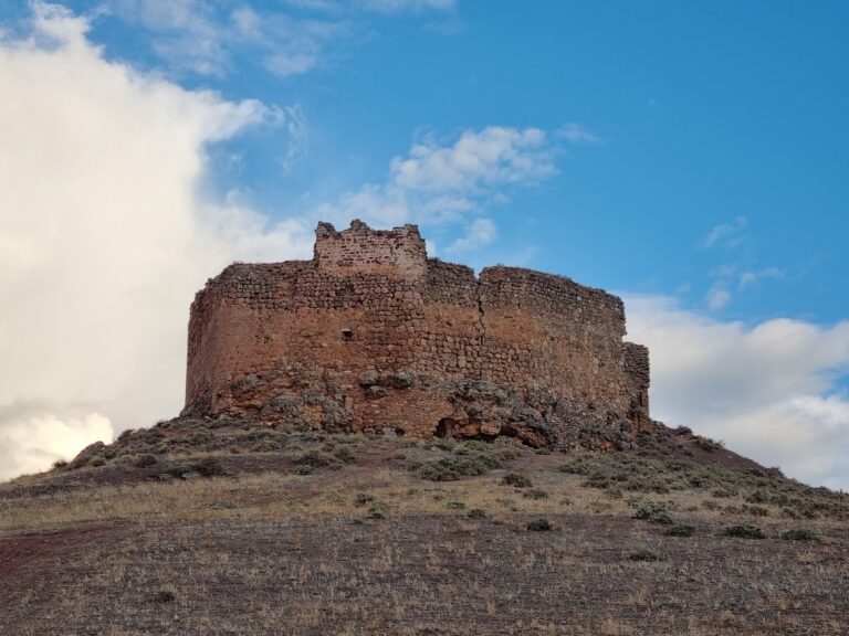
The medieval watchtower stands at the summit of the hill, approximately 1,000 metres above sea level. Traditionally called the castle, it has a square plan measuring 13 metres on each side. Several vaulted floors are connected by a staircase running within the perimeter walls.
The tower was built using formwork. Its outer masonry incorporates limestone, sandstone, and tuff, including stone reused from Roman monuments. The mortar contains a lime binder, coarse orange siliceous aggregate, and small pebbles. The thick wall cores use the same mortar, with stones arranged less regularly. The structure is undergoing consolidation.
Sector 11 complex
Northeast of the forum, Sector 11 affects several tabernae along the decumanus maximus and contains a large politico-religious complex apparently associated with the Military Orders. The complex comprised a northern rectangular courtyard, southern rooms, and an elongated central room. The courtyard held a cistern or silo and was divided by partitions that reused Iberian and Roman walls. The southern rooms reused walls from the street-side tabernae and contained a male burial.
The elongated central room combined representational and religious functions, possibly as a church or basilical hall. It was divided into two hierarchized spaces. The western room measured 17.50 by 4.65 metres internally and had a bench along three sides. Its pebble floor contained two embedded cross pattée motifs made from tile fragments. A cross pattée has arms that broaden towards their ends.
An arch separated the western room from a smaller square cult room measuring 4.65 metres on each side. The room retained a brick floor and a raised altar-like structure set against its eastern wall. Coins indicate use or visitation of the complex from the thirteenth through the seventeenth century.