Carteia: A Phoenician and Roman City in Spain

Site at a Glance
- Rating
- 4.6
- Popularity
- Low
- Country
- Spain
- Primary era
- Classical
- External website
- Open
- Eras represented
- Iron Age, Classical, Medieval, Early Modern
- Civilizations
- Byzantine, Carthaginian, Marinid, Phoenician, Roman, Spanish, Visigothic
- Site type
- City
On this page19 sections
History
Carteia is an ancient Phoenician and Roman city in Spain, located in the territory of San Roque, Andalusia, at the head of the Bay of Gibraltar. Its position beside the ancient Strait of Gibraltar, the main maritime passage between the Mediterranean and Atlantic, gave it political, military, and commercial importance. The settlement developed through several cultural phases, from a Phoenician trading community to a Roman city that became the first known Latin colony outside Italy.
Phoenician origins and urban expansion
A foundation tradition places Carteia’s establishment around 940 BC and connects it with the Phoenician trading settlement of Krt. The Phoenicians were a maritime trading culture formed by city-states along the eastern Mediterranean coast. Archaeological interpretations also place a Phoenician settlement at Cerro del Prado, beside the ancient mouth of the Guadarranque, during the seventh century BC. In the fourth century BC, a larger urban center was established at Carteia, where the setting was better suited to port activity.
The surrounding landscape supplied timber, cereals, metals, fish products, shellfish, and dyes. In later centuries, the city exported local wine in amphorae and produced garum, a fermented fish sauce widely traded around the Roman Mediterranean. Large kilns connected with amphora production indicate the importance of manufacturing within the local economy.
Carteia in the Punic and Roman wars
Carteia became involved in the Second Punic War, the conflict between Carthage and Rome that was fought across the western Mediterranean. Two battles were recorded there in 206 BC. In a land engagement, Roman forces under Gaius Lucius Marcius Septimus defeated the Carthaginian commander Hanno. In a naval battle, Gaius Laelius defeated the Carthaginian admiral Adherbal. Carteia may also have been the place where Hamilcar landed with his army and elephants in 237 BC.
Rome captured Carteia around 190 BC. In 171 BC, the Roman Senate established it as Colonia Libertinorum Carteia, granting the settlement a special civic status. Around 4,000 sons of Roman soldiers and women from Hispania were settled there, received land, and were given Latin rights. Latin rights occupied an intermediate position between full Roman citizenship and the status of provincial non-citizens, providing important legal and commercial privileges. Existing inhabitants were permitted to remain, while the population received the right to marry Roman citizens and conduct trade with Romans.
Under Roman rule, Carteia prospered for approximately 580 years. It possessed a mint, port, temples, an amphitheatre, and other urban institutions, becoming an important city in Roman Hispania. Baetica, the Roman province covering much of southern Hispania, included a network of cities whose prosperity depended on agriculture, manufacturing, maritime exchange, and regional administration.
Roman civil wars and the Principate
Carteia again entered military history during the Roman civil wars. In 68 BC, Pompey used the city as his western base for operations against Mediterranean pirates. In 46 BC, a naval battle near Carteia ended when the Caesarian commander Caius Didius defeated the Pompeian Publius Attius Varus. The following year, Pompey’s sons Gnaeus and Sextus raised an army at Carteia before being defeated by Julius Caesar at Munda. Gnaeus was captured and executed, while Sextus escaped through Carteia’s port.
The city enjoyed renewed prosperity during the Principate, the period beginning under Augustus when emperors retained the outward institutions of the Republic while exercising imperial authority. This phase lasted approximately from 27 BC to AD 284 and included an Augustan redevelopment of Carteia. During the final centuries of the Roman Empire, the city declined. Burials placed around and above the Republican temple suggest that a Christian church may have occupied part of the former monumental area.
Late antique and medieval transformations
Carteia was probably already declining when the Visigoths sacked it around AD 409. Visigothic burials show that occupation continued, although perhaps on a limited scale. Byzantine remains likewise indicate settlement during the sixth and seventh centuries, when Carteia formed part of the Byzantine province of Spania. By the seventh century, urban occupation had greatly contracted and the settlement was depopulated.
After the Muslim conquest of Hispania, Islamic writers referred to the settlement as Qartayanna or Cartagena. A tradition associates Tariq ibn Ziyad’s arrival in the region in 711 with the establishment of a mosque in a pre-existing temple. The mosque was also connected with prayers for rain during drought. The foundation of Algeciras and Gibraltar contributed to Carteia’s final decline as an urban center.
Under the Marinids, a watchtower called Turrus Qartayanna was built on the high ground above the former city. It later formed part of a fortified enclosure known as Hisn Qartayanna or Torre Cartagena. A hisn was a fortified enclosure or settlement in the medieval Islamic world. Alfonso XI of Castile conquered the fortress in the mid-fourteenth century. It was abandoned and destroyed during the second half of that century, probably around 1379. The last recorded occupation of the archaeological landscape belongs to the late sixteenth century, when Torre del Rocadillo was built as a coastal watchtower.
Rediscovery and archaeological investigation
Medieval and early-modern scholars and travelers recognized the ruins as Carteia. From the sixteenth century onward, local scholars connected the site with the Carteia mentioned in classical texts. Antiquarians and travelers produced maps, engravings, and later photographs, but their interest also encouraged the continuing removal of building materials and antiquities.
John Conduitt, a British officer serving in Gibraltar from 1713 to early 1717, identified the ruins on the hill then called El Rocadillo and communicated his conclusions to the Royal Society in London. British antiquarians carried out further investigations in 1811 and 1812 after Vice-Admiral Charles Penrose reached an agreement with the landowners. A description of the theatre appeared in 1777, William Faden produced an early plan of the city in 1781, and an account published in 1816 described excavations by British military personnel during the Peninsular War and included a plan of the fortifications.
Systematic archaeology began in the 1950s under Julio Martínez Santa-Olalla. In 1964, Manuel Pellicer prepared a plan to define and protect the intramural archaeological area before construction of the CEPSA refinery. Excavations sponsored by the William L. Bryant Foundation followed between 1965 and 1970, then continued under Francisco Presedo and the University of Seville from 1971 to 1985. Iberian levels found in the monumental area during the earlier campaign challenged Pellicer’s initial view that the city originated in the third century BC. Later work concentrated on the forum, temple, and baths. The foundation’s sponsorship ended after archaeological research rejected the identification of Carteia with the legendary city of Tartessos.
The project titled “Historical and Archaeological Study of the City of Carteia” began in 1994 after approval by Andalusian cultural authorities. Its work from 1994 to 1999 focused on the Cortijo del Rocadillo area and Torre Cartagena, while a second phase of the Carteia Project continued from 2006 to 2011. Emergency excavations in the Alfarera pottery district took place in 2003 and 2004, and eight soundings were carried out in 2010 from the modern Guadarranque estuary toward Cerro del Prado. Evidence from the pottery district indicates a break between two production phases, possibly caused by a tsunami. The 2010 investigations confirmed the importance of this event and placed it in the first half of the first century.
Carteia was declared an asset of cultural interest in 1968 and forms part of the Network of Cultural Spaces of Andalusia. Torre Cartagena is also protected under the 1949 national legislation concerning castles. In 2007, its protected area was defined as 1,560 square metres of built area and 42,973 square metres of surrounding land.
Remains
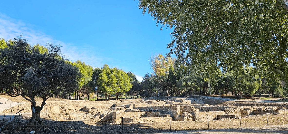
The archaeological site covers approximately 27 hectares on elevated ground at the head of the Bay of Gibraltar, near the confluence of the Guadarranque and Cachón rivers. The ancient mouth of the Guadarranque lay below Cerro del Prado and was once wider, with marshes and sandbanks extending inland. The surviving remains are arranged across the natural rise of Cortijo del Rocadillo and include city defenses, public buildings, domestic structures, industrial installations, cemeteries, and later fortifications.
Defenses and fortified remains
Punic walls
In the eastern forum area, the Punic fortifications consist of two parallel wall sections about three metres apart. Built from squared, rusticated ashlar blocks joined by interlocking masonry, they formed a casemate wall, a fortified wall containing internal compartments or chambers. The construction follows Punic-Hellenistic defensive practices and is associated with the refortification of Carteia during the Second Punic War. The oldest identified phase is Punic, and Iberian pottery was recovered from some sections during excavations in the 1970s. Plans from the 1960s indicate that square towers once stood at intervals along the circuit. Much of the perimeter has been affected by destruction, vegetation, or burial below ground level.
Torre Cartagena
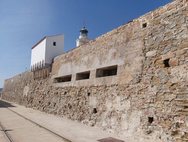
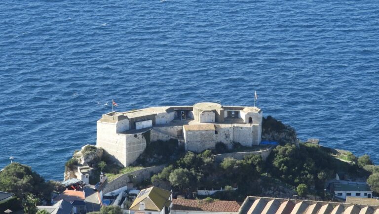
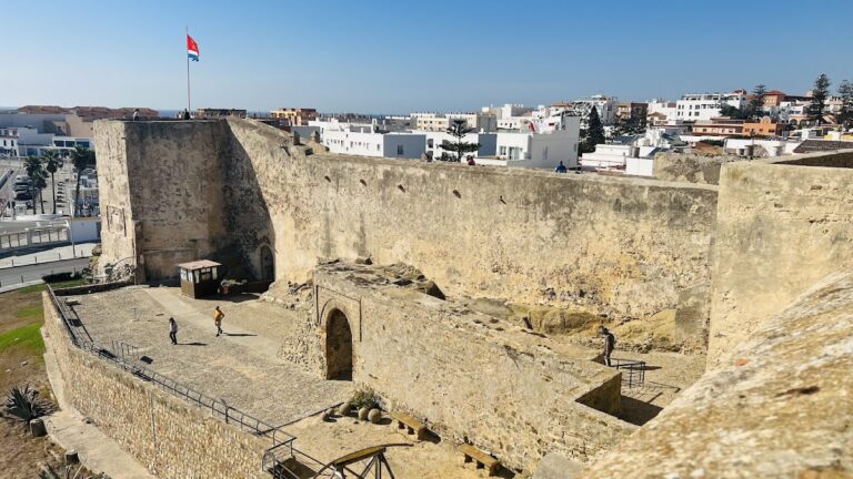
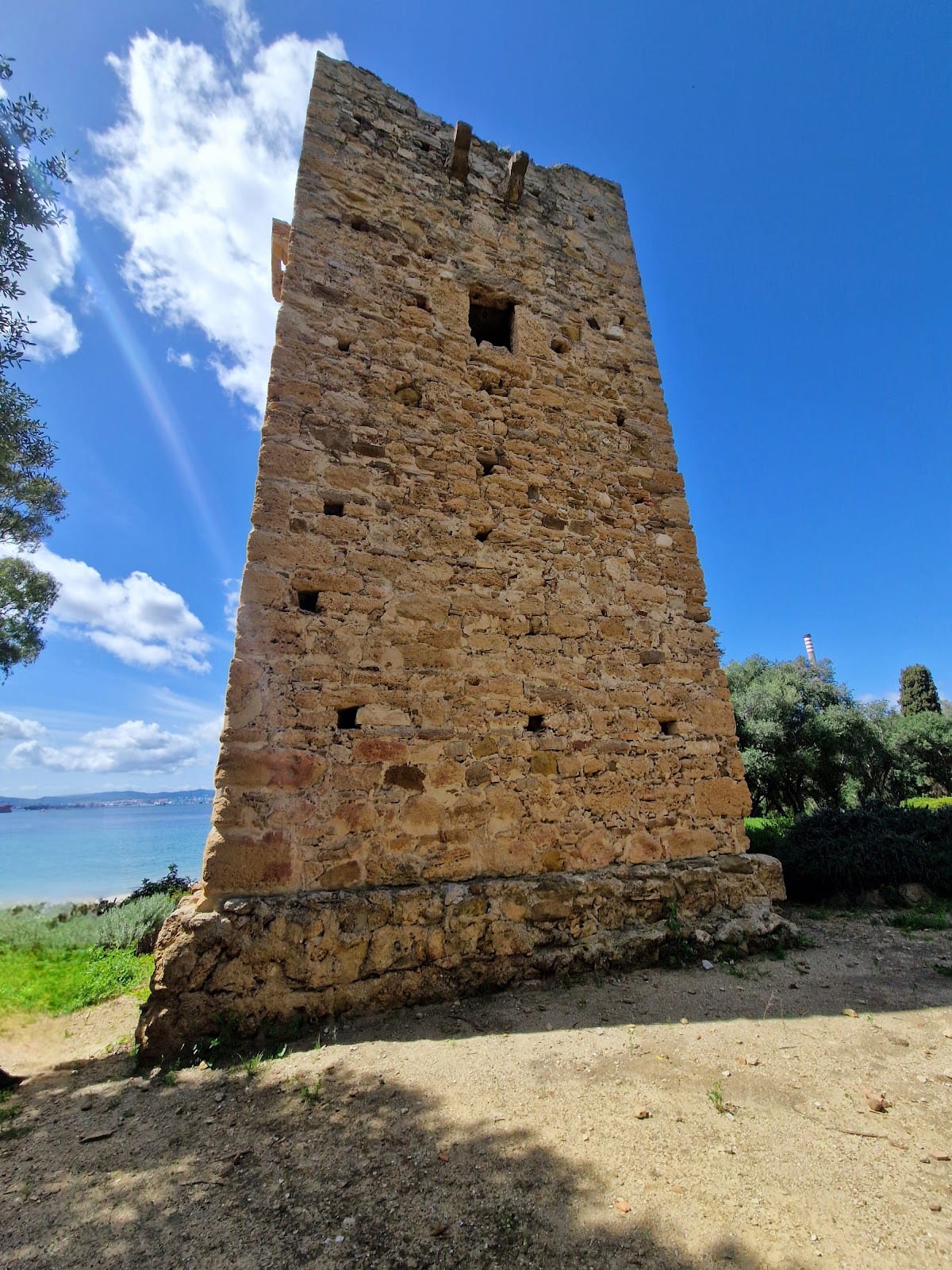
Torre Cartagena, also called Castillo de Carteia or El Castellón, stands north of the ancient city near the refinery. It may incorporate part of an earlier pre-Roman defensive enclosure, although the visible construction is medieval. The complex developed around a tower-bastion with an access gate and included a watchtower, an eastern escarpment or fortified base, remnants of a parapet above that base, and platforms attached to the walls. Ceramic fragments from trays and flasks, shells of edible species, and rammed-earth remains were found outside the access bastion and were associated with production centers in the surrounding region. Pipelines damaged part of the fortress, while erosion and human destruction have also affected its remains.
Forum and public architecture
Theatre
The Roman theatre remains partly buried. Its surviving components include the scaena, the stage building or stage zone, the cavea, or seating area, and approximately two-thirds of the seats. Its estimated dimensions would have exceeded those of several other theatres in Baetica and may have been comparable to the theatre at Mérida.
Forum and temple
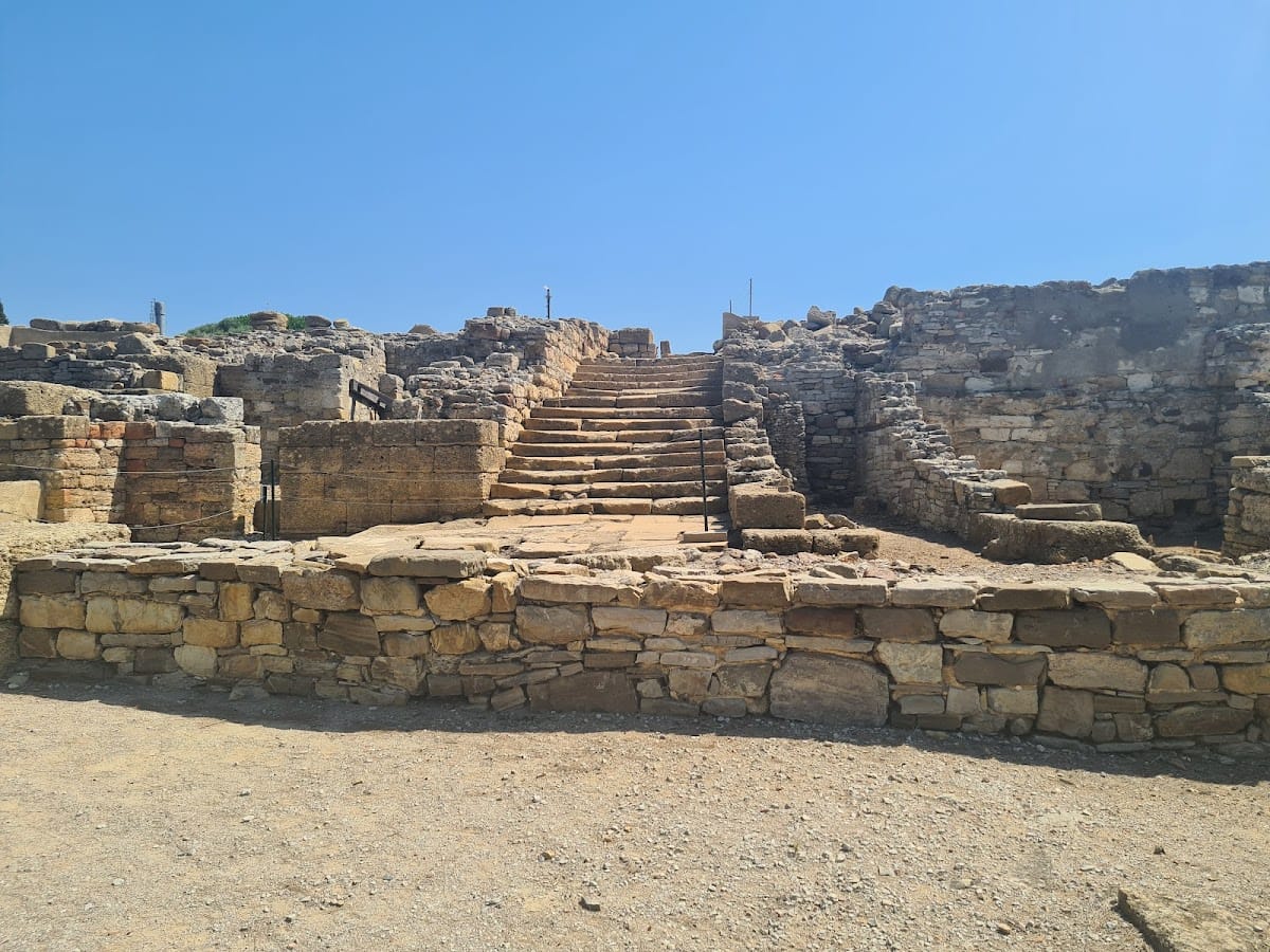
The forum occupied the higher ground of the urban center. A monumental sandstone staircase descended toward the area thought to be the forum, much of which remains unexcavated and is partly covered by the Cortijo de Rocadillo. A temple stood in the upper part of the forum on a square podium measuring 18 metres on each side. Recovered architectural elements include fluted columns, Corinthian capitals, bull protomes, and cornices decorated with plant motifs. A protome is a sculpted representation of the front or upper part of a figure or animal.
Commercial and domestic buildings
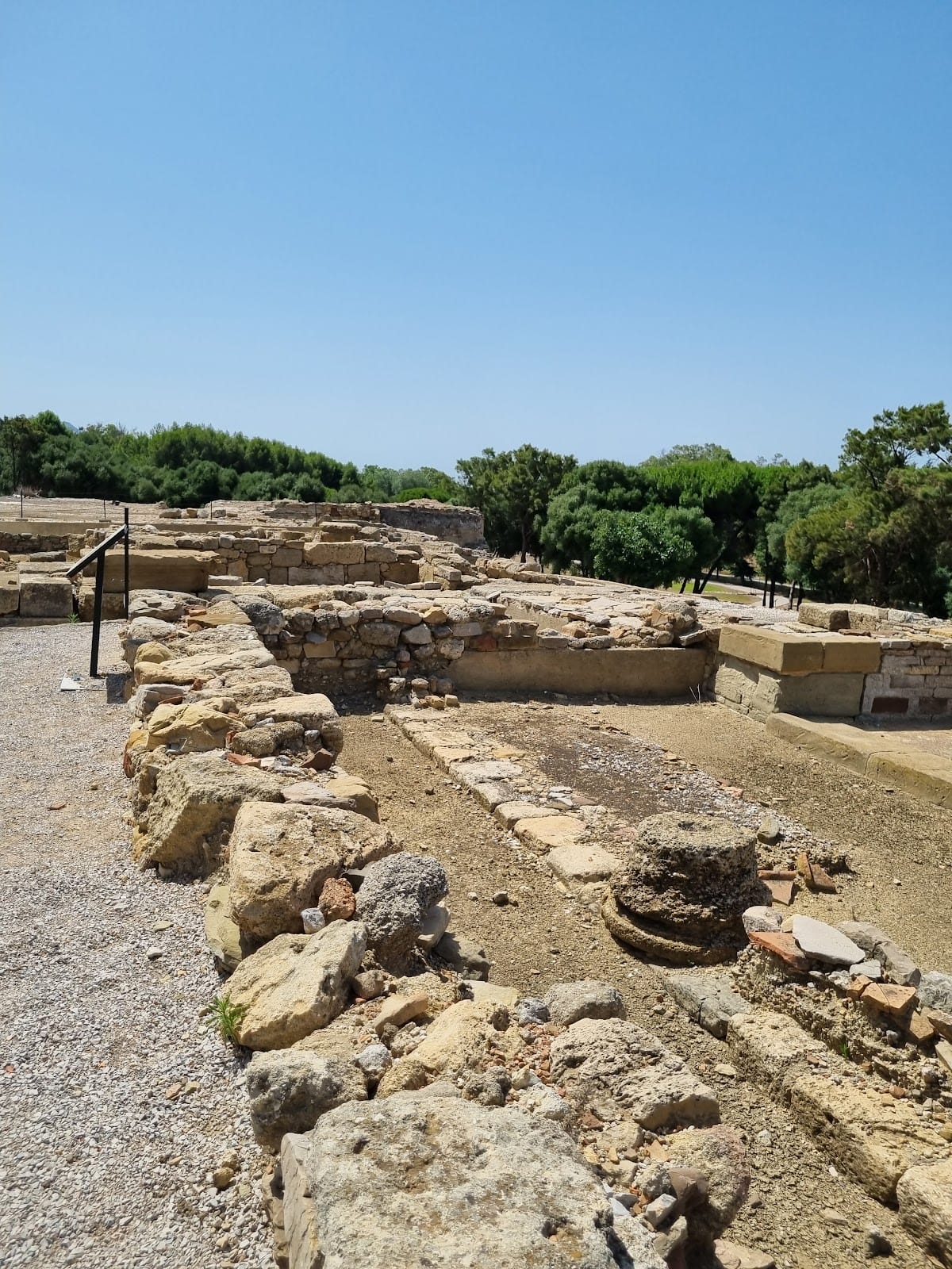
At the foot of the temple were tabernae, small commercial or service spaces associated with a forum or street. A domus, a privately owned Roman urban house organized around internal rooms, bordered the forum. Its atrium remains identifiable, and a passage separated it from the earlier Republican podium. The rear part of the house disappeared when the terrace collapsed at that location.
Roman baths
The Roman baths preserve identifiable examples of a caldarium, a hot room, a tepidarium, a warm room, and a natatio, or bathing pool. Columns belonging to the hypocaust are visible. This Roman underfloor heating system circulated hot air beneath raised floors, including beneath the tepidarium.
Industry, burials, and later occupation
Alfarera pottery district
A Roman-period pottery district occupied the Alfarera area near Puente Mayorga, about three kilometres east of the modern mouth of the Guadarranque. Excavations uncovered successive production phases, pottery-making debris, firing defects, and discarded series of kilns. The deposits also preserve evidence of a break between two phases of manufacture, an event associated with the tsunami placed in the first half of the first century.
Burials and Christian buildings
Visigothic tombs were placed around the temple and built with reused materials taken from earlier nearby buildings. A Visigothic necropolis was also identified near one of the Roman temples. Foundations of an early Christian basilica have been found, and Byzantine remains show that occupation continued after the late Roman period.
Watchtowers and archaeological finds
Torre del Rocadillo, a sixteenth-century coastal watchtower, survives within the archaeological landscape. Early nineteenth-century investigations uncovered a tessellated Roman pavement thought to belong to a temple, together with foundations of Roman buildings. A tessellated pavement is a floor made from small pieces fitted into a geometric or mosaic pattern. Excavations between 1971 and 1974 recovered part of a bust of the emperor Augustus and a headless statue of a man wearing a toga. Other finds from Carteia are displayed in the Carteia Archaeological Museum in San Roque.
Modern industrial development surrounds the archaeological site on three sides, including the CEPSA refinery. Construction of the refinery threatened the remains and contributed to the loss of the necropolis and city gates, while the principal urban area was preserved and remains partly excavated.