Castillo de Caudete: Medieval Fortress and Lordship Centre in Spain

Site at a Glance
- Rating
- 4.2
- Popularity
- Low
- Country
- Spain
- Primary era
- Medieval
- Eras represented
- Medieval
- Civilizations
- Almoravid, Crown of Castile
- Site type
- Military
- Remains
- Castle
On this page10 sections
History
Castillo de Caudete is a medieval fortress in Caudete, Spain, erected in the twelfth century in the Islamic tradition on a hill at the northwestern edge of the town’s Barrio de la Villa. Its construction is associated with the arrival of the Almoravids, a medieval Islamic dynasty that ruled parts of North Africa and al-Andalus, the Muslim-ruled regions of Iberia. The fortress may have replaced an earlier structure dating from the period of the Taifa kingdoms, smaller Muslim states that emerged during political fragmentation. Most of the surviving castle belongs to its later Christian phase, when it became the residence of the lords of Caudete and the political and administrative centre of their lordship.
Creation of the Lordship
The Lordship of Caudete was established by Alfonso X of Castile, known as Alfonso the Wise, on 12 May 1244, following the Treaty of Almizra. It was granted to the military captain Sancho Sánchez de Mazuelo and his wife, María González. The feudal territory included Caudete, Montealegre del Castillo, Ontur, Albatana, and Peñas de San Pedro. A lordship was a territory governed by a lord under the authority of a superior monarch.
Sancho Sánchez de Mazuelo tried to sell the lordship to the Order of Santiago, but Alfonso X prohibited the transaction. The fief was later sold. Peñas de San Pedro passed to the Alfoz of Alcaraz, the territorial jurisdiction associated with Alcaraz, while Caudete and the other places were purchased in 1256 by Gregorio García and his wife, Guiralda de Santa Fe. Gregorio García was a Castilian nobleman, an army official, the castellan of Almansa Castle, and the brother-in-law of Jofré de Loaysa, tutor to Queen Violante.
Caudete under Aragonese authority
Gregorio García was succeeded by his son Joan Garcia I. In 1297, Joan Garcia I recognized James II of Aragon as his lord, and Caudete consequently became part of the Kingdom of Valencia. In 1305 he granted the town a settlement charter, encouraging its repopulation by Christians. He maintained close ties with the Marquis of Villena, a major aristocratic lordship in southeastern Castile, living at the marquis’s court and acting as an intermediary between the marquis and the Aragonese monarch.
Joan Garcia I was followed successively by his brother Pere Eiximenis, Garcia Jofré, and Joan Garcia II. Joan Garcia II may have been a religious figure and died without descendants, bringing the Garcia-Loaysa line of Caudete to an end. Control then passed to Garcia Jofré de Lisón, a relative connected with the principal Loaysa branch of Petrel. As the last lord of Caudete, Garcia Jofré de Lisón sold the lordship to Alfonso V of Aragon in 1422 because of his debts. This ended the Lordship of Caudete and transferred the town into the royal patrimony of the kings of Aragon, where it remained until 1707.
Frontier warfare and reconstruction
Caudete’s position between Aragon and Castile made the castle vulnerable during the War of the Two Peters, a conflict between the two kingdoms that began in 1356. The town and fortress suffered severe damage, and the primitive Islamic forms of the castle were lost during the fighting. After the war ended in 1369, Enrique II of Castile, who founded the Trastámara dynasty after becoming king that year, paid for repairs to the damaged buildings. The remains visible today derive chiefly from this fourteenth-century reconstruction.
Abandonment and changing uses
The dynastic union of Aragon and Castile in 1469 removed the frontier danger that had helped sustain the castle’s military role. After losing its residential use, the fortress retained a military function for a time, but it was gradually abandoned during the sixteenth century. Its ruinous condition was confirmed in 1569.
In 1740, the abandoned complex began to serve as the parish cemetery of the nearby Church of Santa Catalina. Burial use continued until 1870, when the cemetery was moved. Following another period of abandonment, the site became a parish garden in 1905. Earth from the nearby Iberian-Roman site of El Real was used to cover the burial niches. The garden continued through the first half of the twentieth century, after which the site was abandoned again and houses were built against the castle walls.
Recovery and protection
In 1960, the Diocese of Albacete registered the castle ruins as its property. They remain diocesan property and have been ceded to Caudete Town Council until 2097. A long-term recovery process began in 2000. Its first two phases restored the southern and western retaining walls around the hill and part of the northern tower, while further restoration took place in 2005. Periodic archaeological excavations have continued within the enclosure, exposing elements of the fortress and traces of its cemetery and garden phases. Castillo de Caudete is protected as a Spanish Asset of Cultural Interest.
Remains
Hilltop enclosure and defensive structure
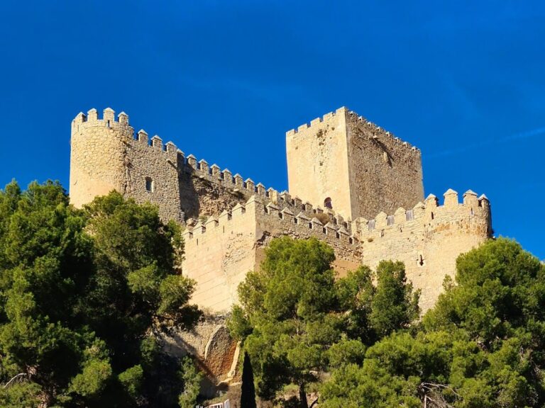
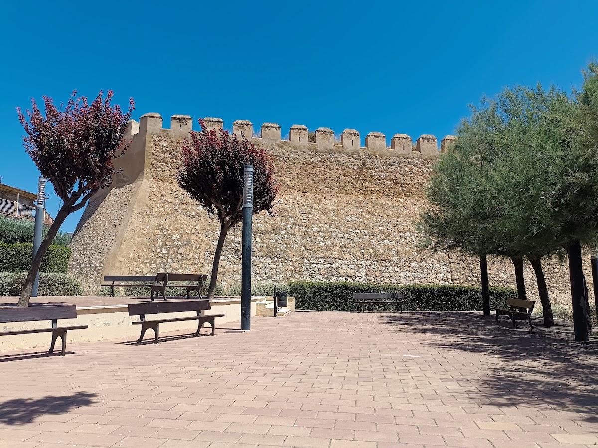
The fortress occupies a small hill in the centre of Caudete, at the northwestern edge of the Barrio de la Villa. Its perimeter follows a polygonal plan and encloses approximately 1,800 square metres. The surviving structure is chiefly a masonry fortress, with stone units set in mortar or a similar binding material. A large alambor, a sloping defensive base added to the lower part of a wall, extends along the southern parapet. Thirty-four quadrangular merlons, the raised sections between openings in a battlement, survive in good condition. Each has a small four-sided, hipped-roof finish.
Four masonry towers mark the corners of the enclosure, two of them identified as Muslim towers. The eastern tower is also identified as the keep. Its wall is specially thickened by more than one metre because it protected the castle entrance and main gate. Archaeological work has uncovered the bases of all four corner towers, the wall-walk, a passage along the top of a defensive wall, a cistern for collecting and storing water, and the staircase leading to the principal entrance. The entrance was protected by the eastern tower.
Fortified town and surrounding landscape
The castle formed part of the fortified enclosure of the town. A wall extended from the fortress around the settlement and contained three documented gates. The Murcia Gate stood beside the castle, the Villa Gate occupied the eastern end of the enclosure, and the Valencia Gate was at the western end. The Valencia Gate served as the principal entrance and led directly to the main square. Its former location is now occupied by the arches of the Lonja, where the enclosure closed the Church Square.
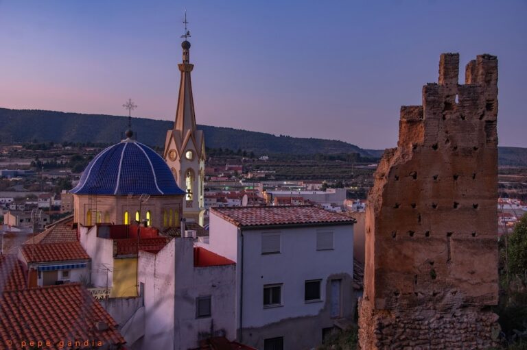
Later archaeological layers preserve physical evidence of the site’s changing functions. Numerous niches belong to the period when the enclosure served as a parish cemetery, while garden beds reflect its subsequent use as a parish garden. Recovery work restored parts of the southern and western retaining walls and part of the northern tower. Adjoining construction has been cleared from the fortress, although four houses remain attached to the northern wall.
Parque de los Reyes Católicos
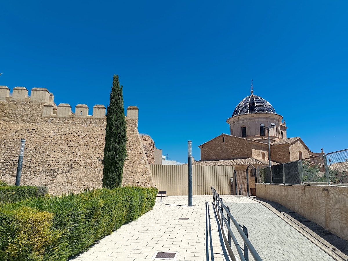
In 2004, the surroundings were adapted by opening the alley that connects the castle with the Church Square. Beside the complex, the Parque de los Reyes Católicos was created with a garden designed in an Andalusi-inspired style. The garden is linked to the castle by the opened alley leading toward the Church Square, adding a later landscaped setting to the preserved medieval enclosure.