Rada: A Medieval Walled Settlement and Castle in Spain
Site at a Glance
- Popularity
- Medium
- Country
- Spain
- Primary era
- Medieval
- Eras represented
- Medieval
- Civilizations
- Kingdom of Navarre
- Site type
- Military
- Remains
- Fortified Town
On this page17 sections
History
Early occupation and frontier role
Rada was a medieval walled settlement and castle site in Spain. Human activity in the area reaches back to the Late Bronze Age and Roman period. A substantial Late Iron Age settlement may also have occupied the hill. Archaeologist Javier Armendáriz has identified it as a possible oppidum, a large fortified settlement, and its abandonment may date to the second century BCE. The hill may then have remained uninhabited for several centuries before settlement returned in Late Antiquity. The later community may have endured until 1455 and may at one stage have been under Muslim rule.
By the tenth century, Rada served as a defensive lookout against Muslim forces. It first belonged to the Kingdom of Pamplona and later to the Kingdom of Navarre, on a frontier that subsequently faced Aragon. From its position, the fortress could monitor the surrounding area and transmit warnings of attack. Its defensive arrangement has been linked to the start of a fortification line associated with Sancho III the Great, king of Pamplona in the eleventh century. That line extended to the former County of Aragon, although Rada’s original construction date is unknown.
The medieval settlement and its lords
In 1093, Sancho Ramírez gave the church of San Nicolás to the Abbey of Montearagón, a religious institution in the Kingdom of Aragon. The settlement reached its height between the twelfth and fifteenth centuries. Rada was also the seat of a powerful Navarrese lineage. One of its prominent members, Rodrigo Ximénez de Rada, became archbishop of Toledo and Primate of Spain.
The family’s connections brought Rada into the politics of neighboring kingdoms. In 1222, Bartolomé Jiménez de Rada paid homage to Sancho VII of Navarre. Around 1250, Gil de Rada reached an agreement with Jaime I, king of Aragon. Gil’s wife, María de Leet, promised Theobald I, king of Navarre, that she would make no concessions concerning the castle or town without his approval.
Royal control and disputes over the castle
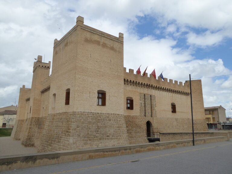
The town and castle passed into the Crown’s possession in 1297. By 1306, the lower defensive wall was in danger of collapsing and threatening the palace and nearby houses, so the Crown ordered repairs. Louis Hutín later granted Rada to Ojer de Mauleón in exchange for the castle of Mauleón and several places in Sola. The Crown took the castle back in 1328 because Ojer had not paid homage to the new king, Philip of Évreux.
In 1351, Charles II granted Rada to Juan de Mauleón with its revenues and jurisdiction. He also assigned income for the castle’s guard and strengthening, as the fortress was close to collapse. Charles III transferred it in 1389 to his chamber attendant, Martín de Aibar, prompting the Mauleón family to challenge the grant. In 1402, Ojer the younger of Agramont and Mauleón paid homage to the king as lord of Rada. He was still receiving a payment for maintaining the castle in 1449.
Civil war and destruction
In the fifteenth century, Rada contained 38 hearths, a count of household units; 21 belonged to hidalgos, members of the lower hereditary nobility. During the Navarrese Civil War, the Beaumontese faction occupied the town and castle. Rada supported Carlos, Prince of Viana, in his struggle with his father, Juan II, after the death of Queen Blanca of Navarre in 1441. The Beaumontese and Agramontese were rival factions in the conflict.
In 1455, the Agramontese commander Martín de Peralta besieged and captured Rada in the king’s name, then ordered its destruction. The church remained standing, while towers and walls survived as ruins; the settlement did not recover. Juan II tried to repopulate Rada in 1462, and Francis Phoebus made a later attempt. Charles and Tristan de Mauleón were its lords during this period. In 1497, Tristan sold the deserted settlement.
Later land use and archaeological work
In 1703, the palace and hereditary estate belonged to José Morales y Rada, who obtained a seat and vote in the Cortes of Navarre, the kingdom’s representative assembly. By 1802, Rada was a depopulated, uncultivated lordship held by the Marquis of Cortes, Duke of Granada de Ega, though its land was considered suitable for livestock. It was divided into five grazing enclosures and included seven leased sheep pens. An 1802 listing placed Rada in the Olite district. A description from 1840 recalled an earlier connection with the district of Tudela, ending sometime after the union with Castile. Municipal reforms between 1835 and 1845 placed the site within the council district of Traibuenas and the municipality of Murillo el Cuende.
The site’s last owner, Luis de Silva, Duke of Miranda, gave it to the Government of Navarre in 1981. Systematic excavations began in 1984.
Remains
The enclosure occupies a hill about 160 metres from north to south and up to 92 metres across. Its roughly triangular, walled area covers approximately 8,300 square metres, with a perimeter of about 400 metres. The surrounding plain is watered by the Aragon River, which runs below the castle site. The surviving medieval remains include defensive walls and towers, the church of San Nicolás, and excavated streets and houses.
Walls and towers
Walls
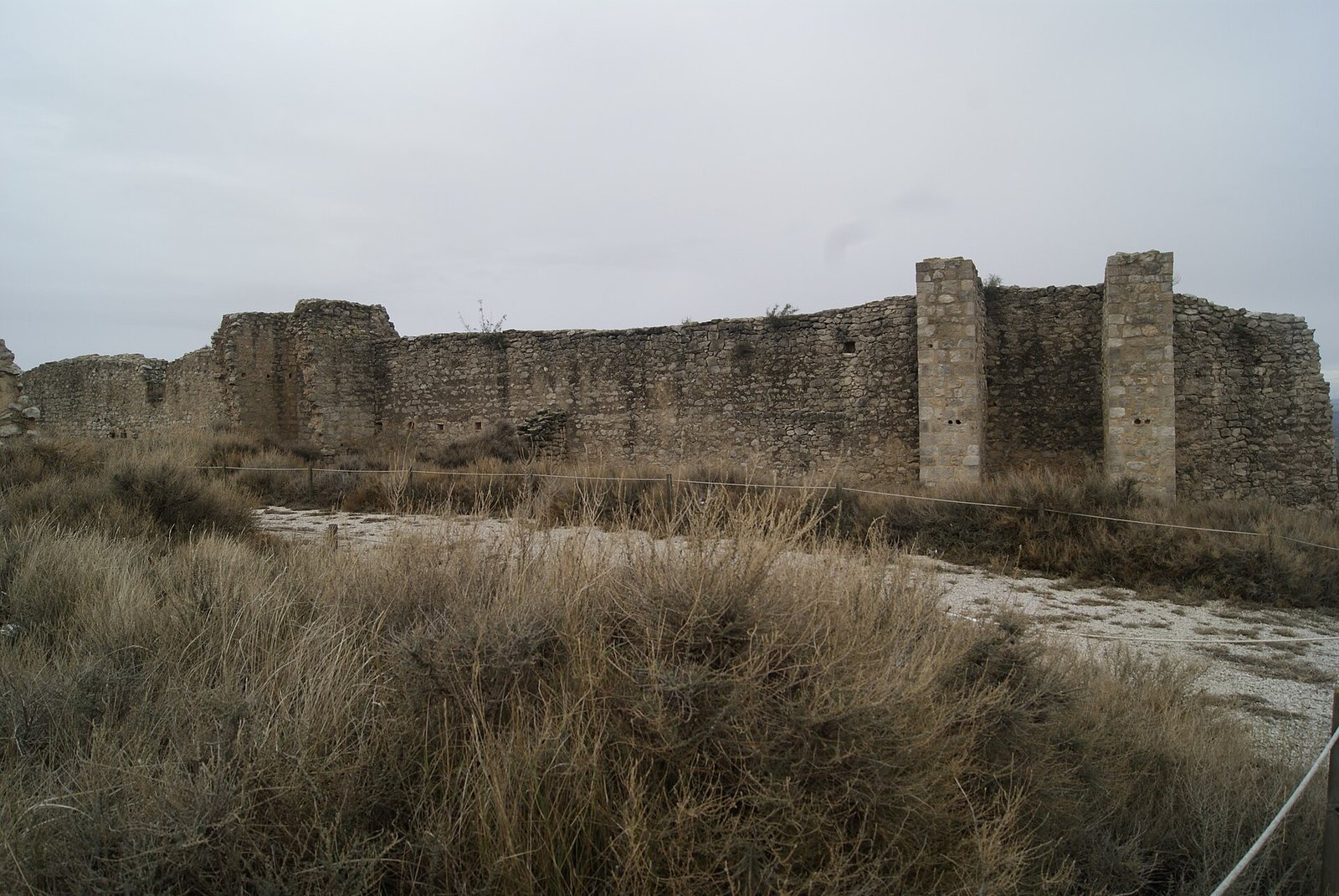
Wall remains survive mainly along the eastern slope and, especially, on the north side of the enclosure. A substantial northern section consists of stone blocks raised on a pronounced foundation. The enclosure’s houses and defenses were built with masonry, and the surviving walls include substantial construction.
Towers
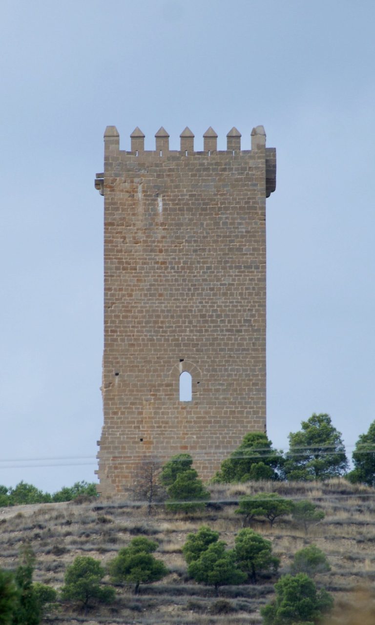
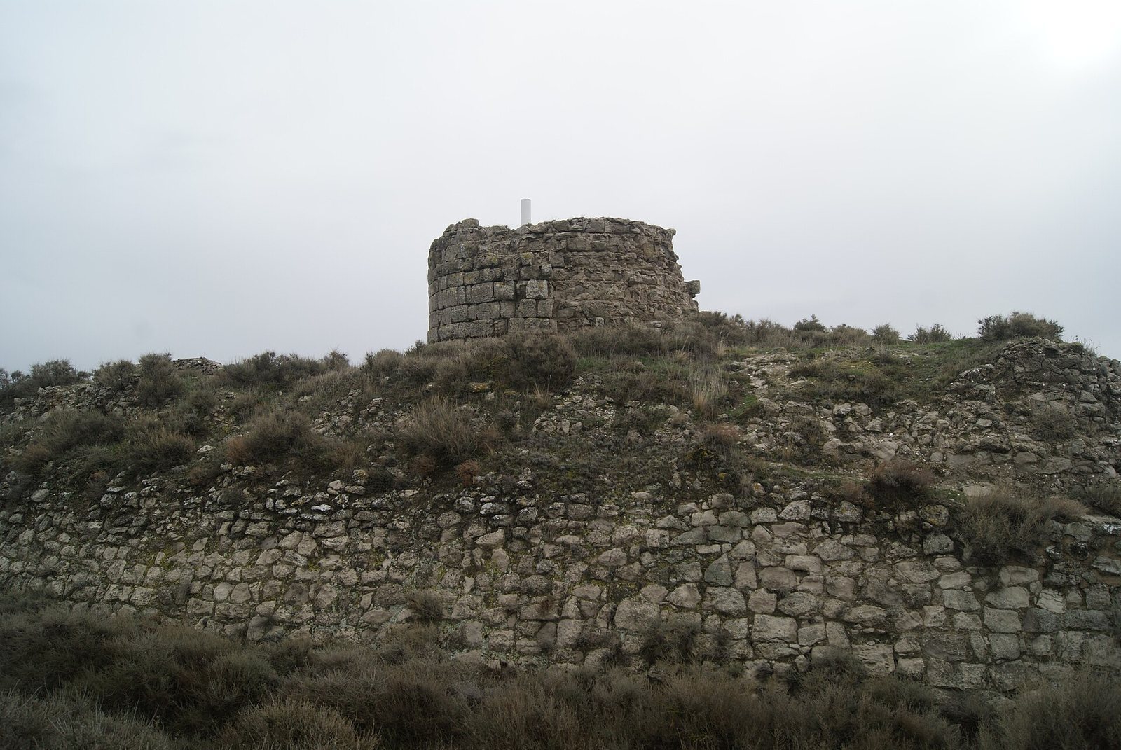
Two prismatic towers stand along the northern wall, with traces of other towers also visible. At the highest and steepest point of the southern corner, the base of a circular watchtower survives. It has massive courses of carefully cut stone blocks, with part of its inner core visible. The tower measures 8.5 metres across externally, and 3.5 metres of its original height remain.
Church of San Nicolás
Plan and construction
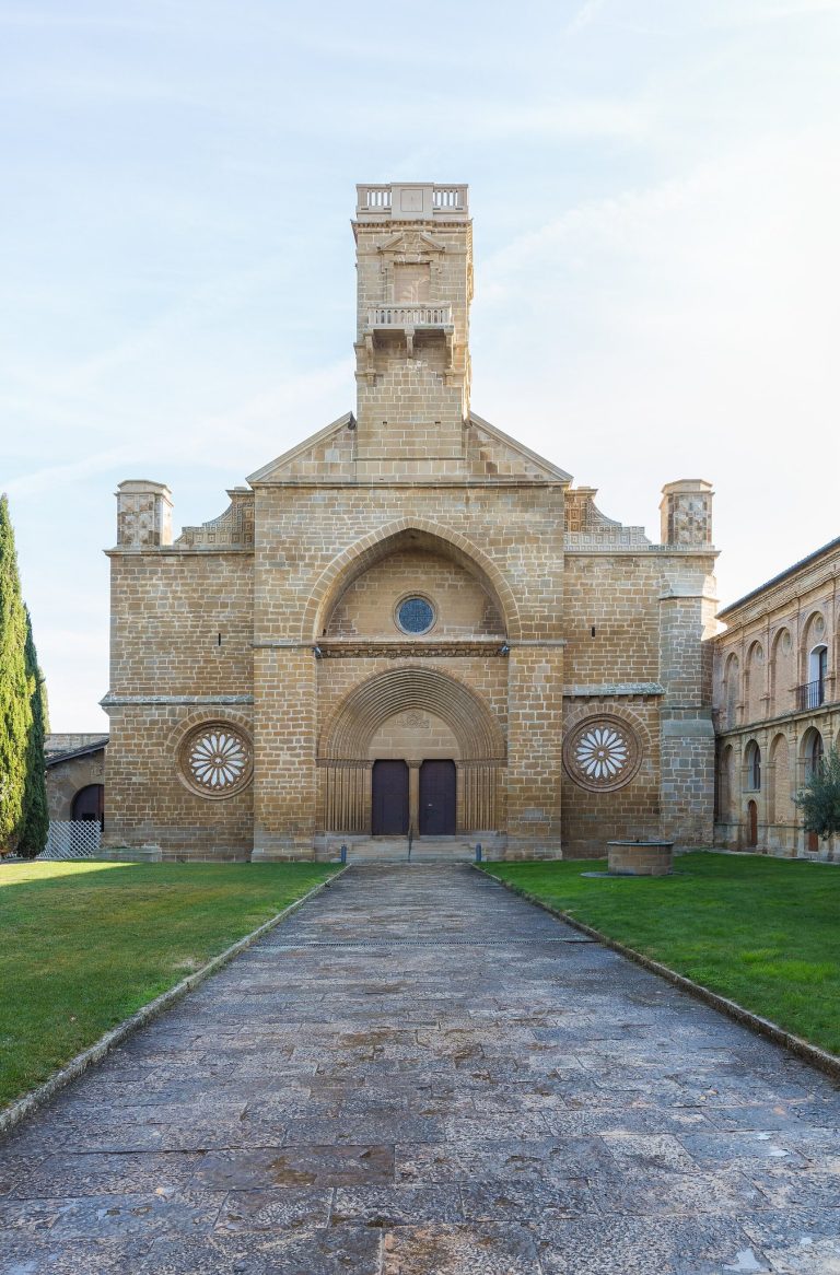
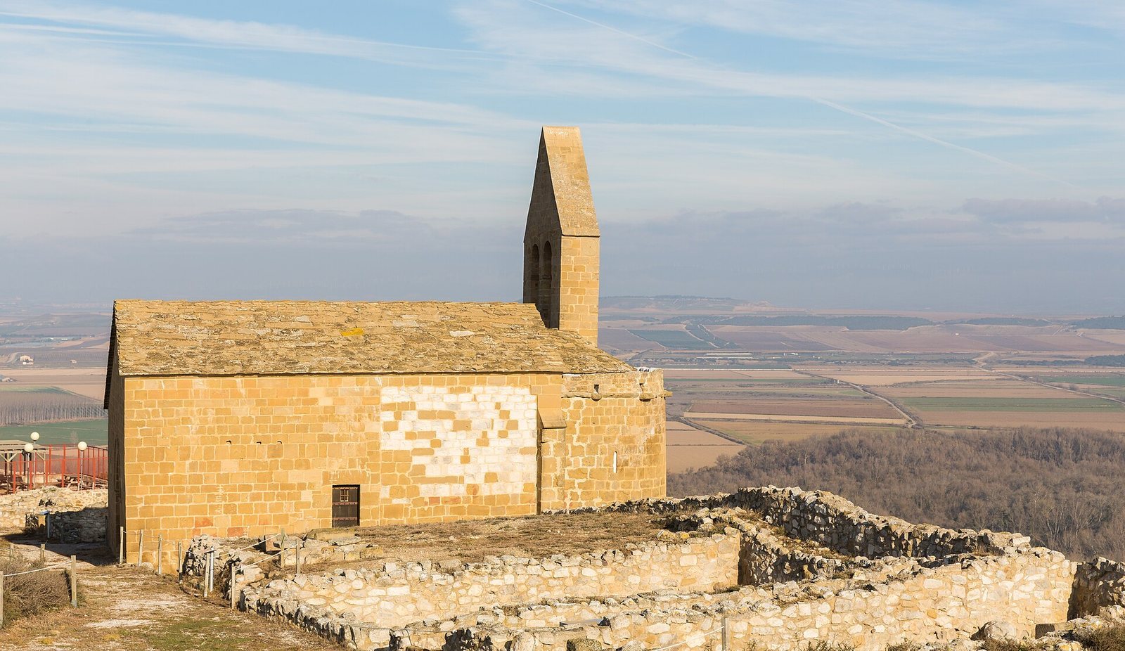
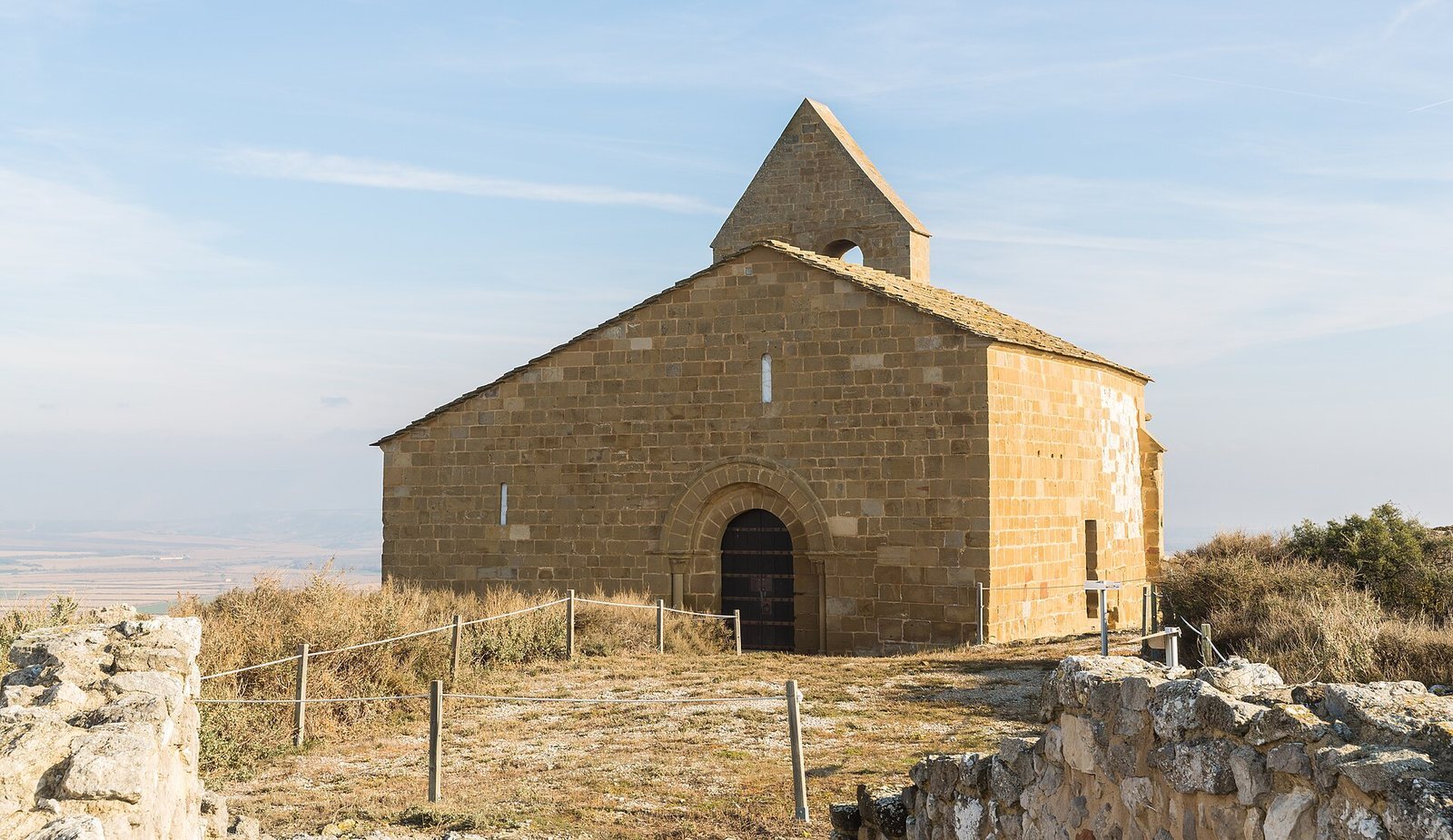
The twelfth-century Romanesque church, built in a medieval European architectural style, survives as a restored hermitage, or small chapel. It formed part of the enclosure, with its apse, the sanctuary end of the church, positioned over a slope. The church stands near the circular tower remains and a second gate. Its original plan had one nave, the main body of a church, ending in a rounded apse. Later, a smaller second nave was added, with a straight-ended sanctuary. The bell gable sits on this addition, which also makes the entrance portal appear off-centre.
The church is built of well-cut sandstone blocks bearing numerous masons’ marks. Inside, the apse has a lintel carved with a checkerboard pattern. The building’s surviving form reflects both its original plan and its later enlargement.
Christian symbols
Two six-armed Christian monograms appear on the church, one in the bell gable and the other above a side door. Each is enclosed by a circle and has a central rosette, with alpha and omega, the first and last letters of the Greek alphabet, representing beginning and end. The church’s design has been compared with Romanesque fortified enclosures in Aragon, including those at Fantova and El Pano.
Streets, houses, and town infrastructure
Streets and houses
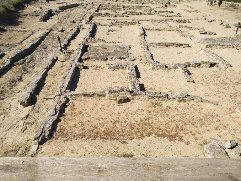
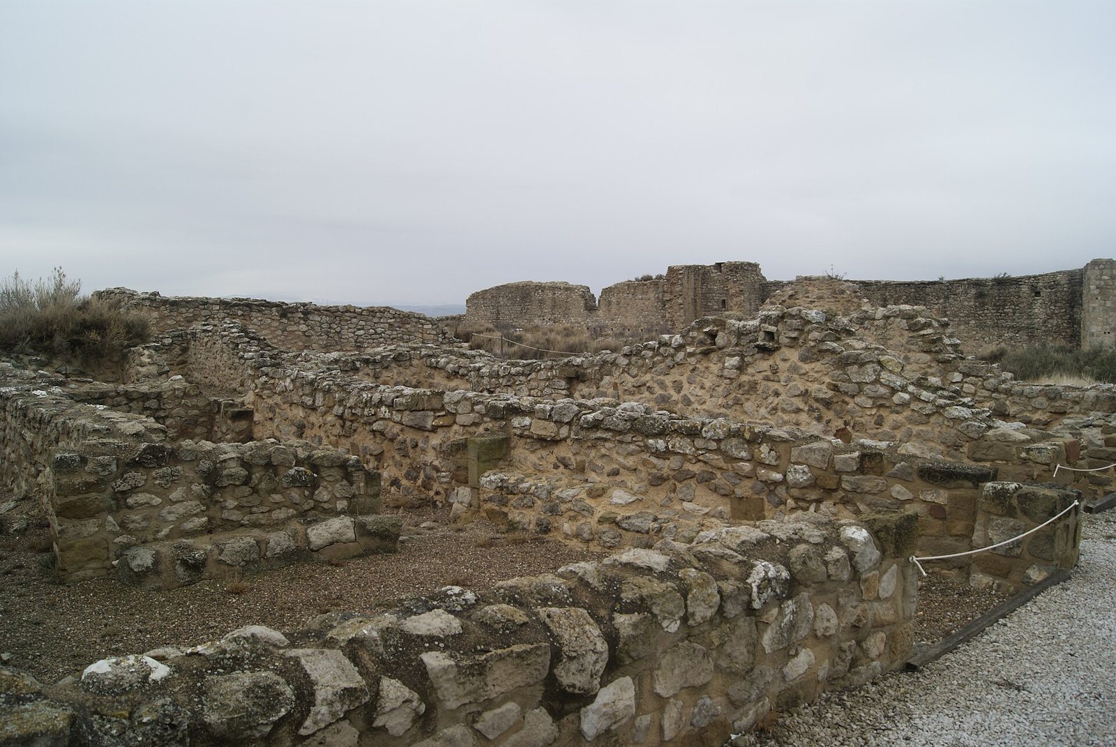
By 1990, excavations had revealed three sections of streets and fifteen houses. The houses were built of masonry and had two storeys, with timber-framed floors between them. The ground floors generally served as living spaces and the upper floors as bedrooms. Some houses had built-in stairs; others used attached wooden stairs to reach the upper level. Roofs probably had timber supports reinforced with branches and tiles.
Numerous burnt remains were found, particularly near walls. The excavated evidence records burning within the settlement, without establishing a single roofing arrangement for all of its houses.
Cistern and burial ground
A large, finely made cistern was exposed in the excavated settlement. Excavation also established the limits of a necropolis, or burial ground.
Outlying settlement
About 400 metres northwest of the enclosure, an unstructured settlement or area of economic activity occupies a hill above a ravine that descends toward the Aragon River. Domestic structures on its southeastern slope may date to before Roman rule, though their age is uncertain. Erosion and later medieval settlement layers have scattered fragments of early household tools across the slopes. Celtiberian pottery and a hand mill were found on the surface, alongside pottery from the Late Bronze Age and Roman period, including fine Roman ware known as sigillata.