Krämerbrücke: Erfurt’s Medieval Merchants’ Bridge
Site at a Glance
- Popularity
- Very High
- Country
- Germany
- Primary era
- Medieval
- Eras represented
- Medieval
- Civilizations
- Holy Roman Empire
- Site type
- Infrastructure
- Remains
- Bridge
On this page10 sections
History
The Krämerbrücke is a medieval stone pedestrian bridge across the Breitstrom, a branch of the Gera, in Erfurt, Germany. Its stone crossing was completed in 1325. The bridge formed part of Erfurt’s medieval trading network, and its combination of commerce and habitation has continued for more than five centuries. It is described as Europe’s oldest continuously inhabited bridge.
Wooden crossing and medieval trade
A wooden bridge stood at the same ford during the eighth to eleventh centuries. A fire had destroyed it by the time the crossing was mentioned in 1117. A chapel beside the ford was mentioned in 1110 and later identified with St Giles’ Church. By 1156, the crossing was referred to as a market bridge, with merchants’ stalls on both sides. The name Krämerbrücke, meaning Merchants’ Bridge, has been used since 1510.
The bridge formed part of the Via Regia, a major medieval network of trade and pilgrimage routes that included a route from the Rhine to Silesia. It also lay on a main route of the Camino de Santiago, the network of pilgrim roads leading to Santiago de Compostela. Erfurt was an important trading centre at a crossroads of the Via Regia and belonged to the Hanseatic League, an alliance of northern European trading towns.
Stone bridge and changing commerce
Fires damaged the wooden crossing in 1175, 1178, 1213, 1222, 1245, 1265 and 1293. After the 1265 fire, the city proposed replacing it with a stone bridge. In 1293, the municipal administration acquired bridge rights from monasteries that had traded there, and the stone crossing was subsequently completed.
For about a century after its completion, stalls mainly sold local produce. The Augustinian monastery of St Augustine, the Dominican Preachers’ Monastery and the Benedictine monastery of St Peter and Paul sold herbs for cooking and medicine, wine and vegetables. Trade later broadened to include paper, goldsmiths’ work, silk, spices and perfumes from the East. Some goods, including frankincense, travelled as far as 7,000 kilometres. Woad, a plant cultivated for the blue dye made from its leaves, was grown locally and sold to merchants who distributed it across Europe.
Rebuilding and community life
A fire in 1472 destroyed nearly half of Erfurt and burned the bridge’s market stalls. Replacement houses were completed in 1486. Later fires and the joining of separate buildings reduced the number of houses to 38 by the eighteenth century. During the sixteenth and seventeenth centuries, bridge workshops housed craftspeople such as toymakers, furriers, makers of decorative textile trimmings and leather tanners.
In 1624, the city council authorized street musicians to perform on and around the bridge. Music remains part of the annual Krämerbrückenfest, held since 1975 and centred on the bridge and medieval culture. An actor playing Till Eulenspiegel, a legendary German trickster, officially opens the festival. In a related tale, he fooled university professors into believing he had taught a donkey to read.
Churches, damage and conservation
At the western end, St Benedict’s Church was sold in 1807 and demolished in 1810, apart from its tower, to make way for a house. The tower was pulled down in 1895 when the Rathausbrücke was built across the river, parallel to the south side of the Krämerbrücke. A proposal to demolish the Krämerbrücke itself was abandoned because of the cost.
An Allied air raid in 1945 damaged houses 11–14 and destroyed No. 12. Houses 12 and 13 were subsequently demolished and rebuilt, with the work completed in 1954. The East German government gave the bridge special monument protection in recognition of its importance to Erfurt’s history and architecture. All the buildings were restored between 1967 and 1973, followed by extensive work on the whole bridge structure, including its arches, in 1985–86.
Maintenance has continued since 1990. In 1996, Erfurt’s city council established the Krämerbrücke Foundation to care for the bridge and promote its history. The foundation also guides the types of businesses operating there to help preserve its historic character. The bridge continues to combine habitation with commerce.
Remains
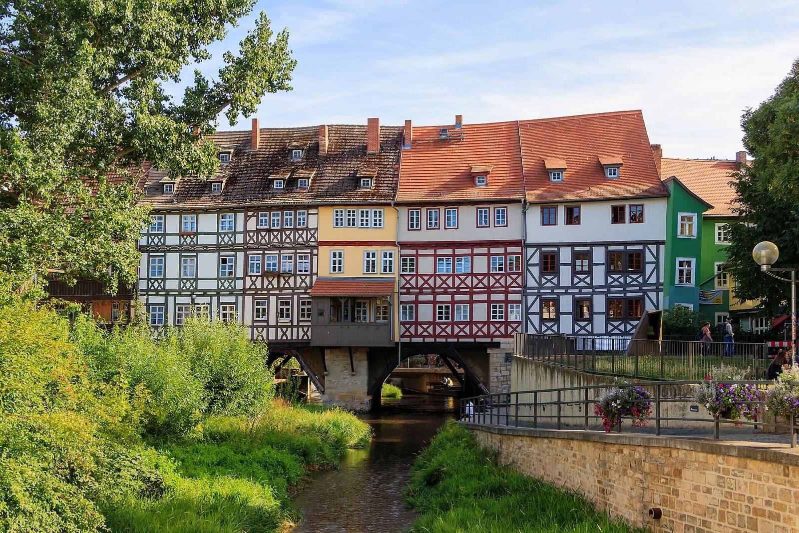
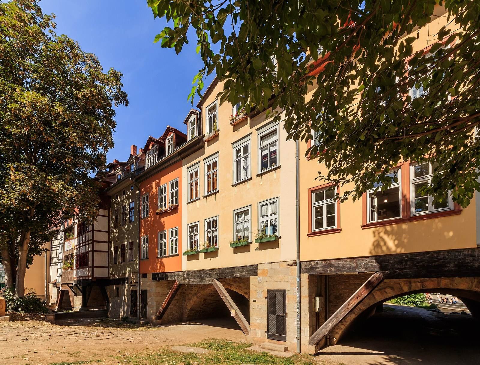
The bridge spans the Breitstrom between Benediktsplatz and Wenigemarkt. Its built-up street rests on a stone structure with six visible arches beneath it, while two rows of houses line the crossing.
Stone crossing
The bridge is 125 metres long and 26 metres wide. Its central section, supported by six visible barrel vaults, extends for 79 metres. A barrel vault is a continuous, half-cylinder-shaped arch. The bridge is built of limestone and sandstone; its vaults are about 5–8 metres wide and 2.4–3.9 metres high. The pier heads and beams are 40–50 centimetres thick. Timber braces alongside the stone arches extend the usable width, allowing the houses to project slightly beyond the masonry.
Half-timbered houses
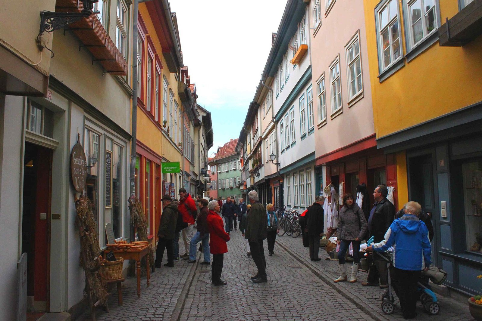
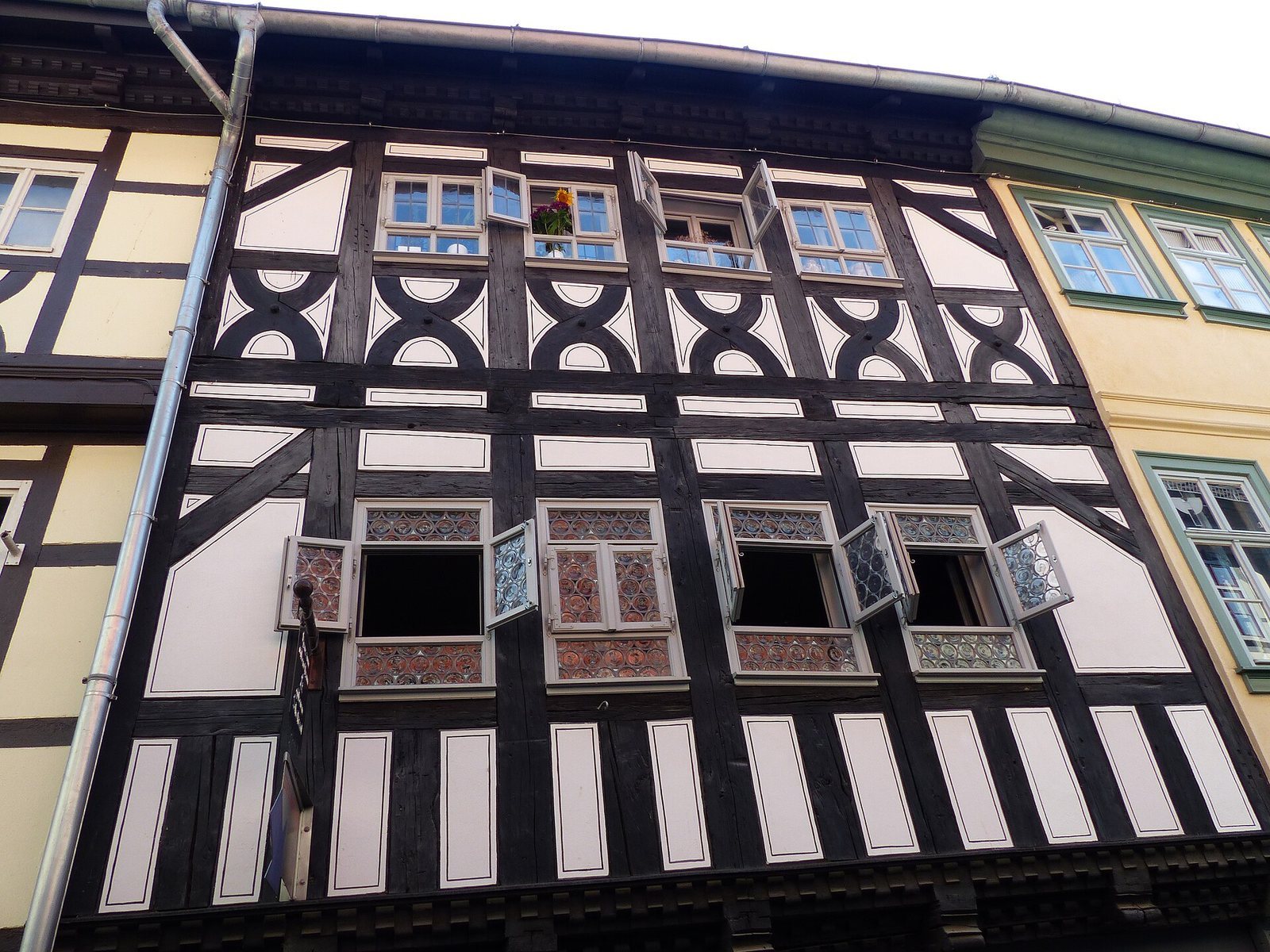
The houses form two rows along a street 5.5 metres wide. These three-storey timber-framed buildings stand 13–15 metres tall, with shops on the ground floors and living quarters above. The original building scheme comprised 62 houses arranged along the stone bridge; 32 houses now stand there. Some retain marks once used to identify buildings and their occupants, as well as original doors that may be several centuries old. Historic house names include Zur Glocke at No. 7, Zum roten Turm at No. 17 and Haus der Stiftung at No. 31. In the postwar rebuilding, replacement beams in houses 11 and 14 were 11.5 metres long, with cross-sections of 48 by 36 centimetres and 26 by 36 centimetres.
Living and working on the bridge
About 80 people live on the bridge. Its premises include craftspeople’s workshops, specialist food shops, antique shops, wine merchants, galleries and cafés. A bakery stands at the western end, and a blue-dye workshop is among the craft businesses. At No. 31, the Foundation’s house contains a permanent exhibition about the bridge and a scale model made at 1:100.
St Giles’ Church
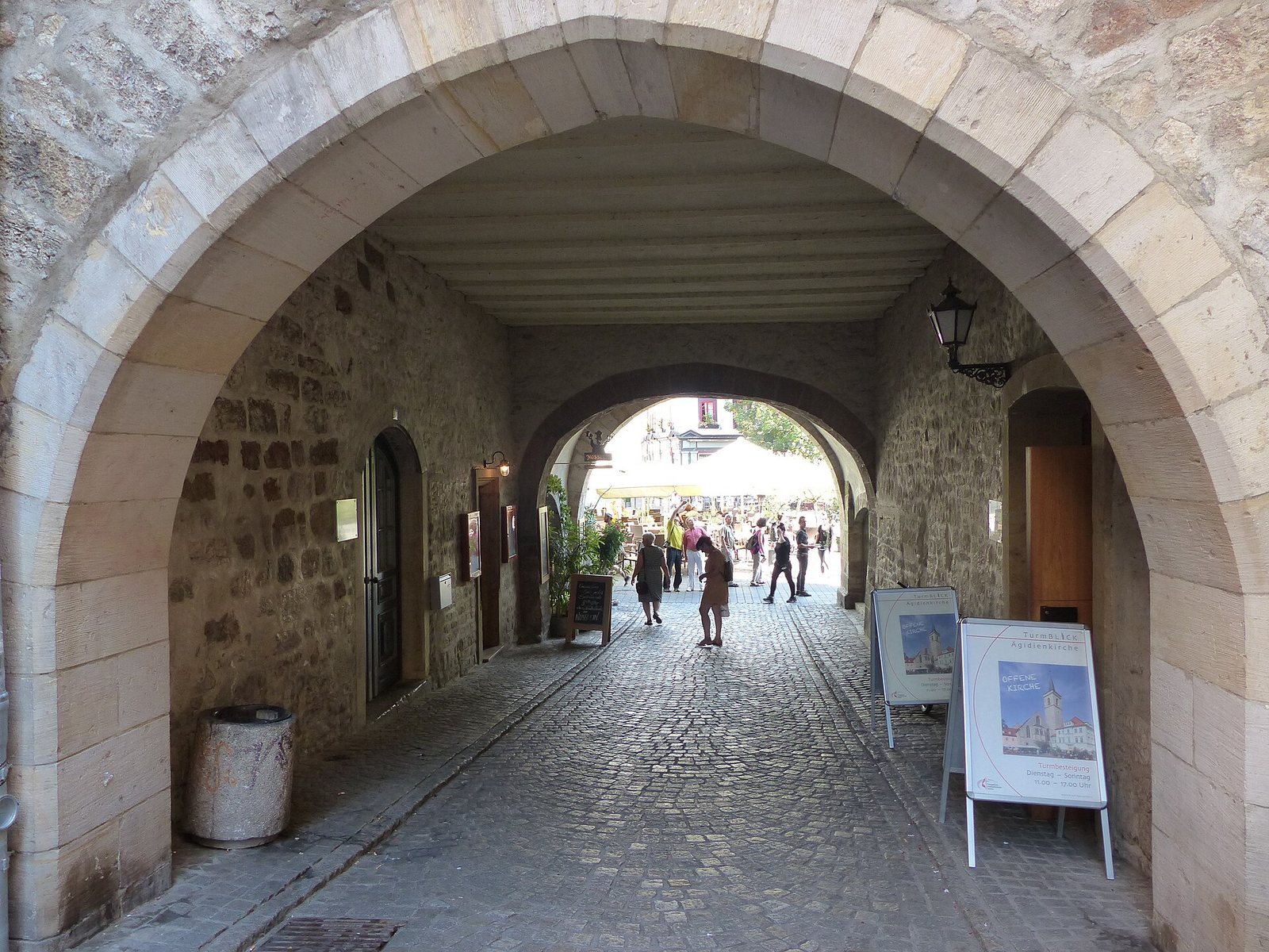
St Giles’ Church stands at the eastern end of the bridge and was formerly a chapel for people using the crossing. Its bell tower, also called the Red Tower, is 33 metres high. Beneath the church, an arched passage provides access to the bridge; it is 3.75 metres wide and 3.25 metres high.