Castle of Borsod: Administrative Center of a Medieval Hungarian County
Site at a Glance
- Popularity
- Medium
- Country
- Hungary
- Primary era
- Medieval
- Eras represented
- Medieval
- Civilizations
- Hungarian
- Site type
- Military
- Remains
- Castle
On this page13 sections
History
The Castle of Borsod was an earthen fort and the administrative center of Borsod County at the former settlement of Borsod, now part of Edelény, Hungary. The fort is dated to around 1000, while a settlement beneath it dates to the mid-tenth century and its two rampart-building phases to the late tenth or early eleventh century. Borsod County took its name from the fort.
Origins and the county
Gesta Hungarorum, a medieval Hungarian chronicle by an anonymous author conventionally called Anonymus, links the fort’s origins to the Hungarian conquest, when Magyars settled and established rule in the Carpathian Basin in the late ninth century. In this account, Árpád, an early Magyar ruler, sent Bors to survey the region as far as the Tatras. Bors supposedly gathered local people, built a fort, and became its ispán, or county administrator. The chronicle says the fort and district were named after him, but Bors’s historical existence is not reliably confirmed. The name’s final “-d” has been interpreted as a diminutive referring to the fort’s small size; archaeologist János Makkay proposed that it could instead express possession, meaning “Bors’s.”
Some earlier scholars accepted a conquest-era origin and viewed the fort as a frontier defense. Historian György Györffy placed Bors about a century later, during the formation of the Hungarian state, and identified him as the area’s first county administrator. He proposed that the fort was built beside an important military route leading out of the country and served as the emerging county’s administrative center.
Charter references and abandonment
The earliest surviving charter, a formal written record, to mention the castle dates to 1219. It names the castle’s castellan, the official responsible for its command or administration, and its prison guards. It also identifies the villages of Múcsony and Berente as belonging to the castle. Charters from 1230 and 1263 likewise mention a castellan.
Some earlier scholars associated these records with the nearby stone castle of Szendrőlád, reasoning that such officials would not have served at an earthen fort. That argument relied on a narrow reading of castrum, a Latin word for a fortification or castle. In period charters the term could describe a fort regardless of its building material, so the wording does not require a stone structure. The Borsod fort probably lost its military and administrative functions in the decades after the Mongol invasion, the campaign in Hungary in 1241–42. It was abandoned in the second half of the thirteenth century and described as a ruin in 1334.
Archaeological investigations
A probing excavation in 1926 reached four metres deep beside the ramparts. Further work took place from 1987 to 1999. In 1988–90, archaeologist Gyula Nováki cut through the ramparts at two points and exposed numerous pieces of timber, including charred wood. The investigations identified two construction phases and showed that the fort did not reuse an earlier prehistoric fortification.
Excavations in 1993 revealed a church associated with the fort, adding evidence of religious life alongside its administrative role.
Remains
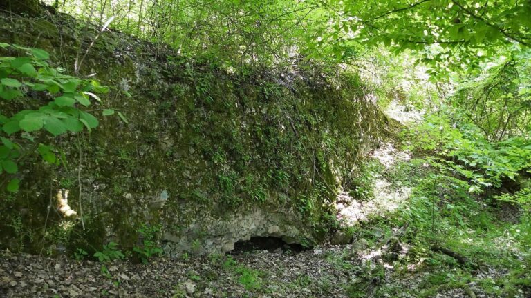
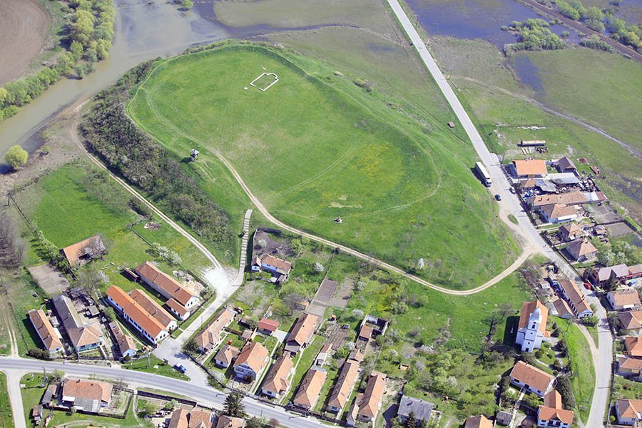
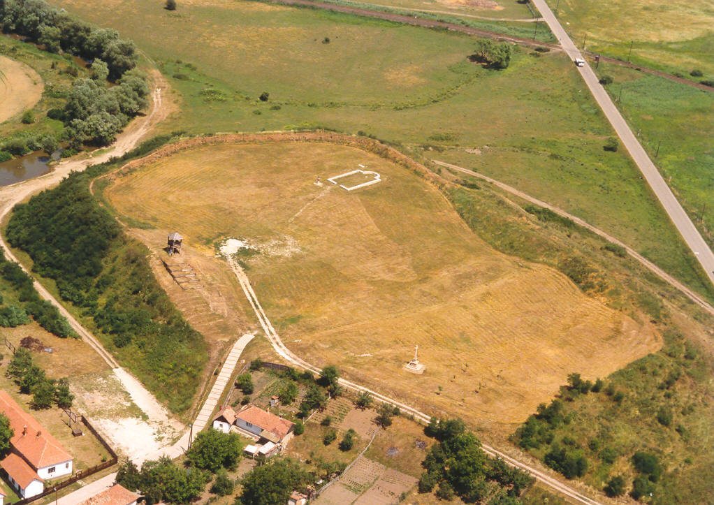
The enclosure covers 1.7 hectares on a hill on the left bank of the Bódva River, about 15 metres above the water. The river and marshes protected its western, northern, and eastern sides. Its area was smaller than the three to four hectares described as usual for forts of the period. Earthen defensive banks, or ramparts, enclose the central area.
Ramparts
The ramparts are about ten metres wide and now rise roughly five metres above the enclosure’s center, though they were probably higher originally. Their foundations were built from two rows of box-like timber compartments, strengthened by beams running through the middle. Round logs were stacked like a woodpile to form the compartments, and the gaps were packed with earth.
The ramparts had a steep outer face and a sloping inner face. A fence of woven branches coated with mud may have stood along the top. The entrance was probably in the southern rampart.
Earlier ditches
Two east–west ditches lie beneath the settlement remains. Each is about 20 metres wide and 3 to 3.5 metres deep. They predate both the settlement and the ramparts, but their relationship to the fort’s later features is uncertain.
Settlement and buildings
Settlement remains
Small houses and freestanding ovens belonged to the settlement within the enclosure; traces of it also lay beneath the ramparts. Because the settlement came before the ramparts and some remains were incorporated into their construction, the defenses could not have protected it. A thick covering of red-burnt clay over the buildings indicates destruction by fire. Finds include pottery fragments, pieces of mud plaster, grinding and sharpening stones, an iron clamp, and a bone skate. Burnt seeds of wheat, barley, millet, and peas, along with medicinally gathered sage and several fruits, provide evidence of food and plant use. Many vessels had ribbed necks, a form rare in the Carpathian Basin and considered probably ancient Hungarian in origin. A small number of metal objects and bronze ornaments were also found; similar ornaments occur in commoner cemeteries dating to the mid-tenth century.
Stone building
At the enclosure’s northeastern side are the remains of an irregular, roughly square stone building, about five metres on each side. Its walls were approximately 80 centimetres thick and built from cut stones set in clay. It may have served as the residence of the settlement’s leader.
Churches and burial grounds
Church within the enclosure
The church had a nave, or main central part, 15 metres long and eight metres wide, ending in a horseshoe-shaped sanctuary, the area around the altar, about 3.5 metres across. Its walls, around 80 centimetres wide, have been removed; their foundation trenches survive, along with stones set in mortar in places. Near the sanctuary were a stone holy-water vessel, a stone slab thought to have served as the altar, and coins from the reign of Solomon, an eleventh-century king of Hungary. Only one grave was found nearby. The church’s size and the nearby burial evidence have prompted the suggestion that it served as the county’s deanery church, a center for religious oversight and activity.
Village church and cemetery
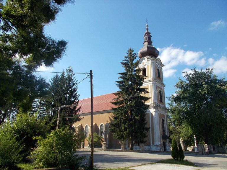
Outside the ramparts, a cemetery dating to the second half of the eleventh century surrounded the separate church used by villagers, on the site of the present-day Reformed church. A cemetery near that church was investigated in 1926 and yielded nine hair rings, ornaments worn in the hair. They date to the Árpád period, the era of the Árpád dynasty’s rule in Hungary.