Castra Drobeta: A Roman Fort Guarding Trajan’s Bridge
Site at a Glance
- Popularity
- Medium
- Country
- Romania
- Primary era
- Classical
- Eras represented
- Classical
- Civilizations
- Byzantine, Roman
- Site type
- Military
- Remains
- Fort
On this page18 sections
History
Castra Drobeta is a Roman military fort in Romania whose construction began in AD 101 under Emperor Trajan, to protect the northern end of Trajan’s Bridge and house about 500 soldiers. Building continued into the opening years of Hadrian’s reign. The bridge, built in AD 103–105 as preparations for Trajan’s Second Dacian War, connected Dacia, the Roman province north of the Danube, with Moesia Superior to the south. Drobeta stood at the beginning of the imperial road into Dacia and, with the bridge and the fort at Pontes, helped secure that connection.
Foundation and the Roman settlement
Drobeta was the first stone fort built by the Romans in Dacia. Trajan spent the winter of AD 105 there. A civilian settlement, known as a vicus, grew around the military installation. Hadrian granted Drobeta municipium status in AD 121, a rank for a Roman town, and Septimius Severus raised it to colonia status, a higher civic status, in AD 193. The settlement developed into an economic and commercial center with close links to ports along the Danube.
The fort passed through at least five building and consolidation phases and continued in use from the Roman period until the early seventh century. Military units associated with Drobeta included Legio IV Flavia Felix, Legio V Macedonica, Legio VII Claudia, and Legio XIII Gemina, as well as Cohors I Antiochensium, Cohors I Sagittariorum, Cohors I Cretum, Cohors II Hispanorum, Cohors III Brittonum, and Cohors III Campestris. A legion was a major Roman military formation, while a cohort was a smaller unit.
Rebuilding and late antique rule
After a Carpic invasion in AD 245–247 damaged the fort, a third construction phase, tentatively associated with Emperor Gallienus, brought changes to its defenses and military arrangements. Repairs and alterations followed in a fourth phase. During the fourth century, the former command area was probably used as a garrison by foederati, allied groups associated here with the Sântana de Mureș-Cerneahov culture of late antiquity in eastern Europe.
The Huns probably destroyed the fort in the first half of the fifth century. Rebuilding at the end of that century, possibly during the reign of Eastern Roman Emperor Anastasius I, began a fifth phase. A partial restoration under Justinian I marked Drobeta’s last period of flourishing. The Avars, a nomadic confederation active in central and eastern Europe, probably destroyed the fort at the beginning of the seventh century. In the tenth century, people established a settlement of huts over the ruins.
Names and archaeological history
Ancient forms of the place-name include Drubetis, Drubeta, and Drobeta. Drobeta and Theodora appear to have been used in the fourth century, while Theodora seems to have become the sole name in the sixth. The sixth-century historian Procopius of Caesarea is the only named ancient author to use Theodora. The name has been linked to Justinian I’s wife, the empress Theodora; other interpretations connect it to Constantine the Great’s wife or apply it only to part of the late fort.
Excavations revealed Bronze Age presence in Drobeta’s territory, including scattered pottery attributed to the Gârla Mare culture of the lower Danube. A hut from the late Hallstatt, an early Iron Age period, contained Dacian pottery. Excavation campaigns were led by P. Polonic and Grigore Tocilescu in 1896–1899, Alexandru Bărcăcilă in 1929–1932, Grigore Florescu, Lucian Roșu, Mișu Davidescu, and Mihail Gușiță in 1960–1965, and Mișu Davidescu in 1963–1970. The fort forms part of the UNESCO World Heritage property Frontiers of the Roman Empire–Dacia, inscribed in 2024.
Remains
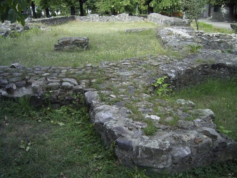
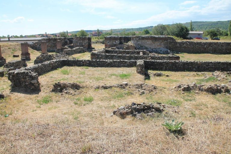
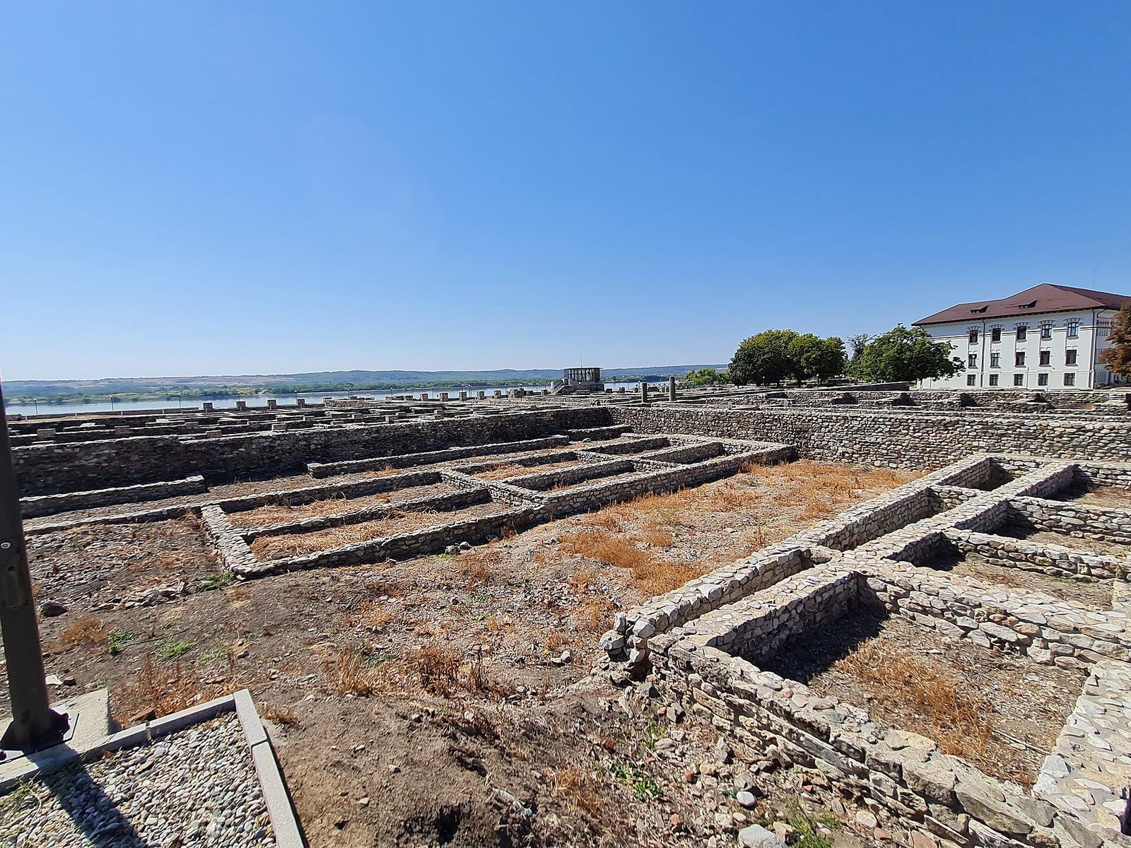
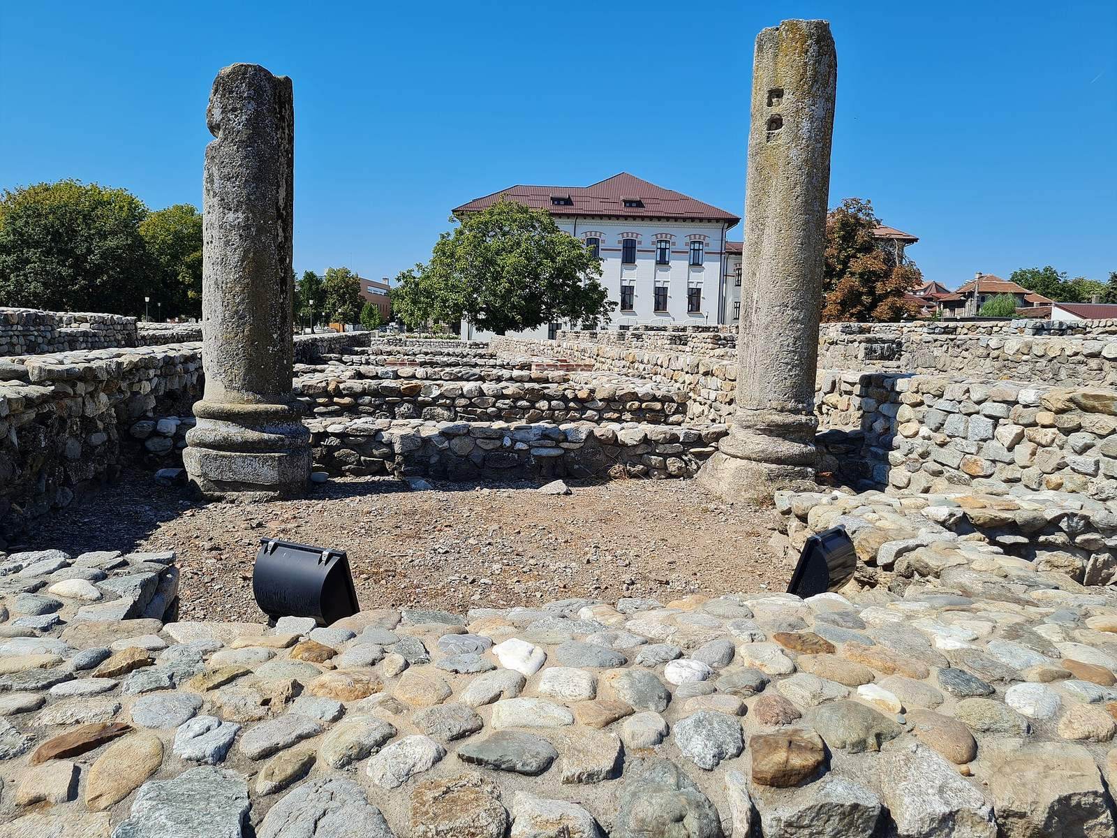
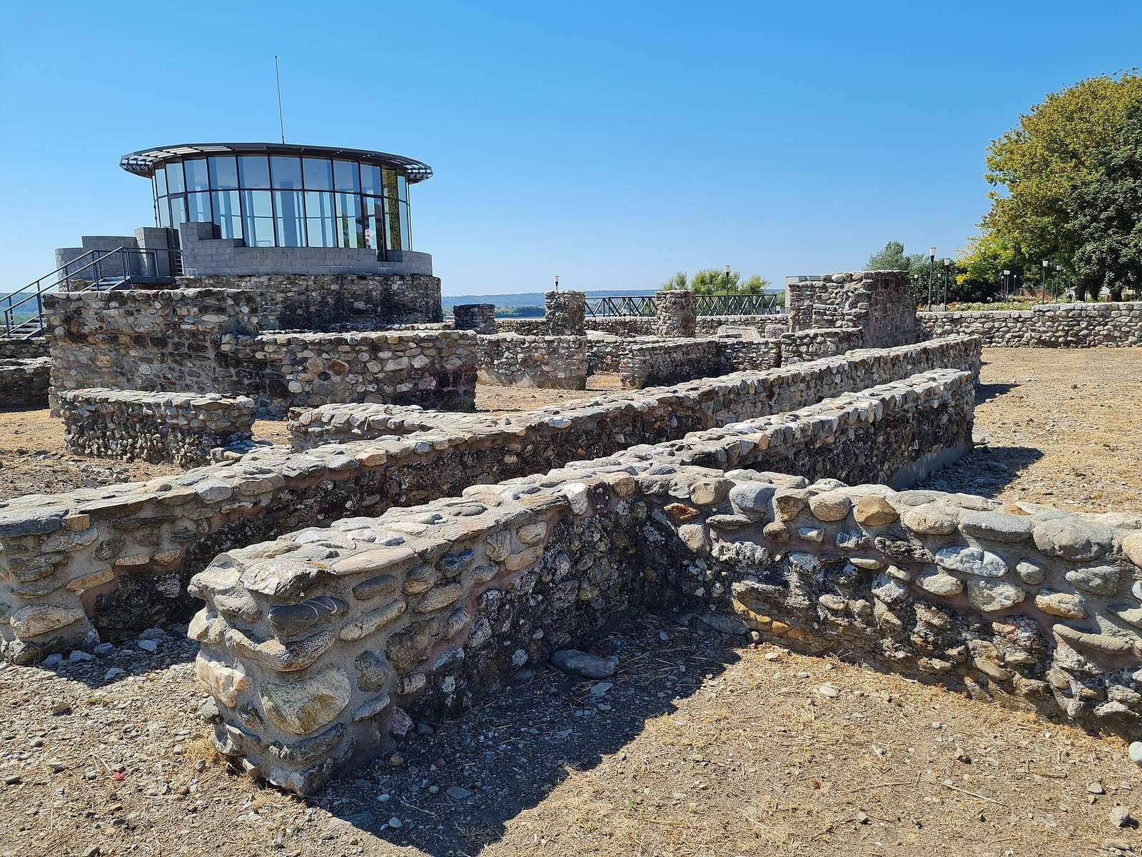
The fort covers about two hectares in a rectangular plan, and its foundations remain visible. Its main gate faced south, an unusual direction for a Roman fort, possibly because the garrison protected the bridge. The surviving layout reflects successive changes to the enclosure, internal buildings, streets, and defensive works.
The fort
Enclosure and first phase
The first enclosure wall used Roman concrete masonry faced with small, regularly laid stone blocks. Four gates pierced the wall: the south-facing main gate, or porta praetoria; the rear gate, or porta decumana; and two side gates, or portae principales. Two towers flanked each gate on the inside, projecting beyond the wall. Intermediate and corner towers followed the same construction style. A second wall ran along the inner side of the enclosure, with a patrol walkway between it and the main wall; a defensive ditch lay outside. The earliest interior buildings may have used timber and beams. Some masonry remains may also belong to this phase, including the fort headquarters and possibly buildings in the side zones.
Hadrianic buildings
During Hadrian’s phase, the interior included an officers’ residence, barracks, a hospital, and two granaries. The residence and hospital had small rooms arranged around central spaces framed by covered walkways. The barracks were L-shaped, with rooms allocated to individual subunits and a wooden walkway along each building’s long side. The two granaries stood symmetrically in the fort’s side zones.
A sacred courtyard had a brick pavement and a large reception room along its rear edge. A small shrine within it was rounded on the inside and rectangular on the outside. The main streets, the road from the main gate and the cross street, had covered walkways on both sides. Two other streets had wooden walkways, including one that ran around the interior beside the enclosure wall.
Third-phase defenses and buildings
In the third phase, builders closed the rear and two side gates and replaced them with large, square towers outside the wall. The rebuilt main gate had two external semicircular towers, while additional outer towers strengthened the existing outer and corner towers. Workers filled the original ditch and dug three parallel ditches that were wider and deeper.
The headquarters was remodeled around a broad corridor in a plan organized like a long central hall. The barracks were reduced and rearranged into rectangular buildings, with rooms grouped into two arrangements resembling those used by frontier troops.
Fourth-phase repairs
Repairs and alterations affected the enclosure, and rectangular barracks were built of stone and earth. Spaces between buildings were adapted for domestic workshops, including pottery kilns.
Fifth-phase buildings
The enclosure wall was rebuilt, and a wooden patrol walkway rested on masonry supports in place of the earlier inner passage. Four groups of barracks stood outside the fort along two crossing streets that flanked the old main streets. Each group had a row of rooms with a covered walkway at the front. The surrounding blocks contained bread ovens, baths, pottery workshops, and other facilities for the garrison.
Bridge and baths
Bridge remains
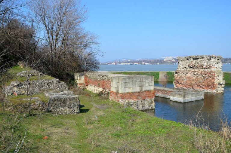
The fort and the surviving masonry remains of the Roman bridge lie on the same side of the Danube, within the local museum park. Three ruined masses represent an abutment supporting the bridge’s end, an intermediate pier, and the portal pier that once carried its monumental entrance. The piers had brick and rough-stone cores bound with mortar that hardens when wet, faced with carefully dressed limestone blocks. Brick courses formed compartments filled with Roman concrete containing large aggregate and rough stone. Timber grilles and tie rods embedded in the masonry extended into the facing and fitted into recesses in the stone blocks. Several facing blocks are grouped on the high riverbank in front of the fort’s main gate.
Bath complex
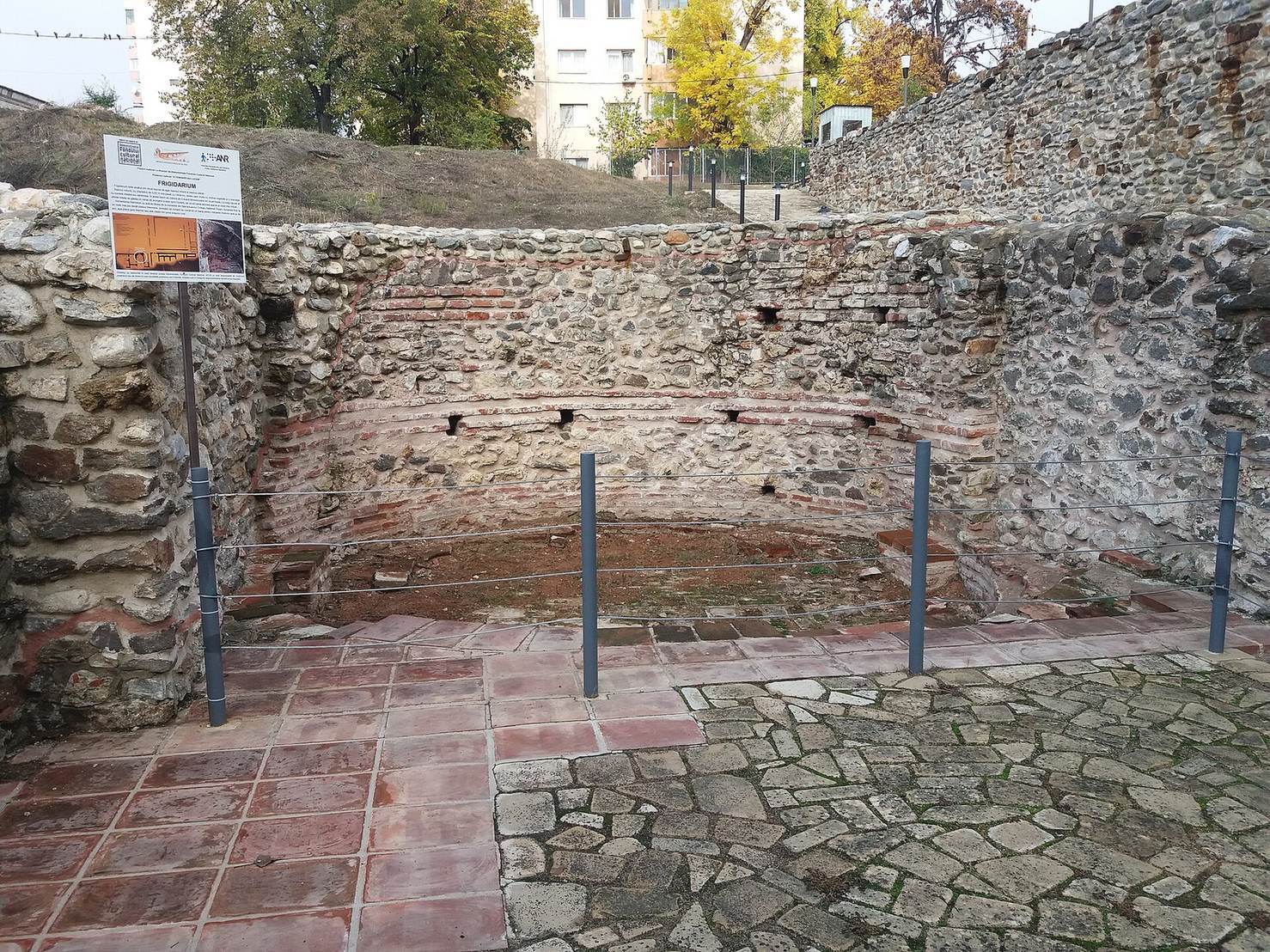
The Roman baths stood west of the fort on the Danube bank, with two levels fitted to the slope. North of the fort, an exercise court formed a quadrangle surrounded by covered walkways; its rooms included underfloor heating systems. Three surviving bathing rooms occupied the lower terrace: a warm room, a sweating room, and a hot room. Rooms on the second level connected with the exercise court. A corridor may mark a staircase that probably led to this upper level. The remains also include a corner of a large hall, a rectangular reservoir, and a circular cold room. Bricks stamped by Legio V Macedonica in the bath walls indicate that the baths belong to the same period as the fort and bridge.
Church, other remains, and cemetery
Early Christian basilica
A three-aisled early Christian church, with a central hall and side aisles ending in a rounded apse, stood northwest of the fort in Ghica Square.
Late Roman masonry
Massive masonry fragments dating to the late Roman period were found at the Craiova barrier, on the southeastern edge of the present city.
Cemetery and grave goods
The Roman cemetery occupied the Danube bank in the area now called Parcul Rozelor. Excavations there yielded funerary objects, tombstones, and jewelry. Finds include a bronze portrait of Faustina the Elder, wife of Emperor Antoninus Pius, attributed to a traveling artist working in the Greek-influenced Hellenistic illusionist tradition. A statue represents Jupiter Dolichenus, a form of Jupiter worshipped in a Roman cult of eastern origin. Two plaques depict the Danubian Horsemen, figures from religious imagery of the Danube region; they were made either as incised marble carvings or as shallow bronze reliefs.
Other funerary monuments use simplified forms and symbolic details, including examples bearing engraved symbols rather than figures. Cemetery finds also include clothing brooches, uniform fittings, beads, decorated lamps, and pottery. Fragments of fine Roman tableware known as terra sigillata show hunting scenes. Many objects from Drobeta are now exhibited at the National Museum of History of Romania and the Iron Gates Museum in Drobeta-Turnu Severin.