Trajan’s Bridge: A Roman Military Bridge over the Lower Danube


Site at a Glance
- Rating
- 3.9
- Popularity
- Medium
- Country
- Serbia
- Primary era
- Classical
- Eras represented
- Classical
- Civilizations
- Roman
- Site type
- Military
- Remains
- Fortified Bridge
On this page11 sections
History
Trajan’s Bridge was a Roman bridge over the lower Danube in Romania, near the Serbian town of Kladovo, linking the Roman provinces of Moesia and Dacia. Built between 103 and 105 during the reign of Emperor Trajan, it was the first bridge across the lower Danube and became one of the major achievements of Roman architecture. Its construction supported Rome’s campaigns against the Dacian kingdom and helped make possible the conquest of Dacia in 106.
Construction during the Dacian Wars
Trajan ordered the bridge during the Second Dacian War, Rome’s conflict with the Dacian kingdom ruled by Decebalus. The bridge was intended to carry troops and supplies across the river, forming part of a larger military and logistical scheme. This project also included a road through the Iron Gates, canals that bypassed dangerous rapids, defensive posts, and facilities for gathering intelligence along the frontier.
Apollodorus of Damascus, a prominent architect and engineer of Trajan’s reign, directed the design and construction. The bridge opened in 105 and connected the Pontes fort on the southern bank with the Drobeta fort on the northern bank. Access was controlled through these two military installations rather than by an open approach from the surrounding land.
The Pontes fort was built in 103 at the modern village of Kostol. A civilian settlement, known as a vicus, later grew beside it. On the northern bank, Drobeta had come under Roman control after the First Dacian War of 101 to 102. It developed into a military, economic, and religious urban centre. Emperor Hadrian raised Drobeta to municipal status in 126, and Emperor Septimius Severus made it a colony in 193.
Ritual and imperial associations
Trajan’s military activity at Drobeta was associated with a ritual libation in the settlement’s principal temple at the beginning of the Second Dacian War. The ceremony included the sacrifice of a pig, a ram, and a bull. Its exact purpose is uncertain. It may have consecrated the bridge, commemorated the repulse of a Dacian attack, blessed the imperial family, or honoured Virtue and Honor.
Destruction and abandonment
The bridge functioned for about 165 years. Its wooden superstructure was destroyed by fire and was probably removed or demolished after Rome’s position in Dacia became vulnerable. One tradition attributes the partial destruction to Trajan’s successor, Hadrian, perhaps as a measure to protect Moesia from attacks from the north. Another associates it with Emperor Aurelian during Rome’s withdrawal from Dacia around 270 to 275. The bridge’s complete abandonment is linked to that Roman withdrawal.
Rediscovery and investigation
Exceptionally low Danube water levels in the 1850s revealed all twenty piers. Navigation later led to further losses: in 1906, the International Commission of the Danube ordered two piers to be destroyed because they obstructed shipping. Sixteen underwater piers were recorded in 1932. By 1982, archaeologists could locate only twelve, while four were probably swept away by the river.
The remains had already attracted technical interest in 1689, when the Austrian military engineer Luigi Ferdinando, Count of Marsigli, studied them and considered building a new bridge beside the ancient structure. Modern archaeological investigation has remained incomplete. In September 2003, archaeologist Gordana Karovic led preparatory underwater surveys using sonar, electronic equipment, diving, and underwater cameras. These surveys produced documentation of submerged stone and wooden remains.
Trajan’s Bridge is protected in Serbia as a Monument of Culture and an Archaeological Site of Exceptional Importance. In Romania, it is listed as a Historic Monument under the designation Podul lui Traian, code MH-I-m-A-10047.04, designated in 2004. The bridge is often considered to have held the record for the longest arch bridge in total span and length for more than a thousand years, despite its comparatively brief period of operation.
Remains
Trajan’s Bridge was a segmental-arch bridge with a wooden superstructure carried by twenty masonry piers. It crossed a section of the Danube approximately 800 metres wide. The bridge measured about 1.1 kilometres in total length, with recorded figures of 1,097.5 metres and 1,135 metres. It was approximately 14.5 to 15 metres wide and stood about 18 to 19 metres above the river, allowing shipping to pass beneath it.
River foundations and masonry piers
Caisson foundations
The piers were founded within wooden caissons, temporary partly enclosed structures used to create foundations in or beside water. Wooden piles were driven into the riverbed in rectangular arrangements, coated with clay, and used as the base for the supporting structures. Roman engineers used oak for the bridge’s wooden structural elements. The first ten to twelve piers were built on dry ground after the Danube was partly diverted.
Pier construction
The remaining piers were constructed with oak-beam formwork and pumping systems. Their cores contained stones bonded with mortar, while their outer faces were made from Roman bricks and dressed stone. Transverse and longitudinal wooden beams strengthened the interiors. The piers were aligned with their long axes across the current and had pointed projections upstream and downstream to reduce water pressure.
Recorded pier dimensions include widths of approximately 18 to 19 metres, lengths of 33 to 34 metres, and heights of 44.46 metres. The spaces between piers were roughly 50 to 55 metres, while an underwater survey measured approximately 55 metres between the central axes of eighteen river piers. Each wooden arch spanned about 38 metres.
Canal, forts, and bridge entrances
To make construction possible, Roman engineers diverted part of the Danube through a canal and an existing southern channel. The bypass ran from the area west of modern Kladovo towards Mala Vrbica, about two kilometres downstream from the bridge, and was approximately 3.2 kilometres long.
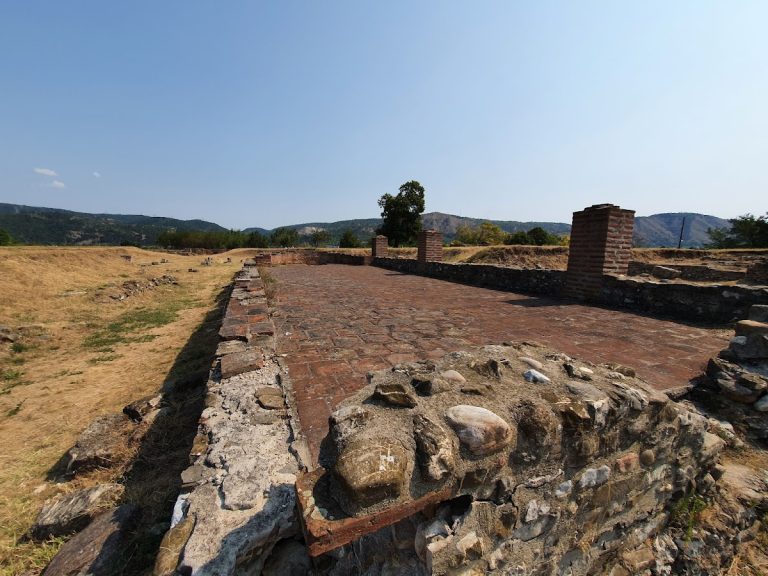
Monumental gates marked the two entrances, at Pontes on the southern bank and Drobeta on the northern bank. The Pontes fort covered several hectares and included a castrum, a Roman military fort, about 40 metres long, with substantial ramparts. Parts of its remains are still visible. The bridge’s entrance structures formed part of this fortified connection between the two banks.
Inscriptions, sculpture, and surviving evidence
Bricks used in the bridge carried the names of the military units that produced them. They include Legions IV Flavia Felix, VII Claudia, V Macedonica, and XIII Gemina, as well as Cohorts I Cretum, II Hispanorum, III Brittonum, and I Antiochensium.
A bronze head of Trajan, from a statue erected at the bridge entrance, was found at Pontes and is preserved in the National Museum in Belgrade. The Drobeta fort also contained a bronze statue of the emperor. Trajan’s Column in Rome shows a stylized version of the bridge. Its relief includes fewer piers than the actual structure, but it broadly corresponds to written descriptions and depicts the combination of wooden and stone elements.
On the Serbian side, facing the Romanian bank, stands the Tabula Traiana, a Roman memorial plaque commemorating the completion of Trajan’s military road. The plaque is approximately four metres long and 1.75 metres high.
Today, only the entrance piers are visible above the Danube’s banks, one in Romania and one in Serbia. Underwater remains include carved stone blocks, wooden boards, and piles. Tree rings can still be seen in some of the wood after roughly 1,900 years beneath the river.