Barad: A Byzantine-Era Settlement in Syria
Site at a Glance
- Popularity
- Medium
- Country
- Syria
- Primary era
- Medieval
- Eras represented
- Classical, Medieval
- Civilizations
- Byzantine, Roman
- Site type
- Settlement
- Remains
- Town
On this page18 sections
History
Barad is an ancient settlement in Syria’s Jebel Seman highlands, about 40 kilometres northwest of Aleppo. Its beginnings are placed in the second century, and it later became a major centre in the Byzantine period, the eastern continuation of the Roman Empire. Barad belonged to the Dead Cities, a group of ancient settlements in northwestern Syria, many of whose surviving buildings date to the Byzantine period.
Origins and expansion
In the second and third centuries, Barad was an agricultural settlement where olive growing and trade were important. It expanded in the early third century, with a new district of villas for wealthy residents. By the fourth century, large country houses had spread northward, while housing and craft production expanded to the west and a commercial quarter developed to the south.
A residence for the Byzantine governor of Jebel Seman was built in 496. A Greek inscription gives the date, placing the governor’s residence among the settlement’s recorded late-antique developments.
Commercial and Christian centre
Barad flourished in the fifth and sixth centuries as a commercial and Christian centre. It also served as the administrative centre of the northern region associated with Antioch, a major city and administrative hub in the eastern Roman world. At its height, the settlement included several churches and monasteries.
Decline and abandonment
Barad began to decline in the seventh century, as its inhabitants gradually departed. The settlement lay amid the Byzantine-Persian wars, fought between the Byzantine Empire and the Sasanian Empire, the Persian power contesting Byzantine control of the region. Later, it stood on the frontier between the Umayyad state, an early Islamic caliphate, and the Byzantine Empire. This changing military and political setting formed part of the circumstances surrounding its abandonment.
Modern recognition and conflict
In 1905, Gertrude Bell described Barad as the largest village on Jebel Seman and noted that Kurds lived there. Excavations began in 2002 under Ghassan al-Shami. Later work involved a United States delegation, supported by the Maronite Archdiocese of Aleppo, the Holy Spirit University of Kaslik in Lebanon, and Syria’s Ministry of Tourism; archaeological investigations have continued.
On 30 June 2004, the Maronite Archdiocese of Aleppo identified a tomb at Barad as that of Saint Maron, a Christian ascetic, and declared the site a pilgrimage destination for the Maronite Church. The Maronite Church is an Eastern Catholic church whose liturgy uses Syriac, a literary and religious form of Aramaic. A portion of Maron’s relics was brought back to Barad in 2010 for the 1,600th anniversary of his death. In 2011, Barad became part of UNESCO’s World Heritage listing of the Ancient Villages of Northern Syria, also known as the Dead Cities.
Turkish forces and allied Syrian opposition factions occupied Barad on 21 March 2018. The following day, Turkish forces bombed the site during Operation Olive Branch, a Turkish military offensive. The tomb identified as Saint Maron’s, Julianos Church, and other important structures were damaged or destroyed.
Remains
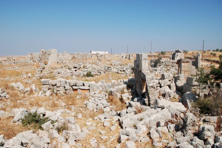
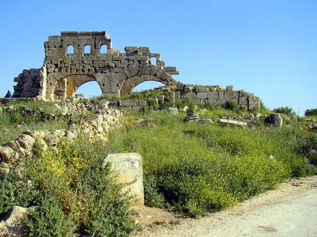
The ancient settlement lies at about 586 metres above sea level in the limestone highlands of Jebel Seman. At its sixth-century height it covered about two square kilometres. Its remains include churches and monasteries, residences, commercial and agricultural buildings, tombs, and public structures. Stone construction is especially evident in the churches, the tomb monument, and the paved path linking the village square with Julianos Church.
Churches and monastery buildings
Julianos Church
Julianos Church was built between 395 and 402 on the site of a second-century pagan temple. A Greek inscription records its dedication in 401/2. The architects Julianos and Marinos are associated with the work. It was a three-aisled basilica, a church with a central hall and two side aisles, measuring about 42 metres long and 22 metres wide. It was described as one of the largest churches in northern Syria.
Builders reused decorated Corinthian columns and polished stone from the earlier temple. The west entrance incorporated the temple portal, with long limestone blocks and half-columns. Projecting stone brackets supported the horizontal doorway block beneath shallow arches. The west entrance received particular emphasis, unlike the south-side entrances common in many churches of the region.
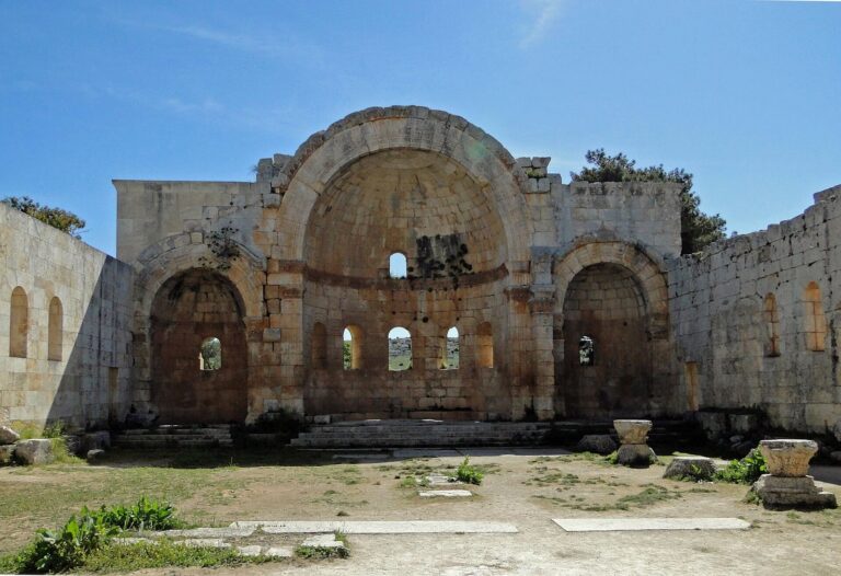
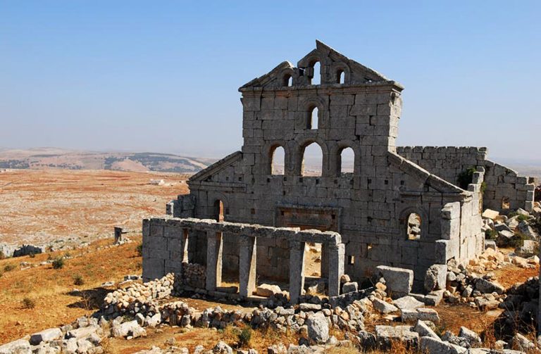
The church had ten doorways. Two entrances on each of its north and south sides, accompanied by columned porches, are considered later additions. The eastern apse (the sanctuary end of a church) had three round-arched windows. Doors linked the rooms beside it with the side aisles, and windows opened above those doors. A large arch at the apse wall remains intact, and the church opens from there toward the tomb nearby.
A broad central bema (a raised platform in a church) was among the earliest known in the region. It first held movable wooden seats on a low platform, then was enlarged with a U-shaped stone base for twelve fixed seats. A book rest stood at the end of the wall.
North chapel
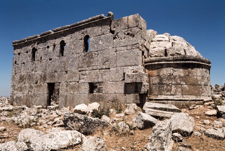
A smaller church or chapel was added on the north side around 410. It had two entrances and a three-aisled plan resembling the larger church. Its central apse served as a chamber for relics, and a stone coffin was found in the middle of it. The eastern portion, including the apse, remains intact, while the other walls are ruined.
North Church
Dated to 561, the North Church had broad interior arcades and a semicircular sanctuary end set within a straight eastern wall. Rectangular rooms flanked the apse: one was associated with the keeping of martyrs’ relics, and the other served liturgical purposes. The church had two south-side entrances and another entrance into the southern side room. A Greek dedication inscription stood above that room’s entrance.
A carved garland band framed the upper windows, ran across them, and ended in scroll-like curves. Individual carved bands decorated the lower windows on the outer south wall. Two arches and the central part of the eastern altar wall remain standing.
South Church and monastery complex
The sixth-century South Church, also called the South-West Church, was a large building with a single broad hall and a rectangular sanctuary end. It formed part of a monastery complex locally called Qasr al-Barad, meaning Barad Castle, alongside residential buildings and an inn. One two-storey residence survives with attached columned porches. South of the church’s west end stands a square tower, three or four storeys high and preserved to the projecting band at the roofline. It may have served as a place of monastic retreat.
Civic, residential, and agricultural buildings
Meeting house
A communal meeting house stood about 100 metres east of Julianos Church. Its upper storey and the two-storey porch attached to the entrance have collapsed. Three broad arches, each spanning about five metres, supported the heavy floor above.
Public bath
The remains of a Roman bath lie north of the present village, but its date is uncertain. Historian and archaeologist Georges Tchalenko reconstructed it as a two-storey, hall-like building with several additions. He proposed that it belonged to an estate older than the village.
Residences and working buildings
Barad’s other remains include an inn, five warehouses, a magistrate’s residence, oil presses, and agricultural and animal-husbandry buildings. These structures reflect the range of residential, commercial, and productive activity represented across the settlement.
Tomb monument and pilgrimage path
Tomb monument
About 100 metres east of the bath stands a tomb monument dated to the second or third century. It is a tetrapylon, a four-gateway monument formed by four supports. Four massive corner piers rise from a low square base and carry arches beneath a pyramidal roof. Sculpted busts look down from the arch stones. A chamber inside the base may have held a coffin; alternatively, the monument may have marked the visible portion of an underground tomb.
Paved path
A stone-paved pilgrimage path connects the village square with Julianos Church.